Ionian sailing holidays
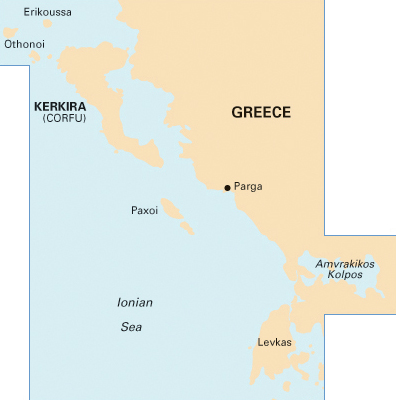
The Ionian Islands - Ιόνια νησιά, also known as the Eptanisa or Heptanese (Seven Islands), are strung out along the west coast of Greece from the Albanian frontier to the Peloponnese. On top of the principal 7 there are endless smaller islands
In this westerly situation, with more rain in early spring than most other parts of Greece, the islands have a mild climate and lush growth of vegetation.
Only second to the Saronic gulf - Athens, the Ionian is one of the most important areas for yacht charters → unbiased guide in the Mediterranean Sea.
West Greece is ideal for (beginning) bareboats, flotillas, assisted bareboats charters and for crewed yacht charters.
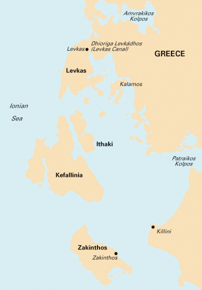
Ionian sailing areas
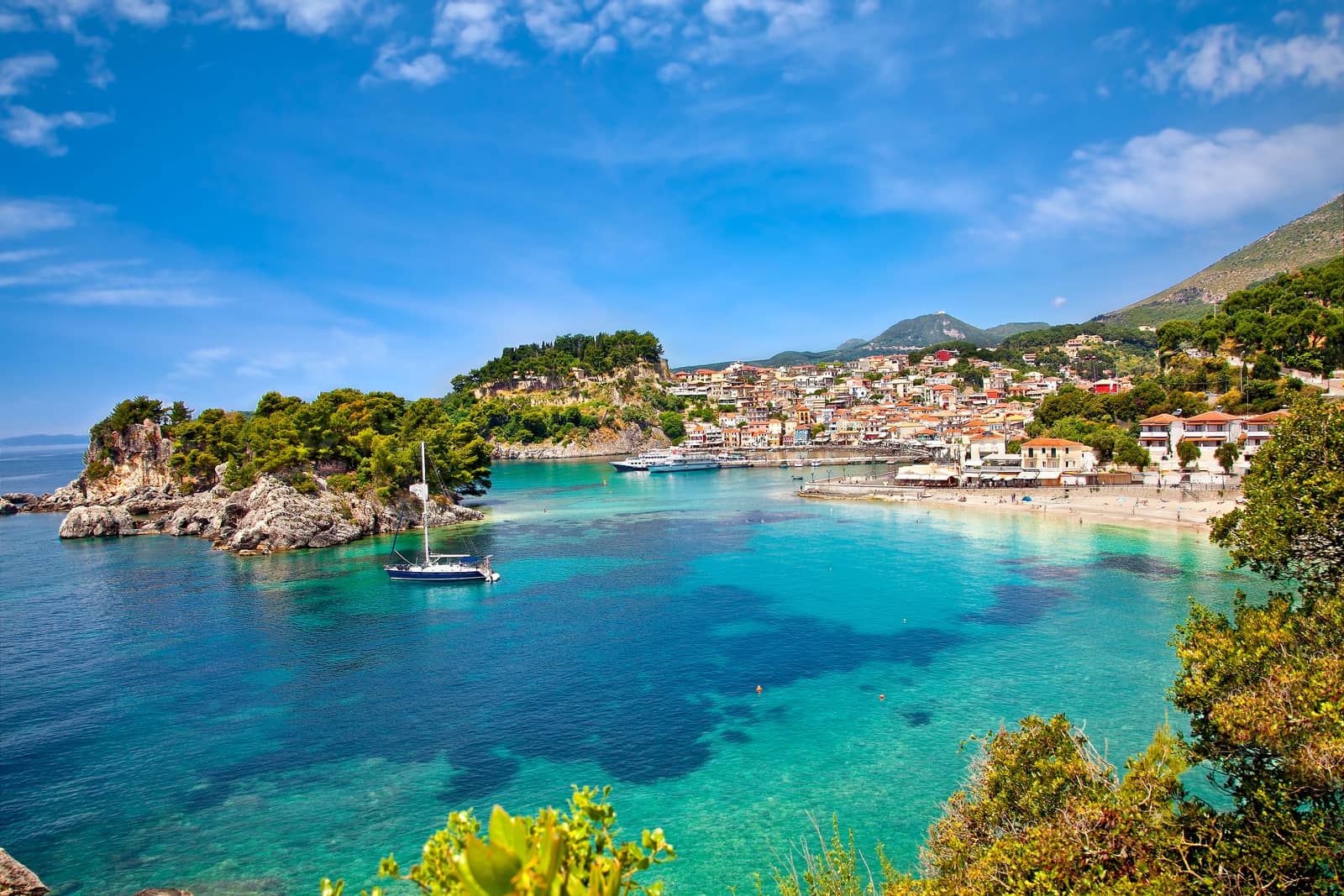
Due to less severe winds than in other regions these islands form the perfect ground for sailing holidays and yacht charters with children or less experienced crew. The best bases for yacht charters can be found in Preveza, Corfu, Gouvia, Lefkas and Nidri.

Bareboat sailing
holidays & cruising
Ionian sea.
Myth and history
The Ionian Sea, which was equated by ancient authors with the Adriatic and is now seen as its southern continuation, and the Ionian Islands owe their name, according to Aeschylus, to the wanderings of Io or, according to later sources, to the Illyrian hero Ionios (spelt with an omicron, literally the short “o”: ο). They have thus no connection with the Ionian Greeks (derived from Ion, with an omega, literally the long “o”: ω) who left Greece in the 11th and 10th c. BCE and settled on the Anatolian coast, giving this eastern Greek territory its name of Ionia. See “Ionian or Ionic” for further reading.
Evidence of settlement dating back to Mycenaean times has been found on the islands, but their first emergence into the light of history was in 734 BCE when Corinth founded the city of Korkyra (later Kerkyra).
In the 5th c. BCE the islands came under Athenian influence, and in the 2nd c. BCE all of them, including Kythira, became Roman. Later they came under Byzantine rule and in 1085 CE were conquered by the Normans; then in 1203 – 4 the Fourth Crusade brought another change of matters. The islands now fell into the hands of Italian barons, and then, one after another, came under Venetian control – Kythira in 1363, Kerkyra (thereafter known as Corfu) in 1386, Zakynthos in 1479, Kefalonia in 1500 (after 21 years of Turkish rule) and finally Lefkas – which had been Turkish since 1467 – in 1684.
Venetian rule lasted until the fall of the Republic of St Mark in 1797. During this period the islands provided a refuge for many Greeks fleeing from the Turks, including artists from Crete who established a school of their own here; and throughout these years they enjoyed a richer cultural life than the rest of Greece.
After an interlude of French rule the young “Republic of the seven Islands” became a British protectorate in 1815. In 1864 Britain returned the islands to Greece.
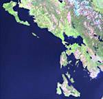
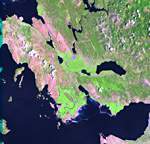
Click on the thumbnails to see a larger image. The satellite images are active maps: mouseover to see the names of ports, islands and islets of the North Ionian and South Ionian Seas.
Ionian sailing area rated
To help you choose your ideal sailing area in Greece, I selected 11 criteria and gave each region ratings accordingly.
More stars indicate a more valid statement:
→ not valid
→ half valid
→ very valid
Therefore → “ Easy sailing conditions ” means that conditions are *not* easy.
Characteristics
Easy access by plane / ferry
Unspoiled by tourism
Picturesque ports
Tavernas & facilities
Ancient Greek sites
Medieval sites
Secluded anchorages
Sublime scenery
Easy sailing conditions
Fertile & lush vegetation
Wildlife
Ratings
See the ratings of the other sailing areas in Greece.
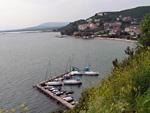
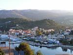
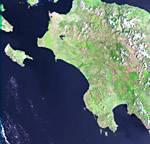
Preveza
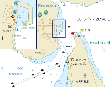
The Preveza - Πρέβεζα port of entry lies on the Greek mainland guarding the Ambracian Gulf. Leading lights will guide your way into this gulf. On the north side of the channel a dense forest and St George's Castle can be seen.
The channel was built in 1937 and has a length of 2700 m, a width of 60 m and an “official” depth of 12 m. It is marked by 4 pairs of lighted buoys with a direction of 066° — 246°. The second leg of 027° — 207° leads to the Q Fl Red buoy, after which you can steer for the Preveza marina. An optional leg of 010° — 190° will allow you to enter the Ambracian Gulf.
In the marina ask for a berth and go where directed, or go stern-to on the boulevard near the clamorous bars; good holding in mud.
New pontoons in the Preveza marina, as well as laid moorings at the boulevard / quay are being implemented.
The charming market town is mildly touristy with a myriad of restaurants; especially the more traditional alleys, away from the quay, are a treat.
Visit the impressive ruins plus local Archaeological Museum of the ancient city of Nicopolis - “City of Victory” founded after the
Battle of Actium
Even more worthwhile is the ancient site of Cassope , 27 km north of Preveza, 30 min by taxi.
Kakistocracy
A kakistocracy is a government run by the worst, least qualified, or most unscrupulous citizens… →
Dangers
Before entering or leaving the channel all vessels must make contact with the harbour office of Preveza (VHF Ch12).
Currents (max. 3 knots at full moon) flow in the Preveza channel, changing direction every 6 hours, 1.5 knots; heavy rains will increase the outgoing flow; South winds leads to ingoing tide of 2.5 knots, while north winds result in 3.5 knots outgoing. The channel is unlikely to live up to the “official” depths → expect 5 m min. due to silting; prevailing winds from the NW – W will create choppy conditions when the tide is flowing out. Tide table Preveza, Tidal chart
Finally, make sure to constantly check the buoys in front and behind you to correct your course upstream / upwind and also to spot commercial shipping.
Books and nautical charts

Sailing areas in the Ionian
View all Greek isles