Cyclades sailing holidays
The Cyclades - Κυκλάδες lay in a circle (Greek: kyklos) around the sacred island of Delos, the birthplace of Apollo, and consists of 23 large islands and some 200 smaller ones.
This ultimate archipelago is based on a submarine plateau which extends in an arc from the most easterly point of Attica and Evia towards the coast of Asia Minor.
All the islands are hilly. The northern ones consist predominantly of Cretaceous limestone, micaceous schists, gneisses and marbles; those to the south consist in part of volcanic materials.
The top yacht charter companies have their bases in Athens (Alimos / Kalamaki marina) and Paros. Another useful charter base in the Aegean is Kos in the Dodecanese to the East.

With the exception of Naxos the islands have no perennial rivers, and as a result of the prevailing sharp sea-winds (the Meltemi in summer) are lacking in trees. The sheer cliffs and rugged sea-scapes are truly sublime – as defined by Edmund Burke – and awe-inspiring.
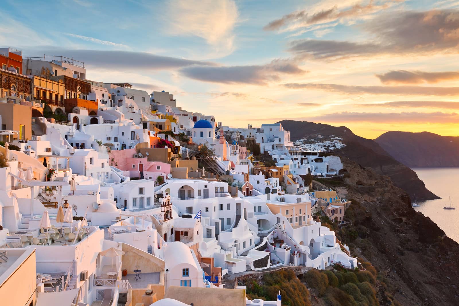
Characteristic features of the landscape are the cubed whitewashed Cycladic houses and the thatch-roofed windmills, very romantic, ideal for honeymoons and for history-themed sailing holidays.
July and especially August and possibly early September means Meltemi season: storm days more likely.
Kyklades
The name refers to the circle - κυκλάς of islands around the focal point of the Aegean Sea: Sacred Delos, one of the most significant mythological, historical, and archaeological sites in Greece.History of the Cyclades
Evidence of settlement dating back to Mycenaean times has been found on the islands, but their first emergence into the light of history was in 743 BCE.
In the 5th century BCE the islands came under Athenian influence, and in the 2nd century BCE the Roman Empire took over.
Later they became under Byzantine rule, and in 1085 were conquered by the Normans; subsequently in 1203-04 the Fourth Crusade brought another change of masters. The Cyclades now fell into the hands of Italian rulers, and came under Venetian control.


Venetian rule lasted until the fall of the Republic of St Mark in 1797. And during this period the islands provided a refuge for many Greeks fleeing from the Turks, including artists from Crete who founded a school of their own here, and throughout these centuries they enjoyed a richer cultural life than the rest of Greece.
After an interlude of French rule the young Republic of the Seven Islands became a British Protectorate in 1815; in 1864 Britain returned the islands to Greece.
Cyclades sailing areas rated
To help you choose your ideal sailing area in Greece, I selected 11 criteria and gave each region ratings accordingly.
More stars indicate a more valid statement:
→ not valid
→ half valid
→ very valid
Therefore → “ Easy sailing conditions ” means that conditions are *not* easy.
Characteristics
Easy access by plane / ferry
Unspoiled by tourism
Picturesque ports
Tavernas & facilities
Ancient Greek sites
Medieval sites
Secluded anchorages
Sublime scenery
Easy sailing conditions
Fertile & lush vegetation
Wildlife
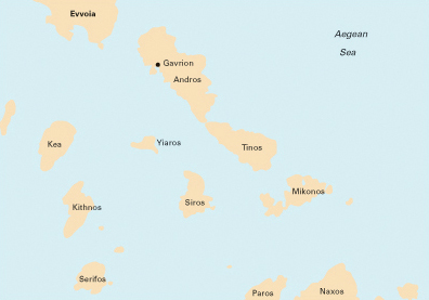
Northern Cyclades
Characteristics
Easy access by plane / ferry
Unspoiled by tourism
Picturesque ports
Tavernas & facilities
Ancient Greek sites
Medieval sites
Secluded anchorages
Sublime scenery
Easy sailing conditions
Fertile & lush vegetation
Wildlife
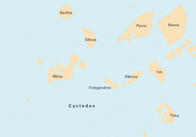
Southern Cyclades
See the ratings of the other sailing areas in Greece.
Important reading
Guide to yacht charters: 8 steps towards a succesful sailing holiday in Greece or Turkey.


Lavrion yacht charter base
The port of Lavrion (Laurion) - Λαύριο is located at the south east of Attica, and is in many aspects a more convenient location for yacht charters to explore the Cyclades than the Alimos marina – Kalamaki marina in Athens.
The distances from the International Athens Airport are roughly the same, yet you will spare yourself 20 nm along the dull concrete outskirts of Athens and for instance the port of Kea is just 14 nm away. But, althought the port of Lavrion is sometimes called the gate of the Cyclades, it can be difficult to find local reputable charter companies or yachts.

Other harbours to start your sailing holiday are Parikia - Παροικιά port in Paros, rarely Syros and most likely Athens, which makes it possible to sail a one way from for instance Athens to Paros. Note, that one-way charters usually need to be booked far in advance. The down-sides are a half a day less sailing to have the yacht delivered back to Athens and a one-way fee of 400 – 700 euros depending on yacht and distance.
For unbiased advice on charter companies please go to my page on Yacht charters.
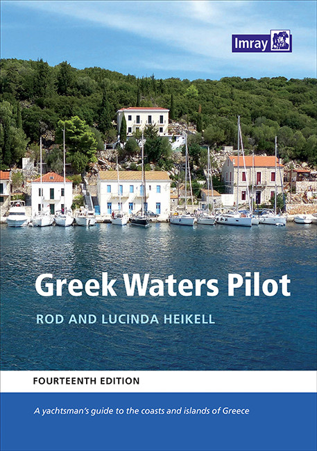
Books and nautical charts
The Cyclades islands
- Kea
- Kythnos
- Syros
- Tinos • Andros
- Mykonos • Delos
- Serifos
- Sifnos
- Paros • Antiparos
- Naxos • Little Cyclades
- Milos • Kimolos
- Folegandros • Sikinos
- Ios
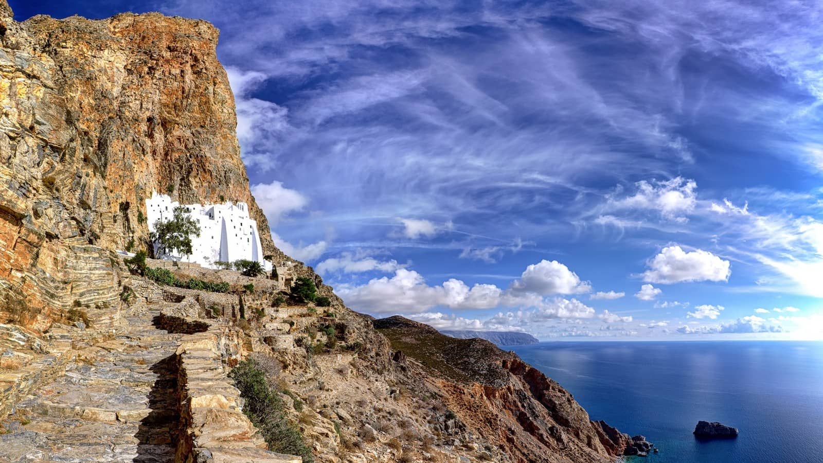
- Amorgos
- Santorini
- Itineraries in the Cyclades out of yacht charter bases: Athens, Mykonos or Paros.
- Full list of Cyclades islands and their Greek, Ancient Greek, Medieval and Latin names.
- Larger list of the Aegean islands.
View all Greek isles