Dodecanese sailing holidays
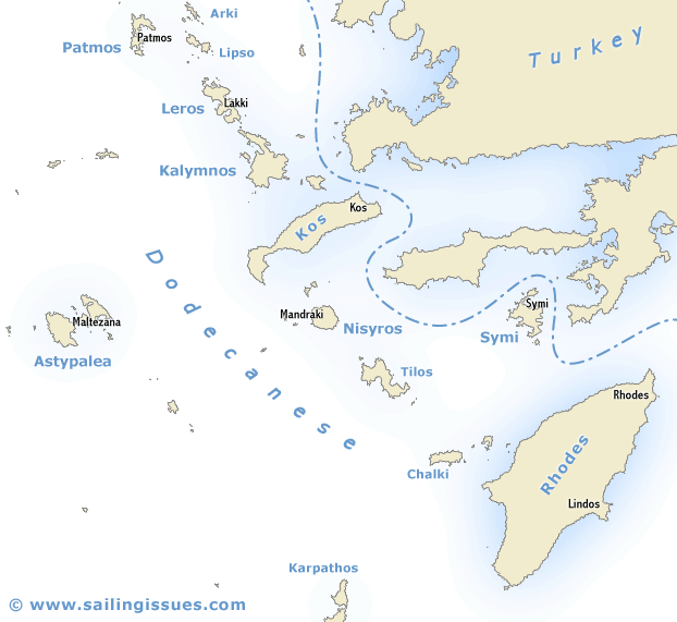
Dodecanese islands
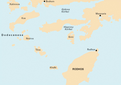
The Dodecanese - Δωδεκάνησα (Twelve Islands) are located off the south-west coast of Asia Minor; the Ionian and Carian coasts of Turkey.
It includes the 14 larger islands of Lipsi, Patmos, Leros, Kalymnos, Kos, Astypalea, Nisyros, Symi, Tilos, Rhodes, Khalki, Karpathos and Kasos, together with over 40 smaller islets — some with superb anchorages — and rocks.
Sporades → Sporadic confusion
“Sporades” means “those scattered” and from Classical Antiquity this name has referred to the Aegean island groups outside the central archipelago of the Cyclades.
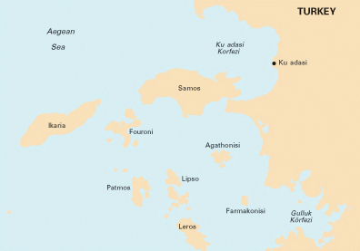
- Southern Sporades - Νότιες Σποράδες are Greek islands situated between the Cyclades and Turkey. They correspond to the Dodecanese (except Kastellorizo) plus a few Northern islands such as Samos and Ikaria. Also included by some geographers are the islands of Chios and Lesbos.
- Eastern Sporades - Ανατολικές Σποράδες include Samos, Ikaria and Lesbos, Chios, Tenedos, Psara, Oinousses and smaller island groups, strung along the Northern Anatolian coasts, and nowadays exclude the Dodecanese.
- Northern Sporades - Βόρειες Σποράδες – since c. 1960, the generic term “Sporades” suffices – include the islands of Skopelos, Alonnisos, Skiathos, Skyros, Kyra Panagia, and adjacent smaller islets and rocks.
The top yacht charter companies have their bases in Rhodes and especially in Kos. Other charter bases in the area are Bodrum, Marmaris and Fethiye in Turkey as well as Paros and Mykonos in the Cyclades to the west.
Dodecanese sailing area rated
To help you choose your ideal sailing area in Greece, I selected 11 criteria and gave each region ratings accordingly.
More stars indicate a more valid statement:
→ not valid
→ half valid
→ very valid
Therefore → “ Easy sailing conditions ” means that conditions are *not* easy.
Characteristics
Easy access by plane / ferry
Unspoiled by tourism
Picturesque ports
Tavernas & facilities
Ancient Greek sites
Medieval sites
Secluded anchorages
Sublime scenery
Easy sailing conditions
Fertile & lush vegetation
Wildlife
Ratings
See the ratings of the other sailing areas in Greece.
With the exception of Rhodes, which belongs culturally to Greece but geologically to the mainland of Anatolia, the islands are arid and largely barren; the ports and blue anchorages suddenly green, lush in fertile valleys. Their inhabitants live by farming, sponge-fishing (the Dodecanese forms the base of the Greek sponge-fishing fleet), but increasingly, the tourist trade.
Dodecahedron
This word for any polyhedron with twelve flat faces, from δώδεκα dódeka “twelve” + ἕδρα hédra “base”, “seat” or “face”, links to the word cathedral, καθέδρα “seat” (of the bishop)… →The islands
- Chios
- Samos
- Patmos • Arki • Lipso
- Leros • Kalymnos
- Kos • Nisyros • Tilos
- Astypalaia
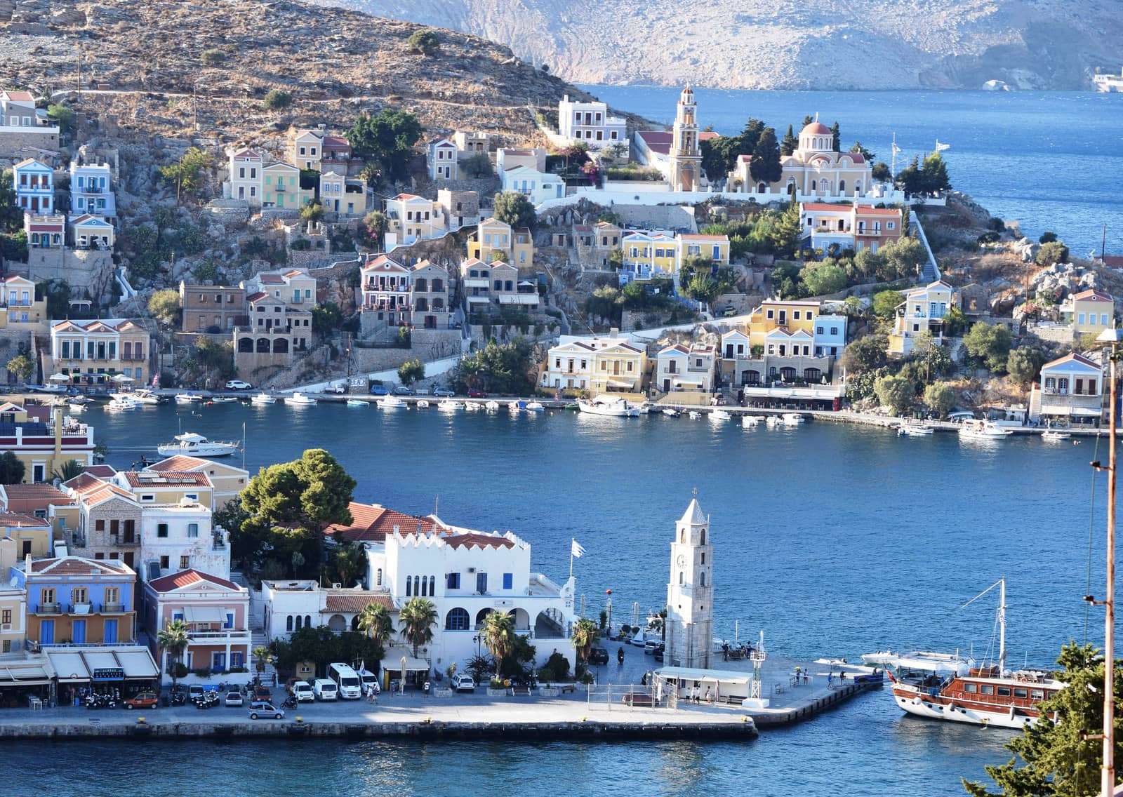
- Symi
- Rhodes
- Itineraries in the Dodecanese, adjacent Turquoise coasts and Southern Sporades.
- Full list of Dodecanese islands and their Greek, Ancient Greek, Medieval, Turkish and Latin names.


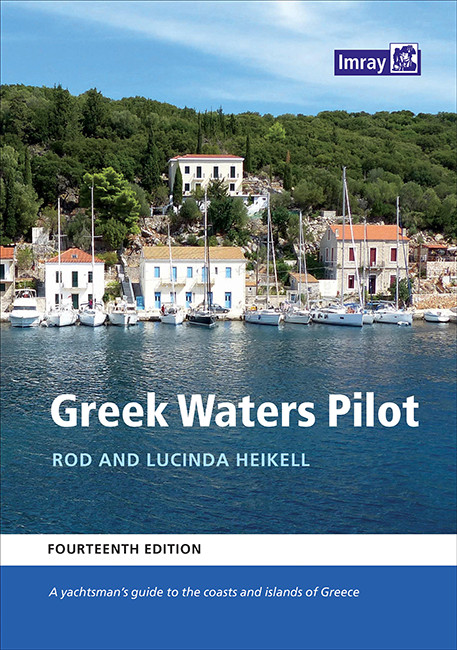
Books and nautical charts
History of the Dodecanese
Neither in Greek or in Roman times was the Dodecanese a separate political entity. It was an administrative region of the Byzantine Empire, and it was only when the islands came under Turkish rule in the 16th century that they were given extensive rights of self-government in domestic affairs and gained a common political status.
In 1912 most of the islands were occupied by Italy as a counter-measure to the Turkish occupation of Libya. Under the Treaty of Lausanne in 1923 Turkey formally ceded the whole of the Dodecanese to Italy.
After being occupied by German forces during the Second World War the islands were reunited with Greece in 1947.
These classical islands abound in must-see archaeological sites.
View all Greek isles and the renowned Meltemi storm guide