Symi sailing holidays
The exquisite island of Symi - Σύμη (Italian: Simi, Turkish: Sömbeki) lies about 23 NM north-west of Rhodes in between two Turkish peninsulae. It has a much-indented coast and already Homer claimed it possessed eight good harbours.
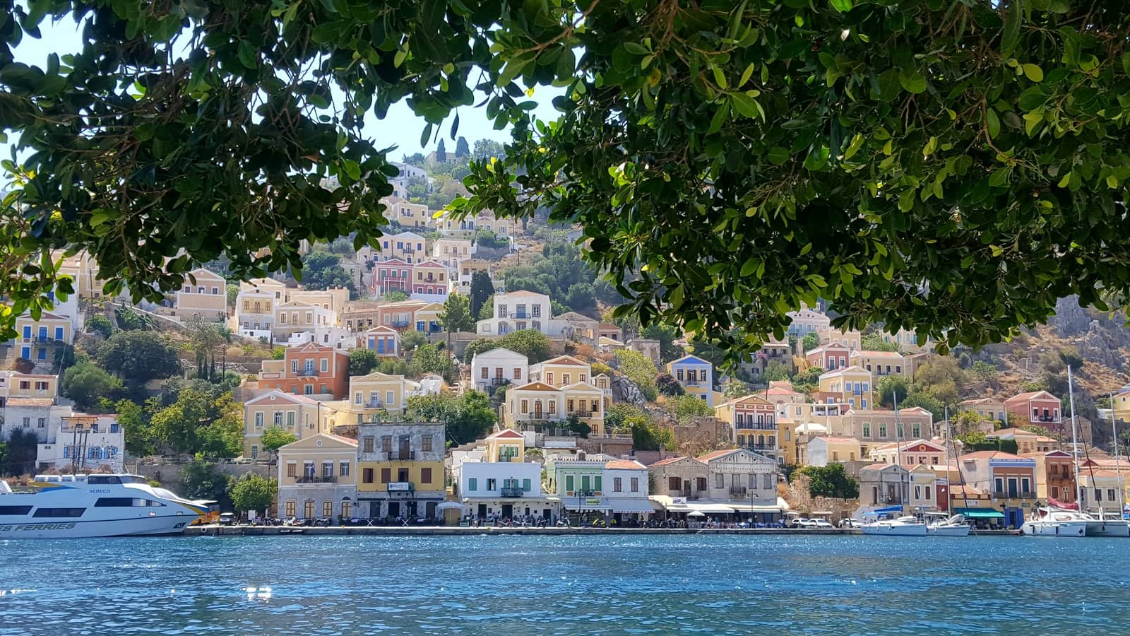
Symi's main port with its amphitheatrical ambiance of Neoclassical mansions, in soft ochre or traditional deep shades, stacked one on top of the other right up the hill sides is unparalleled.
The inhabitants used to live of sponge-fishing and were especially celebrated for their boat-building craftsmanship; in these glory days the population reached a peak of 30 thousand by the “fin de siècle”.
Nowadays, Symi's main industry is tourism, and its permanent population has declined to 2500.
Before 1970 there weren't any cars or motorcycles on the island; all was transported via either mule or ship.
Drinking water is brought in from Rhodes, since the island's sources aren't sufficient.
British Admiralty Charts 1055, 1532
- All Greek islands
- Dodecanese • Southern Sporades overview
- Chios
- Samos
- Patmos • Arki • Lipso
- Leros • Kalymnos
- Kos • Nisyros • Tilos
- Astypalaia
- Symi
- Rhodes
- Itineraries in the Dodecanese, adjacent Turquoise coasts and Southern Sporades.
Previous island: Astypalaia ↑
Next island: Rhodes ↓
History of Symi
From ancient times the fortunes of Symi were closely linked with those of Rhodes.
In Homer's Iliad Symi is mentioned as the domain of King Nireus, who fought in the Trojan War on the side of the Greeks and was described as the handsomest man in the Achaean forces, after Achilles.
Thucydides writes that during the Peloponnesian War there was a Battle of Syme near the island in January, 411 BCE, in which an unspecified number of Spartan ships defeated a squadron of Athenian vessels, see Seskli islet.
Little was known about the island until the 14th century, but archaeological evidence indicates that it was continuously inhabited, and ruins of citadels suggest that it was an important location. It was first part of the Roman Empire and then the Byzantine Empire, until its conquest by the Knights of St. John in 1309.
The island was occupied by the Turks in 1523 and after the Balkan War of 1912 was held by Italy.
It was reunited with Greece in 1947.
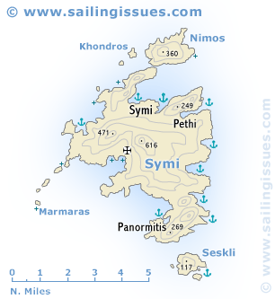
Symi island ports & anchorages
Clockwise ↻

|
Ag Marina
Agia Marina - Αγία Μαρίνα bay – midway between Symi harbour and Pedi – offers outstanding shelter, also from fierce Meltemi (NW) winds.
Anchor in delightful surroundings in 3,5 – 5 m over sand; good holding; snorkeling in cerulean waters.
We didn't see it, but C-MAP shows a “rock awash” in the middle of the northern passage – and although this rock is not shown on Openseamap, Eagleray and Navionics the islet is indeed connected with a shoal to the north coast of Symi. Be sure to use the southern passage.
We skipped the taverna whose owners thought it in good taste to pour cement over the entire beach.
The eponymous Chapel on Vrakonisida Agia Marina, does not
refer to a marina port such as nearby Pedi marina, rather to the martyr Margaret the Virgin (of Antioch).
Not to be confused with Agia Marina bay on Aegina.
Most yachts should go around Pazmadi islet (unnamed on most charts) - Ραζμάδι in the front and right.
In the front and left is the entrance to Pedi bay and on the horizon: Turkey.
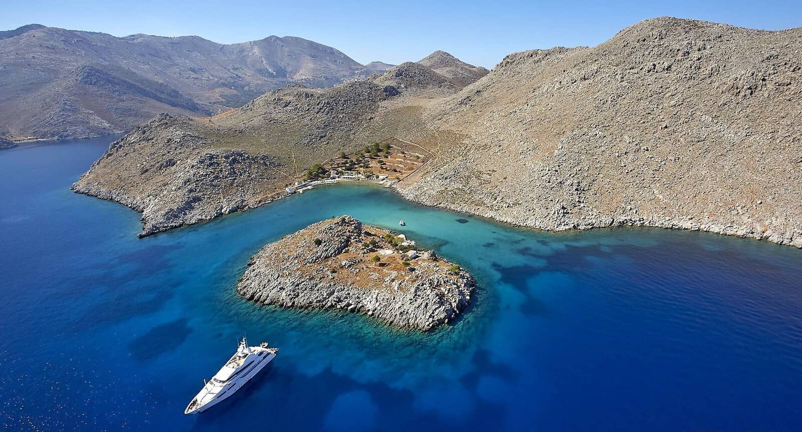
On the left is the entrance to Pedi bay.
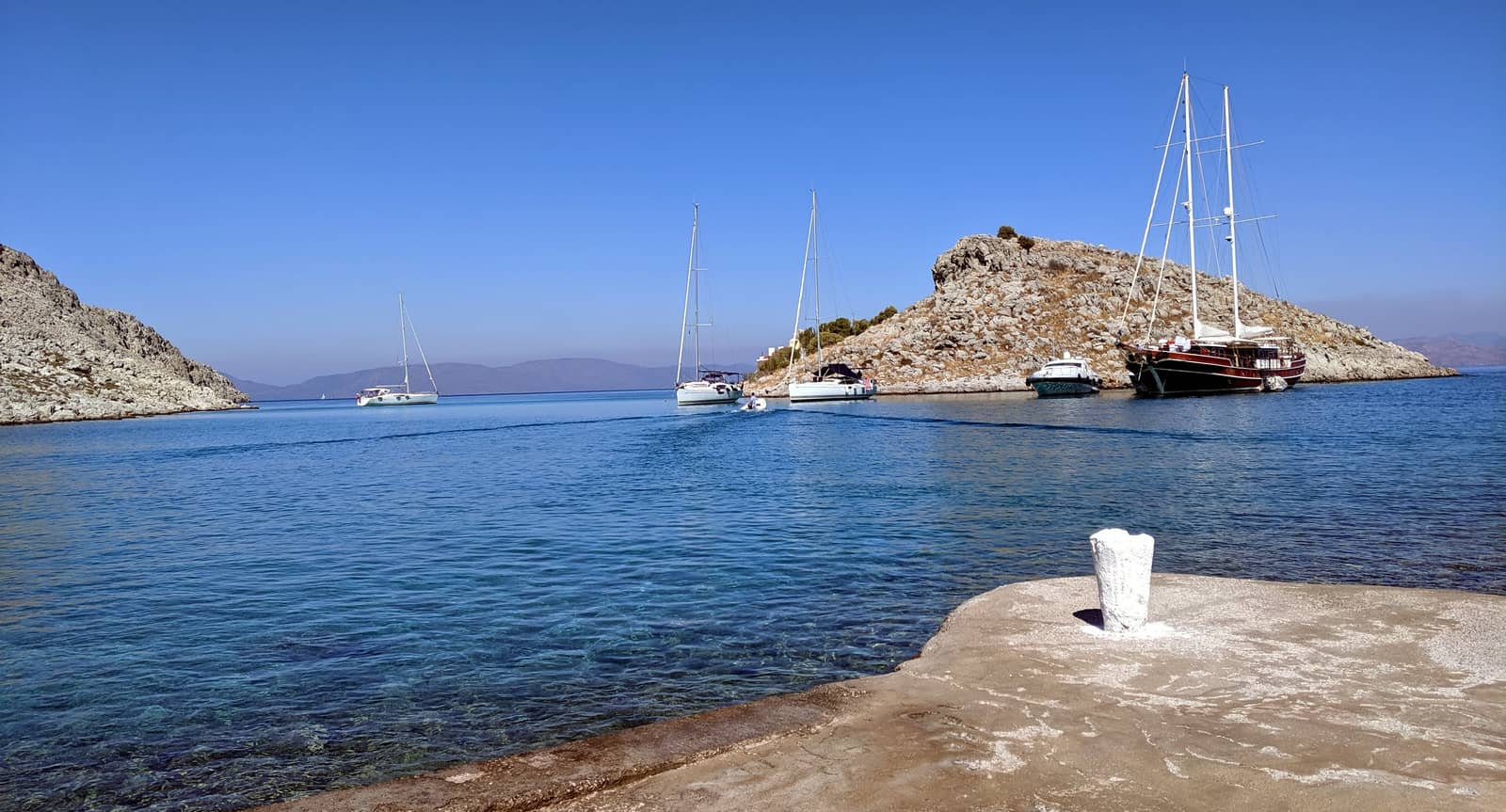
Pedi
Pedi - Πεδί village, with flat fertile fields, is located at the head of a deep bay. The GWP mentions “a rock above water on the N side of the entrance”, surely this must be Pazmadi islet (unnamed on most charts) - Ραζμάδι which is connected by a reef to the coast: keep on starboard when entering Pedi bay.
On September 18, 2021 the Symi – Marina was opened, located at the already existing Northern mole; VHF 71; 50+ berths and mooring balls.
See marina layout and contact details PDF.
Strong Southeasterlies (only Nov – May) can make the mole and quayside unmanageable; leave and drop anchor in the South.
The pier in the West is used by fishing boats, tripper boats and the occasionally large freighter; you can be requested to leave.
Go alongside (if necessary by rafting up), or stern-to at the tip.
The premium spots to anchor are in front of the “Pedi Beach Hotel”, which is the pastel blue and yellow coloured building without the neoclassical triangular pediment. Alternatively, anchor in 5 – 8 m North of the pier ending. Sand / weed and a bit of rocks and in the North Mud as well; holding can be good, but double-check.
Strong gusts possible, mostly SW – NW.
“Taverna Tolis” in the NW corner serves excellent dishes for low prices.
For all your dipsomaniacal desires: a dangerously well-stocked liquor store in the SW corner.
Symi capital is a 25 min. walk, with along the way the in 2020 modernised and revamped Historical Museum. In contrast, the Kastro (i.e. castle ruins of Knights of St John) isn't worth the detour.
St Nicholas
The cove of Ayios Nikolaos or St Nicholas - Παραλία Αγίου Νικολάου provides a snug anchorage with a (buzzing) beach on the south coast of Pedi bay.
Lat Long
There is tranquility after the late afternoon departure of the sun tanning tourists.
Good holding in sand and patches of weed; for the night we opted to take a line to the West shore, from where you can just see Pazmadi islet, looking out of Pedi bay with the Turkish coast on the horizon; gusts from either SW or NW. Taverna was closed during our last visit of the bay; a splendid 20 min. hike along a lovely path to “Taverna Tolis”.
The wooden disembarkation pier on the East side is used for sun bathing (parasols) and tripperboats, though is sometimes “adrift”; a cement quay is found the SW corner.
Agios Nikolaos – Saint Nicholas → Sinterklaas → Santa Claus
The Americanized ”Santa Claus” does not exist in Europe, but evolved from Dutch traditions regarding “Sinterklaas” when the Dutch established the colony of New Amsterdam (New York).
In Belgium, The Netherlands and parts of Germany the bishop-like Sinterklaas brings gifts to children on 5 December, the evening before his death (6 December).
Yet in Greece it is “Saint Basil – Agios Vasilis” who does the giving and does so on New Year’s Day!
See Agios Vasíleios (St Basil) anchorage below.
”Santa Claus”, “Sinterklaas” and “St Nicholas” are all modernized versions of ”Ayios Nikolaos”, the devoted Greek bishop who lived in the fourth century in the Lycian town of Myra in Asia Minor.
He has become a patron saint of children, sailors, fishermen, even of all of Greece, particularly of the Hellenic Navy… and also of prostitutes.
St George • Thessálona
St George - Άγιος Γεώργιος bay – also known as Ormos Thessálona – or rather Ag Georgíou Dysalona in full, is a squarish and deep bay enclosed by magnificent towering cliffs.
Drop anchor in 3½ – 10 m near the beach Lat Long
or close to the North shore Lat Long where there are plenty of convenient rocks to take a line to.
Most of the bay is too despairingly deep to anchor; open to NNE – S winds; (occasionally formidable katabatic) gusts from NW ; strong northerlies can introduce a swell.
There is a modest Monastery of Ayios Georgios - Μονή Αγίου Γεωργίου worth visiting in the middle of the beach.
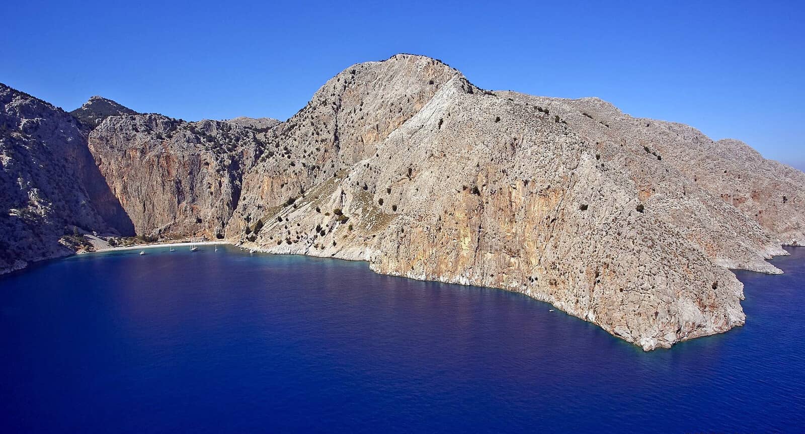
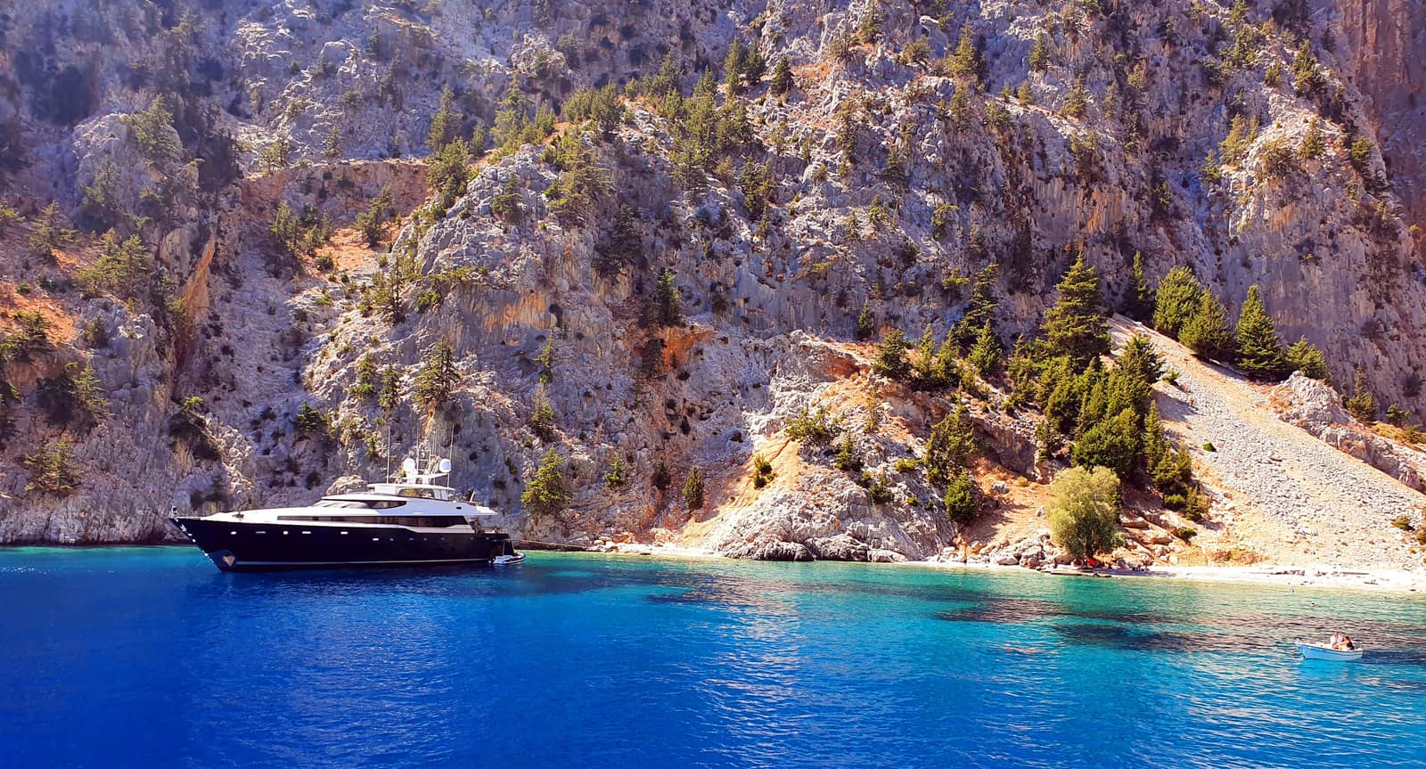
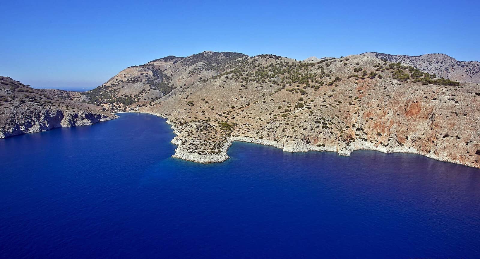
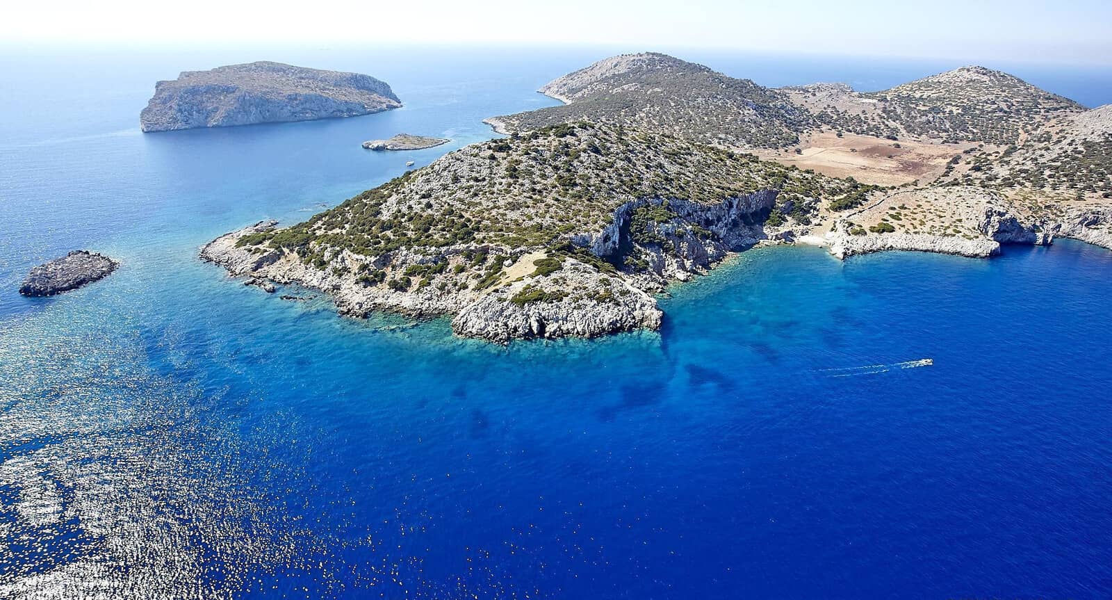
Nanoú
The bay of Nanoú - Νανού is yet another sizable, steep and stunning indentation of Simi's serpentiform shoreline.
The tamarisk lined beach has goats, a Church, a mini-taverna (in summer) and a mini-pier for the unavoidable tripper boat.
A rocky promontory in the SW corner sections off a small coveted cove under pine clad, verdant hills – away from the pebble beach –
the super yachts tend to gather here, seeking privacy from the hoi polloi take a line to the shore amidst the privileged…
Lat Long
Strong NW gusts with Meltemi, good holding and therefore more than a mere lunch stop anchorage as suggested in the GWP;
open to N – SSE; mind the isolated rock / shallow patch in the South, see Eagleray, Navionics & C-MAP.
Notice the shallow areas along the South shore (left).
The megayacht is anchored in the “coveted cove”.
Since the roof was painted white in 2020 the Church of St Pantaleon - Άγιος Παντελεήμων (patron of Physicians, Midwives, & Apothecaries) is marginally conspicuous when sailing into Nanóu bay.
Handy to know is that Saint Pantaleon can also be invoked against headaches, tuberculosis, COVID-19 ? , locusts, witchcraft, accidents, loneliness and crying children; his name means the "all-compassionate".
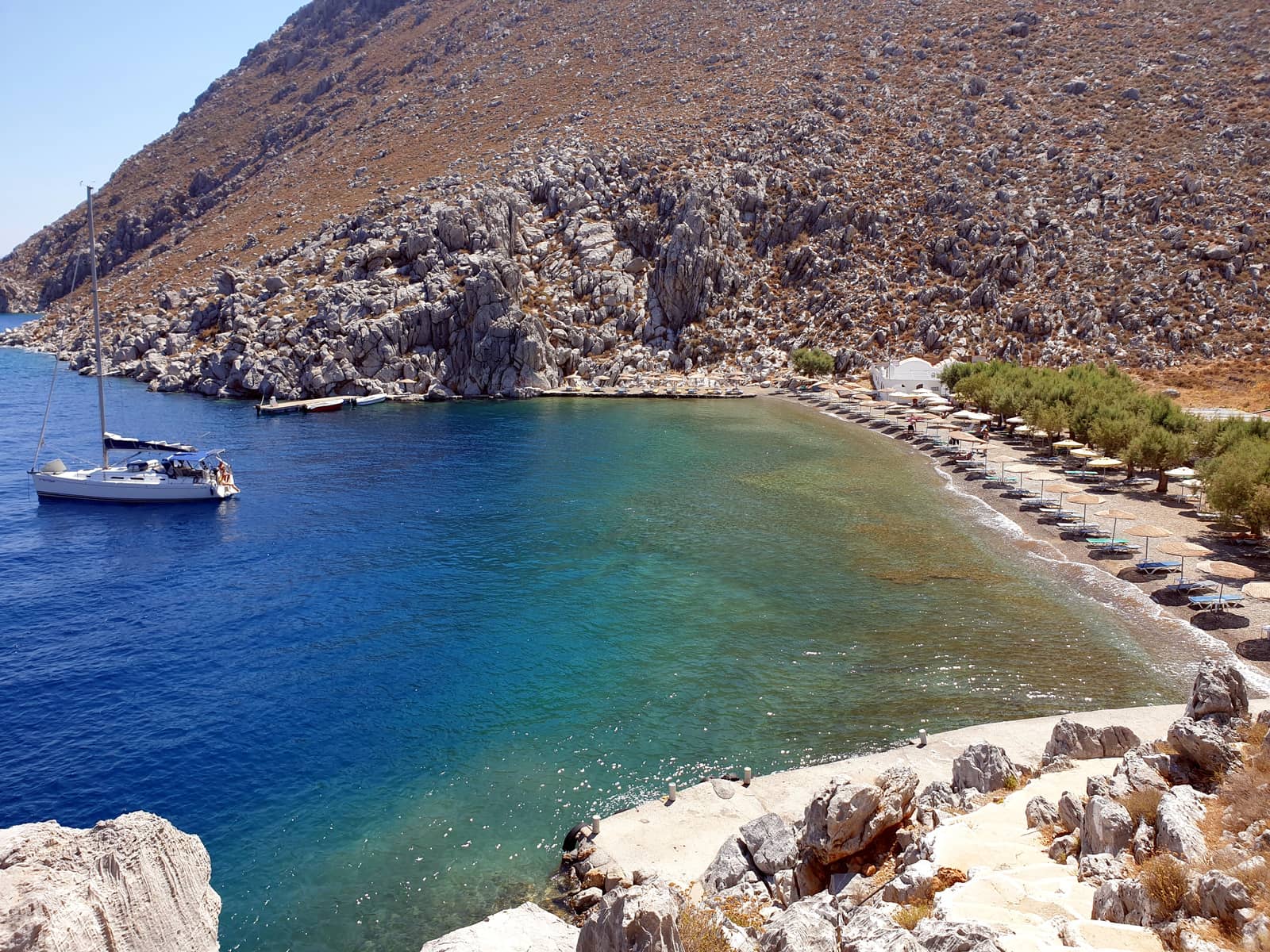
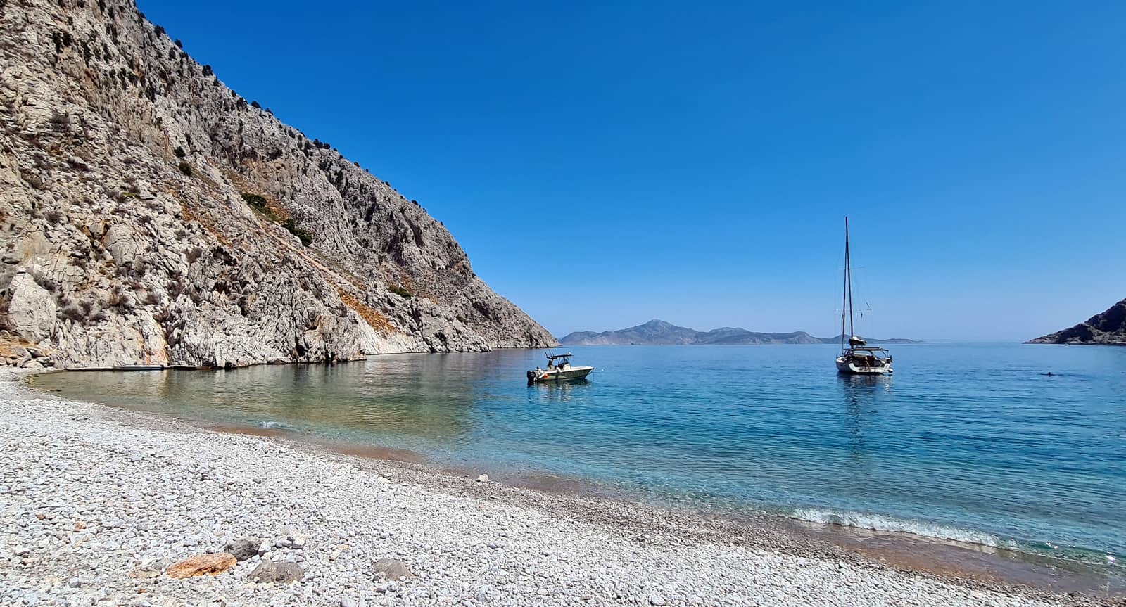
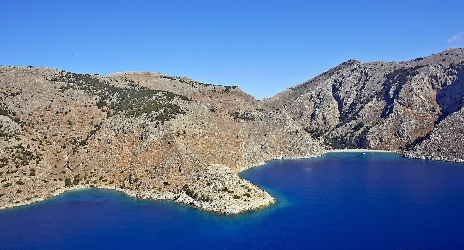
Marathounta
Marathounta - Μαραθούντα is a much tighter bay than Nanou, less fertile but still with some charm – closer to a road, reachable by car. The beach is populated by cheeky longhorned goats (also baby goats) who claim their spots under the tamarix trees.
Marathounta bay ends in a dogleg with nearly alround protection except in stronger winds; open to E – S.
There is a lovely bar / taverna “KYMA Coffee” with superb mojitos North of the disembarkation pier (tourist transport). The other taverna “Ταβέρνα Μαραθούντα” in the South (mixed experiences) offers three permanent moorings for its customers, Tel. 22460 71425.

The violent gusts from the mountain can be disquieting – Symi island is here almost at its narrowest.
Specifically in the winter a strong Southern wind can introduce dangerous waves that reach the beach → don't get caught inside.
Anchor at the head of the bay in 4 – 7 m over sand; the seabed rises quite steeply which makes for mediocre holding, see C-Map and in particular Eagleray, consider taking a line to the Northern shore
Lat Long or (optionally) in lighter conditions to the Southern shore.
2 additional anchor options southward:
Mind the reefs extending from Cape Skouloudas, and also note that the first bay around this cape is Vathy Gialó and the second bay is Faneromenis
- Roughly 1 NM South of Marathounta is Vathy Gialo bay: a tranquil alternative; no beach; tiny anchorage over sand / weed; no tripper boats and “off the beaten track”; vulnerable to NE – S winds.
Lat Long
Gialo (γιαλός) “seashore” and Vathy (βαθιές) “deep”. - A further 0.25 nautical miles to the South, around Cape Faneromeni, is the triangular Faneromenis bay; no beach, beautiful rocks with some greens; use a trip line when anchoring close to the apex Lat Long, but there is a sandy seabed some distance away; not much room to swing at anchor → less exposed than Vathy Gialo; impracticable in windy conditions, yet at least an alluring lunch stop;
there is a dinghy disembarkation option (for the sporadic tripper boat) at the bottom of the winding cement steps that lead over the sadle to Panormitis bay.
Compare Panagia Phaneromene – Holy Mary revealed herself…
Mind the “rock awash” extending from the the next (unnamed) cape.
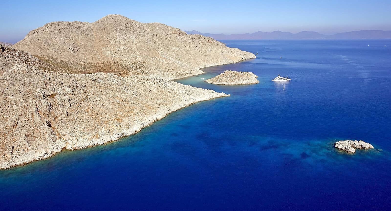
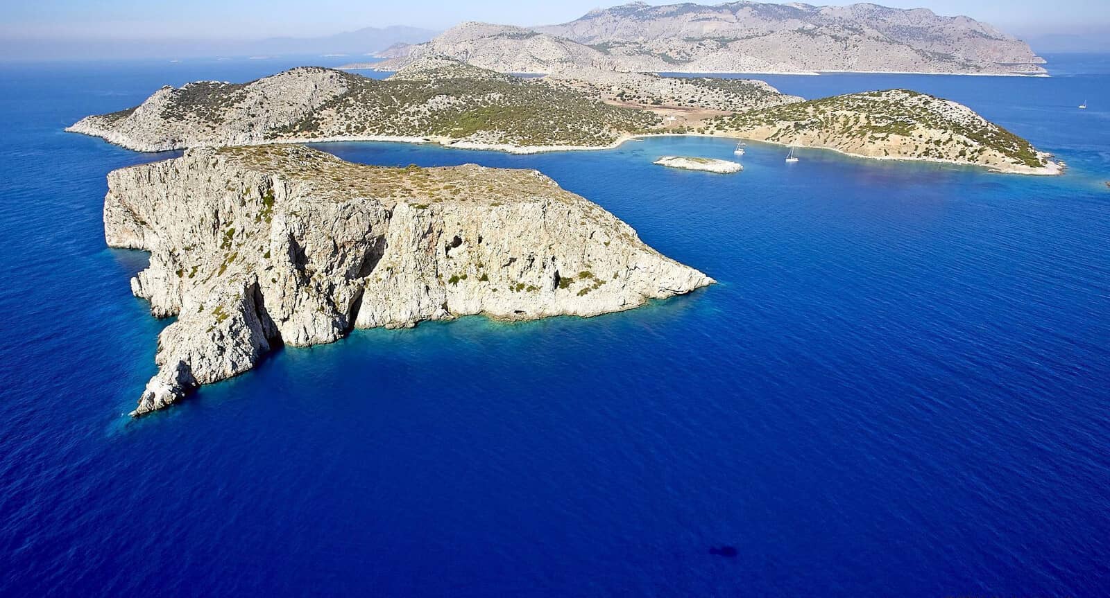
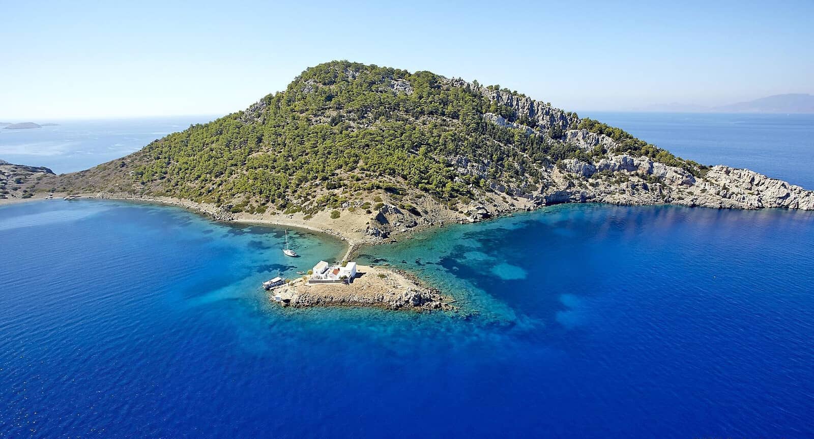
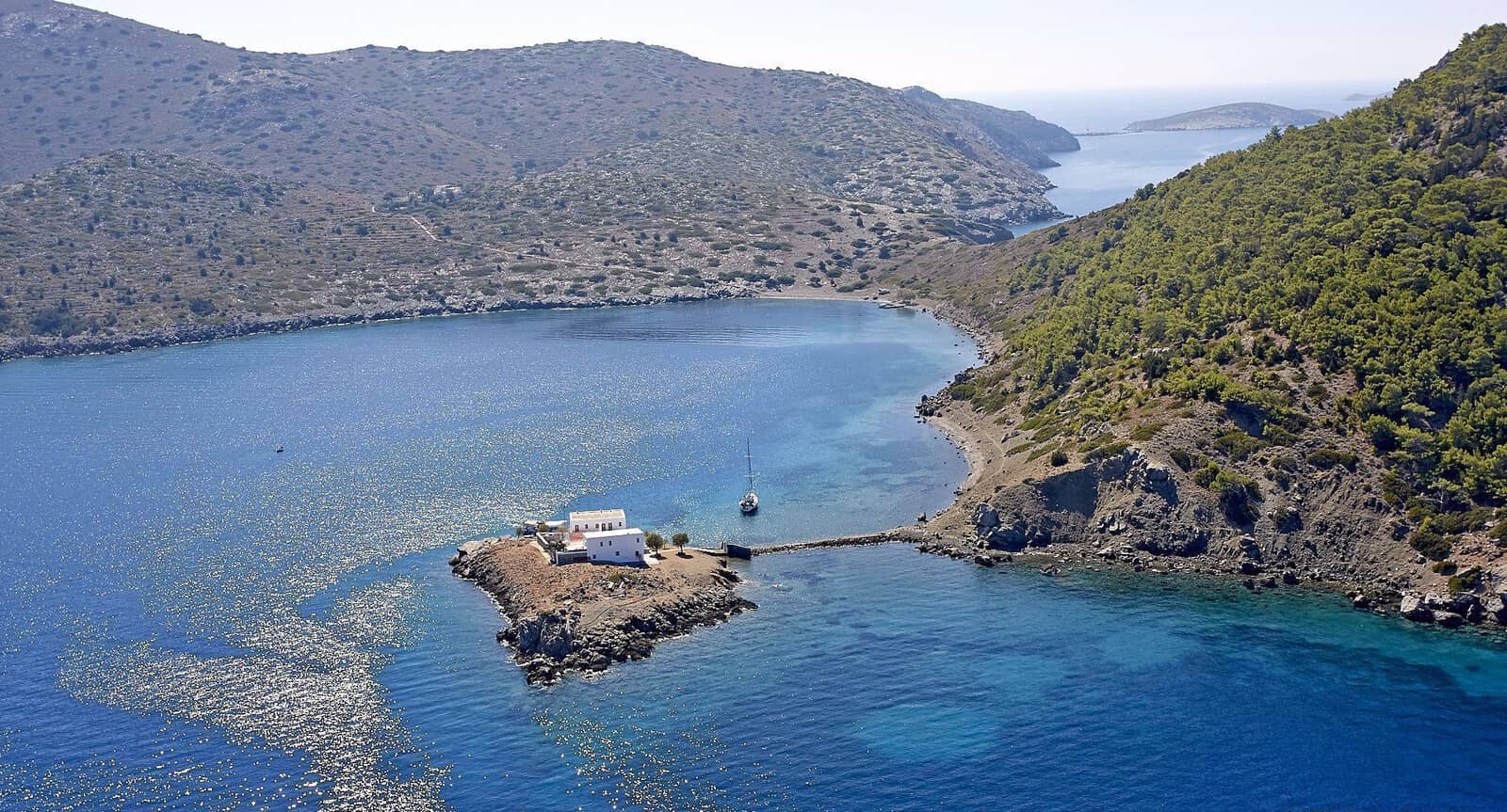
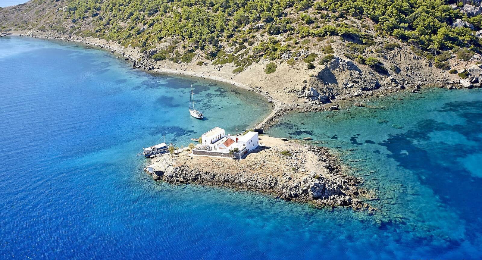
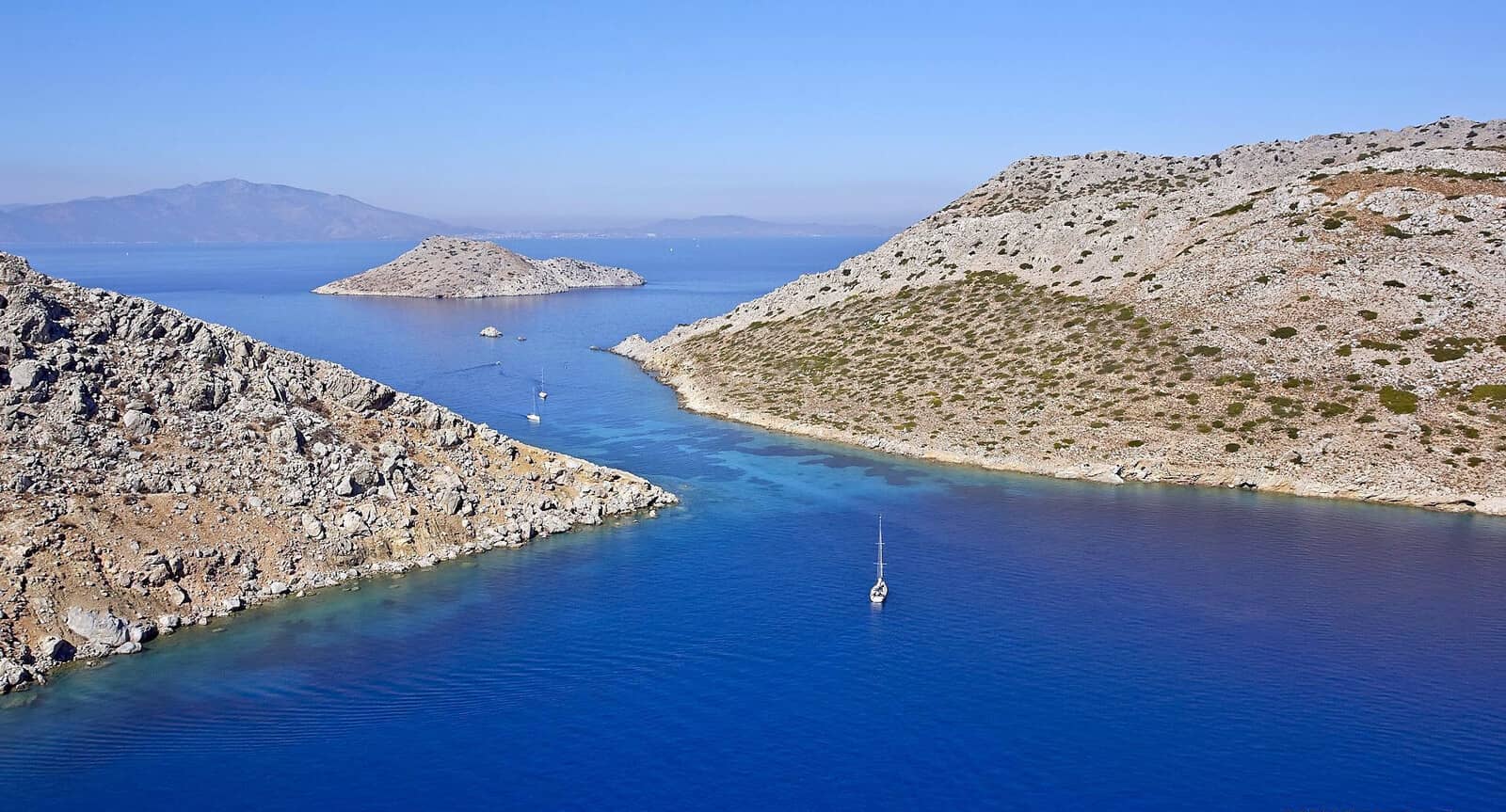
Seskli islet
The islet of Seskli - Σεσκλί or Sesklia - Σεσκλία, plural, to include the islets around Seskli, are uninhabited and belong to the Monastery of Panormitiss.
To the South the confined anchorage of Skomisa bay is guarded by Koulountros islet (lighthouse), and the smaller Artikonisi nearby.
The Koutsoumpi rock plus reefs cover the East and Northeast.
C-MAP is incorrect!
Some guides mention bad holding, yet we endured a mild Meltemi here without dragging anchor.
Open to NE – SW, anchor over sand (some rocks and pebbles) in
4 – 7 m; preferred spot is
Lat Long and mind the low rock and shallow area “inside” Skomisa bay.
The L-shaped pier is used by the Poseidon tripper boat from symiexcursions.com and is rather too shallow for regular catamarans and monohulls.
Archaeological evidence shows a human presence as far back as the late Neolithic period (4th millennium BCE).
Sesklia’s ancient settlement was named “Teutloussa” and you can explore the small stretches of its ancient Pelasgian wall near the island’s summit.
Thucydides mentions in his “Peloponnesian War” VIII.42 that it was here that the Athenian fleet under its general, Charminos, retreated and hid after its unexpected defeat at the hands of Spartan ships off Cnidos in 411 BCE.
Mind Koutsoumpi rock plus reefs on the left.
The islet in the top left is Koulountros.
The Sesklia islets – together with Symi island – are a Natura 2000 and an Important Bird and Biodiversity Area (IBA) Nº 169.
Besides the beautiful shores that calls for swimming / snorkeling, the island is surprisingly green, with a variety of vegetation supporting a vigorous bird life – including partridge which in turn attracts raptors.
Of significance – certainly to the joy of us sailors – is the Cory’s shearwater Calonectris borealis / diomedea is that also breeds here, and can been seen gliding and fishing in the open waters between here and Karpathos island. Borealis and diomedea were once considered conspecific but are now classified as separate species.
The herpetofauna includes the Turkish Worm Lizard, Rough-tailed Agama, Lacerta Lizard, Snake-eyed (Wall) Lizard and the Dwarf Snake.
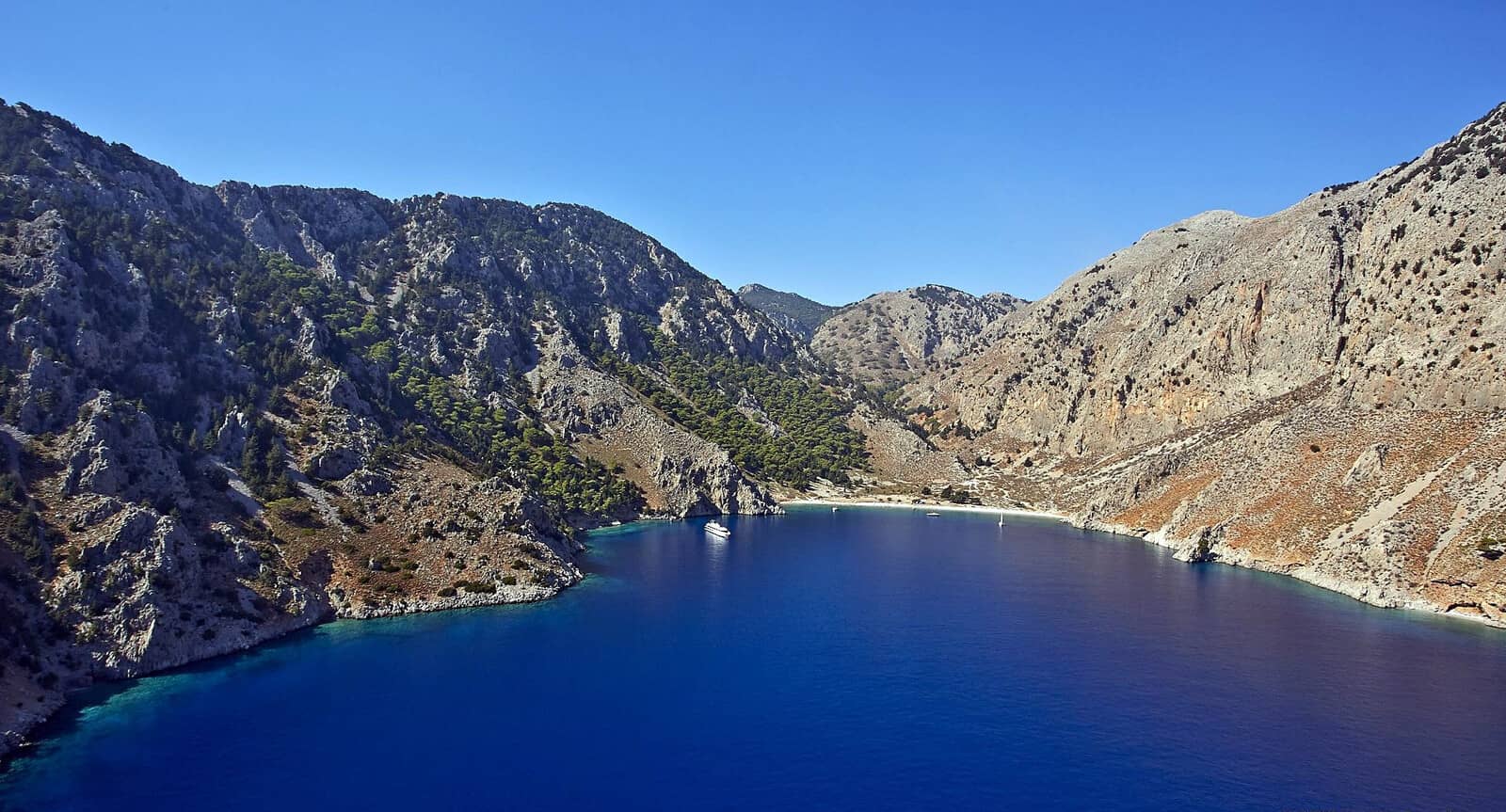
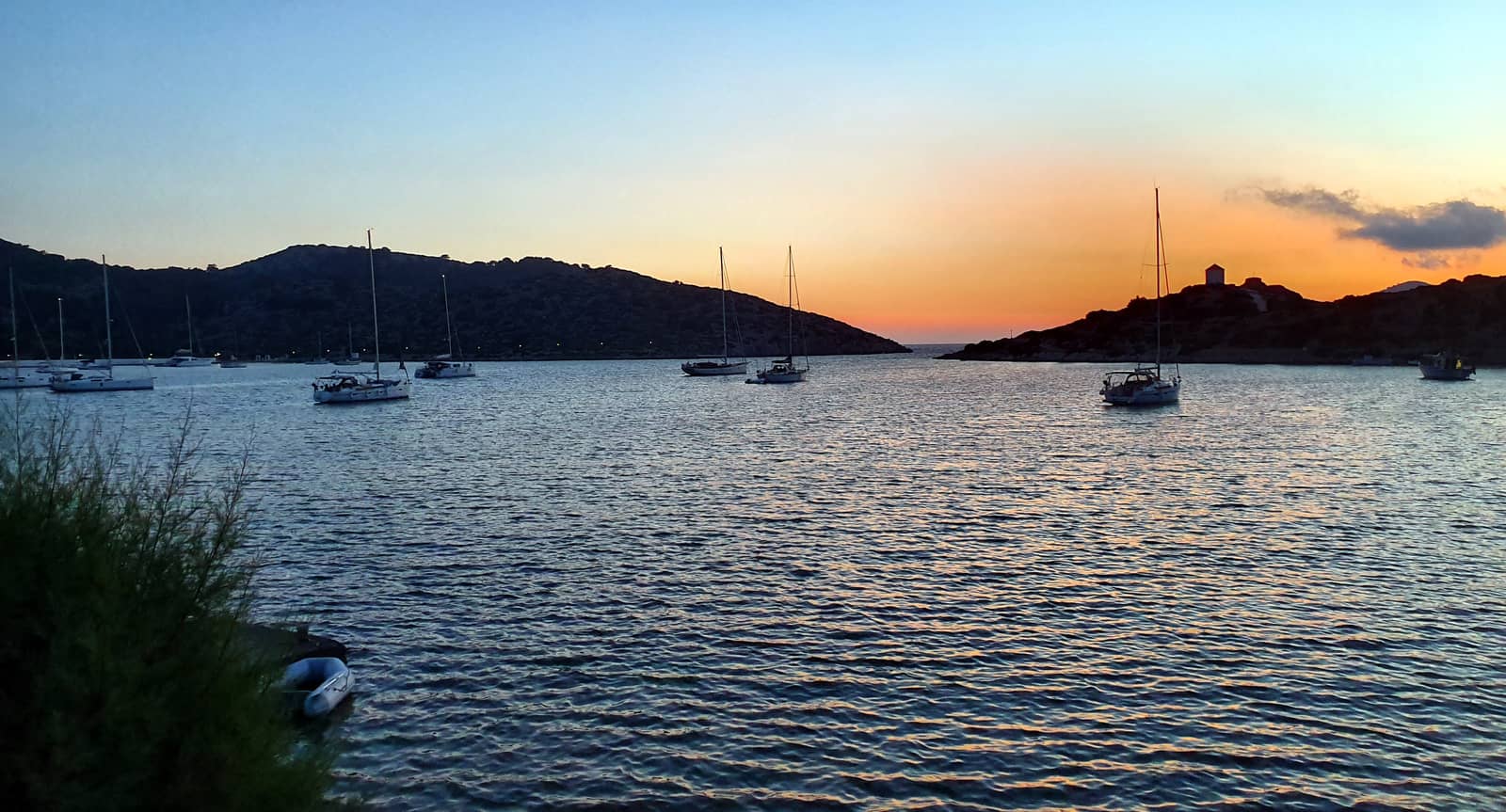
Panormitis
The natural harbour of Panormitis - Πανορμίτης bay is centered around the cherished Monastery of Archangel Michael “Panormitis” with its remarkable bell tower.
This monastic complex of “Panormitis”[in Greek] is the most important on the island, and second largest in the Dodecanese after the Monastery of St John the Theologian in Patmos, and well worth a visit.
The 18th-century Venetian-styled buildings contain great artifacts such as antique chandeliers and the quintessential silver icon of the Archangel Michael, who is the Patron Saint of the island and the guardian of sailors.
This Panormitis icon is one of the four miraculous icons of the Archangel Michael in the Dodecanese of Greece.
Approach:
the Northern cape (lighted) features a conspicuous red roofed windmill, called “Mirador” often in full glory with its 8 sails.
Moreover, the baroque bell tower is renovated in 2017 and 2018 and is brightly illuminated at night.
Finally Eagleray mentions: “in strong NW winds a rebound of sea is created at the bay's entrance”.
The bay provides perfect allround shelter, although in northerlies it is best to avoid anchoring in the vicinity of the pier and quayside.
Solid holding in muddy sand, avoid the weed patches; the premium anchorage is in the North Lat Long, where you are also clear of the manoeuvring ranges of the ferries & hydrofoils.
The mountainous backdrop is covered with pine trees which give the area an ambiance of solitude (after the tourists' retreat), in sum: a fascinating venue.
Archangel / Taxiarchis Michael
- In Christianity, and especially in the Old Testament, angels are depicted as heralds, as messengers, which is the original meaning of the greek word “άγγελος” - messenger. Angels were also seen as spiritual warriors who protected believers.
- The arch- prefix in archangel is derived from Ancient Greek - ἀρχι “chief” or “principal”.
- Another name for the Monastery is “Taxiarchis Mihail Panormitis”.
Taxiarchis - ταξιάρχης singular (or in plural, taxiarches - ταξιάρχες) literally means “commander” (of a taxis, a squadron). The name is usually translated into English as “Archangel”, particularly in relation to Gabriel and Michael. - Archangels Michael and Gabriel are therefore called the Taxiarches in Greek Orthodoxy because they lead the “heavenly host”.
- Heavenly host refers to the army (Luke 2:13) of angels mentioned both in the Hebrew and Christian Bibles.

Constructed by the Italians after World War II, these buildings now contain rooms to host ±500 tourists / pilgrims visiting the Monastery.
A sailing yacht is moored alongside the innerside (the only possible berths) of the L-pier.
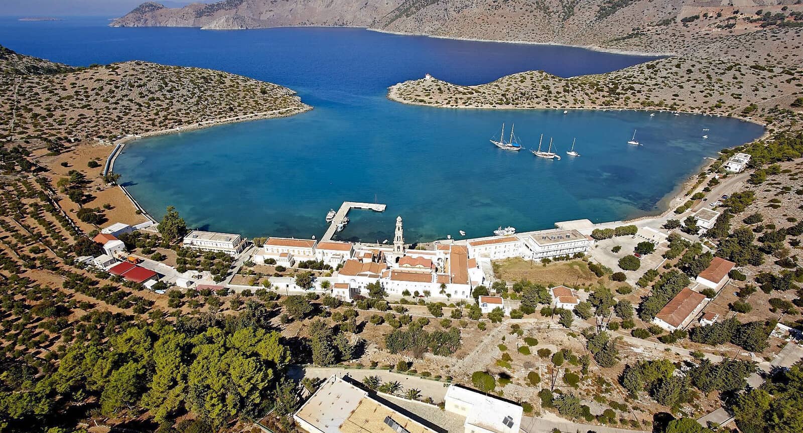
Hydrofoils and giant ferries use the various sides of the L-pier, upto 5 ferries simultaneously.
The quay is too shallow and even the “stem” of the L of the pier is mostly less than 1.5 m deep. Only the innerside of the L is 3.6 – 4.7 m deep. If allowed by the Harbour Office you can go alongside (only on the interior), but you will have to endure the floods of tourists and pilgrims when a ferry docks!
Local amenities are meagre:
Bakery “The oven of Panormitis” - Ο Φούρνος Του Πανορμιτή run by monks
“Panormio Cafe-Restaurant” in front of the premium anchorage.
Minimarket.
No water and no fuel.
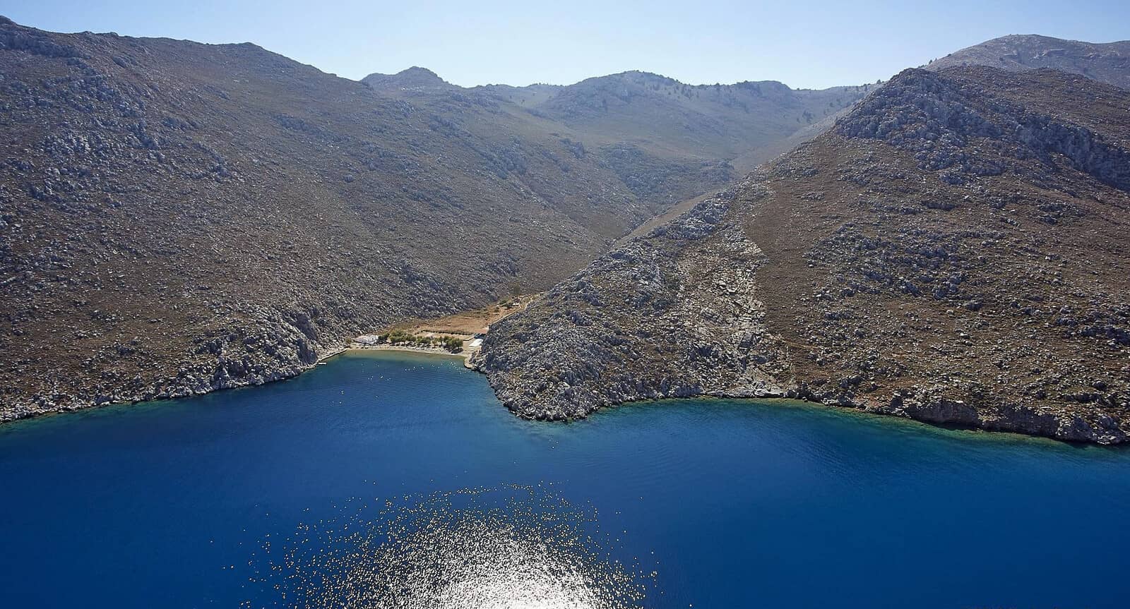
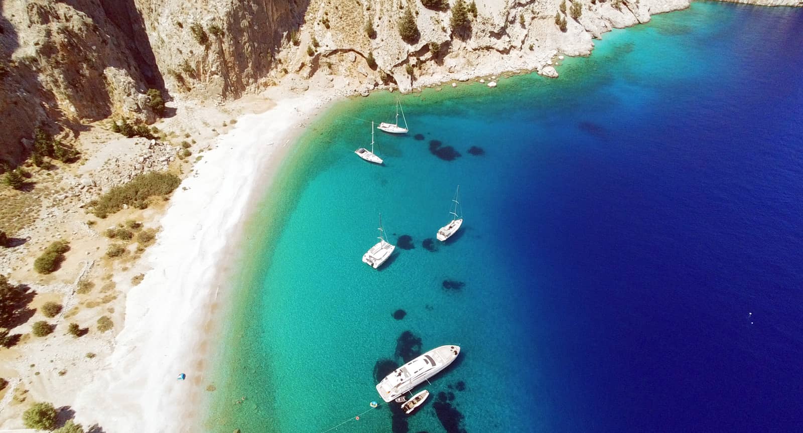
Ag Vasíleios (St Basil)
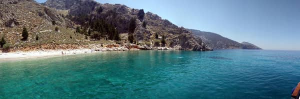
Agios Vasíleios (St Basil) - Άγιος Βασίλειος is a much indented bay with a wonderful anchorage in the far NE corner.
It features one of the most beautiful beaches (very fine pebbles and sand) of the island with negligible tourism since the beach is accessible only by boat.
Saint Basil
The Greek version of Santa Claus (and Sinterklaas) is St Basil !
According to Christmas traditions in Greece, giving presents is associated with Basil of Caesarea i.e. Saint Basil (Agios Vassileios), an old man with a white beard and a red cape.
Since
St Basil's feast Day is on 1st of January, this is the day that Greeks usually exchange gifts.
Anchor in 4 – 10 m over sand and weed South Lat Long of the white Church of St. Basil and take a line ashore SW of the Church; open to S – W winds.
C-Map and Navionics show a surplus of rocks and hazards along the bay's craggy shores, which we mostly couldn't locate (likewise no fish farm). The Greek publications are likely more accurate.
The white Church of St Basil - Εκκλησία Άγιος Βασίλειος is just visible to the North (left) of the beach.
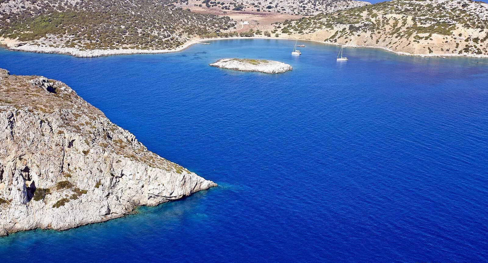
Ag Emilianos with Maroni & Toli
Around Cape Kefala is the wide bay of Agios Emilianos - Άγιος Αιμιλιανός i.e. Ormos Ag. Aimilianoú.
- Underneath the Church / Monastery of Ag Emilianos is the prime anchorage; open to NNE – ESE winds. Lat Long
anchor in 4 – 6 m over sand and weed. Optionally, take a line to the short quay.
The actual beautifully pastel blue embelished Agios Emilianos Church is cloistered in the courtyard of the Monastery, hidden within the white block structure standing on the peninsula which is connected by a gated isthmus. - The deepest cove in the South is Maroni - Μαρόνι, which has a pebble beach and a sylvan shore. Open to NW – NE winds. Lat Long
- Toli - Τολί is in the far NE of Ormos Emilianos bay; first-class “Taverna Dafnes” , unremarkable pebble beach, yet with grand views; open to S – NW winds. Lat Long
Tolis
The Greek “Tolis” is short for the personal name “Apostolis” or “Apostolos”.
It shares the same nameday on June 30th as it also refers to (the day) of the Assembly of the Apostles, when Christ chose the original 12 Apostles, Judas excluded.
Compare the verb “apostello” which means “to send”.
For perfect solitide there are (lunch stop) anchor possibilities in between these bays, and also SSW of Cape Kefala.
Note the short quay where the local boat docks.
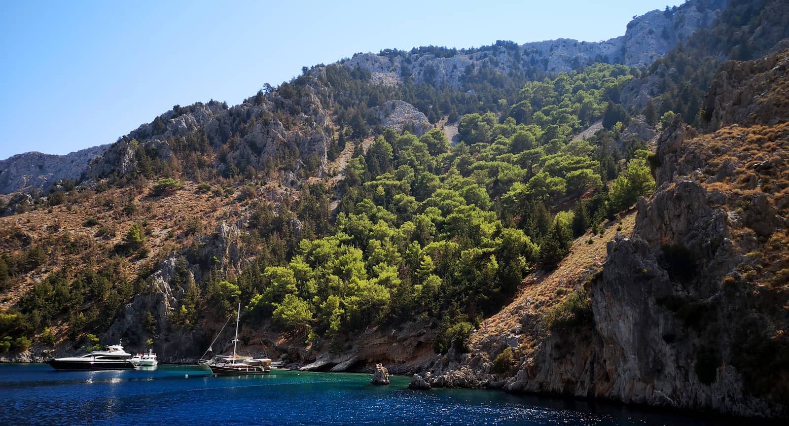
Nimos island & channel
The island of Nimos - Νίμος is separated from Symi island by a shallow channel, Steno Nimou.The channel is used by fast moving liners to Kos and Tilos, don't cut corners, check AIS and sound a 5 seconds prolonged blast.
The depths in the middle are at least 4 m, but on either side there are areas of 3 m and even 2 m → the safety zone is very narrow, but with crystal clear water.
In heavy seas the depths are further reduced by wave heights!
In the NE cove, locally known as Ormos Taviri (but unnamed on most charts) anchor in 3 – 5 m; open to N – E winds; white square house ashore; disembarkation quay on the S side. Lat Long
Emporios
Nimborio(s) - Νημποριώς or Emporios - Εμπορειός
is a large open bay with large depths. Therefore you will mostly find superyachts and megayachts here, which use the bay as an anchorage to Symi port, offering more privacy for the affluent owners.
Ideally take a line to the North shore Lat Long near the white Monastery of Saint Mercurius (note the pigeonhole windows).
Wide open to N – E.
The coastal road that winds all along the South shore is a conspicuous ugly scare.
As the name reflects, the bay was in ancient times the commercial harbour: from Ancient Greek ἐμπόριον (empórion, “trading station” or “market”), compare Chalki Emporios.
Melancholy
Either a gloomy state of mind, especially when habitual or prolonged; depression, or sober thoughtfulness.
Archaic: the condition of having too much black bile, considered in ancient and medieval medicine to cause gloominess and depression, see… →
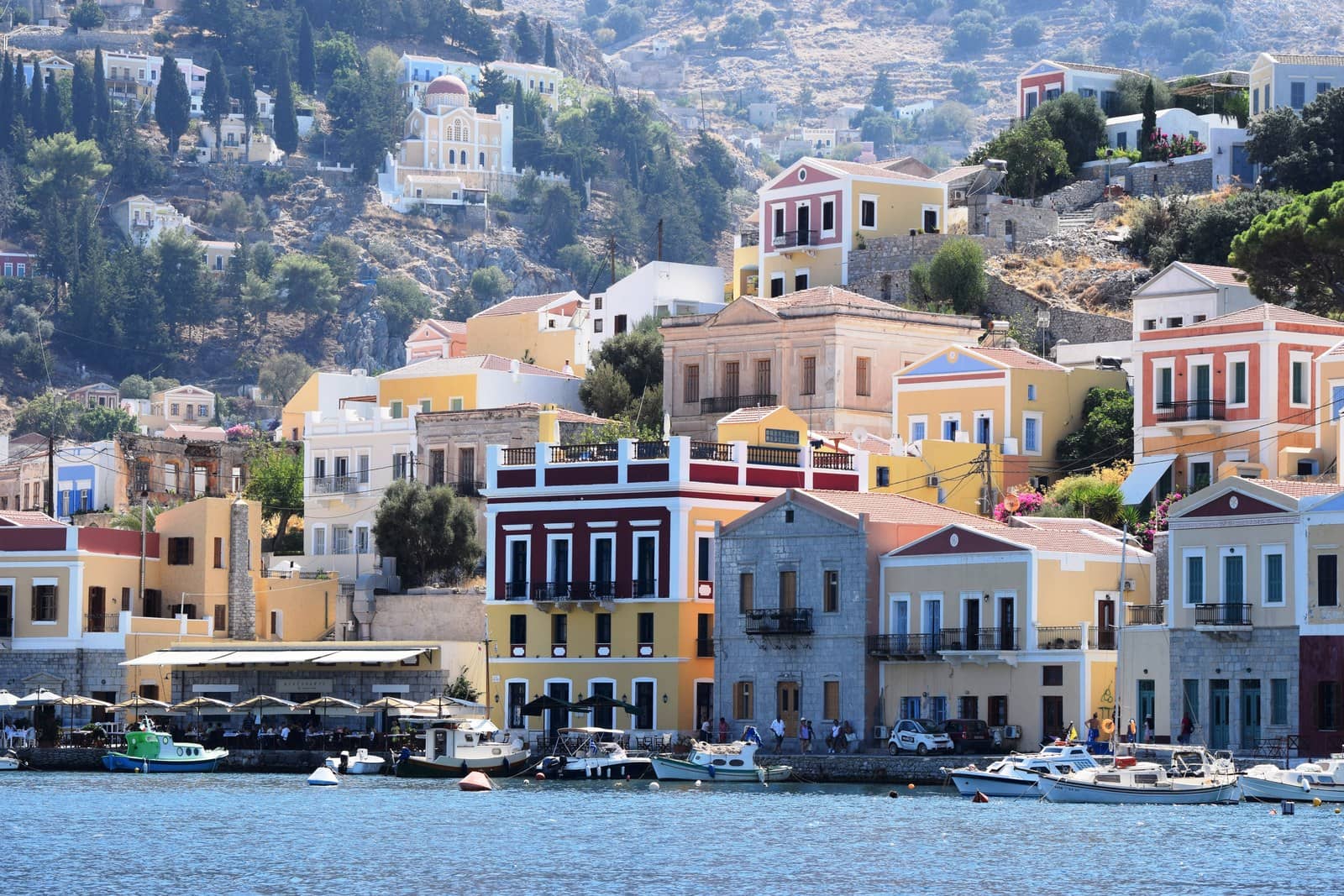
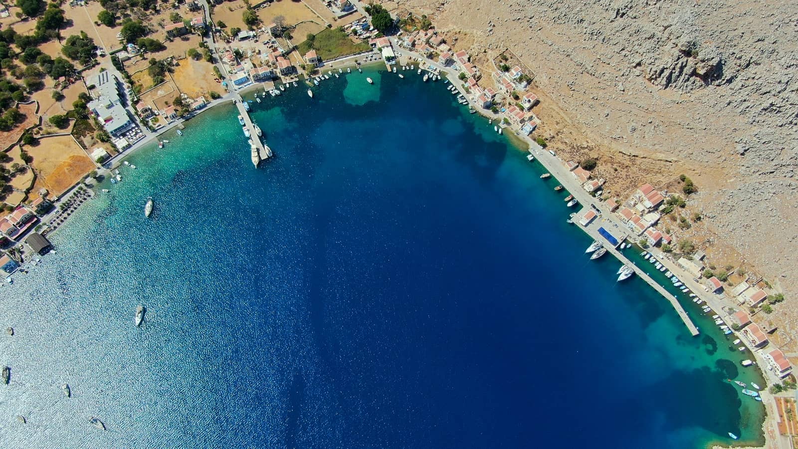
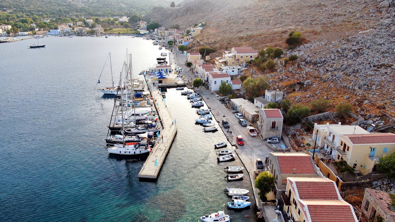
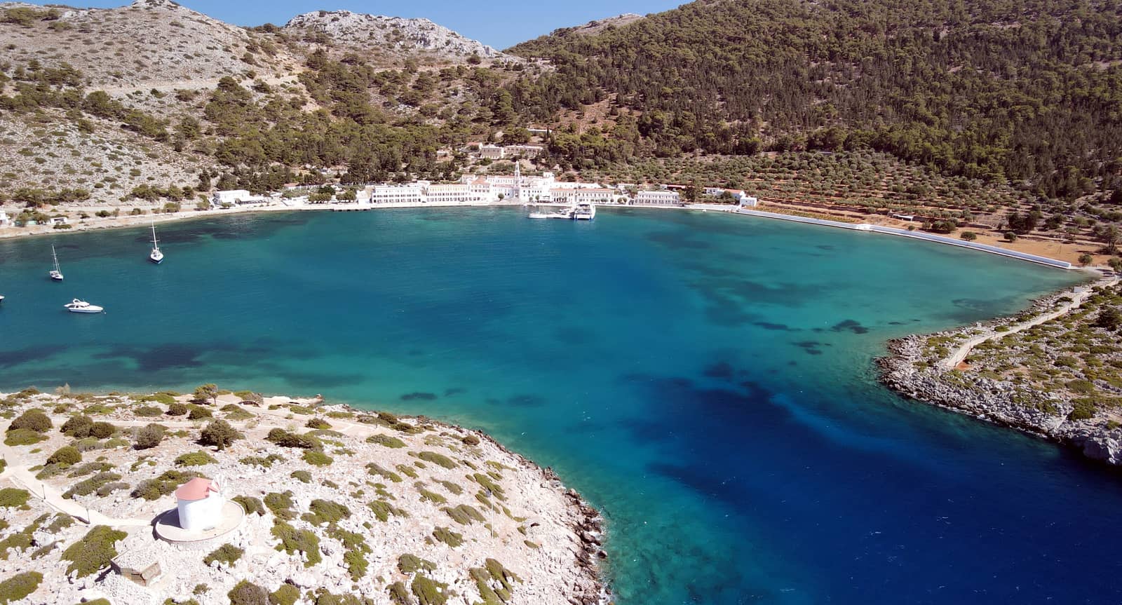
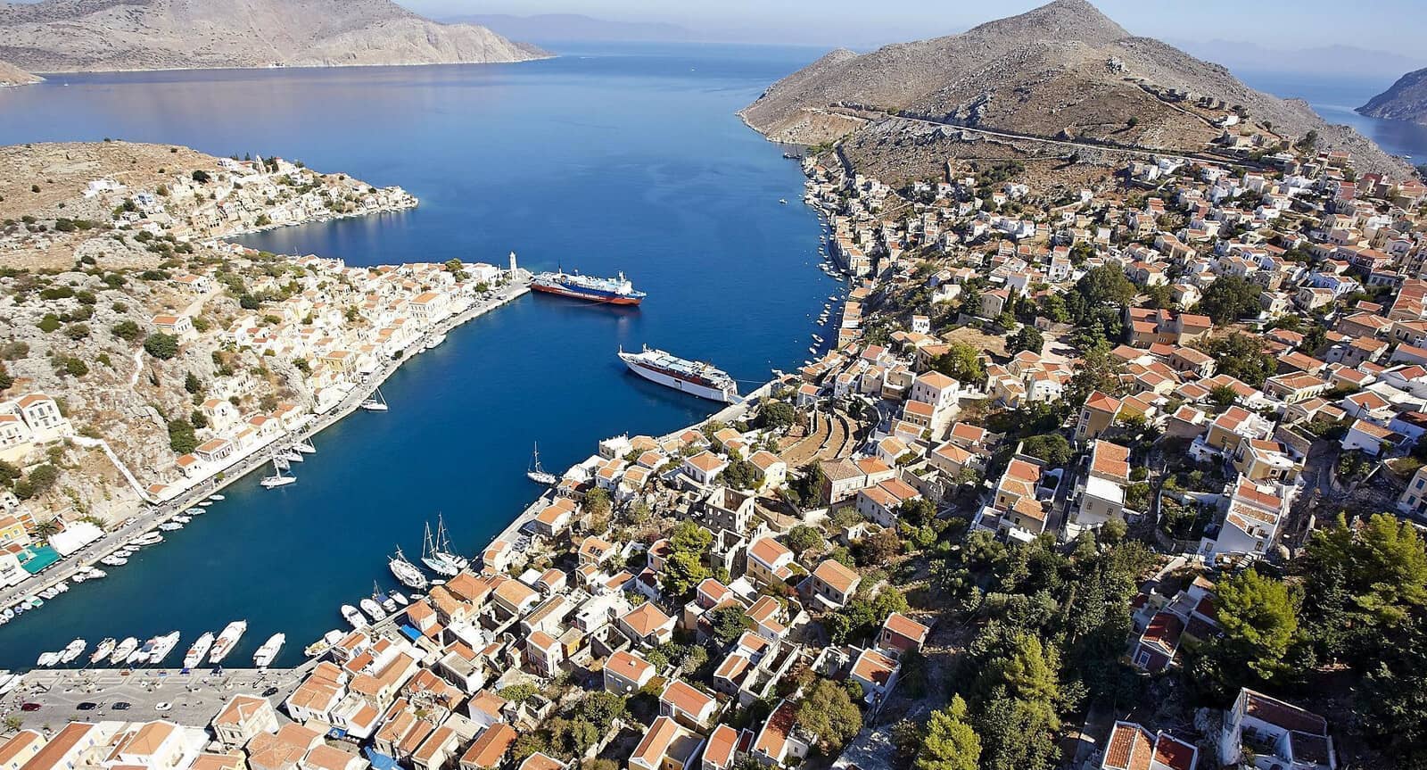
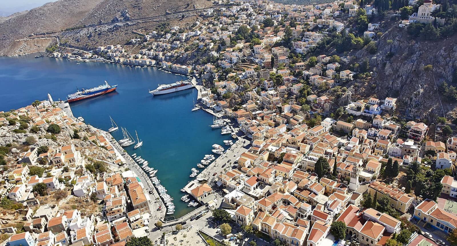
Symi port

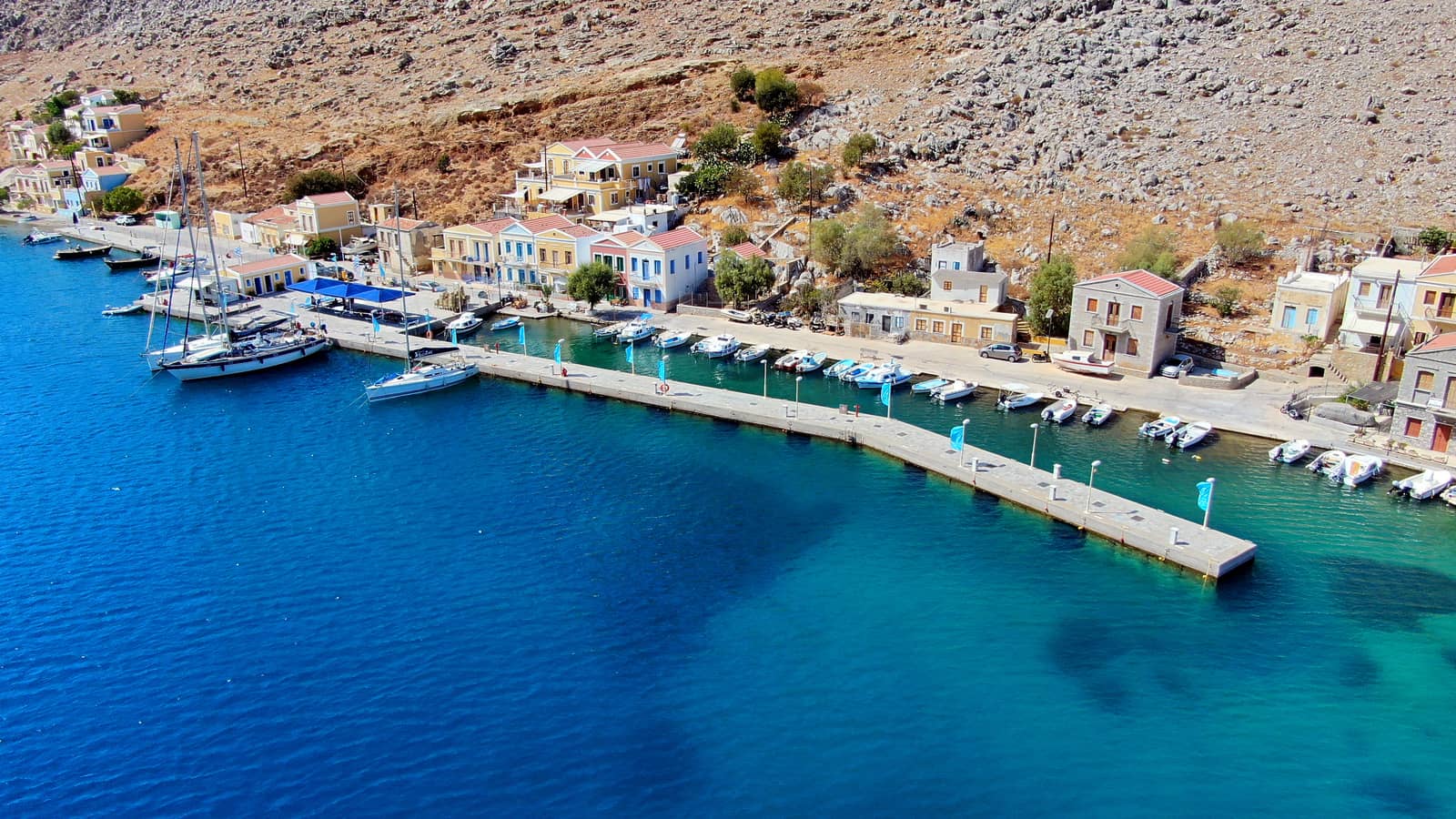
The island's fabulous capital Symi (or Yialos, Gialos), with its handsome 18th and 19th c. mansions, lies on the north coast, in a bay sheltered by the islet of Nimos and the Turkish headlands.
The clock tower on the edge of the natural harbour is easily identified.
During the afternoon numerous ferries bring loads of tourists, but when these invaders depart, the sailing fraternity – flying flags from all nationalities – takes over, and the boulevard rejoices in a more gentil and relaxed air.
At the head of the bay – where once famous local shipbuilders launched their superior caïques – the two flanks of the Chorio uptown meet via a stone bridge, kalderimi in downtown Gialos.
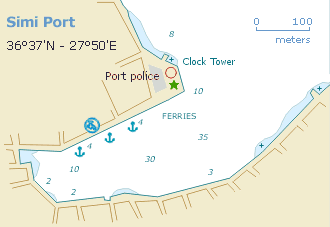
Moor stern-to the quays where directed by the harbour master's whistles and hand gestures, or ask the Harbour Office (VHF 12) for a berth.
The port can suffer from strong W or NW gusts, but it offers allround shelter, except for the NE winds (winter months only).
Depths are considerable and in some areas you will drop anchor in over 20 m; the seabed is mud and rocks; holding can vary between poor to good → do test whether you anchor holds.
After 16:00 most of the daytripper vessels have left, after which also that stretch of quay can be used.
Manifold ferries come and go, creating a lot of wash.
The Charani / Kharani bay, directly North of the clock tower, can be used as an anchorage but only in lighter winds; likewise large depths.

The Archaeological History Museum is a must, see description at Pedi.
Note, that the Nautical Museum is permanently closed and its marvellously multicoloured mansion has become the office and home of the Metropolitan (the Othodox version of a Bishop) of Symi. Although in 2018 a relocation into the Metropolitan's old office was planned, this was never realised.
“Tholos Restaurant” on the outer NE corner of the second bay, Charani, has both spectacular views and food.
A more impressive second clock tower belongs to the Annunciation Church (Evangalistras) - Ναός Ευαγγελίστριας on the hill of the outer corner – renovations 2021 – overlooking Charani bay.
The St John Church - Ναός Αγίου Ιωάννου is built over and has spolia of a temple of Aphrodite, in Gialos, 150 m SW from the waterfront in Gialos.
