Naxos sailing holidays
The largest and one of the most beautiful of the Cyclades, the island of Naxos - Νάξος, is traversed from north to south by a range of hills which fall away steeply on the east but slope down gradually on the west into fertile rolling country and well-watered plains. The hills rise to a height of 1008 m and are cut by two passes.
Since ancient times the economy of the island has depended on agriculture, marble-quarrying, emery-mining (see Moutsouna) and the recovery of salt from the sea, occupations which have brought it a considerable degree of prosperity. In recent years the tourist trade has been an additional source of revenue, despite the surprising – for the size of the island – scarcity of proper anchorages / ports.
- All Greek islands
- Cyclades overview
- Kea
- Kythnos
- Syros
- Tinos • Andros
- Mykonos • Delos
- Serifos
- Sifnos
- Paros • Antiparos
- Naxos • Little Cyclades
- Milos • Kimolos
- Folegandros • Sikinos
- Ios island
- Amorgos
- Santorini
- Itineraries in the Cyclades
Previous island: Paros

Next island: Milos
Ports & anchorages Naxos & Lesser Cyclades
Naxos island
Clockwise ↻
Donousa island
Pano Koufonisi island
Kato Koufonisi island
Glaronisi islet
Keros island
Antikeros Drima islets
Schinoussa island
Irakleia island
Naxos island and town
The island's capital Náxos - Νάξος – in a fertile district growing vines, fruit and vegetables – is picturesquely situated on the slopes of a rocky hill crowned by the ruins of a Venetian castle (1260; panoramic views, well-lit so conspicuously useful for a nightly approach).
Features of interest in the town are a number of dilapitated Venetian palaces (particularly the Barozzi and Sommaripa palaces), the Catholic Church of St Mary (13th c.) and the 15th c. St Anthony's Chapel on the waterfront.
There is an interesting museum with archaeological material from all periods of the island's history, including a fine collection of stone vessels and Cycladic idols (3rd millennium BCE), pottery of the Geometric, Archaic and later periods, capitals and statues and a mosaic of Europa and the bull.
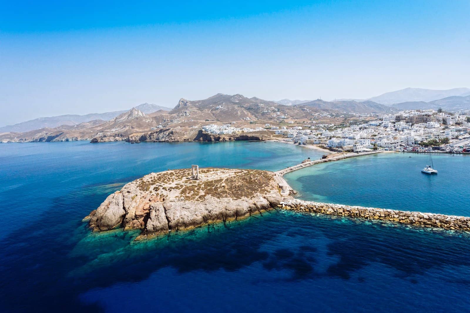
Naxos occupies the site of the ancient capital of the island, the main visible relics of which are a 6 m high marble gateway and the foundations of an unfinished Temple of Apollo or Dionysos (6th c. BCE) on the rocky islet of Sto Palati, which is connected with the main island by a stone causeway.
North-east of the town stands the old fortified Monastery of St John Chrysostom.
Further north-east is the whitewashed Faneromeni Monastery, with a church of 1603.
Characteristic of the Venetian and Turkish period on Naxos are the fortified tower houses, notably the Barozzi Tower in Halki, the Bazeos Tower and the remarkable Tower of Ypsili in Chora (Naxos).

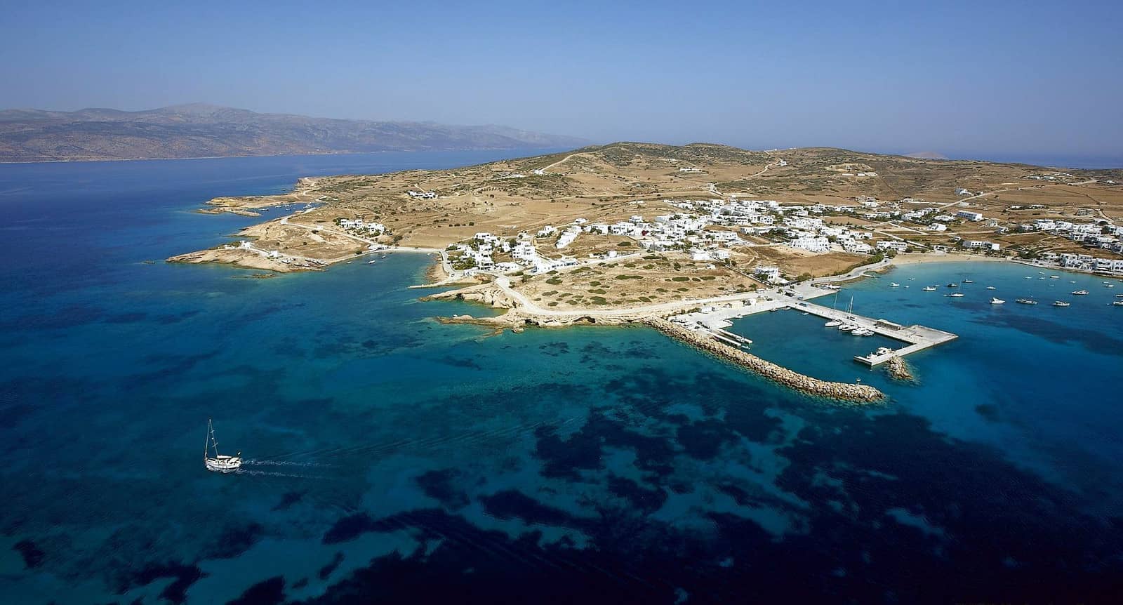
Naxos port / marina
The Naxos marina is incommodious, mostly packed with local yachts with a few antisocial owners . Moreover, the port is too shallow near the quayside. Fortunately, the port police (father) and harbour master (his son Gregoris) are a delight and super-friendly : Port VHF 12 or Marina VHF 69, Tel. (+30) 6946113923.
Beware of the ferries and the wash and huge waves they create.
Sine qua non: there are plans to extend both the outer mole (by 170 m) and ferry quay (by 110 m).
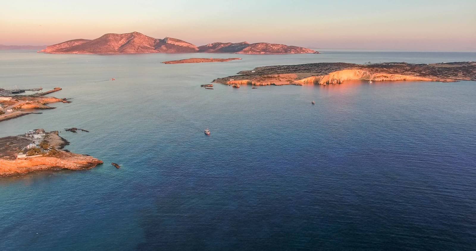
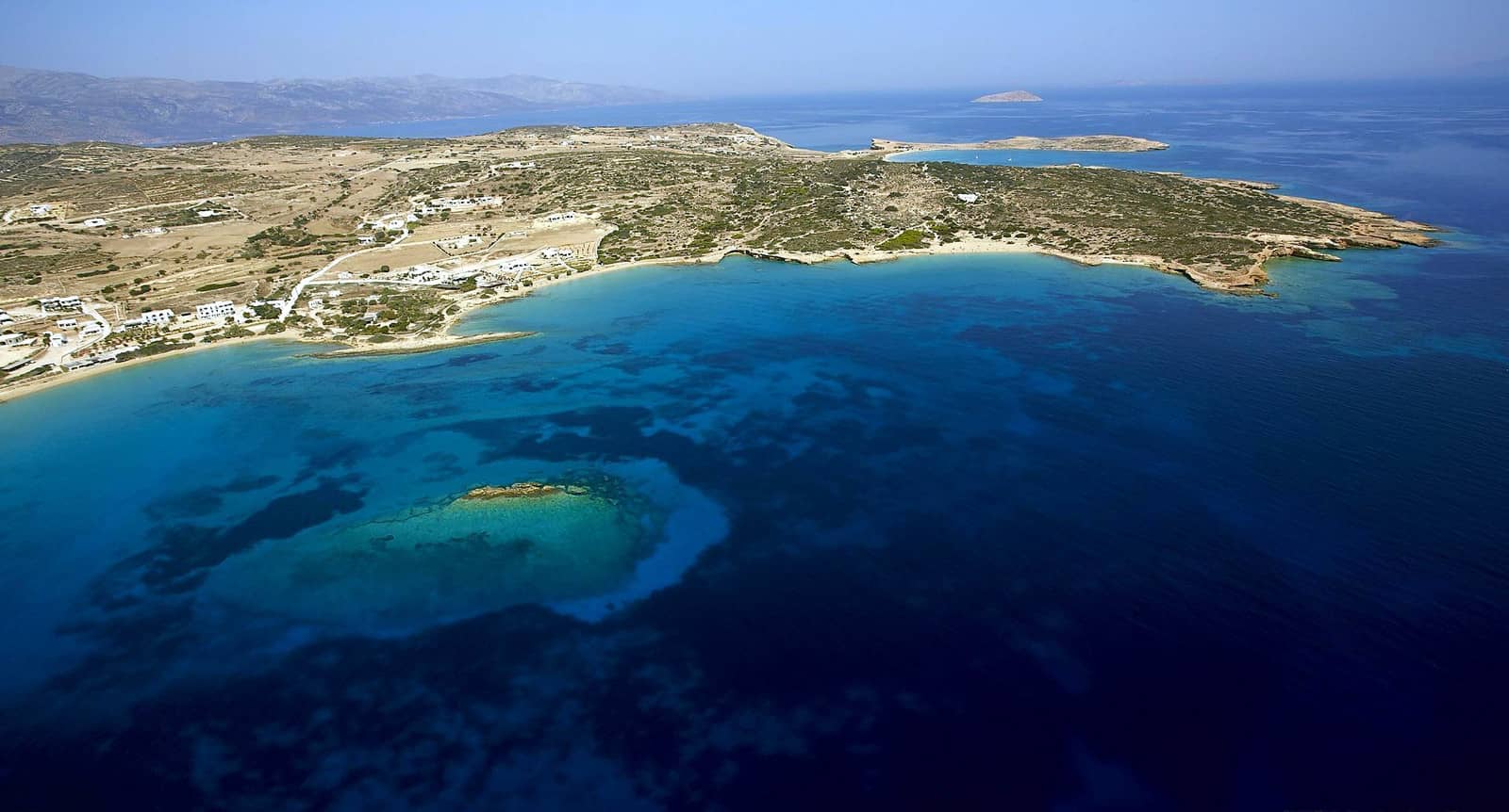
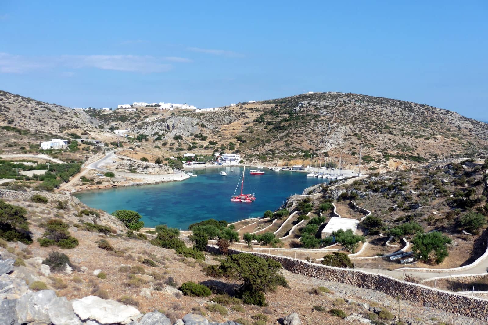
If the marina is full, you can find shelter from the Meltemi in Vintzi just north of the ferry quay; anchor in 5 m just south of the Portara (see catamaran position in the first photo).
We found shelter from the Sirocco (SE) winds by anchoring directly east of the Portara with a line ashore to the easternmost rocks of the actual islet and not to the isthmus as is indicated in GWP.
Apollonas
Apollona or Apóllonas - Απόλλωνας is a lovely small fishing village on the north-east tip of the island. Go stern-to, Mediterranean mooring, and keep the yacht some distace away from the quay; very shallow sandy bottom Lat Long; only tenable in northerlies. Near the entrance of the quarry is a colossal 10 m long kouros – statue of a youth, 6 c. BCE – in the form of Dionysos; many bars and restaurants, aim for “Nikos Tavern” and “La Sabia”.
Azala
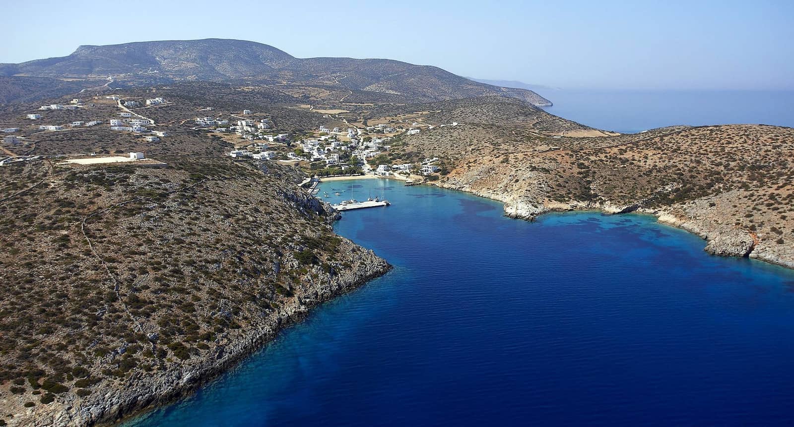
Azalá - Αζαλά bay is a delight in westerlies and southerlies. Amazing pebble beach, almost desolate; good holding in sand Lat Long; views towards Donousa island.
See photo below.
Moutsouna
The village of Moutsoúna - Μουτσούνα is south-west of the destinctive Moutsouna Cape.
Open to NE – SW winds; mind the reefs and rock (awash) on the approach, see chart symbols for the difference between ![]() and
and ![]() ; solid holding in sand; anchor in 3 – 9 m; only the tip of the pier (notice the cranes and the railway) can be used Lat Long.
; solid holding in sand; anchor in 3 – 9 m; only the tip of the pier (notice the cranes and the railway) can be used Lat Long.
The area has an authentic feel, unspoilt and with a compelling industrial heritage: loading corundite (emery) rock.
In stronger northerlies, move to the adjacent Hóhlakas beach - Παραλία Χόχλακας in seclusion Lat Long.
Reported: “We found excellent shelter at Moutsouna second bay along the point. Fish restaurants are overrated but portions are enormous.”

In strong northerlies move to the beach in the foreground or even further west, as described below.
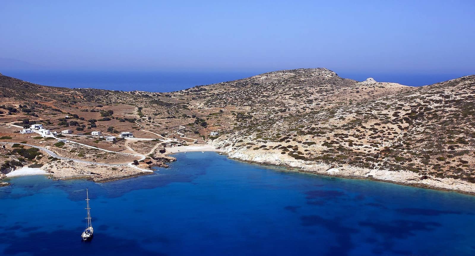
Panormos
The bay of Pánormos - Πάνορμος might look like a safe anchorage, but experiences severe gusts (NE) along the valley. Make sure that your anchor(s) are dug in nicely Lat Long; “Panermos” bar and palm trees on the beach.
Visit the Acropolis ruins – which date back to the end of the 3rd millennium BCE, early Cycladic period – just knee-high walls so imagination is needed.
Mind the outspread Dilos reef on the approach.
In strong northerlies you can move to the secluded beach to the south; sand and some rocky ledges; uncharted; no room to swing, so take the second anchor ashore, either at Lat Long or (in sand / weed / rock) Lat Long.
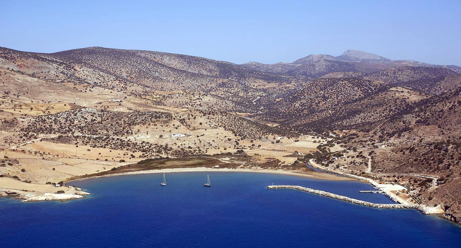
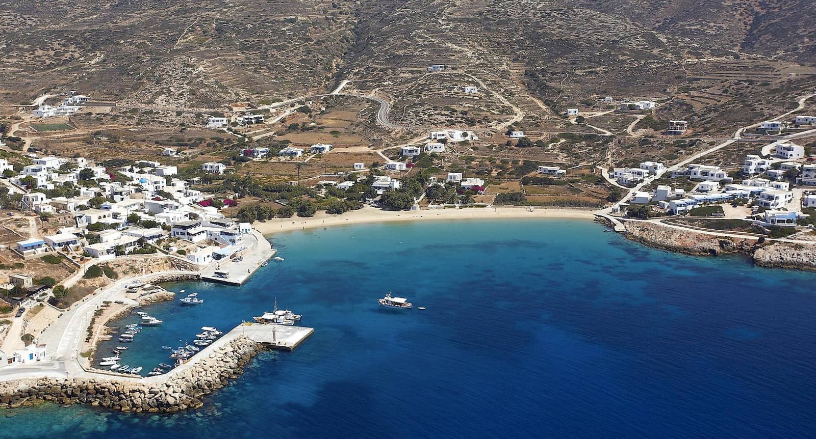
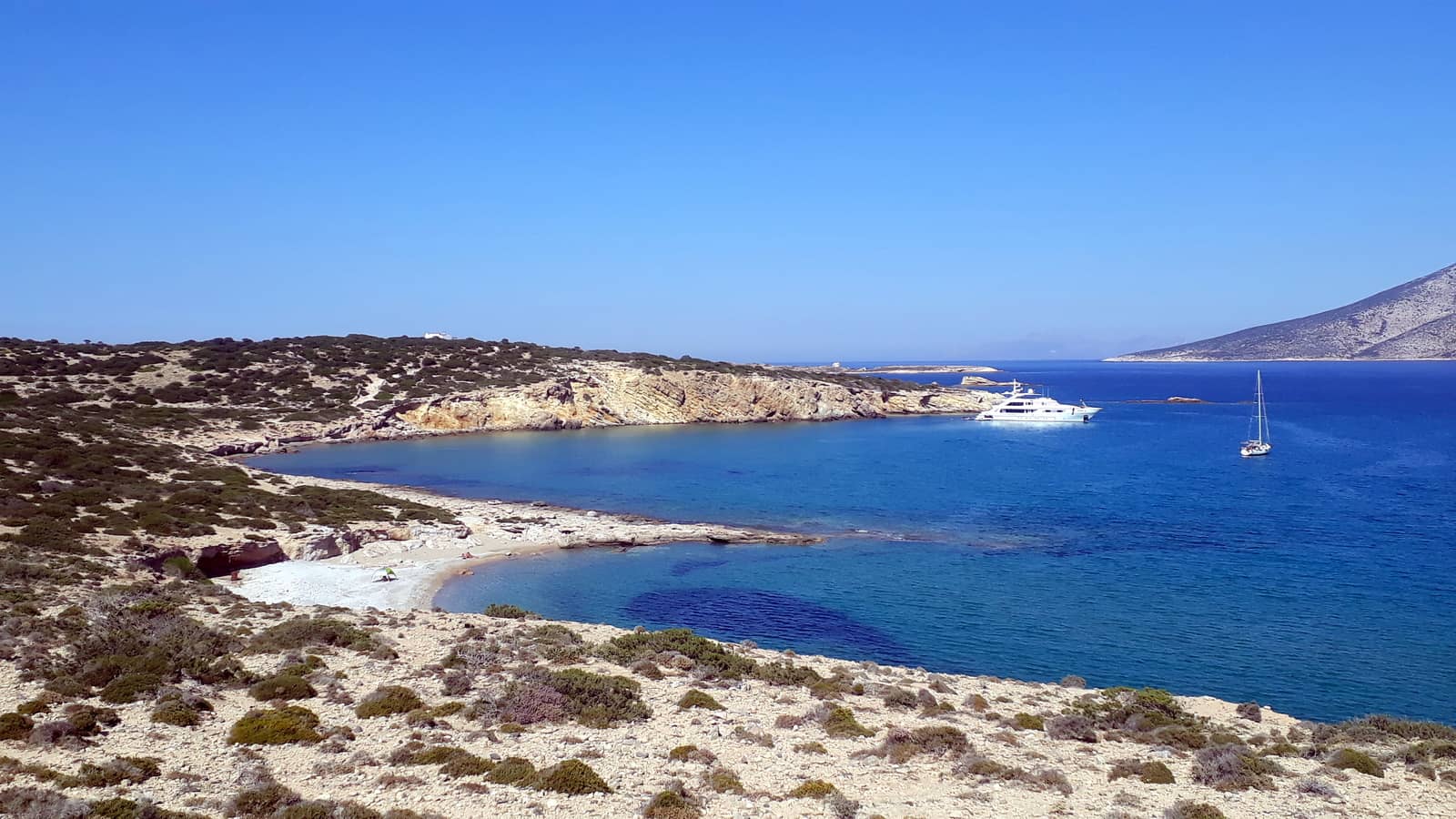
Kalantos
Kalantós or Kaladós - Καλαντός offers the best shelter on the south coast in Meltemi weather, but still you must be vigilant for sudden strong gusts – mainly north – blowing down the mountains. A small river flows into a secluded sandy / rocky bay with crystal clear waters and some dangerous rocks closer to the beach; use a trip line.
The GWP refers to Kalantos as merely a fishing port with insufficient depths, however the port is embracing visiting yachts and inside the basin there is solid holding and mostly sufficient depths at the breakwater, pier and even along the quay (for catamarans) plus electricity and water. The end of the pier has the preferred berths though, as the river brings down silt.
See photo above.
Ashore there is one hotel, one chapel (with goats), one tavern (tasty dishes), one wandering donkey… and nothing more, hence a marvellous venue.
Alyko • Pyrgaki • Agiassou
Often the whole area under Cape Kouroupas is called Agiassou bay, yet starting from the conspicious unfinished hotel there are the following coves:
- Alykó - Αλυκό our favourite; “Hawaii” food truck. Lat Long
- Pyrgáki - Πυργάκι or Ag Giannis / Ioannis. Lat Long
- Roou (deeper, nothing ashore). Lat Long
- Agiássou - Αγιάσσου at the Agiassos settlement
Everywhere solid holding in sand. Mind the offshore islets and reefs.
Agia Anna
Under the west cape of Naxos is the unassuming St Anna / Agía Ánna - Αγία Άννα port, which is quite the opposite of the nearby Naxos marina and offers more tranquil surroundings.
Dock along-side the mole or go stern-to on the leeside Lat Long. Not suitable in Meltemi / Mistral conditions.
There is a sunken chain (~2 boat lengths long) linked to the mole (south side near the bend); tripper boats claim most berths; beach resorts.
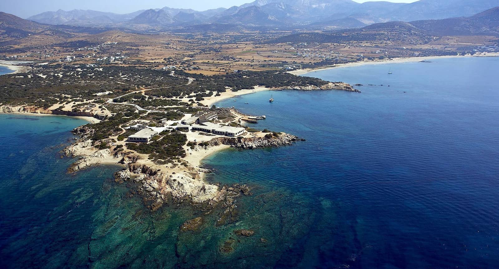
Highly recommended is the 40 min. walk through fecund fields to the Ionic Temple and Sanctuary of Dionysos from 575 – 550 BCE, opening hours 80:00 – 15:00, closed on Mondays.
Lesser Cyclades
Pano Koufonisi with Koufonisi port to the left and Kato Koufonisi island to the right.
The low lying islet in the centre is Glaros, with the rugged Keros in the background.
Small Cyclades or Lesser Cyclades - Μικρές Κυκλάδες, clockwise ↻ around Naxos:
- Donousa
- Koufonisia include four main islands:
- Koufonisi or Pano (Upper) Koufonisi
- Kato (Lower) Koufonisi
- Keros or Karos
- Glaros or Glaronisi
- Antikeros
- Kato Andikeri or Drima
- Schinoussa
- Iraklia or Irakleia
The Meltemi storms blow here from the north-east.
Donousa island
Not to be confused with Dorousa in the Saronic Gulf, Donousa or Donoussa is the loneliest lesser cycladic island – situated east of Naxos – with a prominent spindly north-west cape. In Mythology Ariadne was hidden here from Theseus by Dionysos. In Roman times the island was used to exile criminals and subsequently it became a pirate lair.
Stavros / Donousa port
The port / village of Donoúsa - Δονούσα, situated in Stavros - Σταύρος bay, is actually called Stavros by the locals.
In port either use extremity of the Γ-shaped ferry pier or the, rather shallow, quay on the north side. C-Map, Navionics and Eagleray show the correct situation. Open to any southerly or westerly winds.
Kedro / Dendro
Directly east is Kédro / Dendro - Κέδρο bay, which is only affected by SE – SW winds and is therefore more suitable in strong NW winds.
The German WWII warship wreck is barely discernible despite translucent waters, so anchor to the south with caution, also because the seafloor rises sharply.
The shoal on the west shore extends further than indicated on most charts, see Navionics; gusts from the NE; refined “Kedra Beach Bar” ashore.
Roussa
The wide bay of Roússa - Ρούσσα has two solid anchorages guarded by the islet of Skilonísi - Σκυλονήσι and is even Meltemi-proof if you anchor in the north corner near Kalotarítissa - Καλοταρίτισσα village Lat Long.
The bay is only open to S – E winds, in mild conditions the “south anchorage” is preferred; excellent holding in 8 – 10 m Lat Long.
Great snorkeling at Skilonisi; delightful area; “Taverna Mitsos” ashore.
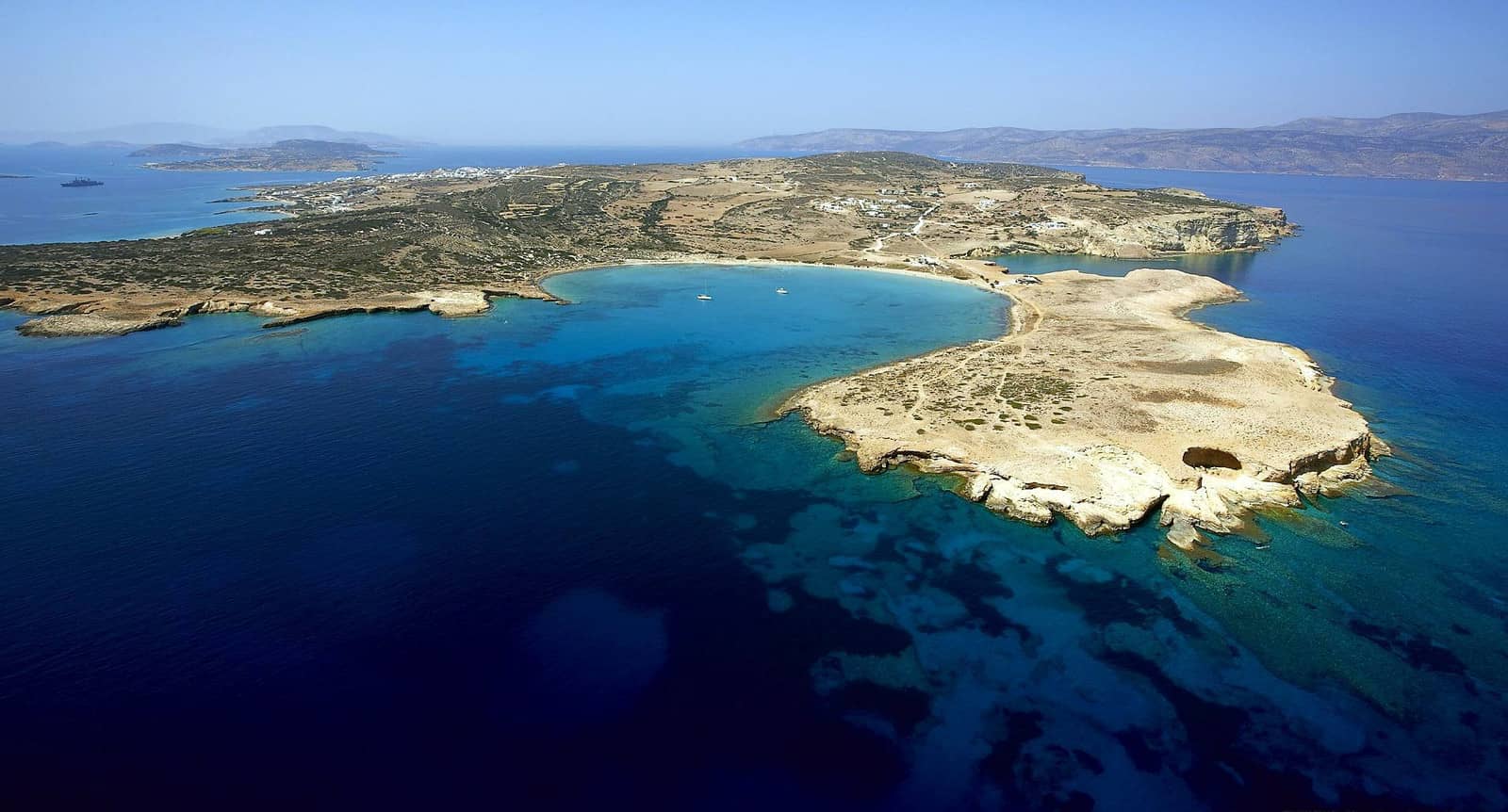
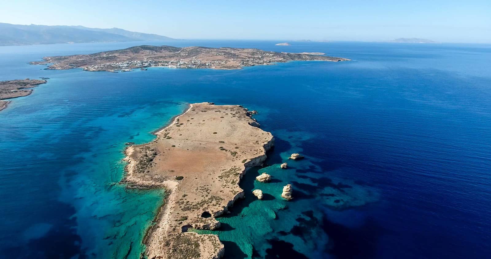
Pano Koufonisi island
The strait (see photo further up) between Koufonisi or Pano (Upper) Koufonisi - Άνω Κουφονήσι and Kato (Lower) Koufonisi - Κάτω Κουφονήσι has a minimal depth of 5 m in the middle. Both islands are famed for the marvellous beaches and bays uniquely coloured by seashell fragments.
Pori
The falciform Porí - Πορί bay on the north-east coast of Koufonisi has a crowned and sparkling beach. There are small caves / rock formations such as the The Eye of the Devil - Το Μάτι του Διαβόλου on both capes; tavernas open in main season; the anchorage is surprisingly suitable in stronger northerlies, although with a Meltemi there will be a swell Lat Long.
The larger taverna is for hip and trendy youth. The smaller one is superb: the Mai Tai cocktails are fabulous and strong!
Italida
Italída - Ιταλίδα bays and beaches are more susceptible to swell than Pori bay, nothing ashore in the NE corner Lat Long; attractive anchorage; use Navionics or EagleRay.
Marina
The windmills of the Chora will guide visiting yachts to the new port of Koufonisi marina - Λιμάνι Πάνω Κουφονησίου, which was constructed to offer all-round shelter right besides the amiable village of Koufonisi.
Note that in strong winds, also northerlies, the basin can suffer from nasty reflected waves despite the narrow entrance.
Larger yachts will normally moor outside on the NE, whereas the ferries use the SE corner.
See photo above.
Inside the harbour there is plenty of room to go along-side, in the summer months go stern-to on the large east pier (laid moorings tailed to the quay). On the headland in between Parianos and the Marina you can explore the archaeological site which dates from first phase of the Cycladic Civilisation (3rd millennium BCE).
Agape
Spiritual, altruistic, beneficial love which wills good for others.
Within Christianity, agape is considered to be the love originating from God or Christ for humankind, read on…
Parianos
The smaller port of Parianós - Παργιανός slightly further north-west is usually filled with local fisherboats and the basin is too shallow for larger sailing yachts. If there is room, use a trip line to deal with the rocky seabed and the farrago of permanent (and ephemeral) moorings. Prevailing gusts from the north.
Kato Koufonisi island
Kato “South bay”
The underappreciated “South bay” on the “Lower” island offers stunning sections of beach with friendly goats and turquoise waters.
Open to NE – SW winds; untested tavernas to the east; seabed is stony with shells / sand Lat Long; in stronger northerlies take a line to the elongated rock formations on the east shore.
Glaronisi islet
The island and port of Koufonisia are visible in front of mountainous Naxos to the left.
Glaros / Glaronisi
The mesmerising “anchorage” of Gláros or Glaronísi - Γλαρονήσι is vulnerable to almost all winds / waves.
In calm weather drop anchor with a trip line near the rock pillars on the east shore; uncharted, approach with care Lat Long; extremely worthwhile: dazzling colours.
Γλάρος Glaros means “Seagull”, therefore Glaronisi is Seagull islet.
Keros island
South bay
The Y-shaped “South bay” on Kéros / Karos - Κέρος island is a fair weather anchorage; mediocre holding; seabed is rock / sand: use a trip line; sudden and strong gusts from N – ENE; best to take the second anchor onto the minute beach in the west cove; total solitude Lat Long.
Keros is archaeologically of great interest with finds from the early Cycladic Period called the “Keros-Syros culture”. Excavated statues of superb quality can be admired in Athens, such as the two musicians of Keros.
Also pertinent is the online exhibition of the Museum of Cycladic Art with, inter alia, the “Treasure of Keros”.
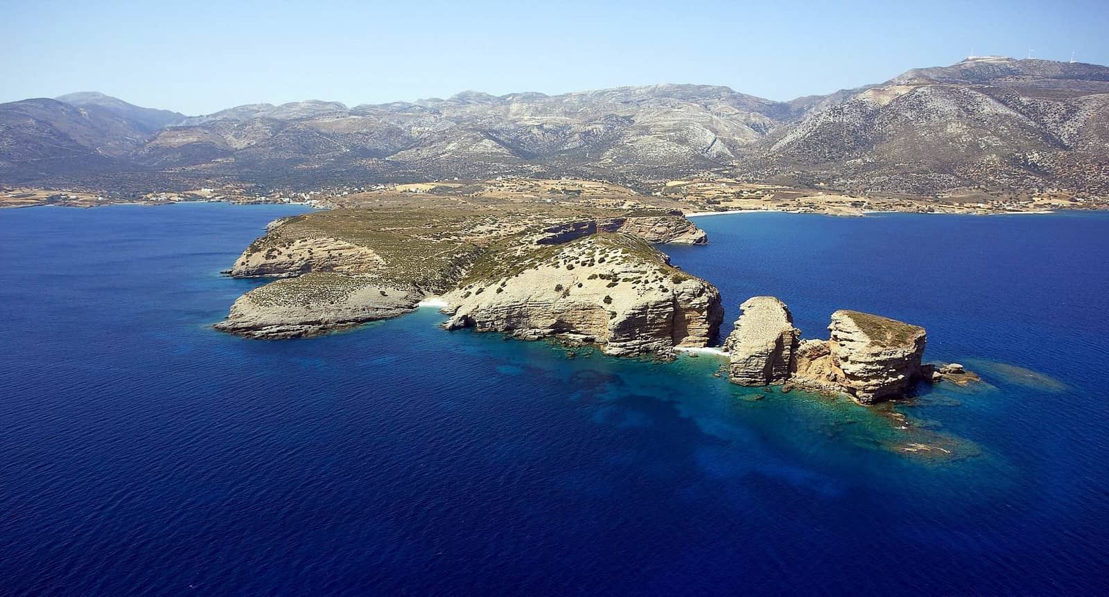
AntiKeros Drima islets
Drima Antikeros
The channel between Antíkeros - Αντίκερος and Káto Andikéri (Dríma) - Κάτω Αντικέρι (Δρίμα) is a wonderful spot: drop anchor east of where the islets meet, in 3 – 8 m, optionally take a line to Antikeros shore Lat Long.
Reasonable-good shelter from the Meltemi (NE) plus other directions; cerulean waters; some lovely stretches of beach and white rock formations: a perfect lunch-stop between Amorgos and the other Lesser Isles .
The channel has a depth of at least 4 m, prevailing gusts from the NE; mind the perilous long reef extending from the north-east of Antikeros. On the south side of Antikeros an isolated rock awash is shown on EagleRay and Navionics.
Schinoussa island
Schinoússa or Schoinoússa - Σχοινούσσα is the second most populated Lesser Cycladic island after Pano Koufonisi, with ~200 inhabitants living mostly in Chora and Mersini, its ferry port.
Myrsini
Myrsíni / Mersíni port - Λιμάνι Μυρσίνη is perhaps the most alluring port in the Lesser Cyclades. Gusts are primarily from the north-east, if possible go stern-to the north-west quay opposite the larger ferry quay, near the north road to the Chora (shallow, so several boat lengths of line required).
Note that the GWP mentions “Recently two very large motorboats have based themselves here, taking much of the quay”, however this was more than a decade ago now.
In summer an eclectic mix of gulets, superyachts, sailing yachts & catamarans will first overflow the quay, then fill the anchor berths across the bay (nearly all with lines ashore).
Livadi
If the port is too crowded then Livádi - Λιβάδι, the second bay towards the south-east, is the alternative. Pleasant surroundings; excellent holding in sand Lat Long; short hike to the Chora.

The higher island in the distance is Keros. To the right is the islet of Agrilia which is connected to Schinoussa by a reef. Hi-res image
Alygaria
Around Agrilia islet – essentially a peninsula – is the secluded bay of Alygariá - Αλυγαριά with solid holding in sand
Lat Long.
In light conditions or westerlies it is possible to anchor in one of the many east bays of Schinoussa island.
Irakleia island
Irákleia or Iráklia - Ηράκλεια is the largest island of the Lesser Cyclades. There are remains from the Cycladic era, as well as well as ruins of the sanctuaries of Tyche and Dias (Δίας is the Modern Greek name for god Zeus) and of a medieval settlement.
The cave of Agios Ioannis can be reached on a path from the port in about 90 minutes, it is a dripstone cavern that supposedly reaches all the way to Ios island. The feast day of the beheading of St John the Baptist is celebrated in the cave on August 29.
Agios Georgios
The port of Ágios Geórgios - Άγιος Γεώργιος, at the head of a fjord-like inlet, offers room for just 3 – 5 yachts at the south side of the short ferry pier, while ferries will dock at the north side. If you are fortunate enough to get a berth under the pier, there is safety even in Meltemi weather.
At the waterside – from where you can keep an eye on your yacht – is the satisfying “Syrma” taverna.

Livadi • Pigadi • Karbounolakos • Alimia • Spilia • Vourkaria
Irakleia's anchorages clockwise ↻ starting from the only port, Agios Georgios:
- The bight of Livádi - Λιβάδι, just south of the port, is too wide to offer shelter against the prevailing NE winds; it features the most prominent beach of Irakleia Lat Long.
- Pigádi - Πηγάδι is a very narrow bay on Irakleia's east coast, open only to the prevailing NE winds Lat Long.
- Karbounólakos - Καρβουνόλακος beach cove; uncharted; use a trip line to deal with rocky seabed Lat Long.
- The aesthetic Alimiá - Αλιμιά cove is customarily overlooked, yet provides good shelter against the prevailing winds Lat Long.
Solid holding in sand; airplane wreck on the seabed; pretty beach; tested meltemi-proof; 30 min. walk across rather rugged terrain with fragrant phrygana vegetation to reach the Ag Ioannis cave.
For toponymy, see Alimia island, near Rhodes. - On the NW coast: Spiliá - Σπηλιά Lat Long and Vourkariá - Βουρκαριά Lat Long bays are completely open to the north, but lonely & lovely.
History & Mythology
Naxos was a centre of the cult of Dionysos. Mythology tells us that it was here that Theseus abandoned Ariadne.
There is much archaeological evidence to show that the island was first settled by Carians and Cretans and developed a flourishing Cycladic culture in the 3rd and 2nd millennia BCE.
In the 1st millennium BCE these first settlers were followed by Ionian Greeks, who in the 6th c. BCE extended their rule over Paros, Andros and other neighbouring islands.
During this period there was a celebrated school of sculptors on Naxos, notable for such works as the colossal statue of Apollo on Delos. A member of the first Attic maritime league, Naxos became subject to Athens after an unsuccessful rising and was compelled to accept the redistribution of land on the island to Athenian citizens.
After being held by Macedon it passed under Egyptian rule, was briefly assigned to Rhodes by Mark Antony and thereafter became part of the Byzantine Empire.
In 1207 Naxos was occupied by a Venetian nobleman named Marco Sanudo, who made it the centre of the Duchy of the Twelve Islands in the Aegean (Duchy of Naxos), which continued in existence until 1566 and achieved a considerable degree of prosperity.
It was taken by the Turks in 1579, and was under Russian rule from 1770 to 1774, but, like the other Cyclades, retained a measure of independence. In 1830 it joined the newly established kingdom of Greece.
The island is not yet ready to cope with mass tourism, but it has much to offer those visiting on a sailing holiday – an equable climate, a wide variety of scenery, from the sandy anchorages and monuments of both antiquity and medieval periods.
More photos and information can be found in the logbook of our trip from Athens to Milos via Paros (Naoussa, Parikia and the Paros – Antiparos Channel), as well as in my Guide to sailing holidays and yacht charters in 8 steps.
In-depth Meltemi storm guide