Skip over navigation
Interactive maps of Greece
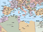
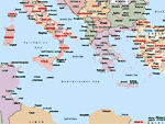
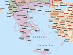
Greece is situated in the Eastern Mediterranean Sea and borders to Albania, Macedonia, Bulgaria and Turkey. Furthermore, Greece is only separated from Italy by the narrow Otranto strait. To view the location of Greece between Europe and Asia Minor please click on the three main maps. To see detailed maps of the Greek regions please use the interactive map below.
Interactive map of Greece
This is a clickable map: please click on the highlighted areas to see a detailed map of that Greek region in a new window.
These interactive maps - as well the three maps at the top of this page - should be up to date till January 2006 and show primarily political details. The various countries and administrative regions within these countries are distinguished with different colours.
Road maps of Greece
For nautical and sailing maps of Greece see the pages below or visit my collection of Sailing maps of Greece.
Sailing resources
