Spetses sailing holidays
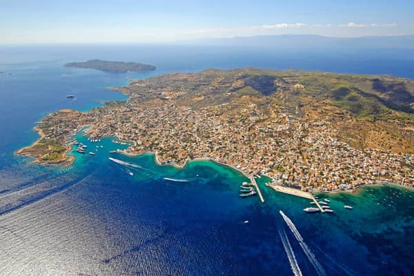
Spetsai - Spetses - Σπέτσες, the ancient Pityousa (Island of Pines), is a hilly and well-wooded island off the south-west coast of the Argolida.
The income of the inhabitants, who are mostly of Albanian descent, comes from farming and now, to an even greater extent, from the tourist trade, for the island's mild climate attracts large numbers of, mostly affluent, holiday-makers.
This mild climate is described by the Admiralty pilot to be “exceedingly healthy” and is indeed more appealing than Hydra or Dokos. No motor vehicles are allowed on Spetses apart from public service vehicles.
- All Greek islands
- Argolic – Saronic overview
- Argolic gulf
- Spetses island
- Hydra gulf
- Poros island
- Aegina island
- Saronic gulf – Athens
- Alimos – Athens
- Sailing itineraries Argolic & Saronic gulfs
In antiquity Spetses was an island of no importance. After the Orlov Rising, a rebellion against the Turks supported by Catherine of Great Russia, the population was expelled from the island in 1770 and Spetses town was laid waste.
However, the inhabitants soon returned to their island and their trading and seafaring activities brought them prosperity. In 1821 Spetsai was the first island to take part in the War of Independence: an event “Armata” commemorated every year by ceremonies and fireworks.
The opulent members of the inner circle – appearantly, Solon of Athens is still relevant – like Dutch King Willem-Alexander and Russian president Vladimir Putin frequent the island from their neighbouring holiday estates in Porto Cheli / Kranidi.
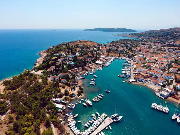
The island's capital, Spetses (pop. 3000), is built on the gentle slopes above the wide bay containing its harbour. The present town, with a number of handsome mansions and three interesting churches in Kastelli, the upper town, dates from the 19th c. There is a local museum in a late 19th c. mansion. The circuit of the island (12 km) is a pleasant day's walk, or it can be done in a horse-drawn carriage.
British Admiralty Chart 1683, 1031
Solon of Athens:
“Laws are like spider's webs: if some poor weak creature come up against them, it is caught; but a bigger one can break through and get away”, read on…

Spetses island ports & anchorages
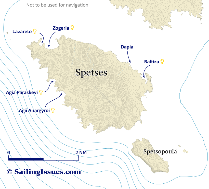
Ports / anchorages are clickable . signifies a highly recommended venue, and a truly must-see venue; see other icons.
Baltiza, Spetsai, Old port
Baltiza is the “old” port of Spetses, a deep inlet and natural harbour where still original wooden ships are built.
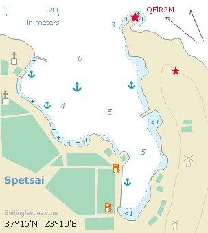
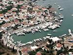
Smaller boats and visiting charter yachts predominantly find a spot at or north of the Panagia Armata pier, which is near the east side of the entrance. Second option is across the inlet – at or south of Ag Nikolaos Church – where you can take a line ashore; see bottom-right on gallery 1; mind the sunken chain (perpendicular to the ballasted mole).
Both areas are affected by north-west winds and wash from water taxis.
Prevailing winds are SE near the ports and E further out.
Dapia port
Dapia is the “new” Spetses port, but mainly for ferries and commercial ships. The west pier would only be suitable for small yachts or catamarans in calm weather, any way, in most cases you will be turned away by port officials.
Take care to avoid Spetsai Reef visible on gallery 2 in between the two ports, Lat Long.
See chart symbols for the meaning of e.g. ![]()
You will find tavernas and bars along the entire waterfront between Baltiza and Dapia, as well as in the delightful old quarter.
Agii Anargyroi
The lush bay, with cypress and pine trees, of Anargiri or in full Agii Anargyroi - Άγιοι Ανάργυροι is named after the nearby Church of the
Holy Unmercenaries
At the 5 m mark – mostly parallel to the beach – there is a sharp decrease in depths: a rocky ledge of 2 – 3 m ; open to WNW – SSE; Bekiris Cave directly west of the collapsed cliff; one taverna ashore; sandy bottom, good holding Lat Long
Also see "Agii”.
Agia Paraskevi
Green reflections in clear blue waters describe the bay of Agia Paraskevi - Αγία Παρασκευή
which is more secluded and open only to SW – SE; Lat Long; beach bar ashore.
Mostly sandy bottom, but the anchor might get caught under slabs of rock or abandoned anchor chains: use a tripline.
Zogeria • Lazareto
The bay of Zogeria - Ζωγερια and the Lazareto Cove immediately west offers crystal clear snorkeling surrounded by pines and garrigue.
No anchoring is possible in Lazareto cove during the season see Greek sailing season.
Nearly allround shelter; taverna opens in the summer months; mind the submerged rock (darkens) in the NE of Zogeria bay; several rock formations can be used to tie a long line to, especially around Lazareto ; a local pod of (short beaked) common dolphins can be spotted off Cape Zogeria; in northerlies anchor south of the disembarkation quay of Ayios Nikolaos Lat Long
