Folegandros & Sikinos sailing holidays
The long straddling island of Folégandros - Φολέγανδρος, between Milos and Santorini, is still relatively untouched by the tourist trade.
The cliff-fringed eastern part of the island, with its highest hill of 413 m is bare and arid; the western half is milder, with water from springs, and supports a modest terraced agriculture, just like the island of Sikinos.
Both islands - especially Sikinos - are well off the beaten track, rather peaceful, and illustrate the authentic Aegean culture.
- All Greek islands
- Cyclades overview
- Kea
- Kythnos
- Syros
- Tinos • Andros
- Mykonos • Delos
- Serifos
- Sifnos
- Paros • Antiparos
- Naxos • Little Cyclades
- Milos • Kimolos
- Folegandros • Sikinos
- Ios island
- Amorgos
- Santorini
- Itineraries in the Cyclades
Ports & anchorages
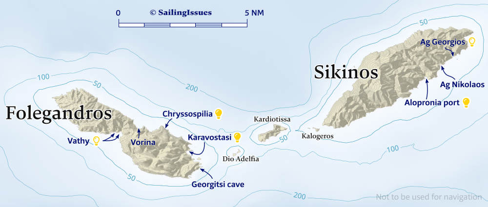
Ports / anchorages are clickable . signifies a highly recommended venue, and a truly must-see venue; see other icons.
Folegandros island
With its poverty and lack of sheltered harbours Folegandros was never an island of any importance. Its destinies were closely linked with those of Naxos and in Roman times it was a place of exile.
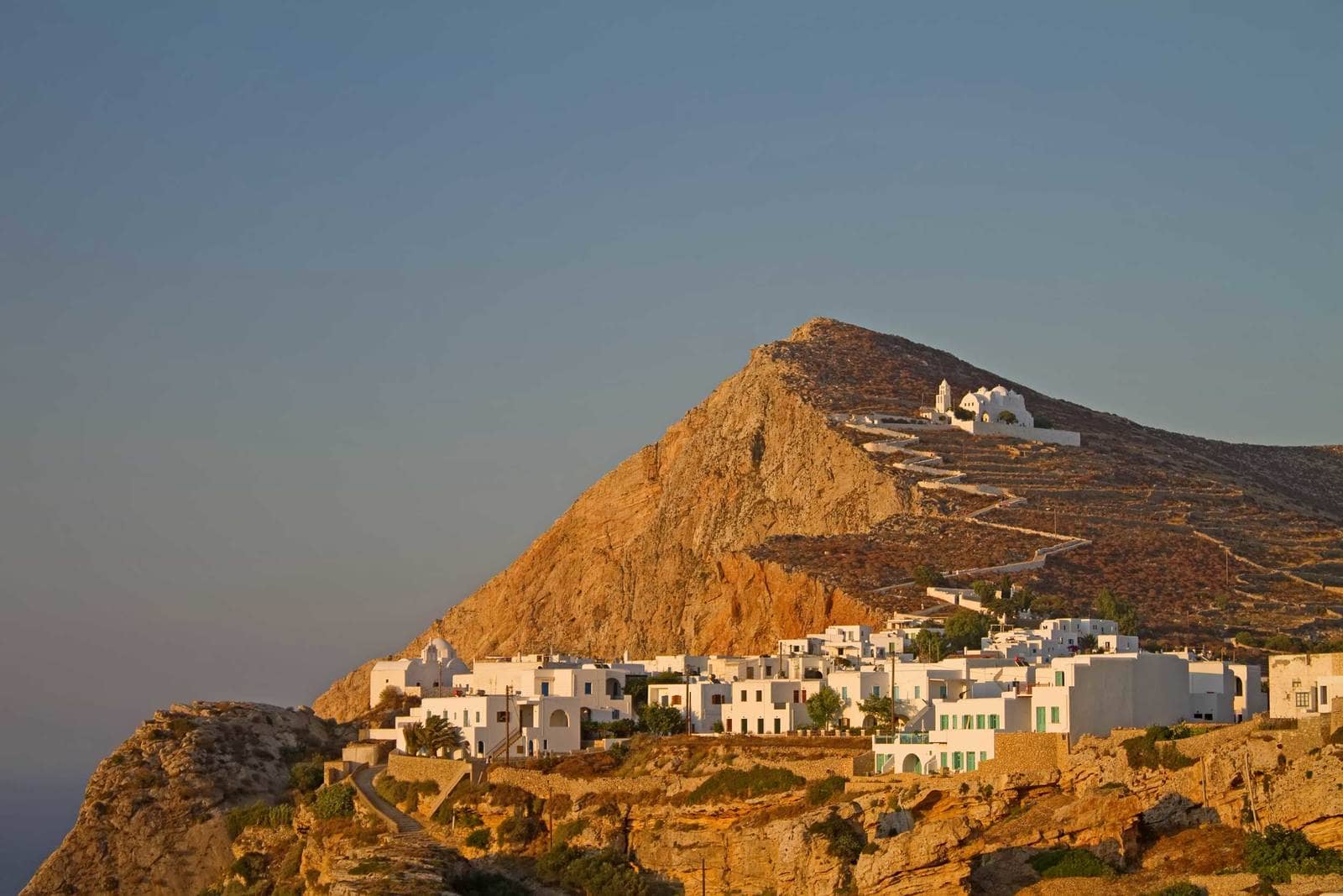
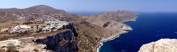
From the sailing port of Karavostasi – a must-see when sailing in Greece – it is an hour's walk or a short trip with the only taxi on the island to the chief place, Chora, a beautiful village of typical Cycladic houses with a medieval Kastro.
To the east is the hill of Palaiokastro, with scanty remains of the ancient town.
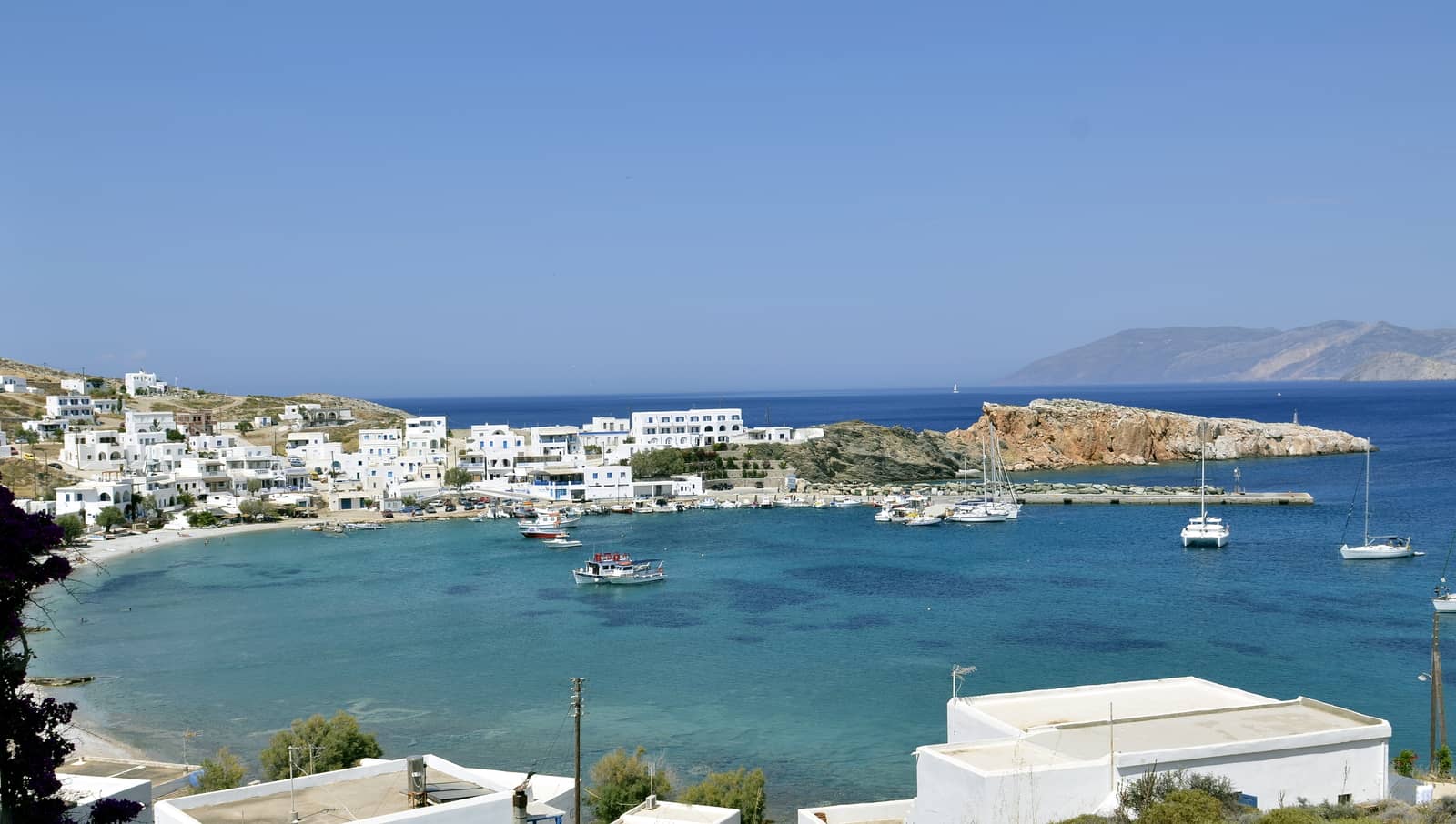
Karavostasi
Karavostási - Καραβοστάση is the only port on Folegandros and serves as the gateway to Chora.
Avoid the reefs on the approach and drop the anchor near the green beacon of the ferry quay and reverse towards the yacht quay.
See my guide to Mediterranean mooring and anchoring.
Omitted in GWP is that also the long side of the ferry quay is reserved for ferries and particularly hydrofoils coming in at 20 knots.
snorkelling to check the anchor is ill-advised here: instead use the dinghy + outboard engine.
Lights and shapes of hydrofoils.
Good holding (mostly sand, some rocks); a very rough swell can penetrate the bay; fierce gusts WNW – NE can terrorise this port, unnerving even seasoned ferry captains.
Note that harbour master (Kostas +30 697 4362313) needs to start sending all yachts away once the northerlies are over 35 knots, as the quay will become untenable. There is just room for 6 visiting yachts.
Vathy
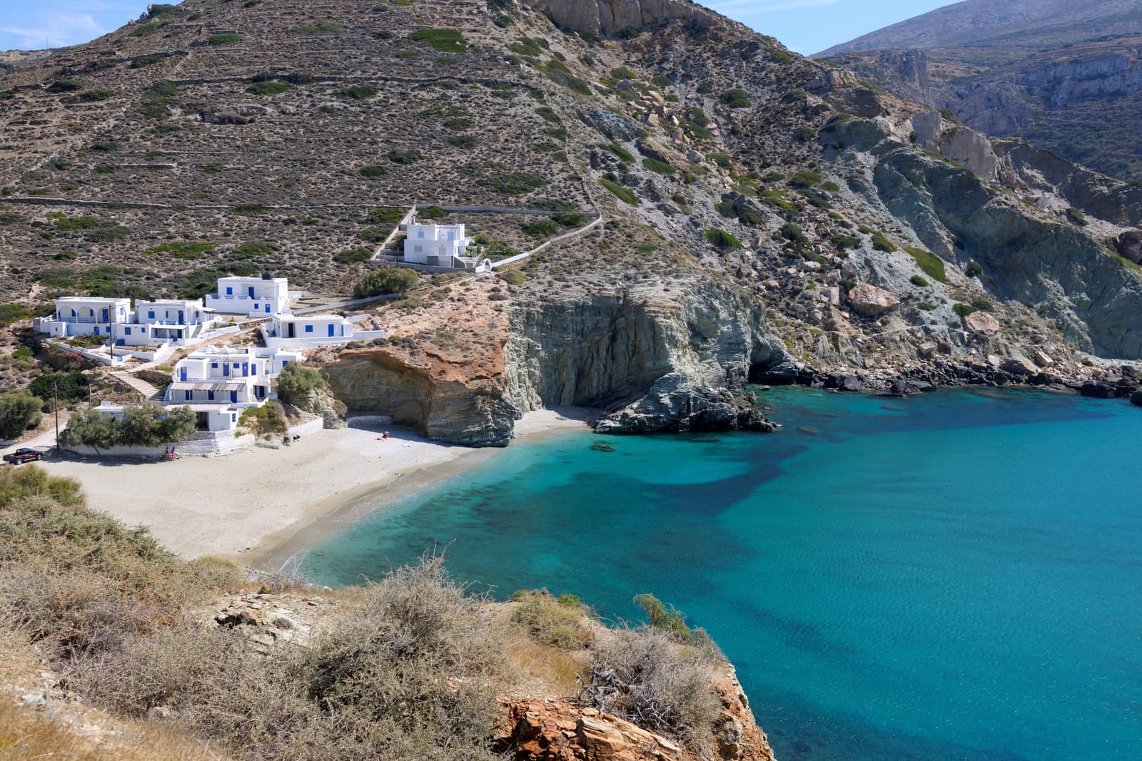
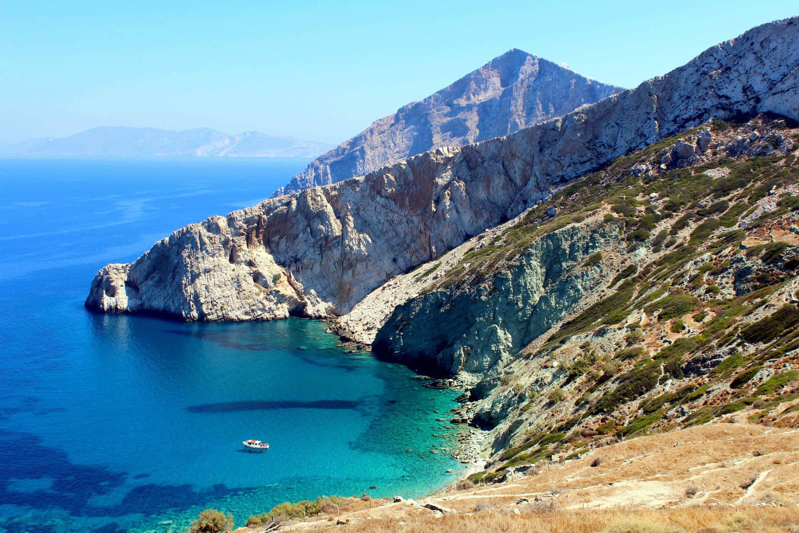
Vathí or Vathý - Βαθύ bay at Agkali - Αγκάλη beach on the SW coast of Folegandros, just east of Cape Aspropounta, is a delightful anchorage with tavernas ashore. It is sheltered from NW – E winds, but a strong Meltemi will result in violent gusts (NE mostly).
Also see close up photo bottom of page.
Anchor either just south of Ayia Marina church Lat Long or 150 m further west Lat Long at Galifos beach.

Chryssospilia
Just north of Karavostasi port – SE of Cape Grotto / Panagias – is the “Golden cave” or Chryssospilia.
While it is too deep to anchor, in light conditions it is possible to approach the stone steps Lat Long with the dinghy and we have explored it in true Indiana Jones style.
Georgitsi
The Georgitsi Cave is also worthwhile, again only accessible by dinghy; just SW of Cape Vitsentzos / Gadara, south of Karavostasi bay.
Vorina
On the NE coast – at the island's narrowest section – is
Voriná - Βορεινά bay. This unfrequented anchorage Lat Long is appropriate in southerlies and westerlies. A sheep's path leads up to Chora, ±25 min. through terraced steep terrain.
Donate now
Sikinos island on the horizon.
Sikinos island
Síkinos - Σίκινος, west of Ios island, is a bare rocky island fringed by sheer cliffs, with rugged hills in the north and north-west and with gentler country in the south-east where terraced cultivation is possible.
With its inhospitable soil and lack of sheltered anchorages, Sikinos was never of any political of cultural importance in antiquity. Like Folegandros it was used as a place of exile.
From the harbour of Alopronia it is an hour's climb to the chief place of the island, Sikinos / Chora, in a wooded gorge. The modest capital is a typical little Cycladic village, with the picturesque Kastro quarter within its medieval walls.
On the hillside above this lies the main village Chorio. Higher up are the ruins of the Nunnery of Zoodochos Pigi.
One and a half hours' walk west is the Chapel of the Panayia, which belonged to the Episkopi Monastery (5th – 7th c.), built on the site of an ancient sanctuary of the 2nd c. BCE.
On the steep hill beside the little Church of Ayia Marina are scanty remains of the ancient city.
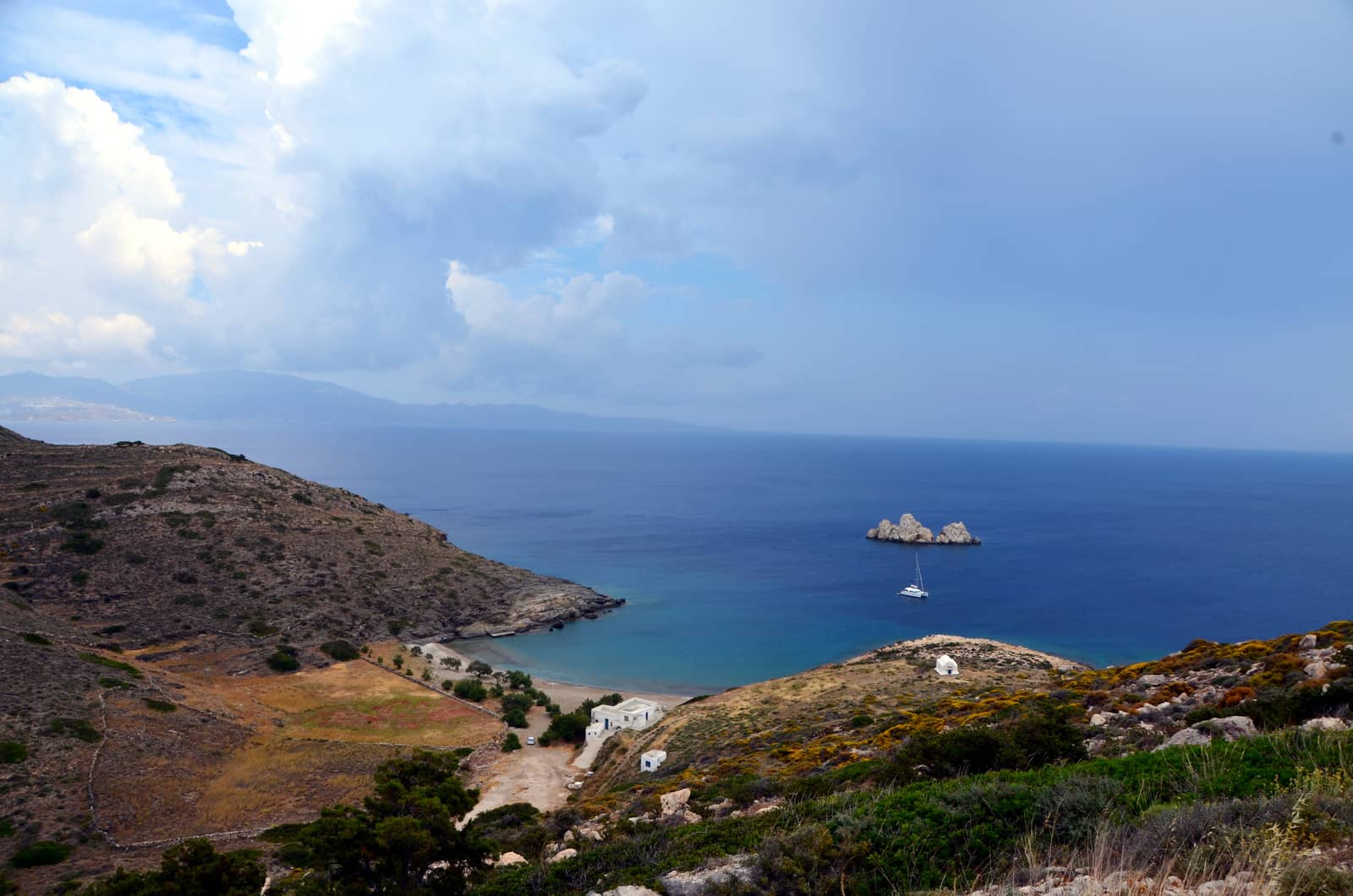
Ios island in the distance left.
Ag Georgios
Ágios Geórgios or Ayios Yioryios - Άγιος Γεώργιος is a very attractive anchorage on the south-east coast – protected by the Ay Yioryios islet, but open to ENE – SW winds Lat Long.
Solid holding in sand, generally just suitable for a lunch-stop; there is a basic fish taverna in the summer months, but mostly solitude; handy disembarkation quay for the dinghy on the east side; anchor in 4 – 6 m and mind the rocks (ledges) closer to the beach.
A-Z index: other places named “St George”.
More photos and information can be found in this logbook of our sailing trip from Athens to Milos via Karavostasi - Folegandros.
Ag Nikolaos
Ágios Nikólaos - Άγιος Νικόλαος bay is situated Lat Long between Sikinos port and Ayios Yioryios.
Its tiny Dialiskári - Διαλισκάρι beach is – like Ag Georgios – lined with Tamarix trees The bay is very narrow; uncharted; easy to take a line ashore.
Alopronia
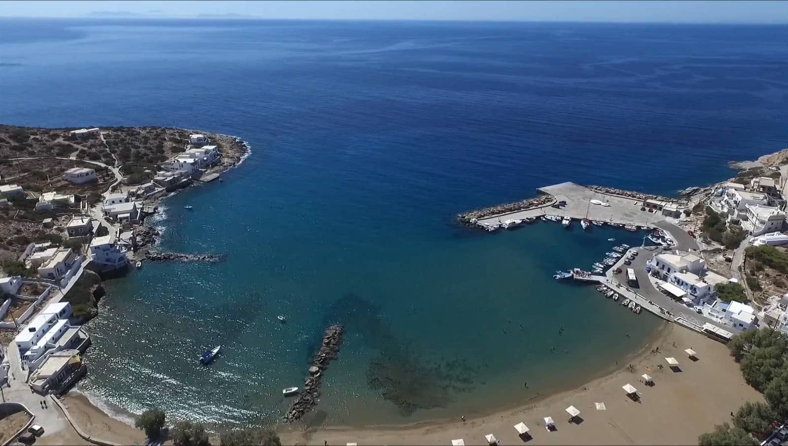
Aloprónia - Αλοπρόνοια or Skala - Σκάλα is the only port from which to visit the exceptional Chora, however, beyond the ferry quay the shallow sandy & rocky bay is often silted up.
More on Skala + Chora toponyms.
The current state can easily be established when sailing in a strait line between Karavostasi and Ios port, and if too shallow or the sea-state is too wild, you can sail on…
The preferred place to dock is behind the ferry quay in the south-westernmost berth Lat Long stern-to or along-side and use a trip line. We took the dinghy to drop the second anchor in <1 m depth directly north: the port has an extremely shallow basin.
Aug 2022 and Sep 2023 and still in July 2025: I am delighted to report that the mole has been extended by a short but convenient pontoon (upgraded from the 2018 version), there is room for ~4 monohulls on the outside where you can roll with the swell, or go alongside on the north side if not too windy / gusty.
The current pontoon is laid towards NE (GWP chartlet shows N ). Moreover, GWP suggest mooring stern-to in the west side of the basin, yet this is completely silted up.
You will find the nice “Café Marconi” in port.
For good restaurants aim for the Chora, which is composed of two settlements adjacent to each other: “Kastro” to the west and “Chorio” to the east.
There is a bus service – which seems to correlate with the ferry arrivals – to take you uphill to the Chora; the walk back down to port is easier (40 min.).