Serifos sailing holidays
The island Sérifos - Sériphos - Σέριφος, north-west of Sifnos, is a bare and rocky island, its hills slashed by gorges; its highest point is Mount Tourlos with 483 m.
The island's main sources of income are its modest agriculture and its open-cast iron mines, which have been worked since ancient times. The ore used to be shipped from Magalo Livadi and Koutalas on the west & south coasts, where there is now room to anchor (magnetic anomalies were reported due to the remaining ore, but we ourselves have never experienced any inconsistencies?).
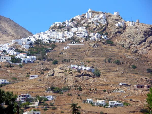
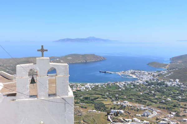
In the island's capital Serifos or Chora, above the natural harbour of Livadi, are the ruins of a Venetian castle, with spectacular views.
Serifos island ports & anchorages
Clockwise ↻
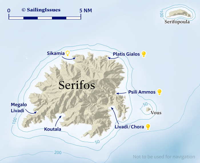
Ports / anchorages are clickable . signifies a highly recommended venue, and a truly must-see venue; see other icons.
Livadi / Chora
The wide bay of Livádi - Λιβάδι suggests a lot of room for anchoring, however it is more prudent to use the marina due to the frequent violent katabatic winds from the north. Moreover, you can expect an extra 1 Bft on top of the prevailing northerly wind.
In Meltemi conditions you will need to be on the inside of the “marina”; laid moorings at most berths; marina is nearly finished and provides a safe stopover on route to the beautiful islands of Sifnos and Milos.
Before setting sail towards these southern Cyclades, first follow the lovely hiking route up to the top of the Chora of Serifos – one of the crown jewels of the Cyclades.
See recurring toponyms: Chora.
Koutala
Koutála - Κουτάλα bay on the south coast offers four anchoring options in the following coves, from east to west:
- Vágia - Βάγια– also known as Chalara – is very useful in south winds and provides unexpected allround shelter; good holding when through the weeds; strong gusts likely; underappreciated yet rather enchanting surroundings Lat Long.
- Gánema - Γάνεμα: anchor in the middle of the beach in 4 – 6 m; sand, good holding; dangerous and sudden gusts from the NE in the prevailing winds Lat Long.
- Koutalas is mostly fouled by anchor chains, but you can anchor in sand on the east side of the beach; potentionally very violent gusts from the north Lat Long.
- Maliádiko - Μαλλιάδικο is a narrow cove further west; weed and sand; less frequented Lat Long.
There are ore mines west of Koutalas & on Cape Chalara; the region isn't very captivating except perhaps for Vagia; avoid the local tavernas, be sure to dine at Τα Πεζούλια - “Ta Pezoulia”, NNE of Ganema beach, a 10 min. walk.
From there you can visit the scant remains of Gria Castle - “Old Woman's Castle”, mainly just walls, thus good wine or imagination is required.
Megalo Livadi
Megálo Livádi - Μεγάλο Λιβάδι, on the west coast of Serifos, is a deep bay with a steep rising seafloor: anchor close to the shore Lat Long.
Reportedly, a chain + sunken buoy fouls the seabed from near the small pier on the north in a south-easterly direction; likewise, a sunken aircraft near the pier.
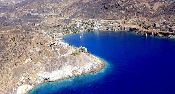
Very secure holding in sand, commodious in Meltemi conditions. The place doesn't ooze charm, even if you consider its industrial heritage (see photo above).
On the north shore is an essential monument that reminds us that here in 1916 one of the first strikes ever in Greeks history resulted in the deaths of four miners: fundamental human rights were fought for and should not be taken for granted.
Fittingly, the “1916 Restaurant” on the beach is the place to eat.
A 45 min. walk eastwards will bring you to the landmark of Aspros Pirgos, the “white tower”, constructed of large white marble blocks (4th c. BCE, partly restored in 2014).
Sikamia
Sikamiá - Συκαμιά bay on the north of Serifos offers several attactive anchorages, the fairest being the north-east Skala cove Lat Long.
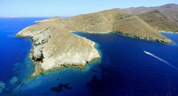
There is a dangerous reef running ±500 m from Cape Sykamia superb snorkeling along this reef but also in Skala itself.
Despite lacking somewhat in room to swing at anchor, Skala is suitable in N – WSW winds.
The anchorage off Sikamia beach is seen as the default, yet is more exposed to the northerlies; the whole area – known as Psarometochi – is subject to violent south gusts in southerlies (rare).
Weed patches make for poor holding, and we found it suspicious in sand as well, so use maximum scope and take a line ashore.
To the south is the pretty village of Panayia, with the Church of Panayia - Ναός Παναγίας “Virgin Mary's Church”, dated from ~950 and the oldest on the island.
Platis Gialos
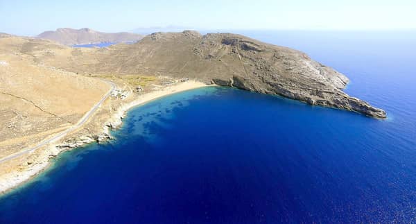
Platís Gialós - Πλατύς Γιαλός is a surprisingly secluded anchorage on the north of Serifos Lat Long only open to E – SE winds, although strong south gusts are possible in southerlies.
Excellent shelter in northerlies.
Platis Gialos is a toponym for “wide seashore”, derived from Platis Aigialos.
Anchor in 3 – 6 m in sand, avoiding the weedy patches; the pier in the north has rocks along both sides, it is however possible to take a line to its extremity; mind the rocky ledges near the beach; turquoise waters & total bliss; taverna in summer.
Visit the fortified Monastery of the Taxiarches – a marvellous 40 min. hike south – which is dedicated to the Archangels Michael and Gabriel and built in 1572 with a fine library.
Psili Ammos
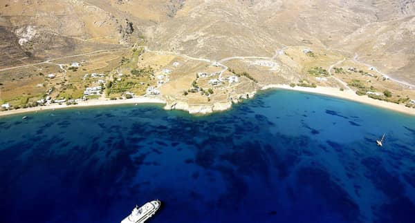
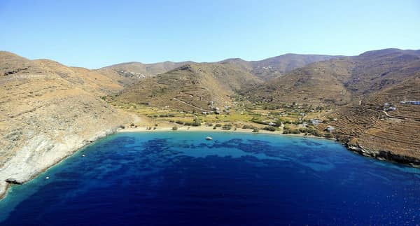
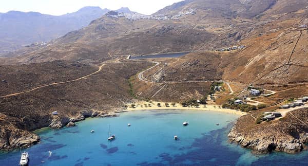
The bay of Psilí Ámmos - Ψιλή Άμμος Lat Long is often overlooked, but is a glorious anchorage with a splendid vista of the Chora overhead. See photo above.
The bay is parted in two by a small headland: aim for the southern beach where there is less weed and better holding in sand. There is a reef extending from the south cape. Open to NNE – ESE winds, but any northerly wind will bring in an uncomfortable swell.
The toponym Psili Ammos means “fine sand”, see Greek chart terms, and veritably describes the best beach on the island; dine at the “Stefanakos Tavern”.
Yacht charters
The Athens' Alimos Marina, and the island of Paros are the most convenient yacht charter bases for sailing holidays and visit Serifos and the other western Cycladic islands.
History of Serifos
Originally settled by Ionian Greeks, the island shared the fortunes of the other Cyclades. In Greek mythology it was the island where Danaë and the young Perseus were washed ashore.
