Syros sailing holidays
The hilly island of Syros or Siros - Σύρος lies half-way between Kythnos and Mykonos.
Its central situation makes it the principal centre of administration, commerce and fisheries in the Cyclades and a focal point of the shipping routes in the Central Aegean.
Agriculture makes a major contribution to the island's economy, supplemented in the last 20 years by a rapidly developing tourist trade.
The islands capital, Ermoupoli – named after Hermes, the Greek god of trade – occupies the site of an ancient settlement of which no trace remains.
Syros, Ermoupoli, is the seat of the Prefect of the Cyclades, a Roman Catholic bishop and an Orthodox archbishop.
The town owes its present extent to Greek refugees from Chios, Psara, Crete, Hydra and other islands, who settled here in 1821, after the War of Liberation, and built the town up into a major port on the sea routes between Asia Minor and western Europe. At the end of the 19th c., however, the economy of the town suffered from the competition of Piraeus.

History of Syros
From the time of the Fourth Crusade at the beginning of the 13th c. until 1568 Syros belonged to the Duchy of Naxos, and since that time it has had a substantial Roman Catholic minority, which during the Turkish period was under protection of France.
During the War of Greek Independence the island remained neutral, and those who had escaped the massacres of Chios and Psara were able to find refuge here.
Close to the town of Ano Syros, which was founded in the 13th c. and had remained predominantly Catholic, these new settlers established the town of Ermoupoli by the harbour, and this developed during the 19th c. into the largest Greek port, before being overtaken by Piraeus.

Ports / anchorages are clickable . signifies a highly recommended venue, and a truly must-see venue; see other icons.
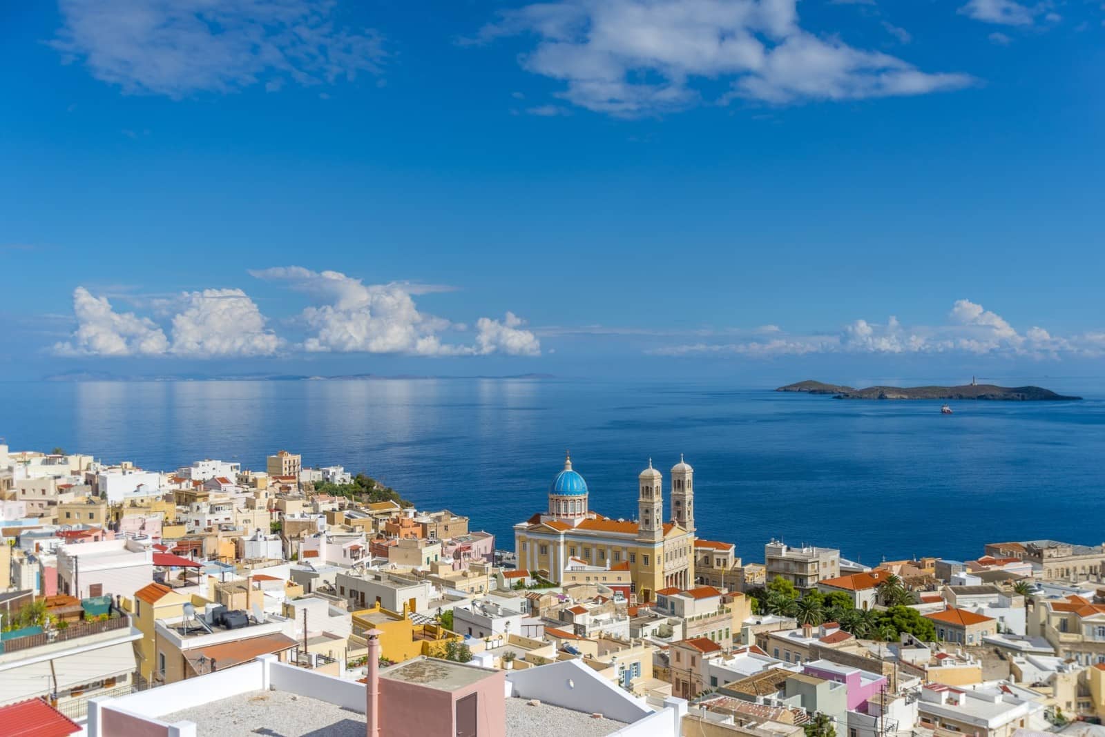
Ermoupoli
The town of Ermoúpoli - Ερμούπολη extends, with its handsome houses in neo-classical style, from the harbour quarter, the administrative and business centre, with the Town Hall (now a museum) and Theatre – a copy of the Milanese La Scala – up the slopes of two hills, in a naturally amphitheatrical fashion.
On the low hill, Vrontado, is the Orthodox Greek quarter (built from 1834 onwards).
On the higher hill lies the Roman Catholic village of Ano Syros, established during the Venetian period (13th c.); monasteries, cobbled narrow streets, no cars allowed. On the summit of the Ano Syros hill stands the Roman Catholic Cathedral of St George (19th c.; panoramic views).
Kastri
North of Ermoupoli, at the village of Chalandriani, is the fortified Cycladic II settlement of Kastri, an important archaeological Carian site, dated 2600 – 2300 BCE.
The approach of Ermoupoli (Ano Syros will be on port side) is one of Greece's most stunning approaches, next to Poros, Santorini and Symi.

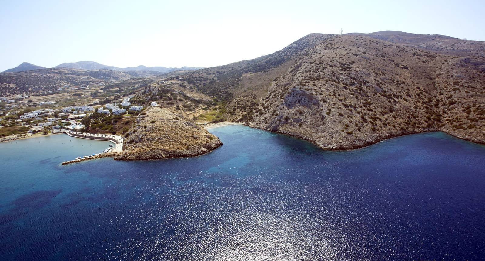
Didyma / Gaidaros
The isle of Didyma / Gaidaros guards the entrance to Ermoupoli bay and on its south side is the Megali Agkali anchorage with excellent holding and shelter from the Meltemi
C-Map, Garmin and particularly Eagleray show the accurate situation , anchor in 6 m Lat Long in the middle of the inlet.

Ampelos
The bay of Ampélos - Αμπέλος should be reached via the south channel between Ampelos isle and Syros, which is a mere 25 keep close to the light on the breakwater of the small boat harbour.
In the indicated Lat Long location the depths are 3.5 – 4.5 m; good holding; not overly pretty but a fun (lunch-stop) anchorage in turquoise water.
Donate now
Varis
Varis / Vári - Βάρη is a rather characterless bay; use Eagleray / Garmin / C-map and anchor in 4 – 5 m to avoid the shallow area in the north; good holding in sand Lat Long Dine at “Giosifaki” on the north-east beach.
Mega Gialos & Ampelas
Méga Gialós & Ampelas /Abéla - Μέγας Γιαλός & Αμπέλα are two delightful bays on the south coast of Syros Lat Long be sure to use Garmin or Eagleray.
A-Z index: other places named “Mega…”.
Abela is the tiny anchorage directly west of the conspicuous Church, it is uncharted but the clear waters make anchoring easy. All bays further west are without any developments.

Finikas
The large secluded bay and port of Fínikas or Foinikas - Φοίνικας – likely named after the Phoenicians – is located near the popular seaside resort of Posidonia. Close to the town is an ancient necropolis.
Archaeological evidence suggests that during ancient times the second town of the island was located here; named after Poseidon, who is not only the god of the sea but also of earthquakes.
Up until 1956 it was possible to distinquish ancient structures on the seabed of Foinikas bay. After the seismic activities of Santorini / Thira that year, these have disappeared.
Galissas
Galissás - Γαλησσάς village is quite cosmopolitan, which unfortunately also involves some cacophonous bars. Outside the main season there might be room behind the mole (partly subsided) for a smaller catamaran; the default is to anchor in 4 – 7 m off the beach, where you will find taverna “Iliovasilema” (modern cuisine) and adjacent “Savvas” (traditional Greek).
We appreciated the stunning cove on the south shore suitable in ENE – SW winds. Lat Long
Symposium
Originally a drinking party in Ancient Greece, especially one with intellectual discussion.
From Ancient Greek συμπόσιον (sumpósion, “drinking party”) from συμπίνω (sumpínō, “drink together”) συν- (sun-, “together-”) + πίνω (pínō, “drink”), more…
West coast anchorages
Kini • Delfini • Aetou • Megas Lakkos • Marmari • Grammata
These bays offer sound protection against the northerlies, but there can be severe gusts from the north-east over the hills. Personally, I find last last three anchorages (the northern ones) the most attractive and secure.
- The bay of Kíni - Κίνι is vigorous with tripper boats and tavernas, the miniscule ramp will be occupied with local boats; mind the Defini reef (37) on the approach. Anchor SSW of the red harbour light Lat Long. Rock rep. halfway near the beach.
- In Delfíni - Δελφίνι bay ideally anchor behind the islet, Lat Long.
Again, mind the reef; beach bar ashore. - Aetoú - Αετού offers marvelous surroundings, especially in the northern Sarakiniko cove, Lat Long.
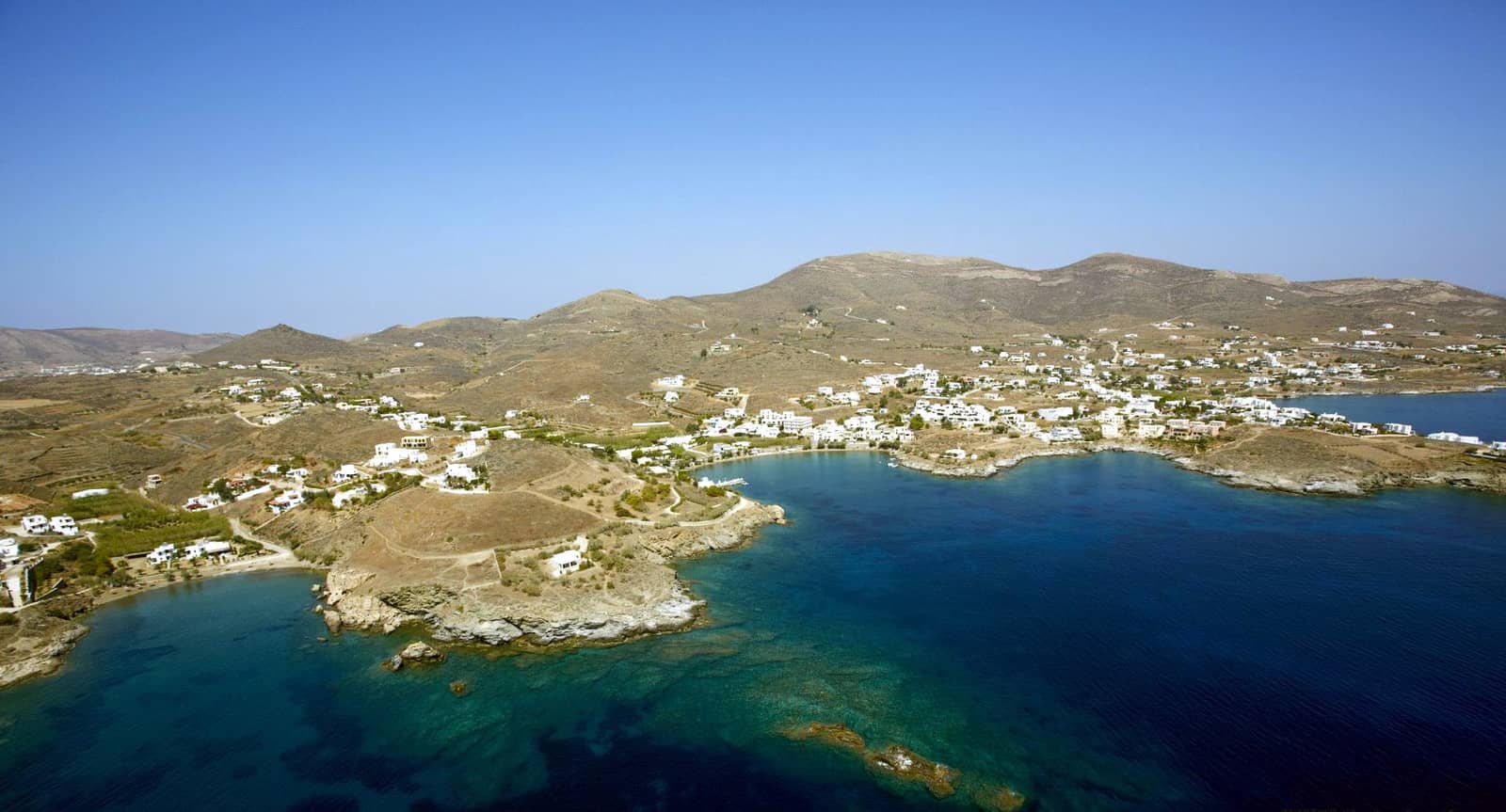
See toponym “Sarakiniko”. - The bays of Mégas Lákkos - Μέγας Λάκκος Lat Long and Marmári - Μαρμάρι Lat Long are truly splendid anchorages.
- Bring a line ashore, (learn how), in the anchorages of Grámmata - Γράμματα Lat Long directly north of Megas Lakkos – in earlier times a welcome harbour of refuge – there are Roman and medieval inscriptions such as expressions of thanks and prayers. Please inform fellow yachtspersons not to add their own inscriptions: this is an archaeological site.
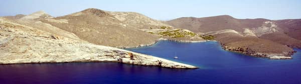
In the far right the entrance to Marmari bay, which is just north of Megas Lakkos (not visible). Hi-res image
Yacht charters Syros
The Athens' Alimos Marina, and the islands of Paros and Mykonos are the most convenient yacht charter bases to start your sailing holidays and visit Syros and the other northern Cycladic islands.
Also see my guide to Mediterranean mooring and anchoring and chart symbols for the meaning of e.g. ![]() .
.
