Milos, Kimolos sailing holidays
The island of Melos - Milos - Μήλος, the most westerly of the larger Cyclades, owes its distinctive topography and the pattern of its economy to its origin as the caldera of a volcano of the Pliocene period, to which the sulphurous hot springs in the north-east and south-east of the island still bear witness.
It has one of the most monumental natural harbours in the Mediterranean, much like Thira, formed when the sea broke into the crater through a gap on its north-west side.
The north-eastern half of the island is flatter and more fertile than the upland region in the south-west, which rises to 752 m in Mount Profitis Ilias.

The island's principal sources of income – besides the tourists either on a sailing holiday or island hopping by ferry / airplane
– are its rich mineral resources, including pumice, perlite, sulphur and keolin (both in small quantities) and bentonite clay.
The Milos Mining Museum has illuminating exhibits.
More photos and information can be found in the logbook of our trip from Athens to Milos, and in my Guide to sailing holidays and yacht charters in 8 steps.
Ports / anchorages are clickable . signifies a highly recommended venue, and a truly must-see venue; see other icons.
History of Milos
The island of Milos was already densely populated in the 3rd millennium BCE, when the inhabitants made implements and weapons from the large local deposits of obsidian and exported them all over the Aegean and as far afield as Asia Minor and Egypt.
About 1200 BCE Dorian incomers settled on the island and founded the city of Melos, defended by walls and towers, on a hill on the north side of Milos bay. They prospered through the export of sulphur, pumice, clay and alum, and also of oil, wine and honey.
In Roman and Early Christian times Milos was also a notable art centre. Its best known work is the Aphrodite of Melos or Venus de Milo (2nd c. BCE), now in the Louvre.
After the fall of the Roman Empire Milos became Byzantine; in the Middle Ages it belonged to the Venetian Duchy of Naxos; and after centuries of Turkish rule it became part of the newly established kingdom of Greece.
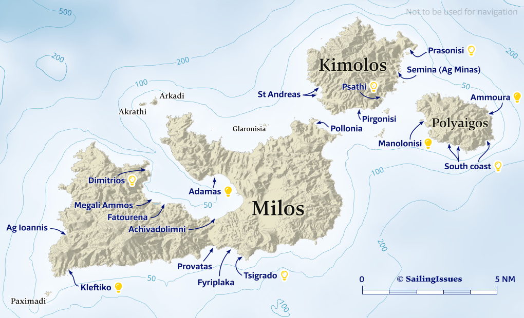
Milos ports & anchorages
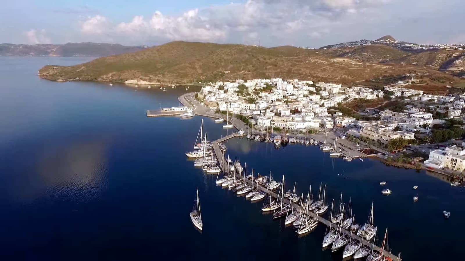
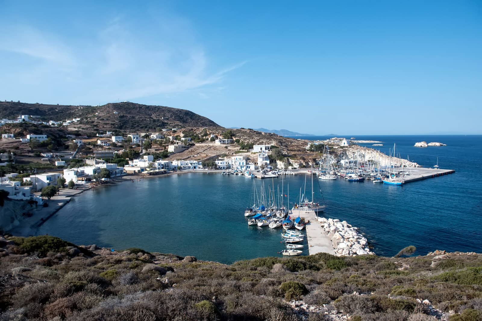
Adamas
The port of Adámantas - Λιμάνι Αδάμαντας, Adámas - Λιμεναρχείο Αδάμας is the principal harbour on Mílos island, which allows a visit to the foremost villages of Klima, Trypiti and Plaka, locally known as Chora
 Excellent protection in NNW – SE winds, even in Meltemia, but dangerous in westerlies and southerlies: ask the harbourmaster for a berth.
When you go stern-to the north side of the pier / pontoon, mind the shoal (usually marked).
The town promenade is a good alternative: moor on either side of the ferry pier and mind the wash from the ferries.
Cultural highlights are the Roman theatre, the Early-Christian catacombs, the 4th c. BCE walls and the gymnasium, all at Trypiti.
Please see Mediterranean mooring and chart symbols.
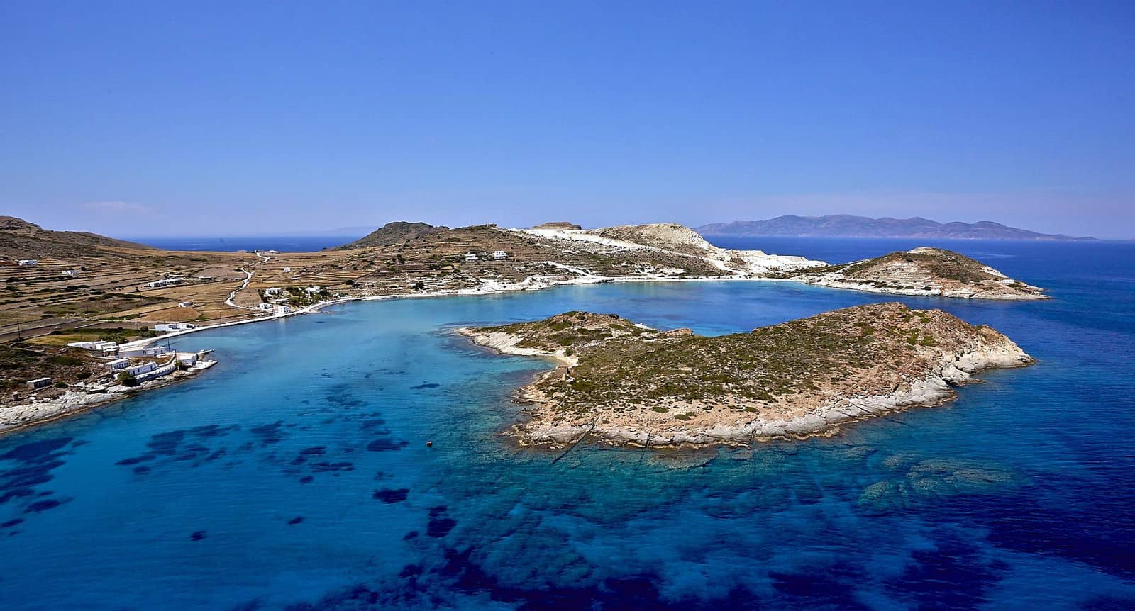
Milos bay anchorages
In western winds the yachts on the outside of the quay or the floating mole cannot stay. Suitable anchorages in the vast Milos bay from north to south are:
- Dimítrios Cove - Δημήτριος Lat Long is not as deep as the charts show and is a superb anchorage in shallow crystal clear water; truly remote, only the Dimitrios Church ashore; exposed to N – SSE winds.
- Megáli Ámmos - Μεγάλη Άμμος just SE of Cape Kokkinos Kavos Lat Long.
- Fatoúrena - Φατούρενα is the preferred option in strong southerlies Lat Long.
- Achivadolímni - Αχιβαδολίμνη (as well as the bay 1 nm to the west) are also useful in southern winds. Sand over rocks not always allows good holding Lat Long.
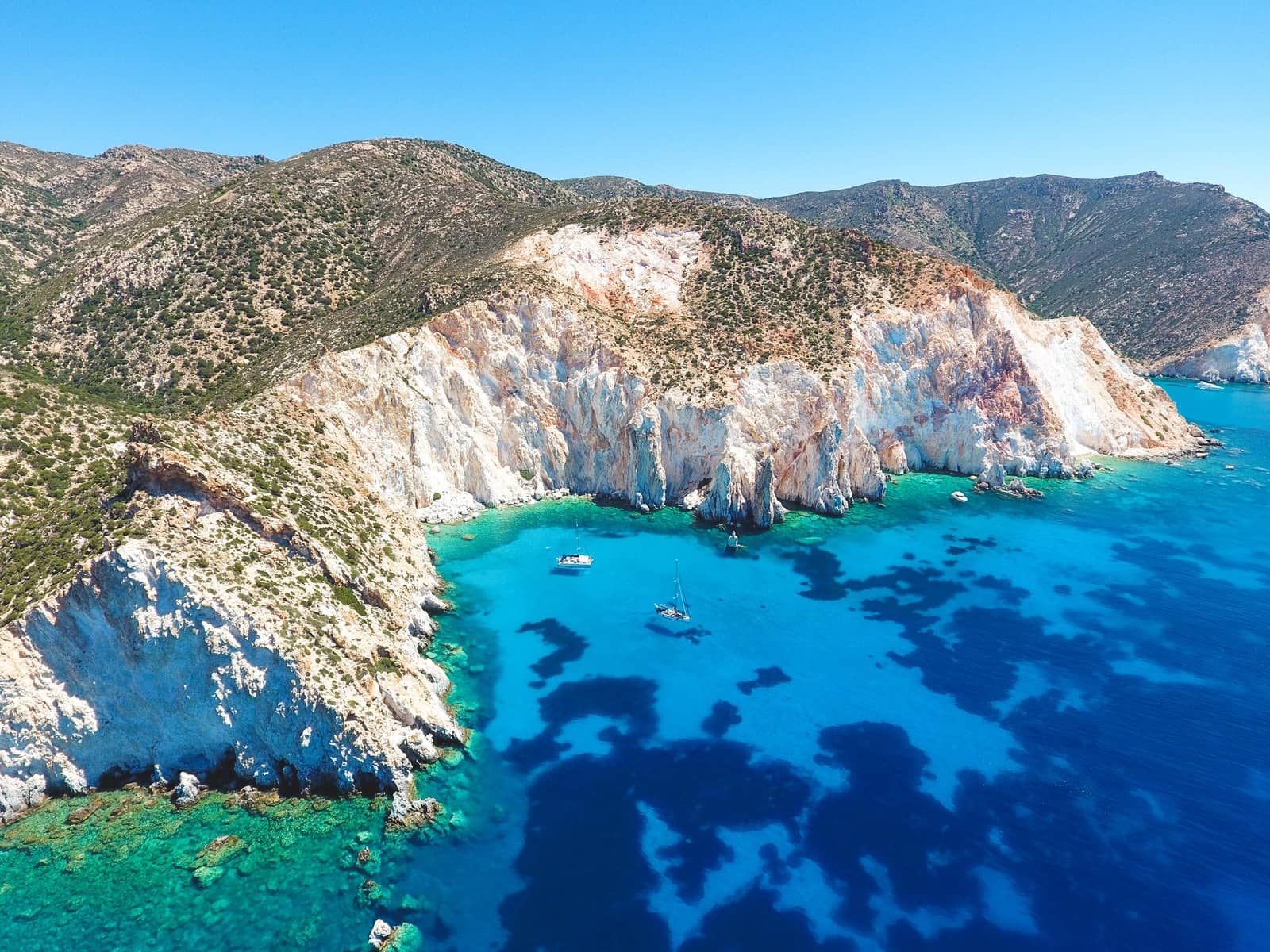
Tsigrado, Fyriplaka, Provatas
The bays are midway on the Milos' south coast and are open to the south; stunning seascapes with white cliffs; good holding and shelter from the prevailing northerlies.
From east to west:
- Tsigrádo - Τσιγκράδο consists of three coves around Cape Zefyros, aim for the easternmost cove with the beach; good holding; landlubbers find access via a ladder in the cliff; shallow & uncharted waters Lat Long.
EagleRay mentions that in this area the volcanically heated seabed causes seawater temperature fluctuations, possibly resulting in alarming depth soundings.
Yet do trust the depth sounder near the Zefyros reef which lies offshore of Cape Zefyros.
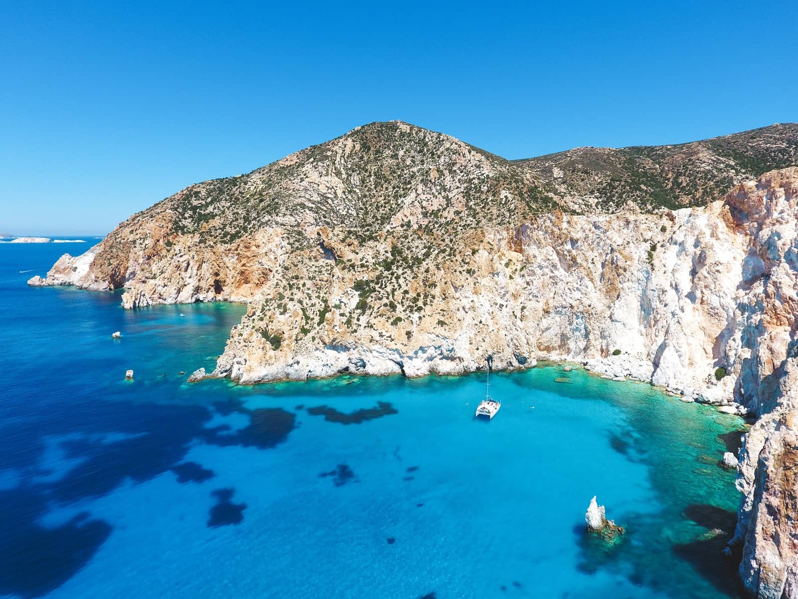
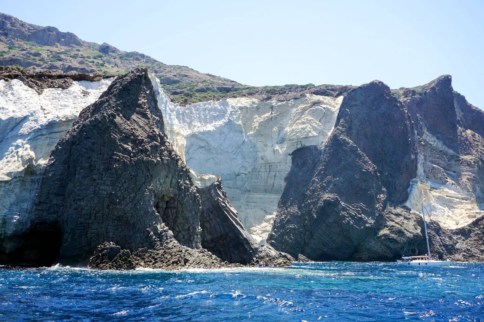
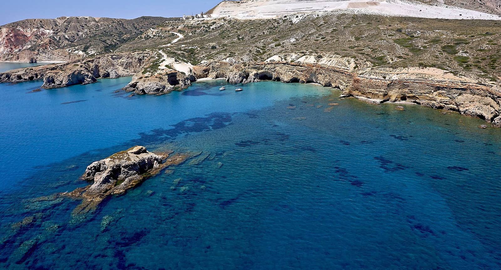
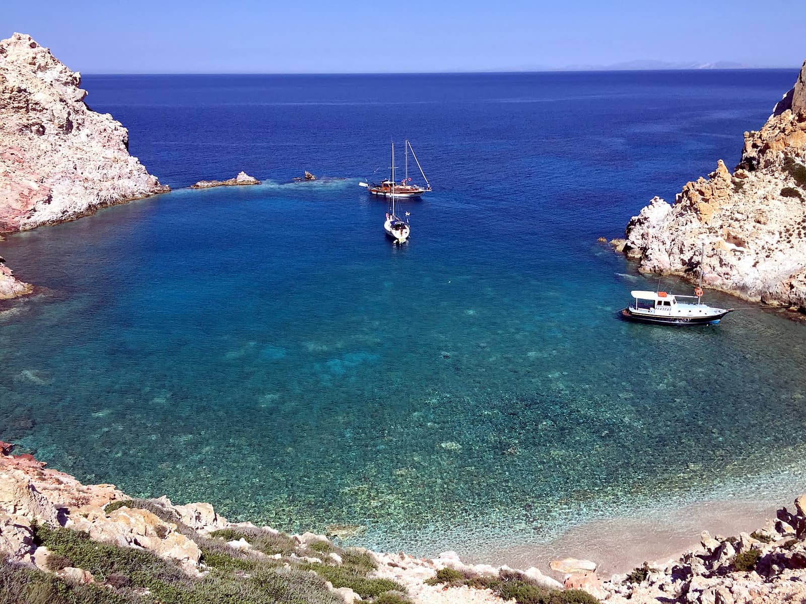
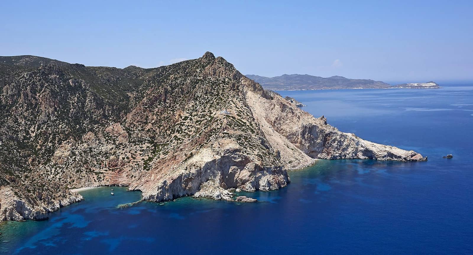
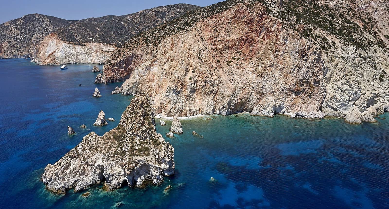
Kleftiko
The must-see stretch of coast of Kléftiko - Κλέφτικο is best appreciated in calm weather while staying the night since numerous tripper boats will ship sightseers during the day Lat Long.
Solid holding and lots of options to take lines ashore; completely open to the south; mainly sandy seabed; in northerlies there is more shelter below the cliffs than near the beach.
The area was a pirates lair, and the name “kleftiko”, like the famous Greek dish, comes from the word “kleftis” κλέφτης meaning “thief”. However, the original thieves were actually Greek guerillas who fought against the Ottoman yoke. These partisans lived in the mountains / isolated places and had to steal meat…
See Greek chart terms.
Ag Ioannis
The bay of Ioánnis - Άγιος Γιάννης (St John) offers a lovely remote sandy beach on the east coast of Milos Lat Long, suitable in NE – SE winds; uncharted; solid holding in sand (weed patches). Make the short pilgrimage to the historic Monastery of St John Siderianos
and 0.8 NM south of the anchorage is the roofless Sikia cave, access via a visible arch on the coast.
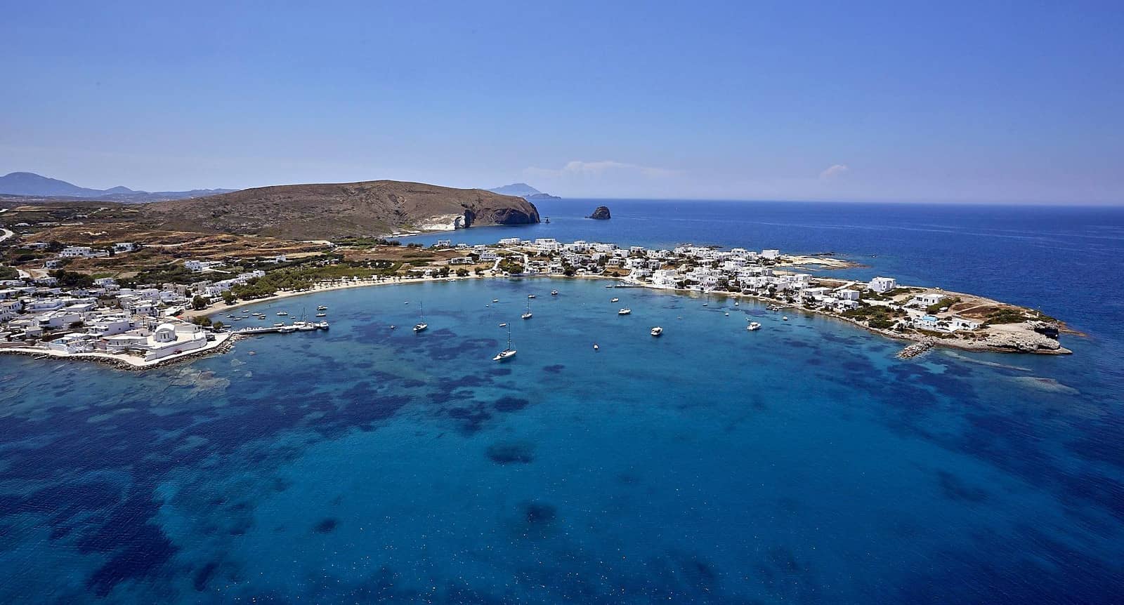
Pollonia
Pollónia (GWP introduced “Apollonia”) - Πολλώνια is a packed port (with the island's diving center) and bay on the south side of the Kimolos – Milos channel. The favorable part of the bay – with good holding and protection against the Meltemi – is mostly filled with a swimming zone and permanent moorings; the quay is used by the tiny Kimolos ferries; consult Garmin and Eagleray publications.
Be sure to explore the key archaeological site at nearby Fylakopi (3rd millennium BCE and later periods).
Visiting yachts will have to leave in case of strong NW – NE Meltemi winds. My preferred alternative is the nearby anchorage under the East Cape Pilonisi, otherwise – further south – you can try the hideous industrial bay of Voudia, which can offer more safety.
Kimolos island
Kímolos - Κίμωλος is an arid and inhospitable island of volcanic origin lying to the north-east of Milos. It was known in antiquity for its terra kimolia (cimolith), used both as a detergent and in medical baths.
The chief place on the island, Chorio, lies near the likeable port of Psathi, round the remains of the late medieval settlement of Kastro. On the island's highest point is the ruined medieval Castle of Palaiokastro (365 m).
Prasonisi
Prasonísi - Πρασονήσι anchorage is a tranquil alternative to Psathi port, although with a lengthy hike (>1 hr using the main road) to Chorio.
The wide shoal that connects the islet and Kimolos has a minimal depth of 1 m.
Either drop anchor west of the island (in front of the homonymous taverna, feels more secure), or (prettier) under Cape Georgios Lat Long.
Around the cape is an inobtrusive mining site for mordenite-bearing tuffs, pyrite and such. The quarry to the south of the taverna is also discreet; depths at the adjacent pier are unknown, but shallow.
The anchorage remains a delightsome spot despite a few additional holiday homes and is lagom-Meltemi-proof.
Predominantly sandy bottom; solid holding; open to NE – SW winds.
Semina (Ag Minas)
The fjord bay of Semina (Ágios Minás) - Άγιος Μηνάς is located between Prasonisi and Psathi, 45 minutes from the Chorio, good holding but only moderate shelter against the prevailing winds. A myriad of local boats occupy every spot in a rather unpleasing setting Lat Long.
Psathi
The modernised Psáthi - Ψάθη port provides the best shelter in a quiet delightful village .
Open to SE winds, which can cause high waves , whereas the prevailing NE winds will cause a heaving but mostly harmless swell; solid holding in sand / weed; gusts from the NNE.
The harbour is now completed and visiting yachts can raft up alongside the south pier or – preferred – go stern-to in the new NE “basin” or alongside near the green light; VHF 9 or 12; the ferry docks on the outside.
For restaurants aim for nearby Chorio (Kimolos' Chora).
Pirgonisi (Aliki)
Pirgonisi / Alikí - Αλυκή is a mildly attractive & windy stretch of coast Lat Long mind the rocky ledges; strong gusts from the north.
Offshore and ESE of Pirgonisi islet is the notorious mud / rock reef: Katergo (lighted), which is not indicated in the otherwise laudable GWP.
Garmin and EagleRay show the correct situation.
There is a very decent restaurant “Sardis” north of the beach.
St Andreas
In antiquity Kimolos had two ports. The ancient, sunken town was located on the SE coast in the area which is now called Ellinika. The islet of Ágios Andréas - Άγιος Ανδρέας with the acropolis of the ancient town and the numerous tombs in the wider area are visible remains of the ancient town.
The sunken – geological event unknown – town and the necropolis at Ellinika have brought a number of Mycenaean, Geometrical, Archaic, Classical and Hellenistic findings into light. It seems that the Kimolians had been residing in this town at least up to the early Christian years.
A-Z index: other places named “St Andreas”.
- In Sykia / Mavrospília - Μαυροσπήλια (northern bay) drop anchor just east of the reef in the far NE corner Lat Long.
- In Elliniká - Ελληνικά (southern bay) the ideal spot is just SSE of the St Andreas islet: sandy bottom, good holding Lat Long.
Noteworthy: the shallow Milos – Kimolos channel was an isthmus in Mycenaean times.
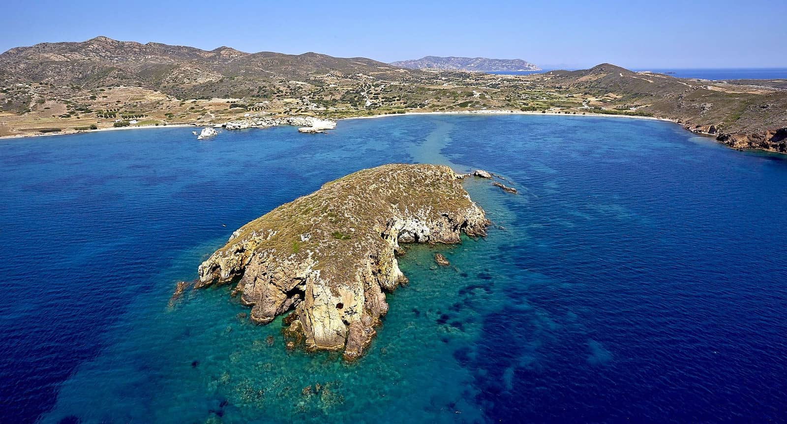
Polyaigos island
The uninhabited island of Polýaigos or Poliegos - Πολύαιγος is to a great extent privately owned by the immensely wealthy Greek Orthodox church, which sublets parts of it to local herdsmen from Milos and Kimolos.
In point of fact, Polyaigos literally means “many goats”.
As a result this goat population – in cooperation with rabbits – is keeping Polyaigos almost barren, though it does feature e.g. Serapias and a fragrant Phrygana ecology.
Polyaigos' shores include some of the most magnificent beaches & anchor bays in the Aegean, as well as many sea-surface caves, which serve as a refuge to a dwindling population of Mediterranean monk seals (Monachus monachus). Moreover, the island is home to the rare endemic Milos viper.
Caïques sometimes bring a handful of tourists to the beaches, however by the afternoon these will have returned to the Psathi or Pollonia ports. Nearest are the north beaches Lat Long but these lack both the shelter as well as the geological grandeur of the anchorages listed below.
Ammoura
The confined Ammoúra - Αμμούρα bay on the NE coast is only known to insiders and offers a splendid beach with a few tamarisk trees, long-horned goats and a lagoon under a “forest” of rocky pinnacles.
From the anchorage a zig-zag path leads up to the Maskoula lighthouse, constructed in 1898, which is half-way up the peak from where there are grand views.
Uncharted area; open to NNE – SE winds; some protection against swell in northerlies; pebbles / sand / weed; plenty of options to take a line ashore, (learn how).
It is very shallow near the beach, a larger keeled yacht can just moor SW of the curved reef
Lat Long.
Kato Mersine bay on the right (south).
Manolonisi
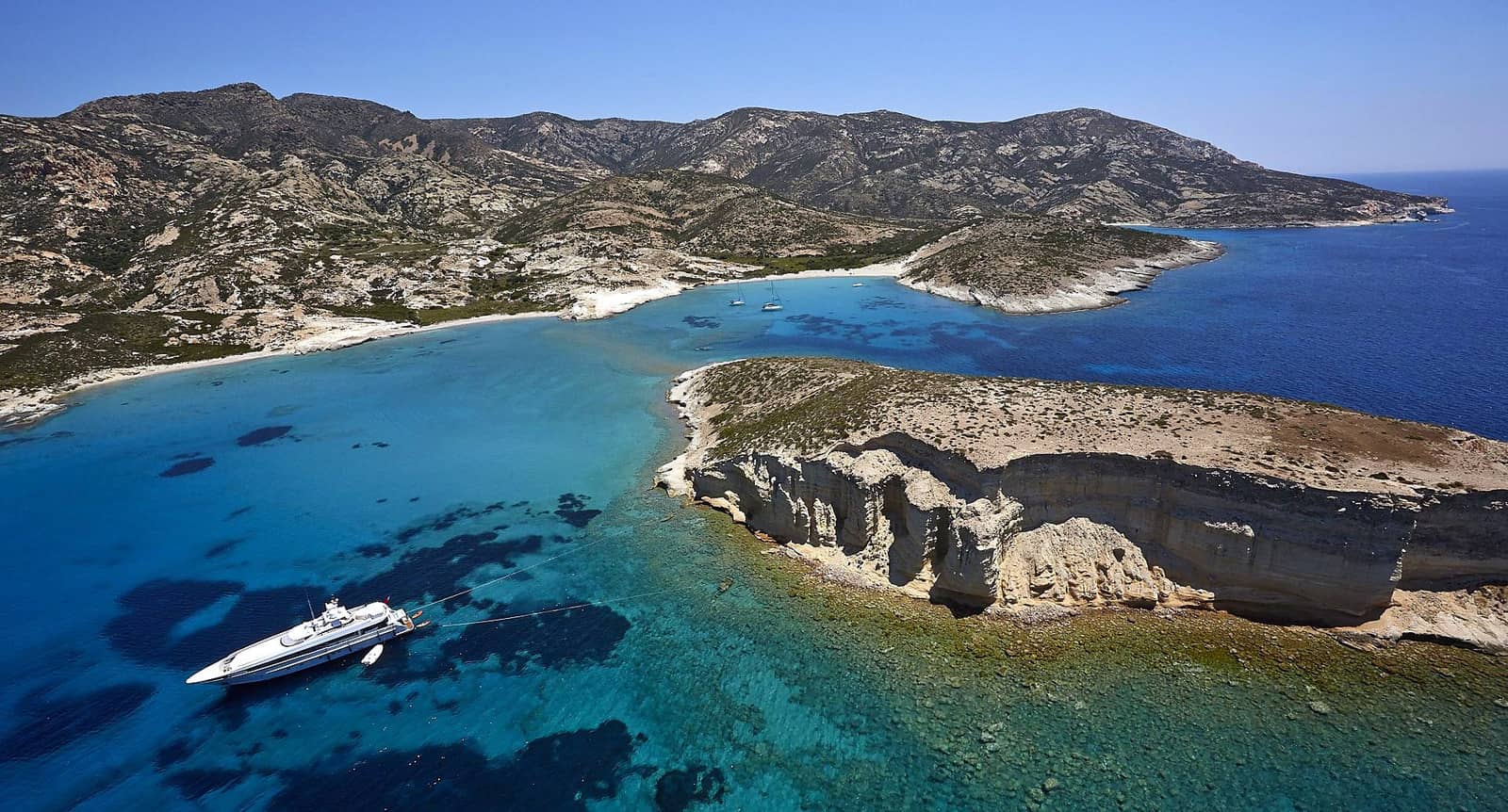
On the W coast is the islet of Manolonísi - Μανωλονήσι bay , which guards one of my favourite anchorages Lat Long in the whole of the Cyclades.
The bay is open to westerly winds, and the reef that connects Manolonisi to Polyaigos provides shelter even in Meltemi conditions; superb snorkeling; solid holding in sand.
Furthermore, even in strong S – SW winds it is possible to find protection north of the islet / reef.
The actual bay is called Mersíne - Μερσίνη whereas the larger, less sheltered bay directly south is called Kato (Lower) Mersine - Κάτω Μερσίνη Lat Long.
South coast anchorages
Along the south coast of Polyaigos there are several geological highlights with dramatic rock formations and cerulean waters, notably:
- “South Bay or Blue Bay” with the iconic spiky rocks Lat Long.
- "South Cape Bay” directly west of the southernmost point of Polyaigos, best shelter in stronger northerlies; small beach Lat Long.
- "South-East Bay” directly north-east of the south cape; more weed than sand; fair-weather only, and like the other south coast anchorages not Meltemi-proof Lat Long.