Amorgos sailing holidays
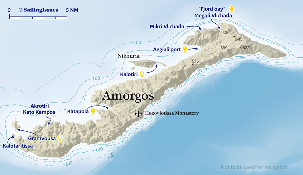
Spectacular Amorgós - Αμοργός is an island of bare rocky hills 17.8 NM long and up to 3.5 NM wide.
For the most part the south-east coast falls steeply down to the sea, but the north-west coast is gentler, with two deep inlets sheltering the Katapola and Aegiali ports.
Moreover, the must-see “Fjord Bay” and Kalotiri anchorages mean that Amorgos should be included when cruising the Cyclades.
The population – much reduced by emigration – lives by farming and fishing. Ferries are smaller and not frequent, which explains the surprising low numbers of tourists.
The remains of several ancient cities, extensive cemetery areas, finds of coins and rock inscriptions bear witness to the importance of the island in Minoan and Hellenistic times as a port of call on the sea route between Milos and the south-eastern Aegean.
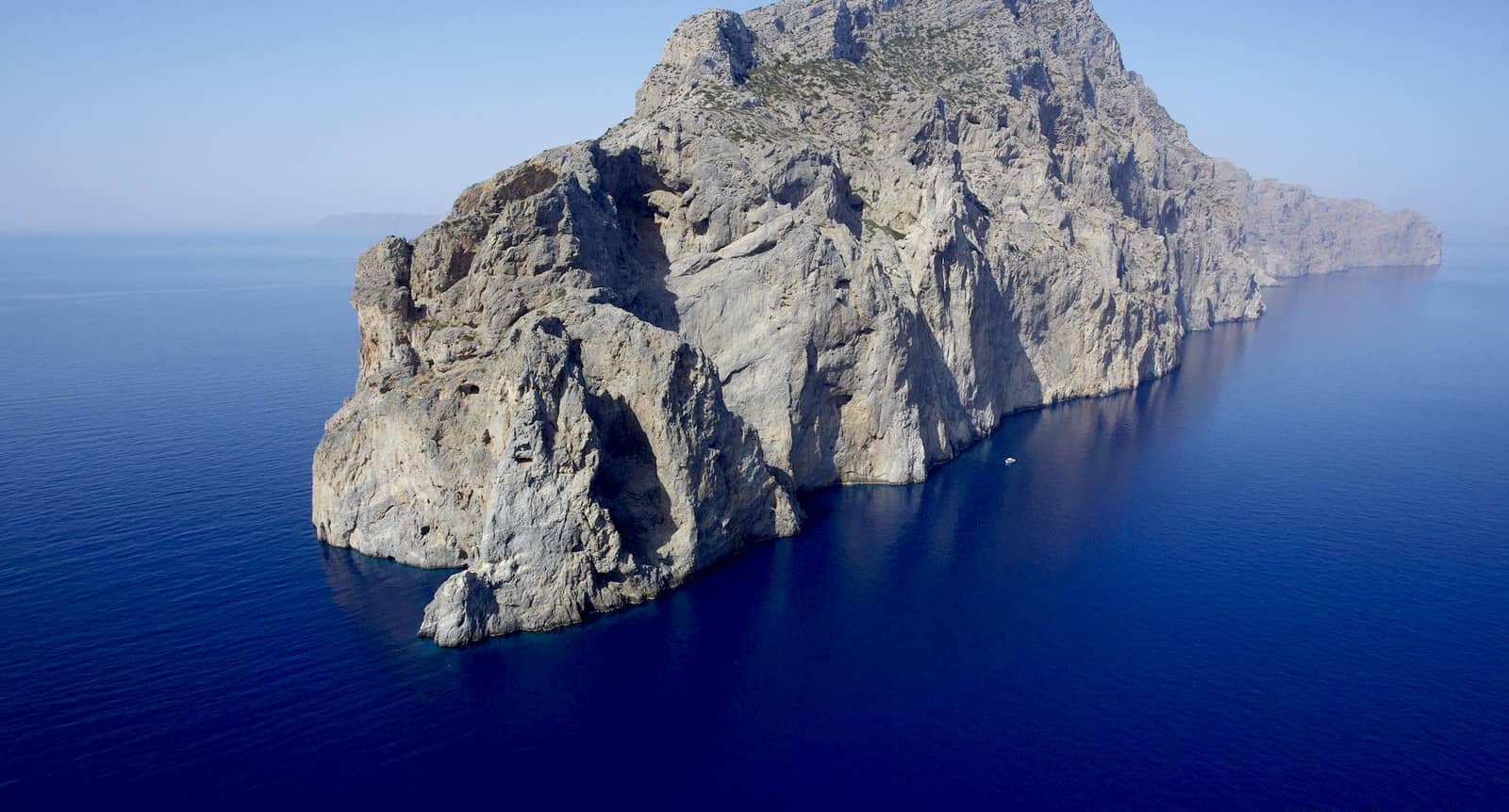
It is possible to sail bloodcurdlingly close along – and seemingly under – the 200 – 650 m high and near-vertical cliffs Lat Long on the NE coast for instance when sailing from / to Astypalaia.
See selected-words: l'appel du vide come to mind…
Amorgos features its own pod of dolphins plus a separate small pod of curious young males.
History
Used in Roman times as a place of exile and in subsequent centuries frequently harried by pirates, Amorgos has remained since then an island of no economic or political importance and has in consequence retained much of its distinctive character.
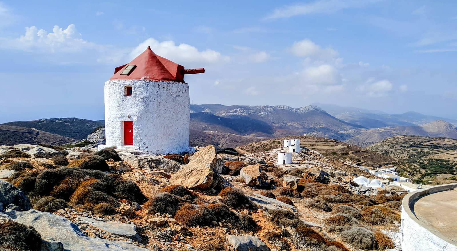
Amorgos or Chora, the chief place on the island, is situated on the slopes of a hill, huddling round a ruined 13th c. Venetian castle with its typical whitewashed Cycladic houses, its many barrel-vaulted family churches and its windmills.
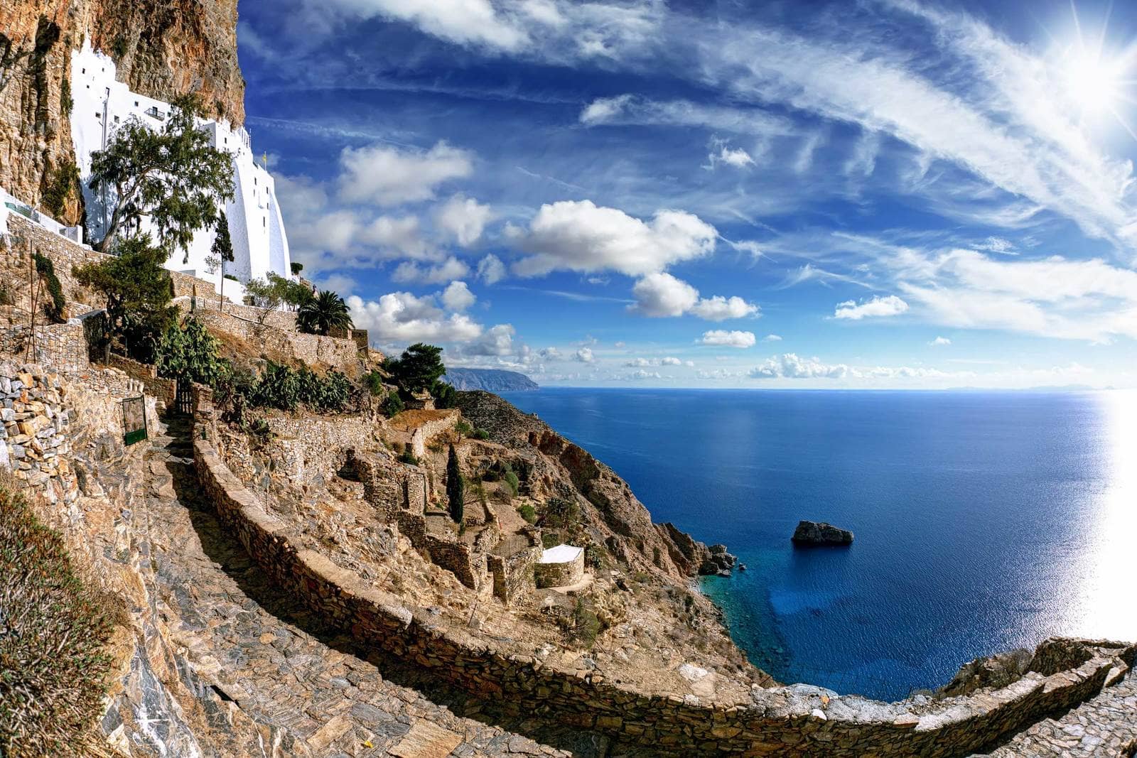
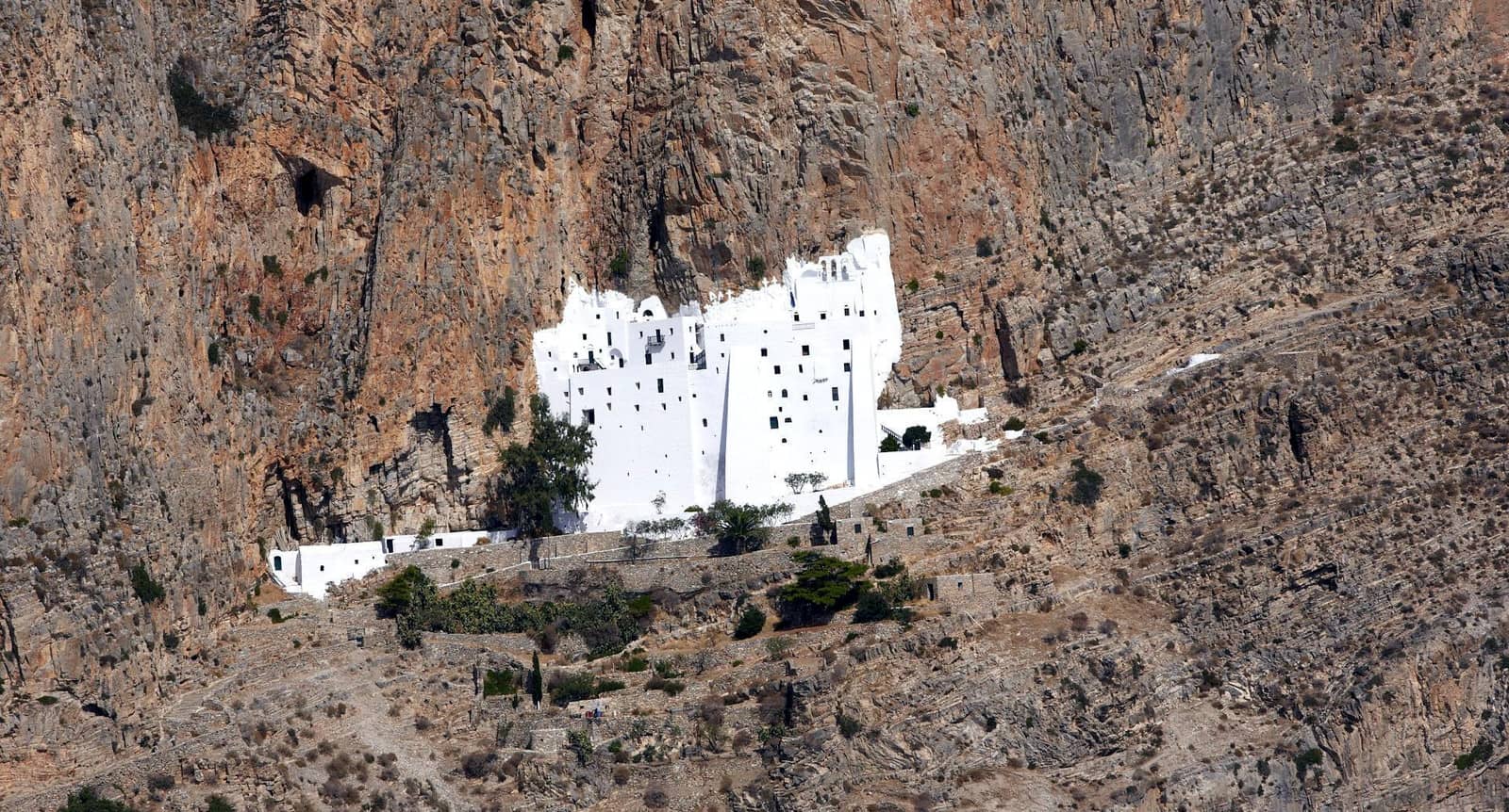
From the town it is a half-hour walk to the Byzantine Monastery of Panagia Hozoviotissa (1088), ordered by Emperor Alexios I Komnenos, clinging to a sheer rock face at a height of 367 m.
The motivation for building this sanctuary was an icon found – after the second Byzantine Iconoclasm – originating from Hozovo, near Jericho, Palestine.
It extends for 8 floors but is only 5 m deep, and from the lower terrace there are breathtaking seascapes. Inside the monastery, there is a library with valuable manuscripts and exceptional icons. When dressed appropriately even the atheists will be greeted with benignity by the residing monks: during our last visit we were fortunate to witness an episcopal baptism.
Opposite on the west coast of the island is Katapola, the main port.
At the south end of the island, at the pretty village of Arkesini - Αρκεσίνη, is the site of Kastri, with remains of a settlement occupied from Mycenaean to Roman times. At the north, near Aegiali port, are traces of a settlement by Milesians. From here there is a very rewarding climb to the summit of Mount Krikelos (821 m), the highest point of the island.
Clockwise ↻
Ports / anchorages are clickable . signifies a highly recommended venue, and a truly must-see venue; see other icons.
Kalotaritissa
Kalotarítissa - Καλοταρίτισσα bay – near the south-west tip of Amorgos, just south of the appealing Gramvousa island – is not as desolate as it appears on the chart: mind the many permanent moorings and chains on the seabed.
Small catamarans might go stern-to the minute quay near the taverna. In the summer months all vessels will have to anchor further east, which means less shelter from the prevailing winds.
The famous grounded ship Olympia is a 20 minutes walk east, but is nothing as monumental as the wreck on Zakynthos.
Gramvousa
 Gramvoúsa - Γραμβούσσα island has two main anchoring options, but the east bay Lat Long – although superbly private – is only suitable in fair weather and is open to N – SE winds.
Fortunately, the south anchorage offers more allround shelter and better holding in sand / weed; mildly Meltemi-proof; anchor in 3 – 5 m south-west Lat Long of the white church.
The GWP, Eagleray and Garmin show the correct situation; perfect sandy beach under a low steep ridge; in the main season sunseekers are ferried over from Kalotaritissa: if too crowded you could probe the cove directly east of the church.
Akrotiri • Kato Kampos
The deep inlet of Akrotiri • Kato Kampos - Ακρωτήρι is open to the prevailing northerlies Lat Long and is rather lacklustre. The rocky slabs on the seabed make it difficult to anchor safely.
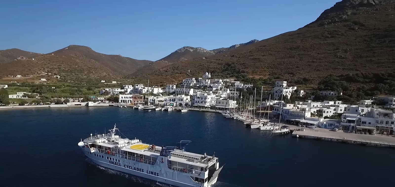
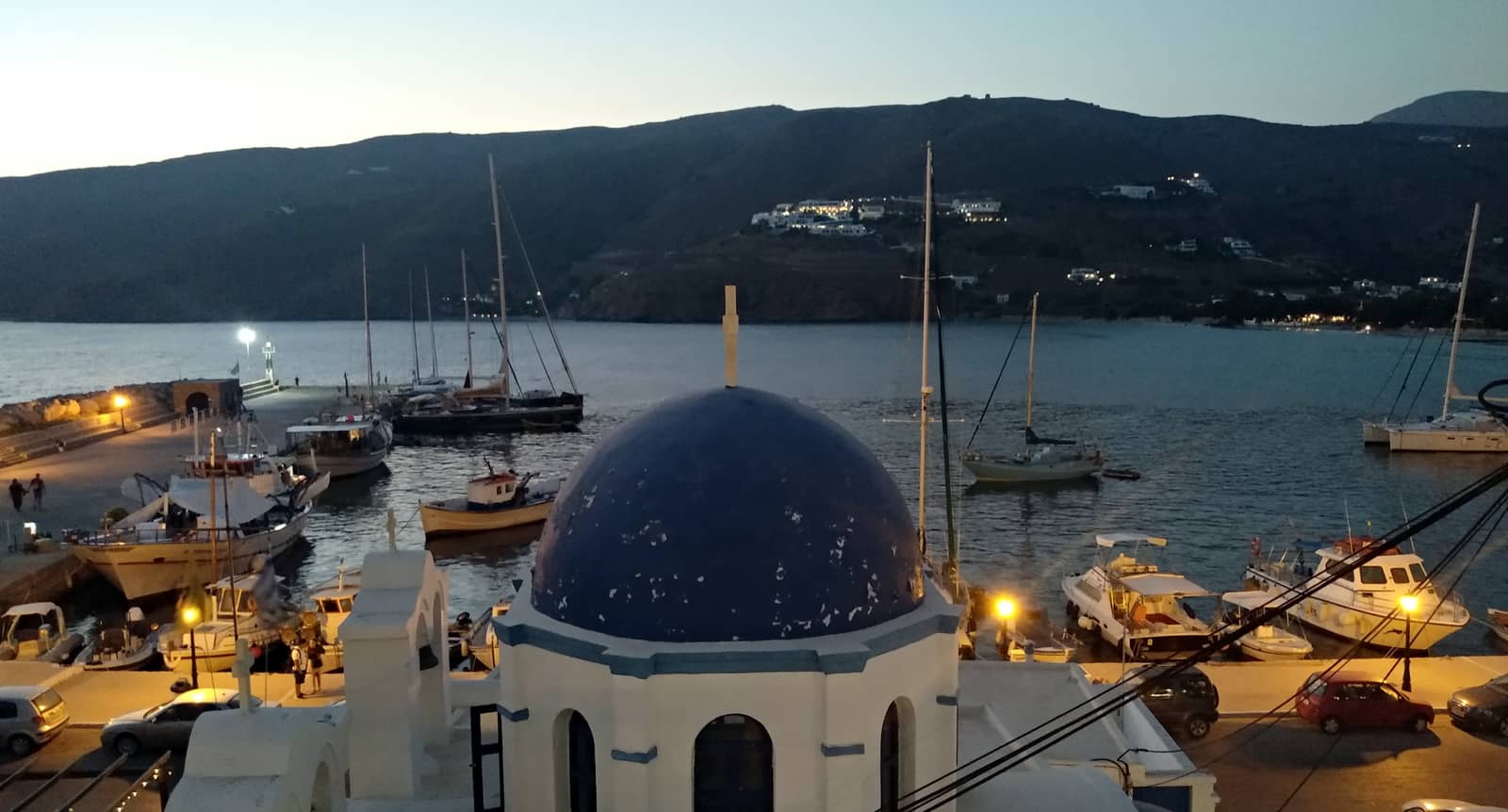
Katapola port
Katápola - Κατάπολα (the name is probably a compound of “Kato” and “Poli”, lower town) is the main port of Amorgos island and serves as the gateway to the cherished Monastery of Hozoviotissa via taxi, bus or rented scooter or car.
In the deep bay there are two safe anchorages west of the port: in northerlies at Maltezi beach (west of Panteleimonas Church) Lat Long and in southerlies between Lat Long the Katapola port and Panagia Church.
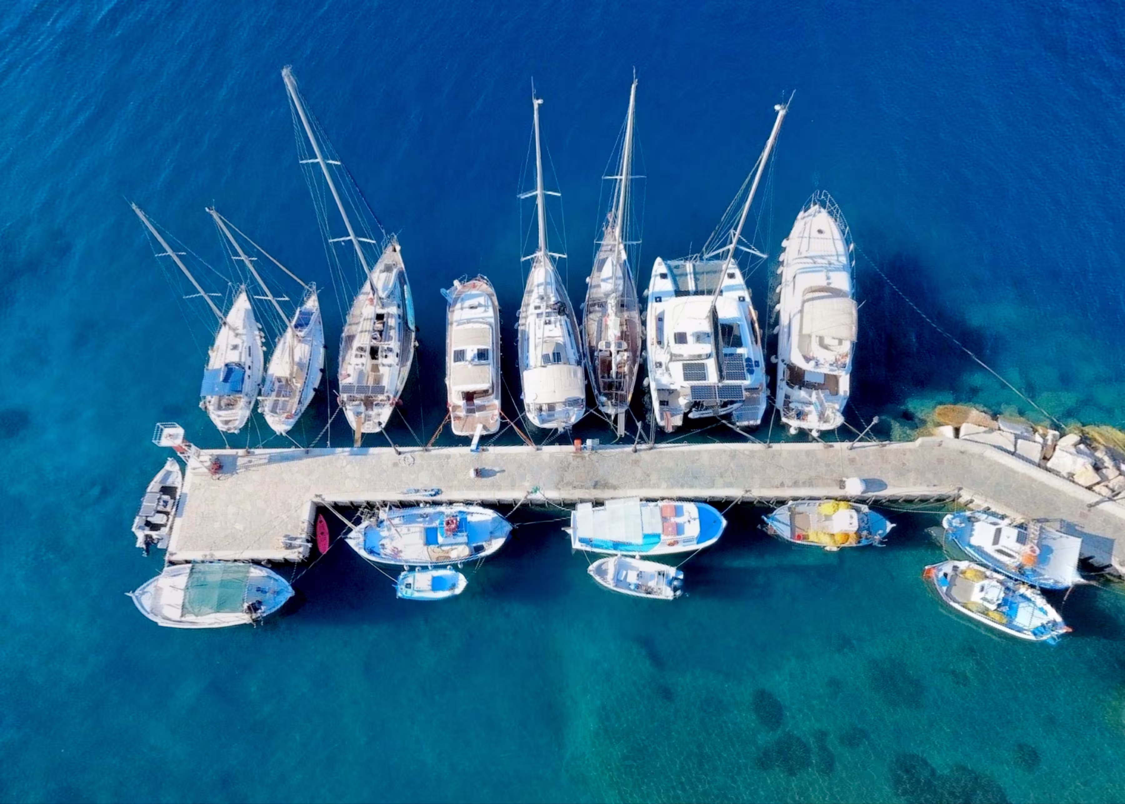
In the port go stern-to the SW or S quay yet not too close to the eastern ferry quay where it is shallow. Note that anchors chains will cross if you use too much scope. Moreover, the ferry could lift your anchor. Yachts and catamarans drawing less than ~2 m can anchor east of the ferries; see the photo of Katapola top of page; (further) dredging is planned, as well as a future marina.
Directly ashore you can find most amenities, otherwise it is a pleasant walk uphill to the Chora.
Worthwhile locally is the Church of Panagia Katapoliani – 1 minute walk from the quay – built over an early-Christian basilica with ancient materials (spolia) from an Apollo temple.
The “Botanical Park” is a lovely oasis to eat out, buy herbs or drink tea under lemon trees.
Moreover, there is the Venetian faucet with excellent spring water delivered by an ancient aqueduct.
Further south are the ancient ruins of Minoa (walls, a school, a temple) built over a pre-historic town; 45 min. circuitous route.
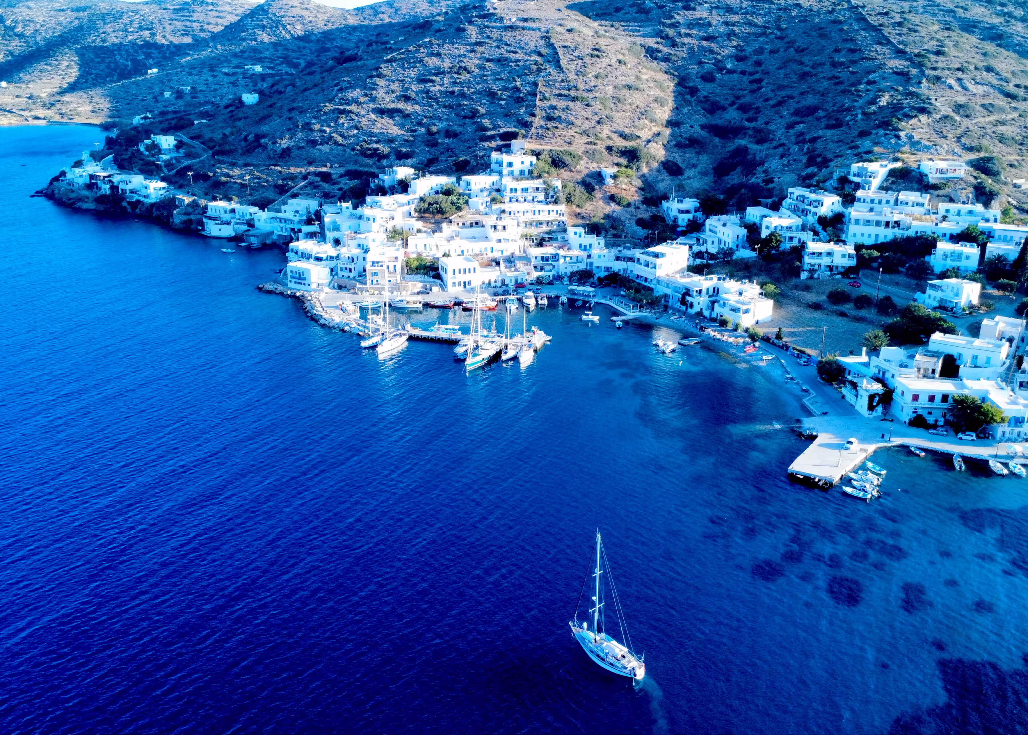
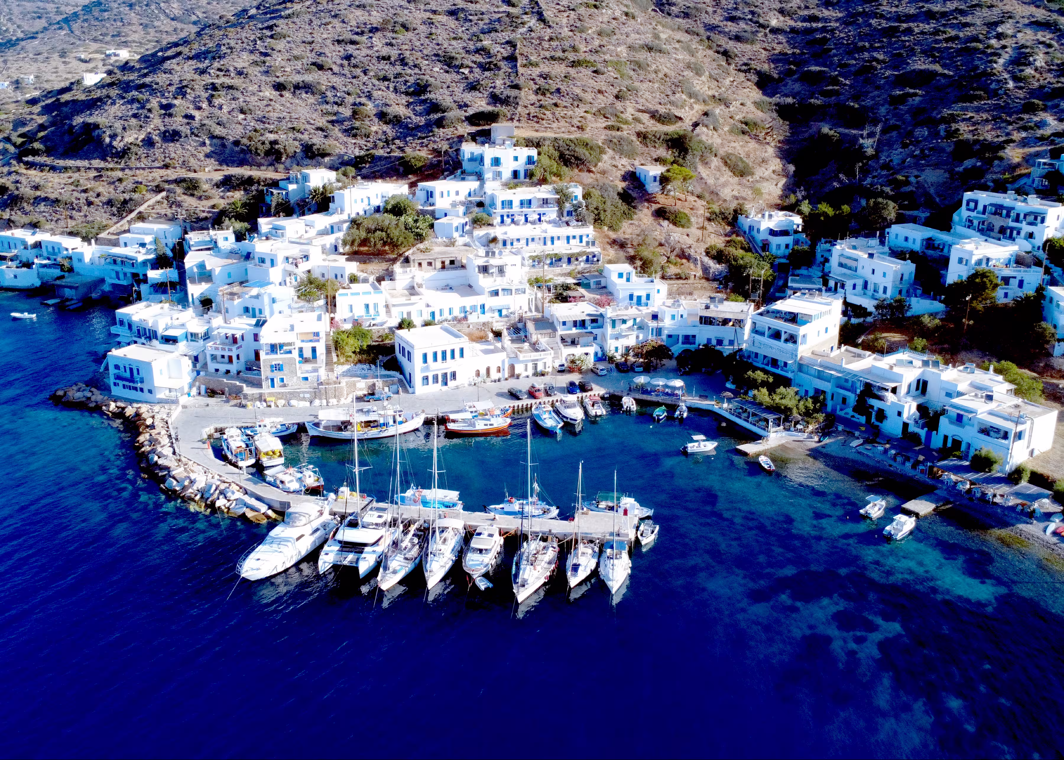
Katápola north pier • Xilokeratidi
The in 2023 completed “North pier of Katápola”, at the tranquil village of Xilokeratídi - Ξυλοκερατίδι, faces the ferry quay on the south side of Katapola bay.
The pier offers about 9 berths (less in case of multihulls) and is the ideal spot in Meltemi conditions, since the wind direction pushes the sailboat away from the pier and there are few, if any, severe gusts here.
You can reserve a berth through Ahmed (whatsapp +30 2285 071285 or +30 6979 494928) who also manages the southern ferry quay; mind that there are no lazy-lines, you'll need to drop anchor in 8 – 10 m with a minimum of 50 m chain; close to the wall there are still depths of 4 – 5 m; electricity and water (trickling) is available from 2 shore power pillars to be shared with the fishermen; mooring fees vary (e.g. first night double) 10 euros per night for a 40 ft monohull, but this often includes electricity.
The Blue Star arrives 3 times a week in season, the coastguard can make you leave if the larger vessels need to drop anchor close to Xilokeratidi; also,
the coastguard might claim this pier for its own vessel, hence the professional rubber fenders.
You will find the office of Hellenic Coastguard (Port Authority) in between the “Moon bar” and “Le grand bleu bar” in front of the small rectangular pier directly east.
The diesel truck cannot visit this pier.
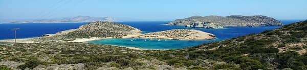
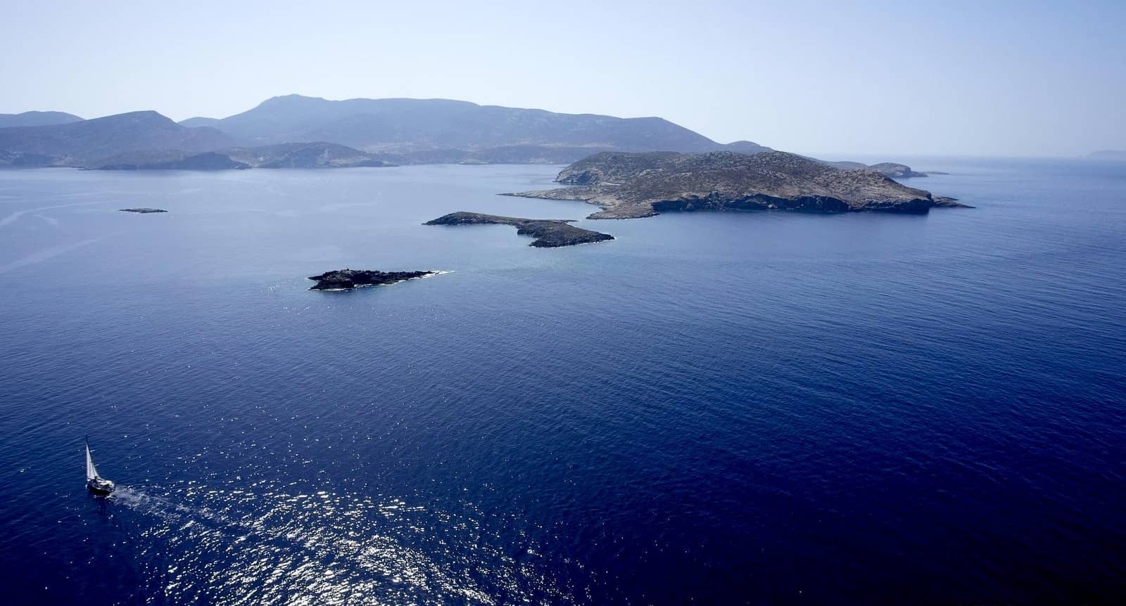
Kalotiri
Kalotiri - Καλοτυρι bay offers a splendid anchorage under the elegantly shaped island of Nikouria - Νικουριά in crystal clear water with hues of greens and azures.
Either anchor in the middle (20 m deep) or – my favourite – close to the beach Lat Long in 4 – 8 m.
The seabed is hard sand with lots of thick weed, so visually check your anchor: snorkeling is a delight here.
Possibly sudden and severe gusts over the low and thinnest part of the island, but otherwise Meltemi-proof;
less suitable in (strong) easterlies and southerlies.

Kalotiri anchorage is behind the curved tail of Nikouria.
In ancient times coins were minted at the Mint just north-west of the conspicuous Church of Panagia. In recent days the island was a refuge for lepers.
The channel between Amorgos and Nikouria has the forewarning name of Kakopérato; a compound of Kako meaning “bad” and Perato meaning “crossing”. Only use the channel in calm conditions and good visibility, while keeping to the north side (60 m off Nikouria island) where there is a minimum depth of 5 m.
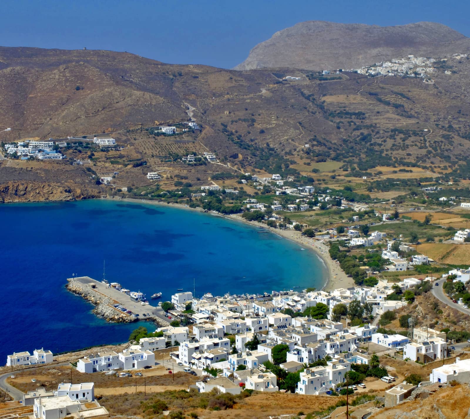
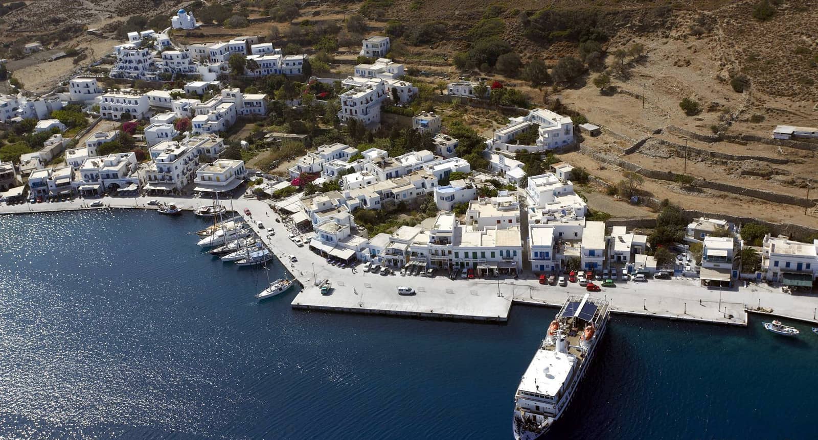
Aegiali port
Aegiali - Αιγιάλη is called Giáli by the locals and is comprised of four villages:
- Gialó ① near the quay has most of the tourist trade and serves as the port.
- Langáda or Lagada ② is the delightful centre of Aegiali and can be reached by a 30 minutes hike uphill, or rent bikes or a car to visit the cave chapel of Agia Triada; festivities 50 days after Greek Easter.
- The village of Potamós ③ is built on the mountain slopes and has been referred to as the “balcony of the Aegean”.
- To the north is Tholária ④ with an ancient citadel and vaulted Roman graves (Tholotos means vaulted).
Also very rewarding is the Monastery of Agios Ioannis the Theologos (6th c.), which has been recently renovated, plus there are exquisite frescoes; a 50 min. walk from Langáda, and celebrations on 26 September and 8 May.
The port of Aegiali provides allround shelter despite strong gusts from the NW. If possible go along-side the pier, alternatively go stern-to. We couldn't find the chains fouling the seabed close to the pier mentioned by GWP. For this port we used Garmin and EagleRay.
The quayside is too shallow for most charter yachts; the ferry docks at the far end of the pier; the preferred berths are at the middle section, see photo Aegiali pier.
There is a diving centre at the beach and delicious (vegetarian!) dishes at the “Amorgialos Taverna” right at the pier.
Solid holding in port but less so in the bay (also due to a steeply angled seabed). If you want to stay at anchor – and avoid most of the ferry noise & light pollution – you'll find the best spot between the green light and the beach; only affected by strong westerlies; reasonable holding in sand / weed / rock.
Mikri Vlichada
Mikrí Vlicháda - Μικρή Βλυχάδα is a tight cove 1.2 NM west Lat Long of “Fjord bay” and is a lonely, lovely location for a lunch-stop or in southerlies.
Visit the stunning village of Tholaria.
Open to WNW – ENE winds, and any northerly will bring in a swell.
Pebbled beach; just room for one yacht / catamaran; good holding.
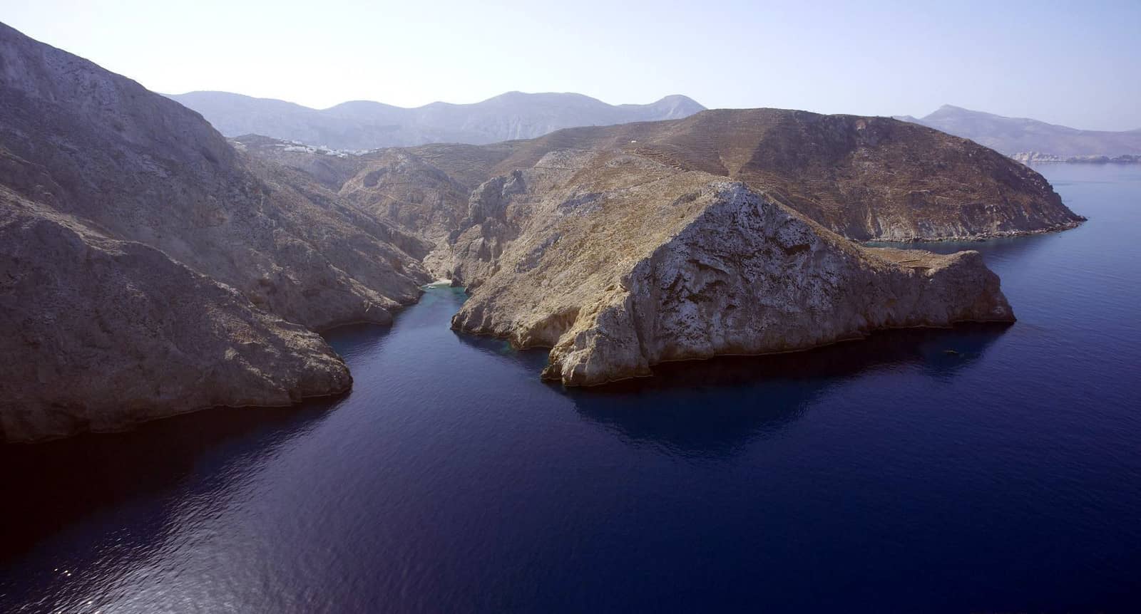
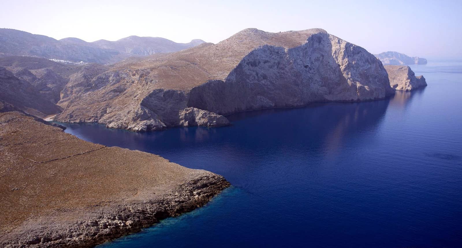
“Fjord bay” • Megali Vlichada
Fjord bay is located Lat Long near the north cape of Amorgos, which is one of my favourite anchorages in the eastern Cyclades. Officially Megáli Vlicháda - Μεγάλη Βλυχάδα, wider and much deeper than Mikri Vlichada.
First admire the desolate fjord-like scenery, then drop the bow anchor in 5 – 10 m (coarse sand) and drag the second anchor onto the beach; gusts will blow down the valley or from the NNW (sea breeze & land breeze style). Very suitable in hot summer weather due to the sudden sunset behind the rock face .
Note, the prevailing NW wind can become a local SE wind in the evening.
Although Cape Vilakarda - Βιλακάρδα (the north cape) provides decent protection for an overnight anchorage at the head of Fjord bay, it is better to relocate to nearby Aegiali port in NNW – NNE winds / gusts over 35 knots.