Meltemi
Etesians Greece & Turkey
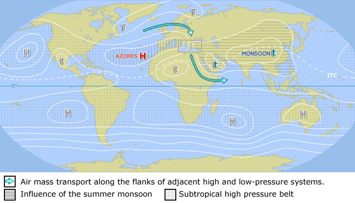
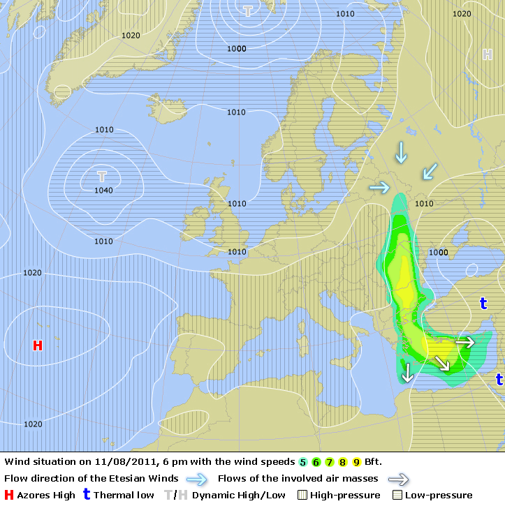
The Meltemi - μελτέμι was known by the old Greeks as the Etesian northerly winds, and results from a high pressure system (>1025) laying over the Balkan/Hungary area and a relatively low pressure (<1010) system over Turkey.
Although this katabatic wind wind can bring about harsh sailing conditions it also provides cooling, low humidity and good visibility.
Furthermore, it can be characterized as one of the few Mediterranean winds that do not necessarily die out at the end of the day and can easily last more than three to six days. See my climate page for Greek weather statistics.
The onset is the monsoonal effect of the summer season that leads to the development of an intense heat trough over southern Asia extending westward over the Anatolian plateau. Higher pressure dominates over the relatively cooler surface of the Mediterranean Sea, and settled, dry weather persists.
Note, that northerly winds prevail along the Greek coasts during the winter also, but only those northerly winds occurring between May and November are considered Etesians.
The pressure gradients necessary to drive the Meltemi result from a combination of:
- The monsoonal effect during the summer that leads to a low pressure trough over Turkey. Etesian winds flow from a high pressure ridge over the Balkans toward the trough. During a strong Etesian, the trough may extend relatively far to the west and beyond Rhodes. It may also form a closed low, resulting in almost calm winds at Rhodes.
- Synoptic conditions leading to anti-cyclogenesis over the Balkans.
- A jet-effect increase of wind caused by channelling of the wind between islands and mountain valleys. These effects tend to render wind reports from certain locations unrepresentative. In the lee of Crete, katabatic flow off the mountains generates gusty winds similar to the Föhn of the Alps. The mountain valleys tend to channel the flow which increases the wind velocity.

The surface flow is generally divergent in an Etesian situation, and the weather is likely to be dry with clear skies. However, this is mostly true only during the main yacht charter season of July and August when scattered altocumulus appear a day before an Etesian, and the only other clouds during the Meltemi are orographic types that may form on the lee side of islands in stronger Etesian winds.
The Meltemi occurs mainly during the summer season (June – September with 70%), but also in May and October one may frequently experience this dry wind, but anticipate its maximum – also in strength or duration – during July and August. It is therefore more prudent to use the yacht charter base of Athens (Alimos) and not start out of Paros , Lavrion or Mykonos .
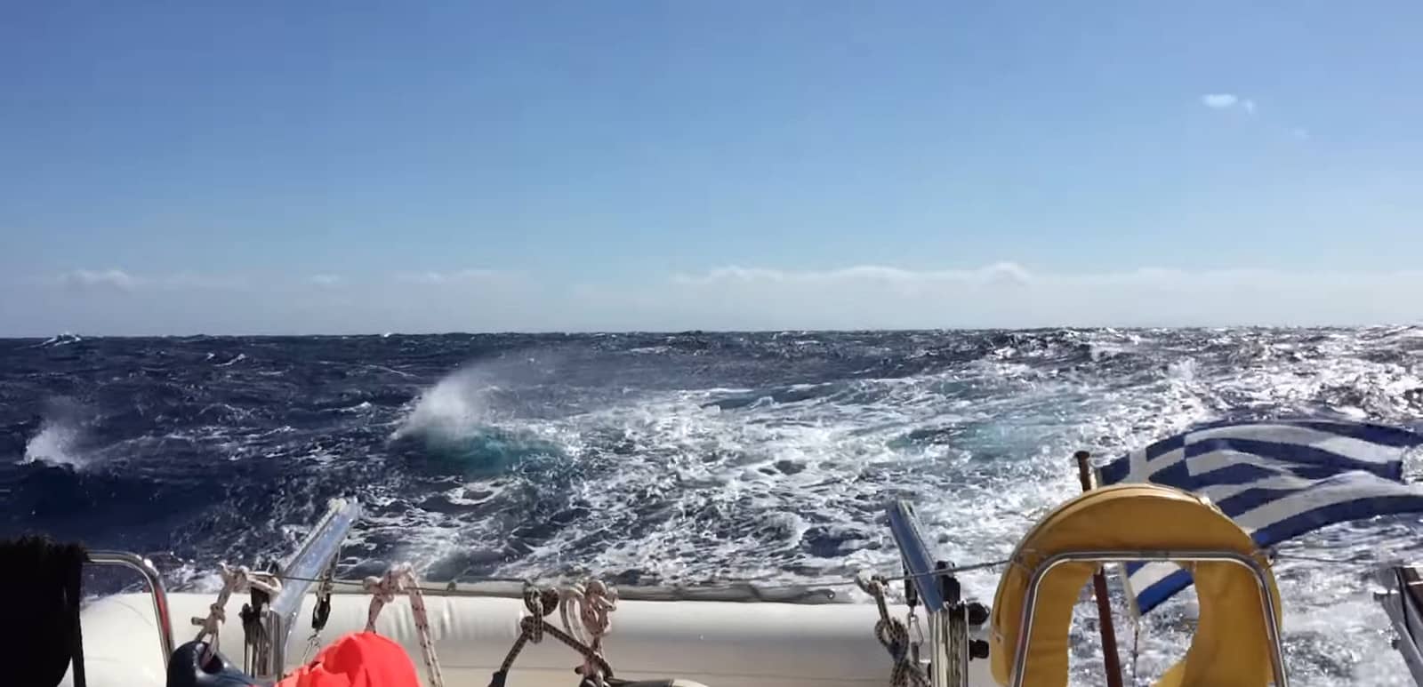
Usually the wind starts in the early afternoon reaching 4 – 5 Beaufort (11 – 21 knots) and dies out at sun set. However, not uncommonly it reaches 5 – 7 Bft (17 – 33 knots) during the day, perseveres during the night and blows 5 – 7 Bft again the next day; a pattern which can easily be repeated over many days, sometimes even up to ten days.
If during this period sailing to windward cannot be avoided, it can be very wise to lift anchor at dawn and to cover as many miles as possible before the wind starts
Climate (change)
The word “climate” is derived from the Ancient Greek κλίμα; klíma, “latitude”, literally “inclination”. Notably because climate was viewed to be related to the position of the stars. A region of Earth that was under the same angle of stars, shared the same climate; see climate change…
Important guidelines
- Due to the katabatic nature of the meltemi one can experience strong fall winds on the leeward side of the islands, notorious are Kea (we did survive though), Evvia, Tinos and Andros, Folegandros, Kos, Serifos, Amorgos and Sifnos. An orographic cloud to leeward of the mountain spells danger.
- When the wind encounters very high cliffs on the north shore of an island, a calm – extending several miles off shore – can be expected. Good examples are Amorgos, Paros and Naxos.
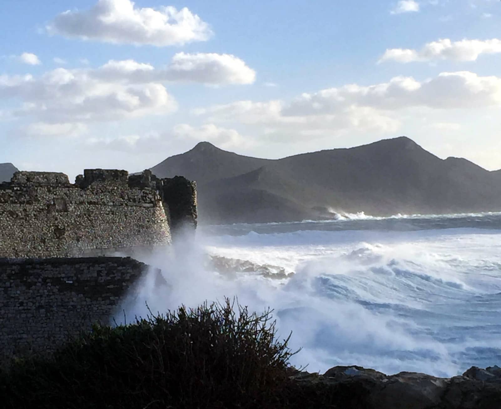
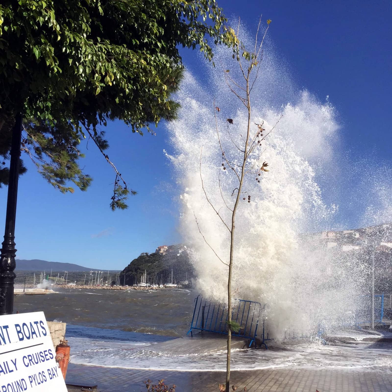
- In the wide corridor between de dodecanese and cycladic islands the Meltemi blows undisturbed over 100 nm. Within six hours of a 30-knot wind, the waves can reach heights over three meters. The adverse currents make these waves steeper, which can be seriously dangerous for yachts and catamarans smaller than 10 meters/33 feet.
- The Ionian Sea in the west of Greece is not affected by these Etesian winds but experiences a reliable Maistro wind throughout the sailing season. For an explanation on the Maistro wind please visit my page on sailing routes in the Ionian.
- Expect funnelling winds , which can make certain straits dangerous to pass because of currents and higher wind velocities. Infamous areas are: between Andros and Evvia (currents up to 5 knots!); between Ikaria and Samos till the Fournoi-archipelago; between Paros and Naxos; north side of Amorgos; west side of Karpathos. Sometimes south of both Kea and Kythnos.
Register for free and join an active, critical sailing community.
- Tell-tales for your own Meltemi 24 – 36 hour prediction :
- Higher predicted atmospheric pressure over the Balkan/Northern Aegean.
- A sudden drop in humidity (e.g. first morning without dew on deck).
- Scattered little altocumulus clouds one day in advance.
- A clear improvement of visibility combined with a raise in atmospheric pressure (4 hPa within 12 hours).

Auspiciously, the possibility of stronger winds is actually the only shortcoming of the Aegean sea. There are hardly any shallow waters, no tidal navigation and no fog (good visibility!): all the ingredients for perfect yacht charter vacations.
Related pages
How to forecast showers by looking at clouds
The Tower of the winds in Athens
Our logbook from Athens to Milos via Santorini
Unique climate data of Greece
Sailing the Turkish Aegean coasts – Bodrum and Marmaris
Raindrops are spherical • Seawater temperatures • Windroses Aegean
Medicanes – tropical-like cyclones – are rare in Greece (so far East in the Mediterranean), but are likely to increase on account of the climate emergency: warmer sea surface temperatures make it easier for wind speeds to become more intense.
These Mediterranean hurricanes can affect the Adriatic (Croatia) and the Ionian (west Greece) – but not so much the Aegean (East Greece) – and are historically peaking between the months of September and January.