Kos & Nisyros sailing holidays
Kos - Κως lays at the mouth of the Turkish Gulf of Kerme (Turkish: Gökova Körfezi) which cuts deep into the coast of Asia Minor.
The island was separated from the Bodrum Peninsula by the collapse of a rift valley in the Pliocene period, which explains the range of limestone hills, rising to 846 m in Mount Dikaios, that runs along Kos island SE shores.
It is the largest island in the Dodecanese after Rhodes and, unlike most other Aegean islands, Kos has a population that is increasing in numbers, and is a weightier charter base for yacht rental companies than Rhodes.
- All Greek islands
- Dodecanese • Southern Sporades overview
- Chios
- Samos
- Patmos • Arki • Lipsi
- Leros • Kalymnos
- Kos • Nisyros • Tilos
- Astypalaia
- Symi
- Rhodes
- Itineraries in the Dodecanese, adjacent Turquoise coasts and Southern Sporades.
Previous islands: Leros and Kalymnos

Approximate and disputed borderline coordinates between Turkey and Greece:
1 36° 57.760' N 27° 16.189' E
2 36° 57.012' N 27° 24.158' E
3 36° 47.417' N 27° 21.943' E
4 36° 43.158' N 27° 18.162' E
5 36° 41.895' N 27° 17.979' E
6 36° 35.520' N 27° 19.951' E
Next island: Astypalaia

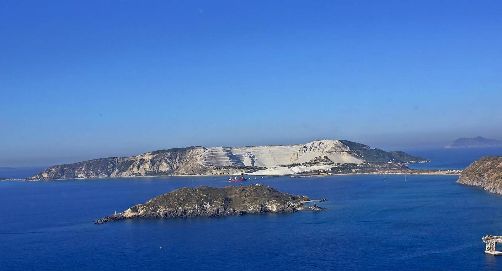
Just south of Kos is Gyali / Yiali – an obsidian island – which houses an ugly pumice quarry.
The origin of this pumice is the volcanic island of Nisyros (a big strato-volcano, which was built up above sea level about 66,000 years ago). It was occasionally active in the Middle Ages but now manifests itself only in the form of solfataras. Pumice from the eruptions may be found in 100 m thick beds on the higher parts of the island and is exported.
You might want to look now at the Glossary of Volcanic & Geologic Terms.
Nisyros is a green and well-watered island, with fertile soil which is cultivated on laboriously construced terraces on the outward-facing slopes.
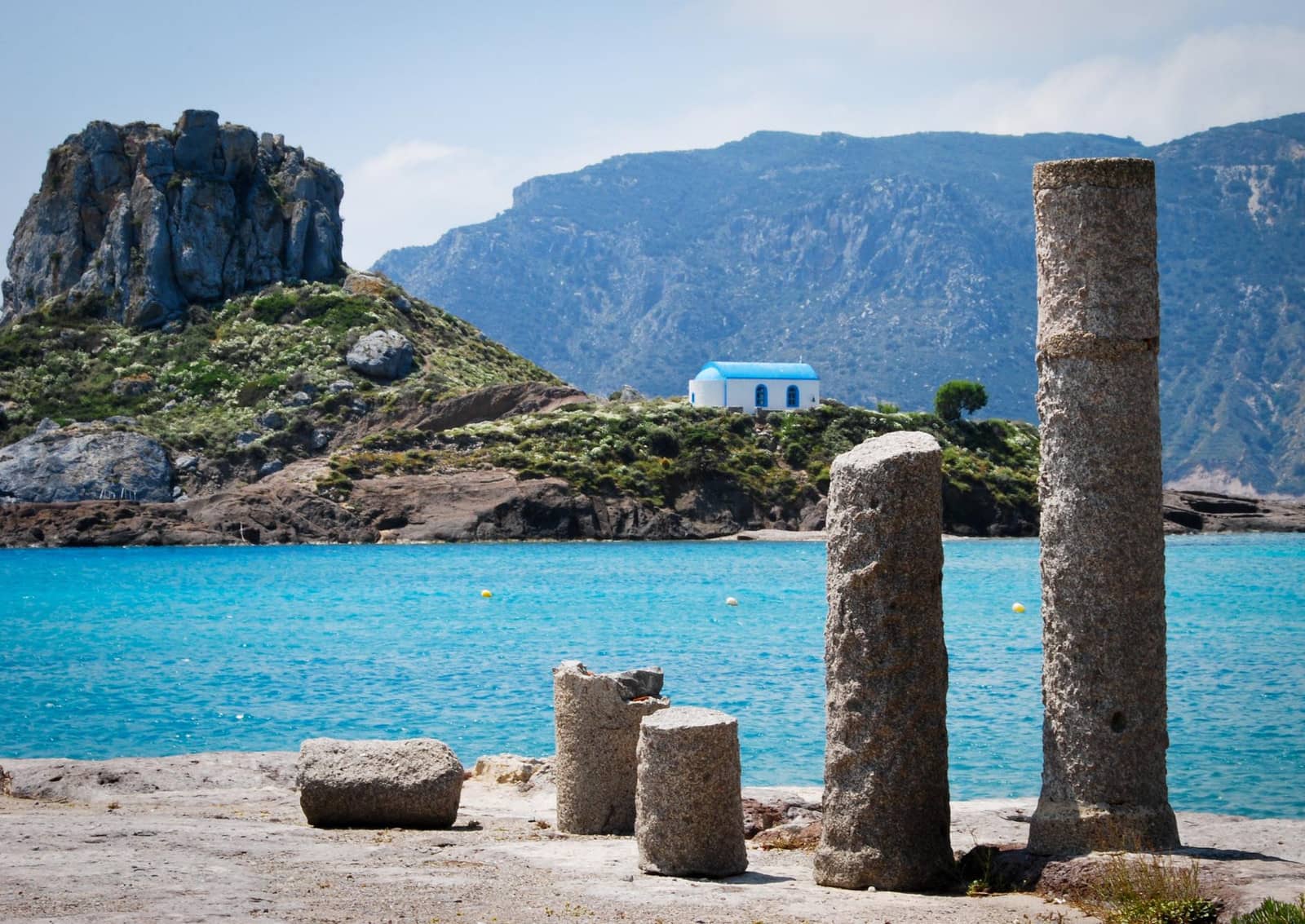
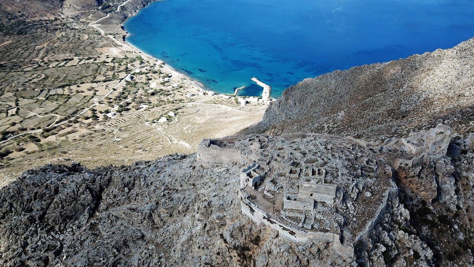
Further south is the beautiful island of Tilos (Italian: Piscopi or Episcopi), which is less frequently visited by tourists and yachties. Near Livadia, the island's port, are the ruins of a Venetian castle and the Kharkadio cave, in which the bones of prehistoric dwarf elephants were found.
British Admiralty Charts 1055, 1531
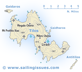
Tilos island
Clockwise ↻
- Chartlet
- Livadia
- Ag Zacharias / Despoti(ko) Nero
- Agios Sergios
- Tholos (Theologos)
- Eristos
- Limenari (shallow)
- Gaidaros (Gaidaronisi)
- Plaka
- St Anthony
- Skafi (More or less No-go)
- Kokkini (shallow)
Ports / anchorages are clickable . signifies a highly recommended venue, and a truly must-see venue; see other icons. |
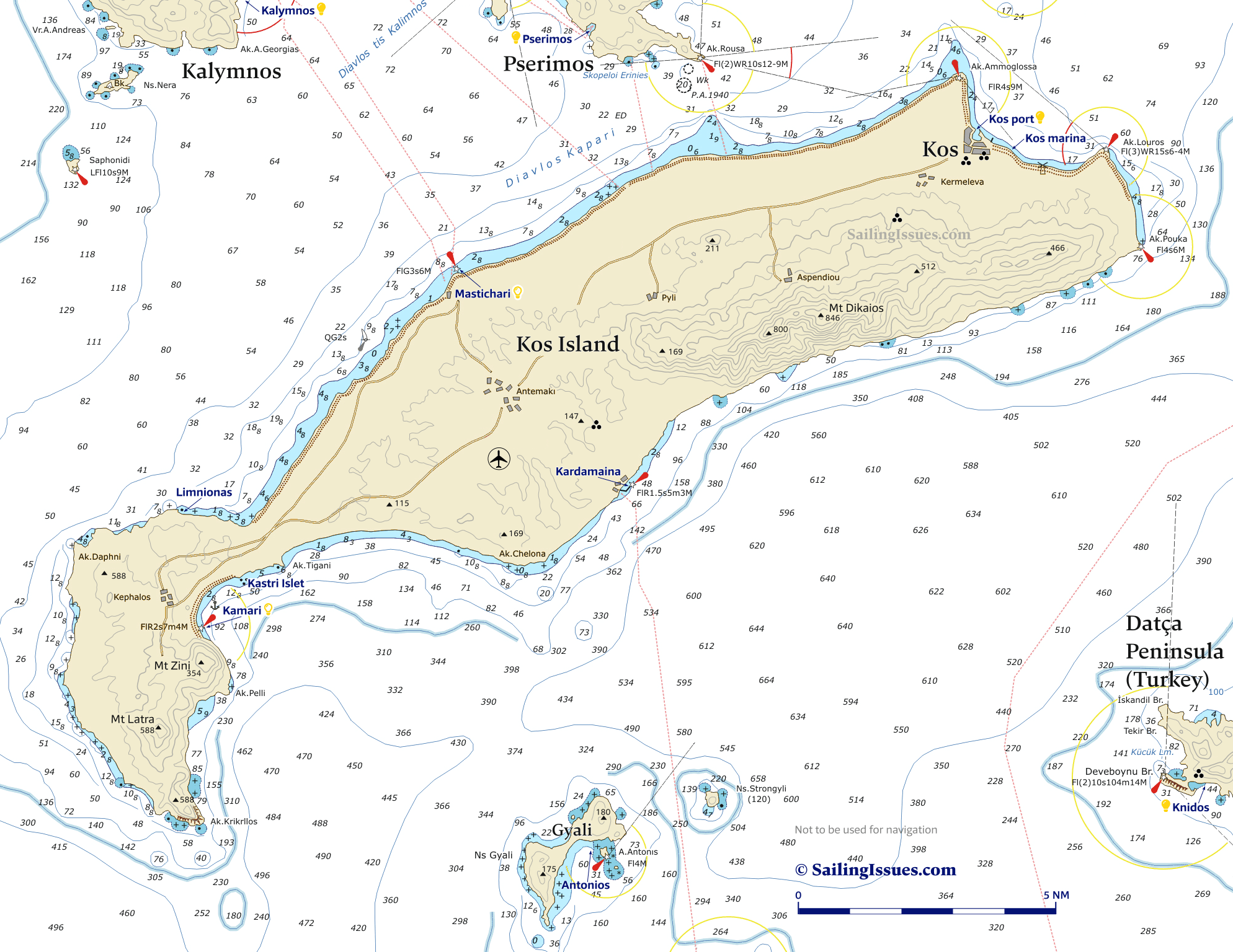
Kos island
The island and town of Kos has been well populated since Neolithic times.
About 700 BCE, together with the five other cities of the Hexapolis (Knidos, Ialysos, Lindos, Halikarnassos and Kamiros), Kos was an outpost of the Dorian League of cities on the Carian coast and the neighbouring islands.
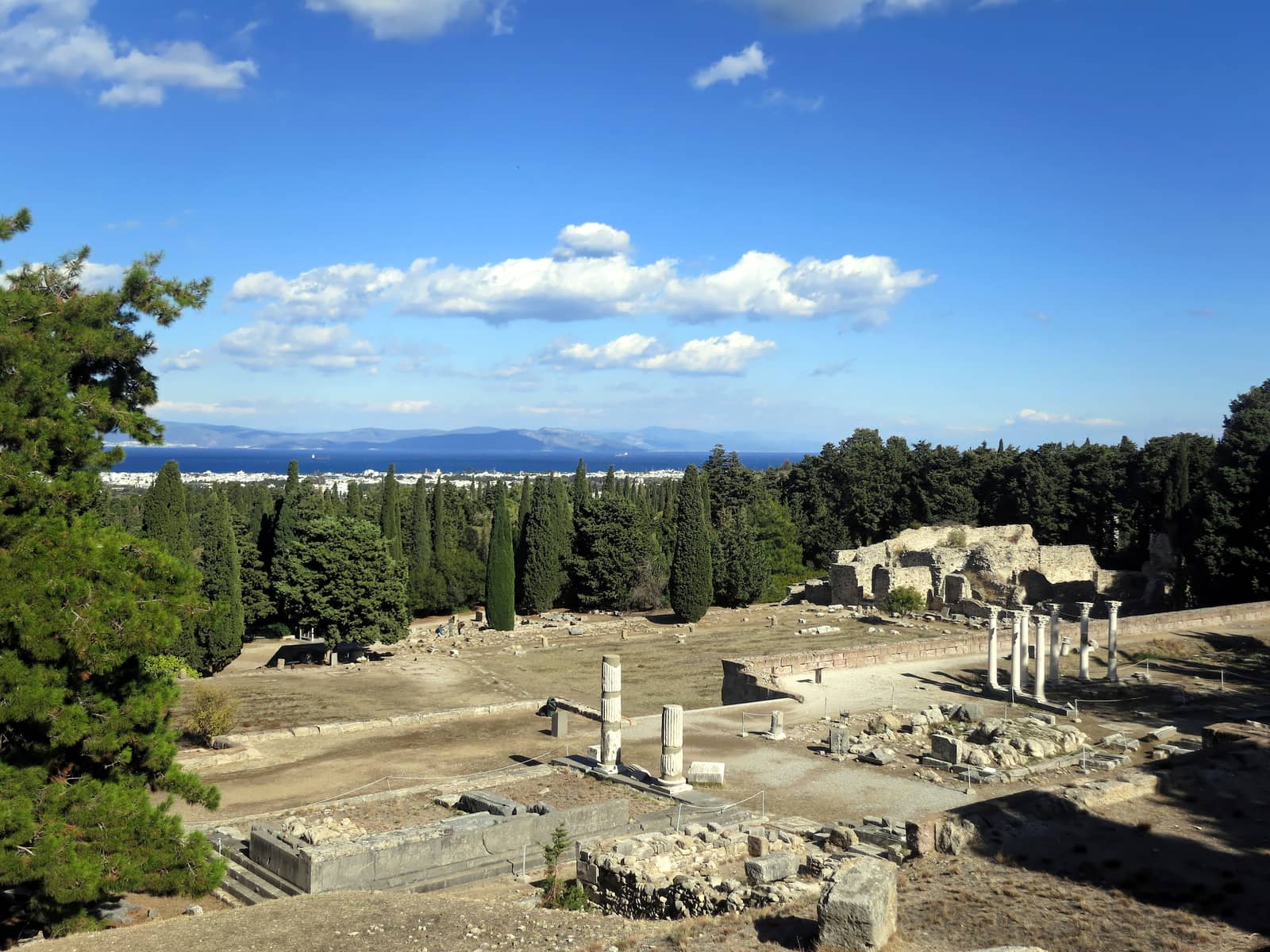
The island was celebrated for the oldest cult site of the healing god Asklepios and for a medical school of which the most famous representative was Hippokrates (5th c. BCE). The Sanctuary of Asklepios on Kos was destroyed by an earthquake in 554 CE.

The Byzantines were succeeded as rulers of the island by the Knights of St John (1306 – 1523), who in the 14th c. established the main seat of their Order in the island's capital Narangia (now the town of Kos).
Kos was captured by the Ottomans some years earlier than Rhodes. Occupied by Italy in 1912, during the Balkan War, it was returned to Greece in 1948.
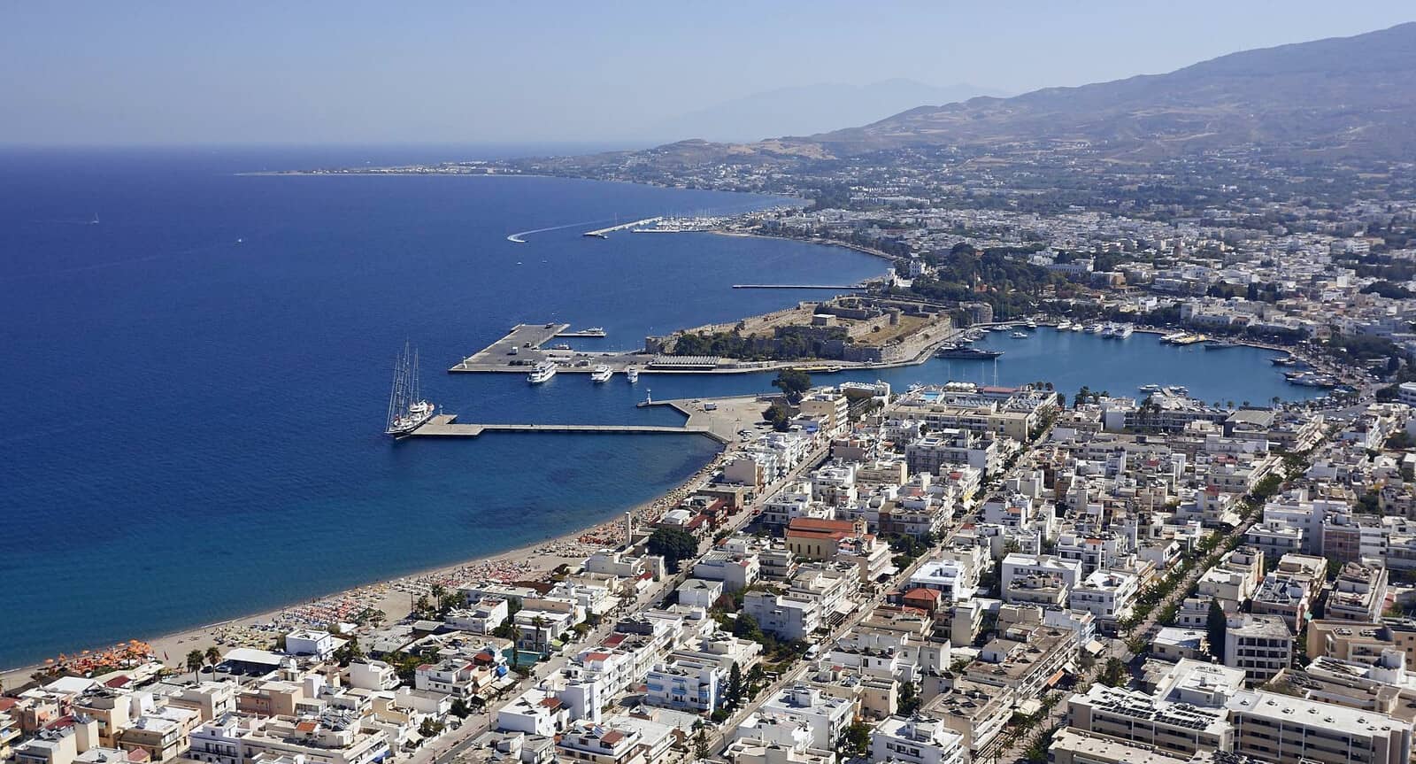
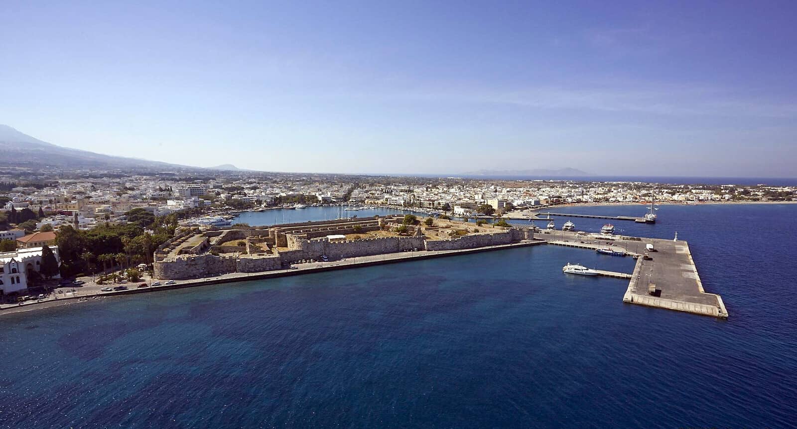
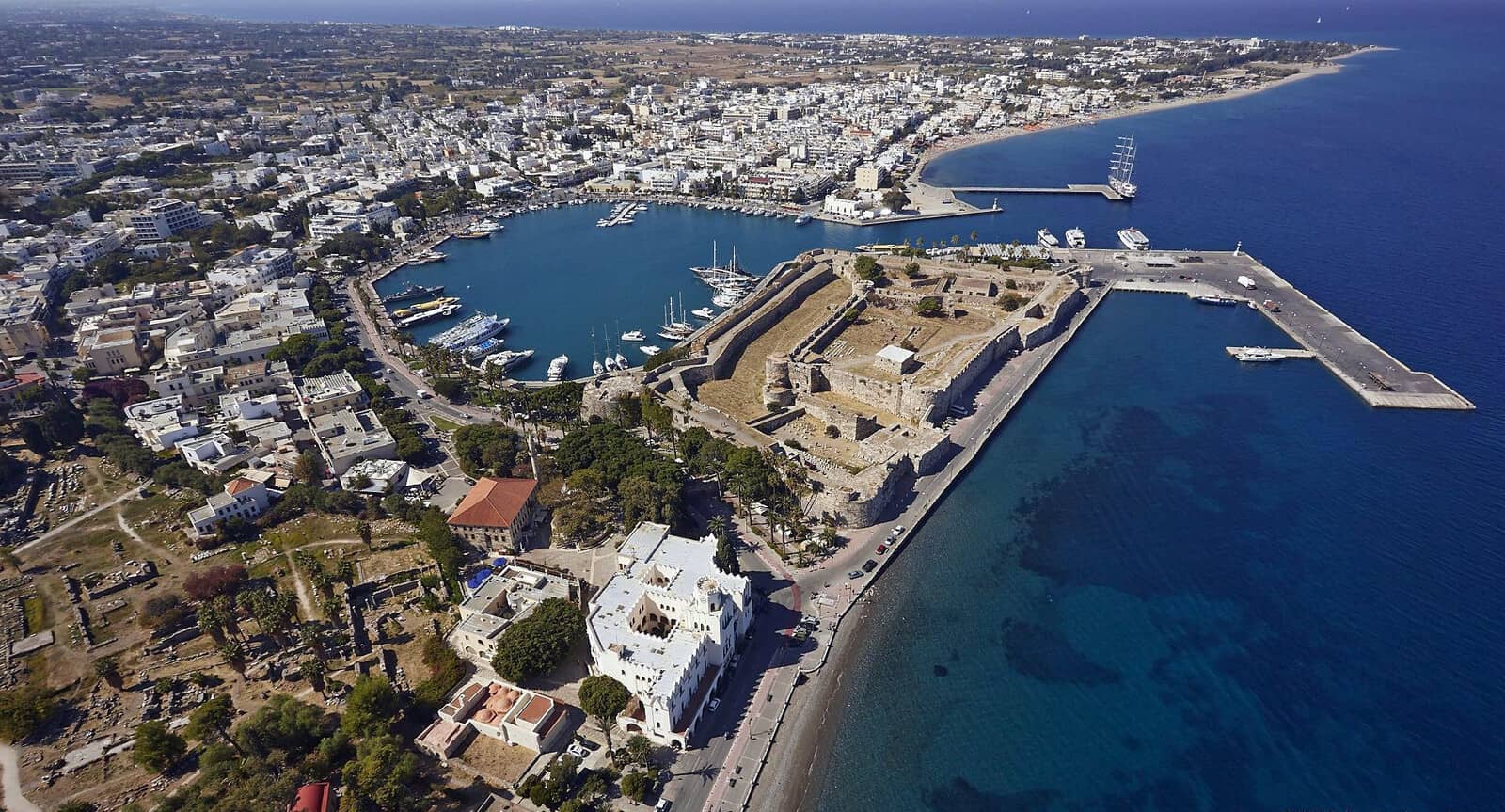
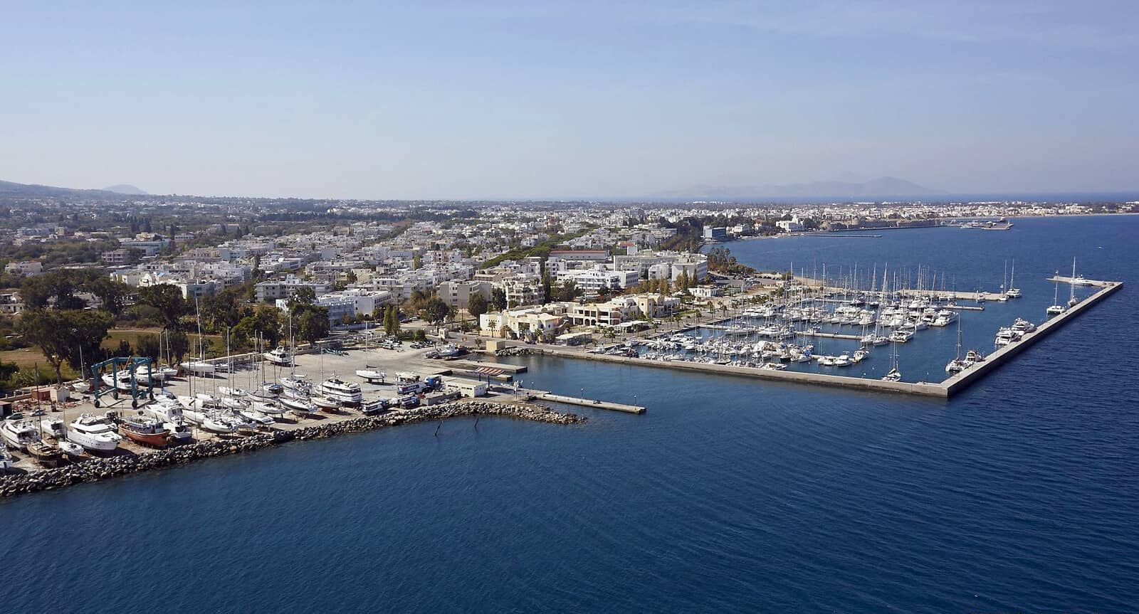
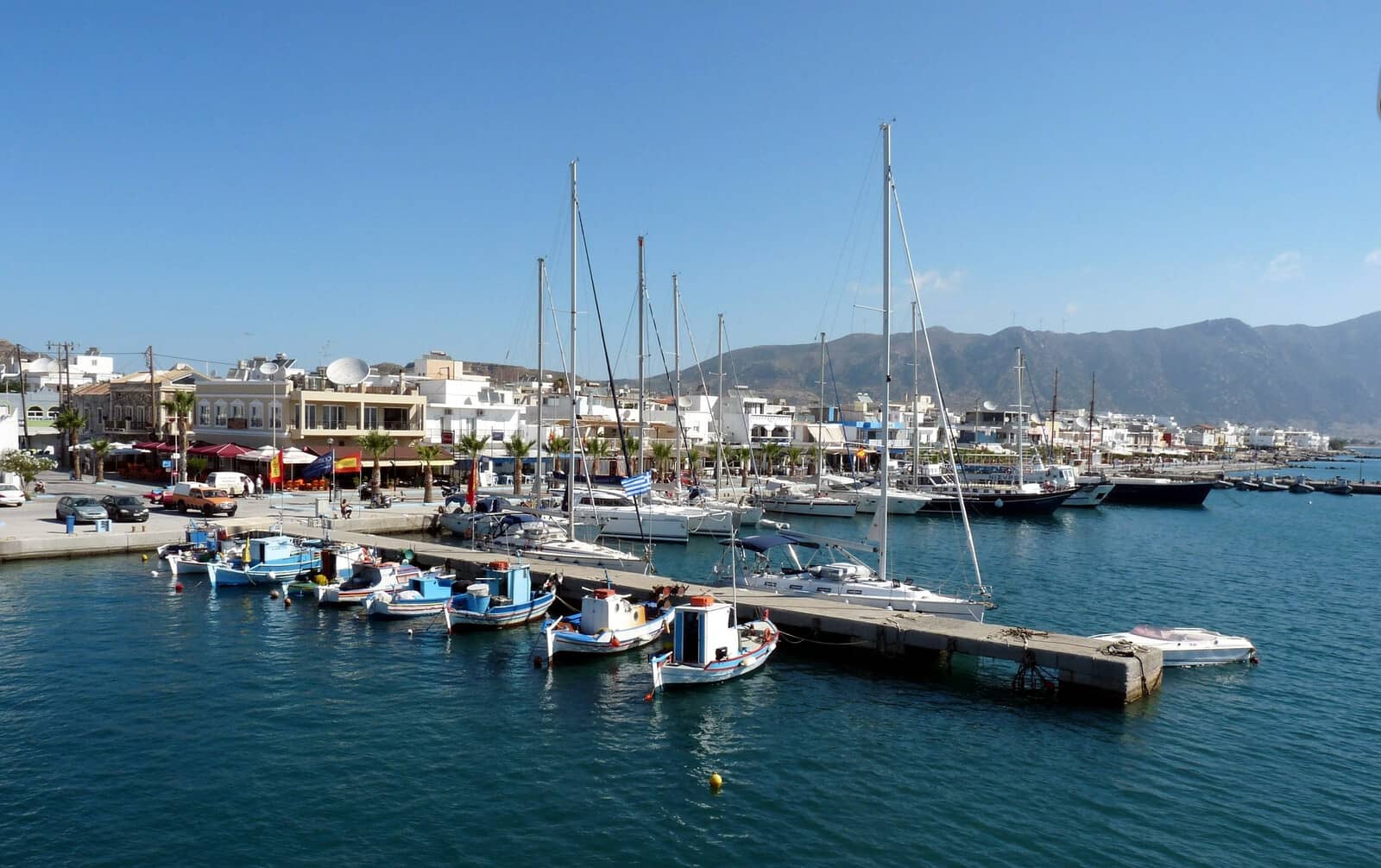
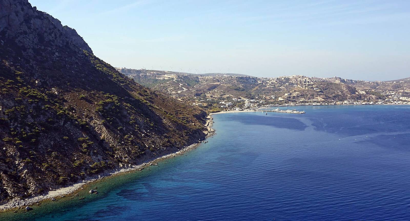
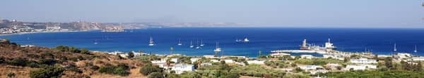
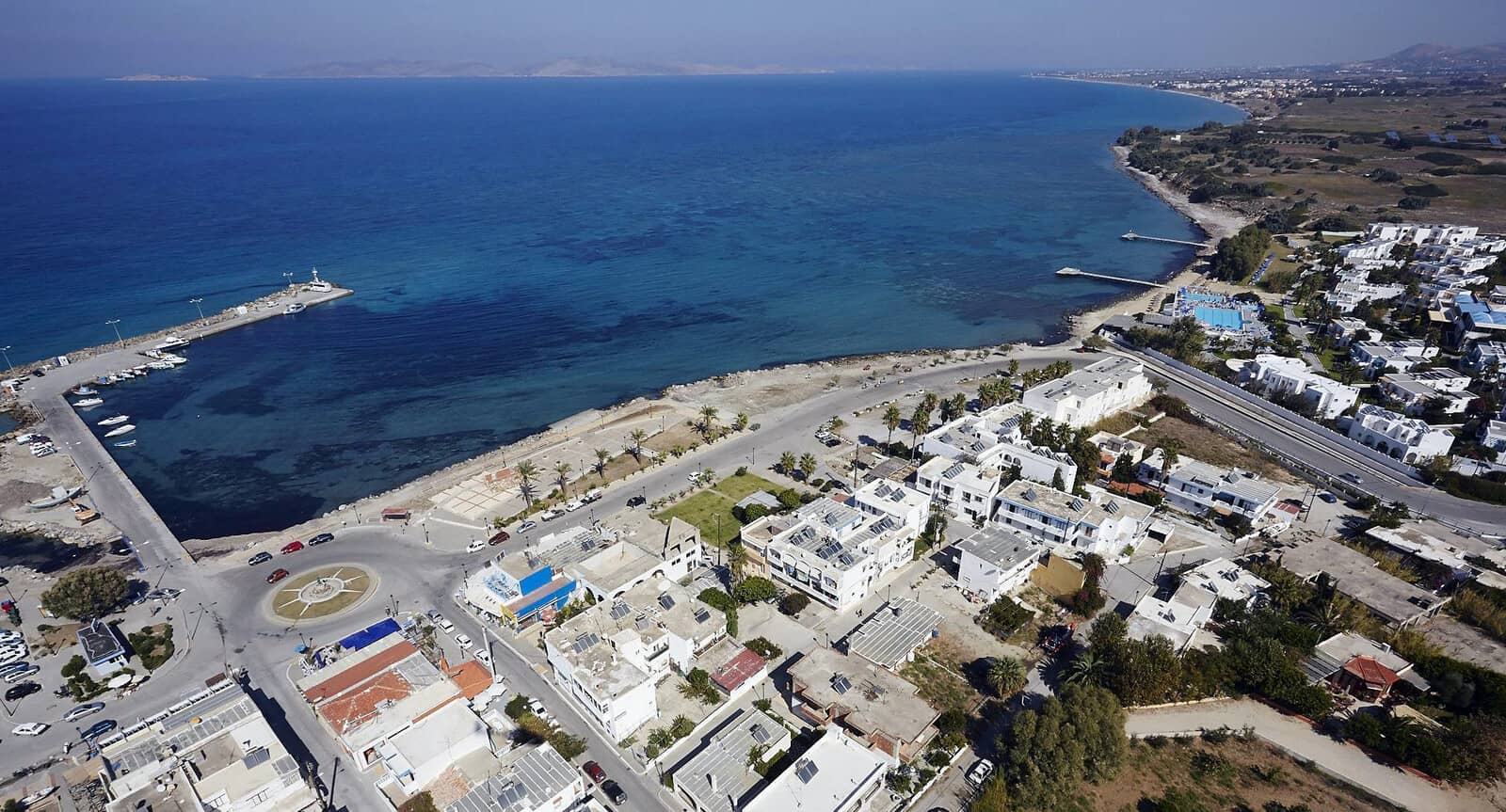
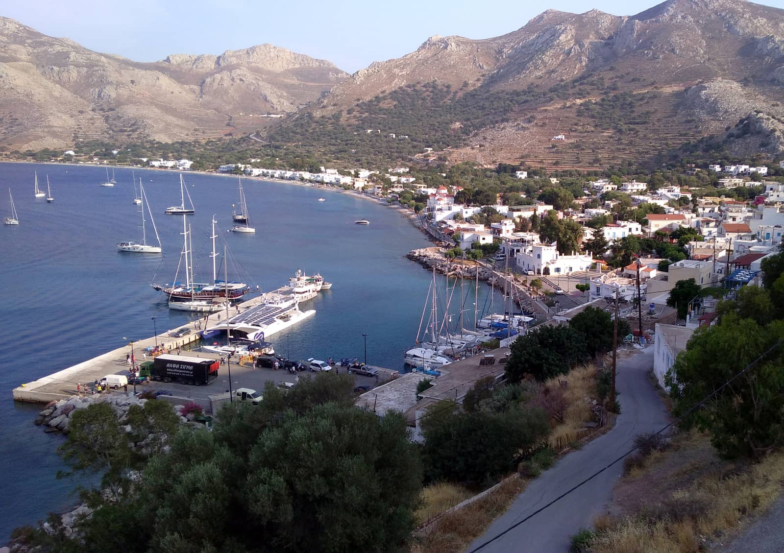
Kos port
The “old port of Kos” or simply Kos port - Λιμάνι Κω is located in a large shallow bay; in the approach the north cape should be kept at a distance.
Note that ±85 berths of the old port is now – under the name Mandraki Port Kos – operated by the Kos marina; without seemingly adding any facilities. The north-east side has lazy-lines, whereas the north-west side requires anchoring. Mind that anchors get regularly here lifted by the superyachts, plus neighbouring chains will most likely cross. Since reservations are mandatory anyway, you can and should request a berth with lazy-lines. All the more since the east side is situated under the Castle of the Knights (1450 – 80): the best part of the old port with matching palm trees and less noisy.
See, how mooring with lazy-lines works.
Kos town is full of bougainvillea, jasmine and exotic whiffs of the middle east.
Our personal top 3 of restaurants is “Aliada”, “Lovemade” and “Kapari Meze”.

Register for free and join an active, critical sailing community.
Kos hydrofoil pier
In between the marina and the old port is the hydrofoil pier, which is
free of charge, hence there is no water, no electricity.
The outer two-thirds of the pier have depths over 2 m, most is 4 m or deeper. Up to 25 knots of NW is doable, but not suitable in Meltemi winds. Moreover, ferries come and go and create a wash; police building ashore; very quiet.
The place to go when both the old port and the marina are full, but also a very accessible venue to explore Kos town from
if the wind conditions allow it, i.e. not too strong and not NE or east.
Directly ashore are the Sanctuary of Aphrodite and the Tree of Hippokrates.
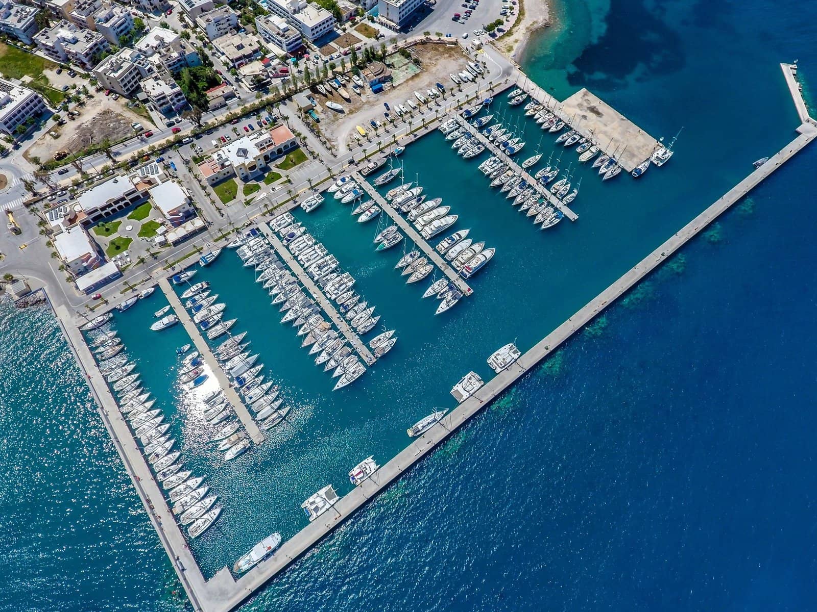
Kos marina
The bland utilitarian Kos marina - Μαρίνα Κω has its merits for the yacht charter companies and is still within walking distance of downtown Kos. Note that there is a wide variety in quality of the offered yachts. Few available berths in the weekends because of the rotation of the charter yachts.
Except for severe weather forecasts try to get a berth in the pleasant old port first.
Upon approach contact the Kos marina office on VHF 77.
The marina offers all-round shelter with 250 berths, you will use a permanent mooring. The harbour master will meet you near the entrance in a RIB and assist you towards your spot.
The fuel quay is located south of the Kos marina.
Pserimos island on the horizon.
Kardamaina
The port of Kardámena or Kardámaina - Καρδάμαινα offers allround shelter, a great beach, and all amenities: a convenient place to resupply.
However, there are just about ±7 berths available for visiting yachts, VHF 12 Harbour Office, large catamarans likely won't find a spot. The tourist boats have their reserved spots clearly marked.
Moreover, this stretch of coast – bordering Kos Airport (KGS) – caters to both lager louts and posh British tourists, meaning aquaparks, boozing bars and beach resorts – even two outlandish “Pirates of the…” ships.
This tourist trap has become as unGreek as it gets. Yet, astonishingly, in 2000 this was still an authentic fishing port where you had to go stern-to a sloping soft-sandy quay!
Note that the GWP chartlet doesn't show the dangerous silts near the entrance and around the green harbour light.
Make your approach from the south and perform a rather tight rounding around the red harbour light; any swimming platforms outside the port have long gone.
Go stern-to the northern section of the quay and the basin is 120 m, therefore wide enough to put a maximum chain length in; mind the buoys and lines from the tourist boats.
A second option is to go alongside (rafting up) the NE side the concrete pontoon / pier; water and berths are often free of charge, extra electricity pillars now installed (update Sep 2023) yet you are required to purchase the card from the Kos Marina; occasionally the only choice is to go alongside the breakwater in the SE corner (not suitable in Meltemi); good holding in sand (some patches of weed).
Academy
The word academy comes from the Greek word “Akademeia”, the name of the grove outside of ancient Athens where Plato taught his students. Akademeia grove in turn was named in honor of a Greek hero: “Akademos”, read on…
Directly south of the port is the archaeological site of Alasarna where continuous excavations unearthed, afresh in 2020, many significant finds.
A 40 min. hike uphill is the 14th c. Antimachia Castle [in German] overlooking the busy strait between Kos and Nisyros.

The Basilica of Ag Stefanos 469 – 554 BCE is just ashore.
Kamari
Kamári - Καμάρι is the recognised name of the port and marvelous turquoise bay Lat Long under Kéfalos - Κέφαλος village
The GWP incorrectly calls the bay and port “Kamares” or “Kamara”, and “Palaiokastro” is locally known as the anchorage under Kastri.
See, Kamares (Καμάρες in Greek means “arches”), the main port of Sifnos island.
Also, the labelled ferry quay never existed and the basin is reserved for local vessels and ferries. Fortunately, Eagleray, Garmin and C-MAP show the correct situation.
As a result visiting yachts always go stern-to the outside, while the locals go alongside the inside. Freighters will use the mole near the red harbour light, and their mooring lines (partly) block the southern side of this mole, leaving only room for one or two yachts, but you can easily place your second anchor on the blocks! Berths, water and electricity are free of charge.
Most yachts will anchor in the bay, one of the preferred spots is south of the mole; good holding and safe during Meltemi; winds are typically either northerlies or southerlies, choose your anchorage accordingly; shallow in the north and deep in the south of the bay. The ferry arrival is just a short importunity, but offloading of the freighter (with cement or otherwise) brings hours of trucks to the scene.
Restaurant of choice is “Cavos” located on the beach directly north of the port; the owner is also a beekeeper and vends delicious honeys.
On the ridge above the Kamari bay is Kefalos village and the ruins of the Kastro.
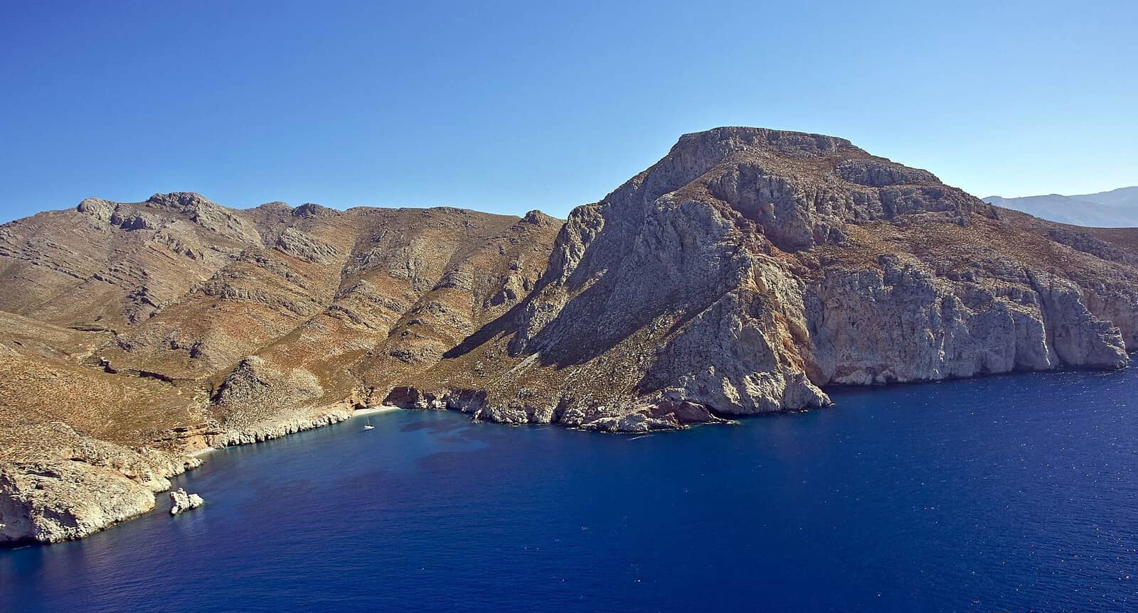
This southern section of Kos is arguably the prettiest, with appealing seascapes, fertile hills, steep cliffs, and less tourism.

Kastri islet on the north side (left) of the bay. Hi-res image
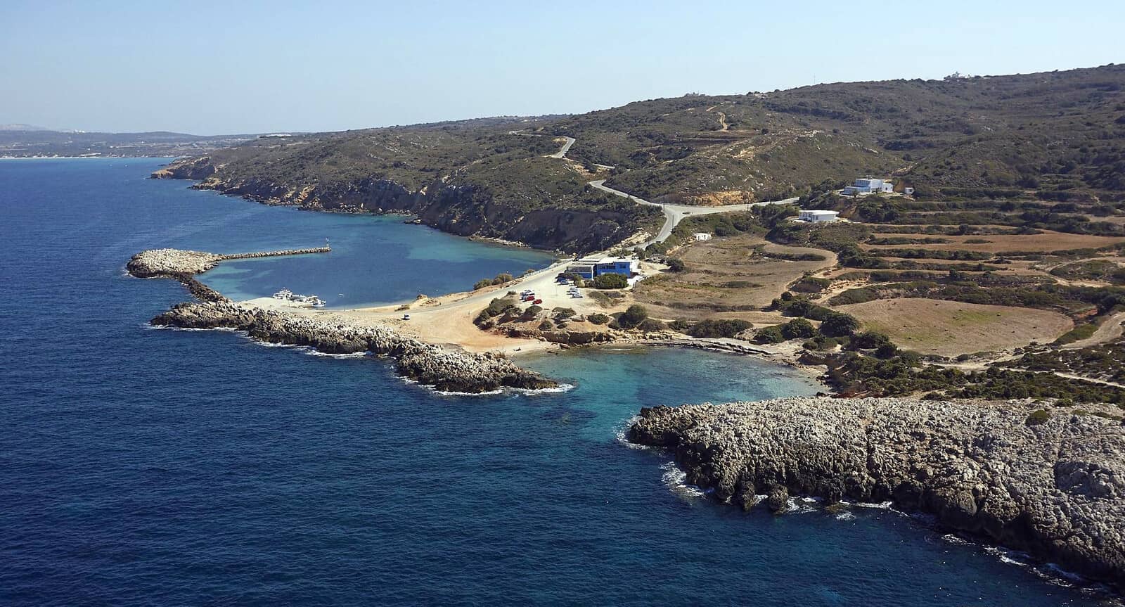
Limnionas
Limniónas - Λιμνιώνας is suggested as allround shelter by
various guides (including the GWP and Eagleray), but we never dared to enter this small and shallow harbour Significantly, we only once saw a small catamaran inside… Lat Long
Mind the shoal roughly near the “Taverna Limionas”; local fishing boats have rights to all the quayside; old (but working) beach shower ashore; allround shelter; 2,5 m depth max. and silted at the W and S inside the basin; weed patches and sandy bottom; keep close to the green harbour light when entering, but entrance is still >30 m wide; taverna serves (rep. very good fish dishes) only during daytime, very quiet in the evening.
This fishing port is proper for catamarans / yachts with a draft of <1.50 m. Well, reportedly, you can anchor inside with a draft of 2.2 m, but holding is suspect due to too much weeds (updated April 2024).
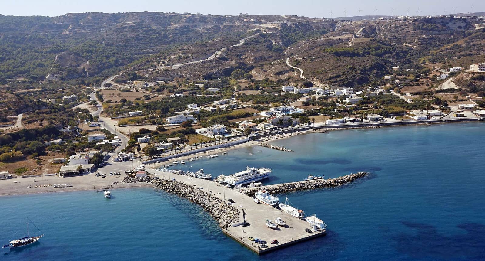
Mastichari
The insouciant ferry port of Mastichári - Μαστιχάρι on Kos' north-east coast is a safe harbour during a Meltemi (NW). Moreover, Mastikhari offers solid shelter from SSE – NNE winds.
Caution 1) SE storms are problematic and NE – E storms bring in such high waves that it is untenable.
Caution 2) The port is known for its bad holding due to dead weeds and thin mud / sand, making it extra difficult in southerlies.
Note that only a tiny area inside the basin is not silted up, and you should stay quite close to the north quay check Eagleray, Garmin or C-MAP before entering.
Since the port seems a well kept secret, berths are predictably available, despite space for just 5 – 7 cruising / charter yachts.
Go stern-to the north quay between the day tripper boats on the west side and the ferry dock near the harbour light. The “Olympios Zeus” car ferry to Kalymnos sails 2+ times a day, see time table.
The preferred berths are on the west (but shallower) side, because the ferry's mooring lines can spread out at 45 degrees. Lat Long Moreover, a smaller ferry (several operators) can go alongside in the middle section, see time table.
On the quay there are water faucets, but no electricity.
Hidden in a backstreet is the very affordable “O Makis” psarotaverna / fish restaurant , the cook catches the fish as well.
The town is tranquil, child friendly and clean – friends of us spotted dolphins inside the port (2021 Oct).
If you need to drop off, or pick up crew the Kos Airport (Antimachia village) is a mere 10 min. taxi drive away.
The German archaeologist Ludwig Ross, while visiting Kos in 1844, saw the remains of an ancient port and ruins of a settlement from the early Christian period in the vicinity of Mastichari, and a 15 min. hike along the SW coast brings you to the archaeological site of the Early Christian Basilica of St John, which ground plan is well preserved.
After the devastating earthquake that hit Antimachia in 1926, 18 families decided to settle in Mastichari, named after the mastic trees that used to thrive in the area. In 1930, the topographic service of the Italian administration implemented an urban planning of Mastichari, with an orthogonal grid of 5 and 3 roads.
In 1944, the Germans built a wooden pier for military purposes that remained in use until the current harbour was constructed in the eighties. For decades, the largest part of Antimachia’s production of watermelons was gathered on Mastichari’s beach and shipped to Kalymnos.
Ports / anchorages are clickable . signifies a highly recommended venue, and a truly must-see venue; see other icons. |
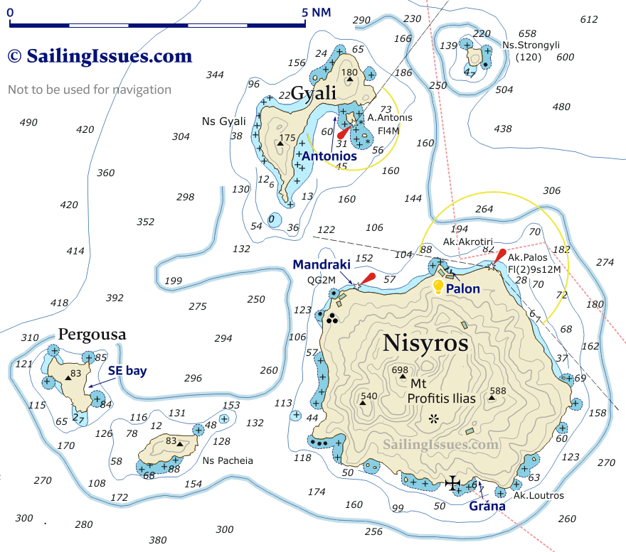
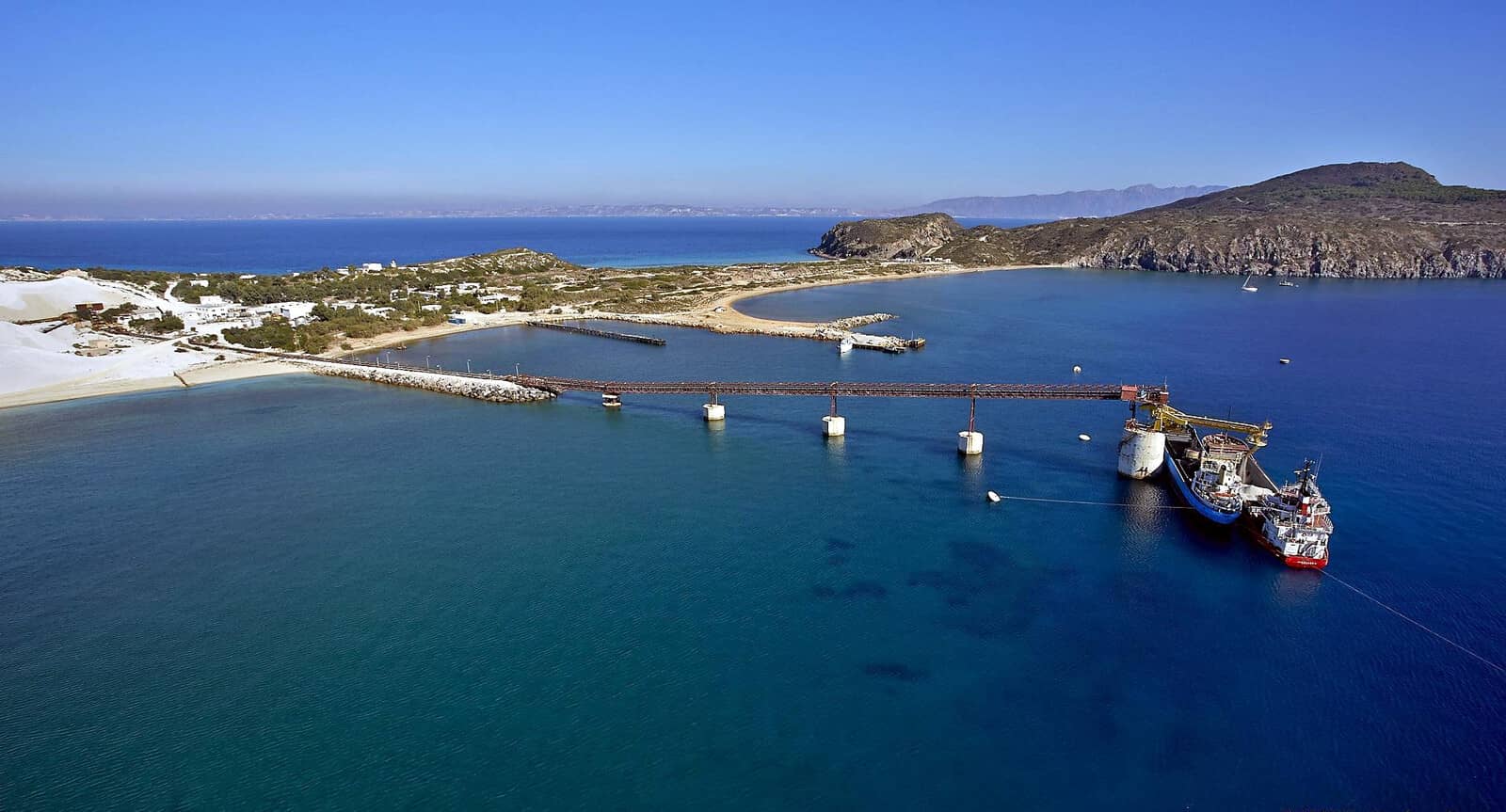
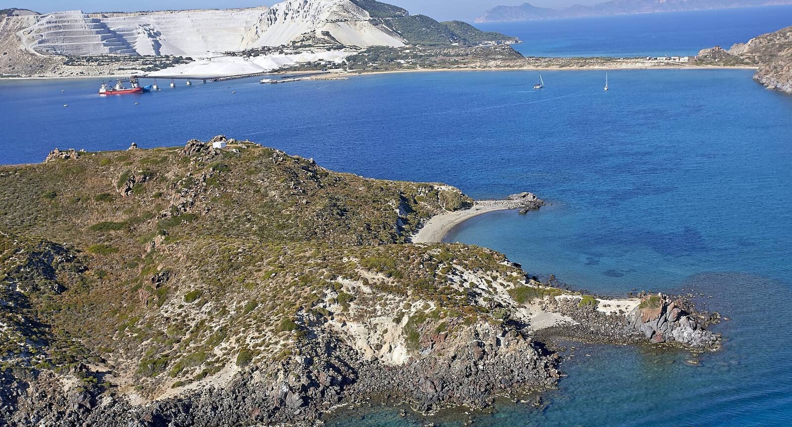
Gyali island
The volcanic island of Gyali, Giali or Yali - Γυαλί (Greek for “glass”) isn't very sightly with its industrial vibe due to strip mining, yet is one the safest places in stronger northerlies / Meltemi.
It consists of two distinct segments – connected by a narrow 250 m wide isthmus – the NE part almost entirely made of obsidian (volcanic glass, hence its name) and the SW part of pumice (volcanic ash). The water there is sometimes whitened by the mineral dust.
The last eruption was around 1460 BCE – relatively short after the Minoan Eruption of Santorini.
Archaeological finds show that the island was already settled near the end of the Neolithic period, approx. 4500 – 3200 BCE, and also in Hellenistic and Roman times.
Local obsidian was of lesser quality than that of Milos, which hampered trade.
There are several anchor spots:
- Anchor over sand in 4 – 6 m
NE Lat Long of the three piers for loading pumice. Not everywhere solid holding, make sure your anchor holds (Eagleray even mentions “poor holding”); mind the mooring buoys used by freighters.
The isthmus has a pleasant beach, yet for snorkelling try the rocks close to Ag Antonios.
Mind the hazardous reef 0.4 NM SE off the southern Cape Kaloutoi of Gyali island.
- Although Giali and St Antonios are losely connected by a shoal, it seems possible to navigate around the two / three shallow patches; anchor at either side of this dubious zigzag “passage”; excellent protection and good holding in sand
Lat Long.
The lighthouse of the islet of Ag Antonios - Άγιος Αντώνιος signals the treacherous shoal & rocks awash towards the south.
The islet's beach on the north side has old tyres, rusty buoys, plastic bottles. Moreover, caïques and the “pirate ship” from Mandraki dock on the NNE tip. - In westerlies there is an adequate cove on the east side Lat Long, anchor in 5 – 10 m, good holding in sand; really shallow near the beach; quarry very close, warning sign on the beach; the water is beautiful.
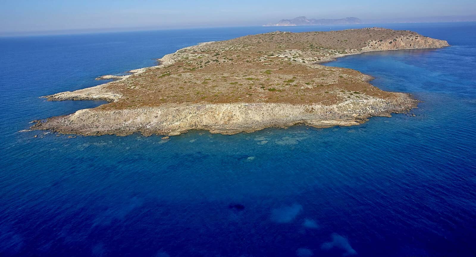
Pergousa islet
Pergoúsa, Pergoussa - Περγούσσα is a low islet 4,5 NM WSW of Mandraki (Nisyros).
Reportedly (we only sailed past) a fair weather anchorage in the SE bay Lat Long; anchor over sand between seaweed beds; good holding; open to NE – SW. Anywhere on its east coast seems very pretty.
The islet is home to the
Erhard's wall lizard.
Nisyros island
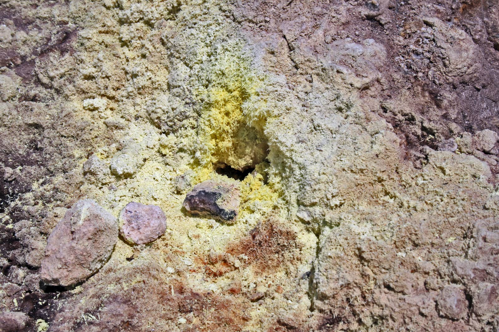
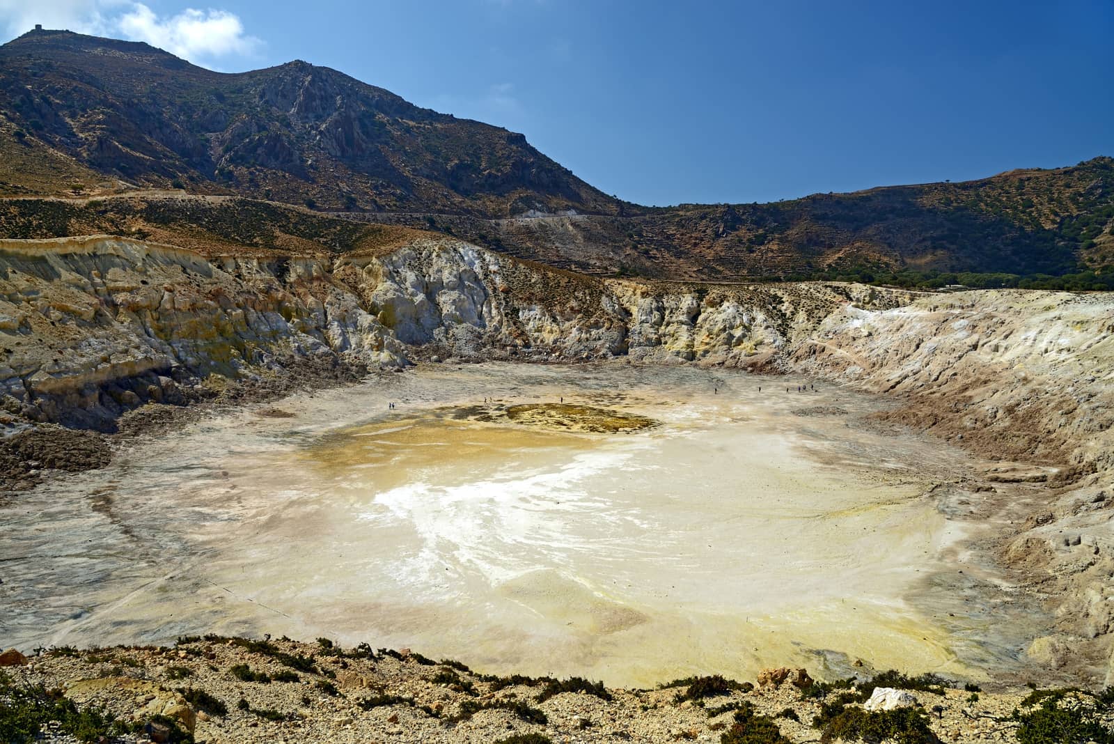
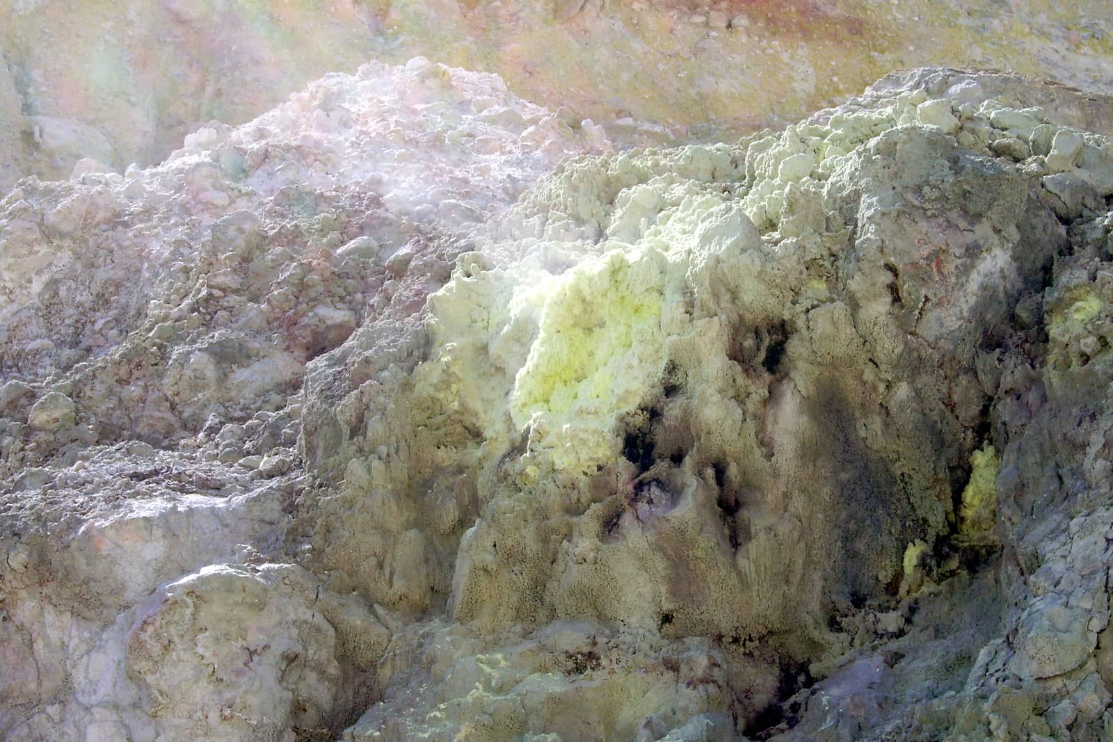
Nísyros (Nísiros) - Νίσυρος unmistakably breathes “volcano” with its mephitic mud pools, vapour holes, cliffs of kaleidoscopic colour, and the ubiquitous and ephemeral formations of brilliant yellow, feathery sulphur crystals: a visit to its active volcano craters is the main attraction as well as the volcanological museum in Nikia village.
Together with all the islands discussed on this page, Nisyros belongs to the “south Aegean Volcanic Arc” AKA “Hellenic Arc”, which comprises a number of dormant and historically active volcanoes, including Aegina, Methana, Milos, Santorini and Kolumbo, Kos, Nisyros and Yali. Of these, only Santorini, Kolumbo and Nisyros have either erupted or shown any significant evidence of unrest during the past 100 years.
Nisyros' volcano facts:
- caldera of 3.8 km diameter, and just 100 m above sea level
- 6 lava domes (five inside the caldera) with Profitis Ilias the highest at 698 m
- Stefanos Crater of 300 m diameter in the SE corner
- other noteworthy craters are Alexandros, (Micro) Polyvotis and Kaminakia
- ± 25 thousand yrs ago the volcano collapsed and the current caldera was formed
- recent erruptions: 1422 (not completely certain), 1871, 1873, 1888 en 1956
- a slowly rising magma chamber currently lies at a depth of 3 – 4 km
See Volcano World • Nisyros and this exhaustive study of the Volcanic field of Yialis, Nisyros and Kos [PDF].
In the late 19th century a British company collected and shipped Nisyros' sulphur through the island’s south coast “harbour” of Aghia Irini.
Nisyros was originally settled by Dorians from Kos and Kamiros (Rhodes). In 1312 it was occupied by the Knights of St John, and later became a fief of the Assanti family. It was taken by the Turks in 1533.
A caldera is not the same as a crater
- A caldera is a depression created after a volcano releases the majority of the contents of its magma chamber in an explosive eruption. Without any structural support below, the land around the erupting volcanic vent or vents collapses inwardly , creating the bowl-shaped caldera, as much as 100 kilometers wide.
- Craters are formed by the outward explosion of rocks and other materials from a volcano, and are usually more circular than calderas.
Calderas, like Milos or Santorini, may have parts of their sides missing because land collapses unevenly.
Craters are also usually much smaller than calderas, only extending to a maximum of one kilometer in diameter.
Nisyros is a textbook example with its <100 – 300 m craters inside a nearly 4 km caldera.

Nisyros can experience the Meltemi Etesian wind through late June – August.
This is most obvious on the eastern and western flanks of the volcano, where trees are bent towards the south from the force of the winds. The wind may be especially strong on the island due to jet effects as it passes over Kos.
Weather forecasts on board.
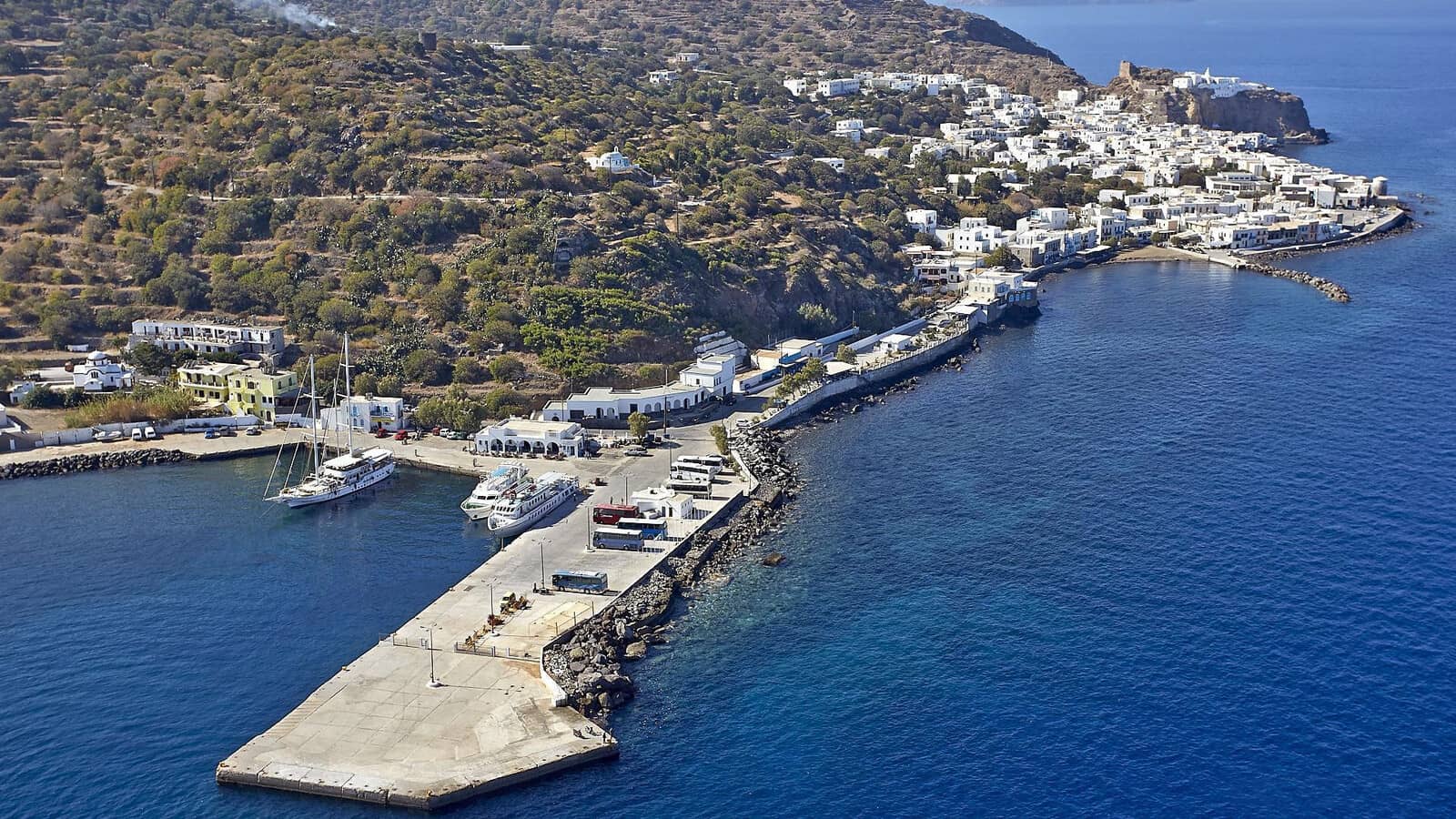
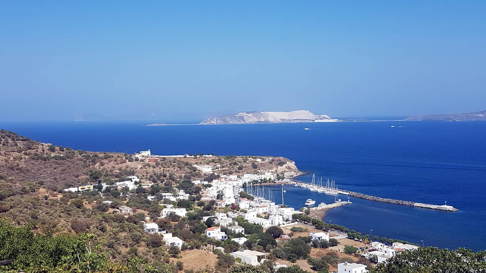
Mandraki
Mandráki - Μανδράκι is the ferry port and capital of Nisyros and exposed to NW – SE and untenable in stronger northerlies. Moreover, the ferry wash and tripper boats – even a hilarious pirate ship – diminishes the likelyhood that you can leave your yacht safely unattended.
South winds can be strong but don't involve waves, the easterlies are potentially dangerous with high seas.
A-Z index: other places named “Mandraki”.
However, the higgledy-piggledy town is a delight with its cute Cycladic cubed houses, bougainvillea adorned and watched over by the Venetian Castle and the 14th c. Panagia Spiliani Monastery, see Virgin of the Caves. The small but stimulating Archaeological Museum as well as a climb to the Paleokastro acropolis are a must.
Good holding, yet (very) few berths for visiting yachts; VHF 12.
Rent scooters to visit the craters.
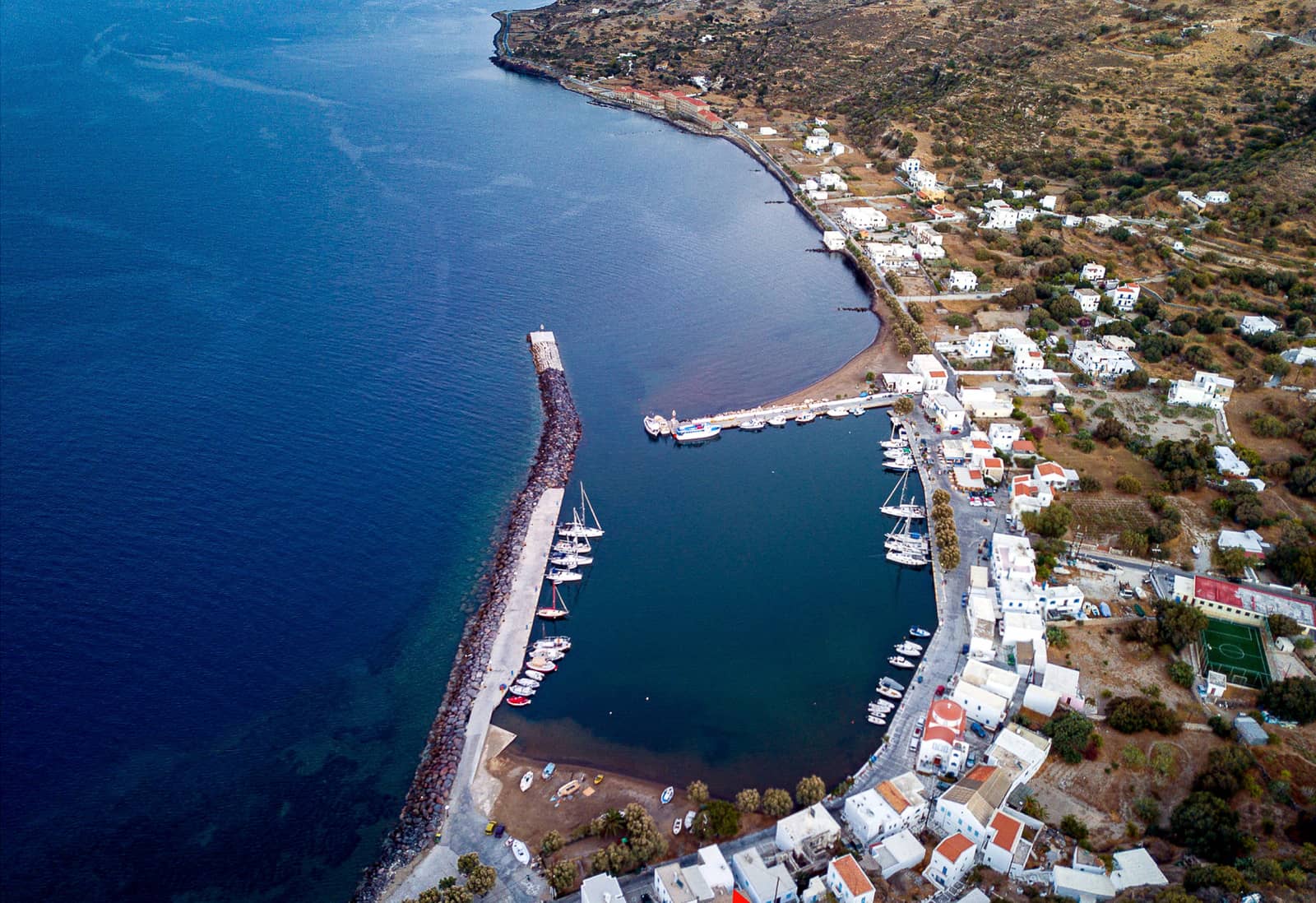
Palon
The charming port of Pálon, Páloi or Páli - Πάλοι offers allround shelter, which is rare in this part of the Dodecanese.
Starting out of the yacht charters base of Kos marina, you will can reach Pali before dusk, but in season the port can be packed. The basin can accommodate 40+ yachts / catamarans, or 50+ if yachts are able to raft up near the red harbour light.
Strong northerlies (including Meltemi, NW) make the entrance cumbersome. Worse again, the south side of the entrance is silted up. Most charts show buoys marking the silts, don't rely on these (or on their colours). Keep close to the green harbour light, because the existence of the silts is not disputed.
Anchor over sand / mud (a few stones); solid holding.
Depths in port and the entrance are a mere 2 – 3 m.
Rent a car, motorbike or e-bike from Manos at the base of the north mole (also in Mandraki port). Moreover, Manos (and Mariza) can arrange fuelling via tanker for your yacht, help with mooring and so forth…
Despite a couple of worthwhile restaurants on the waterfront, you should consider the very modestly priced “Apyriá” - Απυριά; superb dining in the picturesque Church yard of Emporio village, 6 km uphill upvolcano.
Grana
The small bay of Grána - Γράνα is suitable for a lovely lunch stop Lat Long just west of Cape Avlaki / Loutros. There are thermal springs (hence the toponym “Loutra”) near the Church of St Panteleimon (Orthodox spelling), compare Nanou's St Pantaleon (Roman Catholic spelling), festivities 27 and 28 July.
The sunken pier (Avlaki “harbour”) below the Church is now purposeless for anything bigger than a dinghy, and the area has quite a few hazards. Anchor in 5 – 10 m over sand and some patches of weed.
Slightly further to the west is the inconspicuous and abandoned “harbour” of Ayia Irini from which sulphur was shipped from the island.
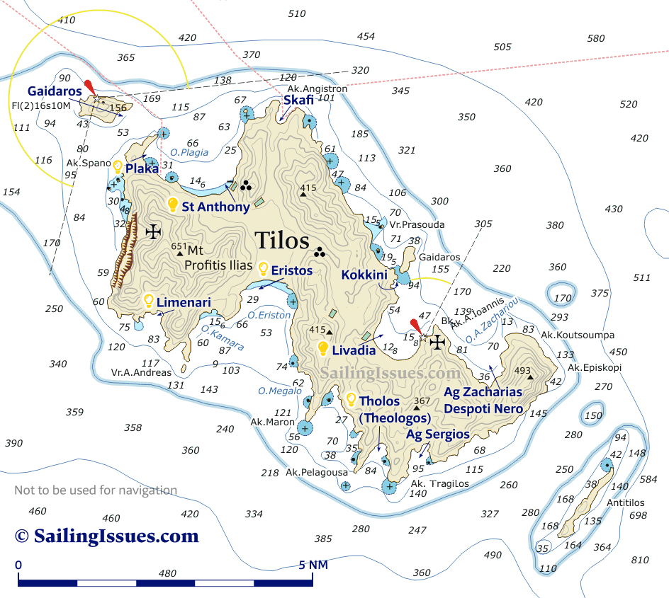
Tilos island chart
|
Tilos island
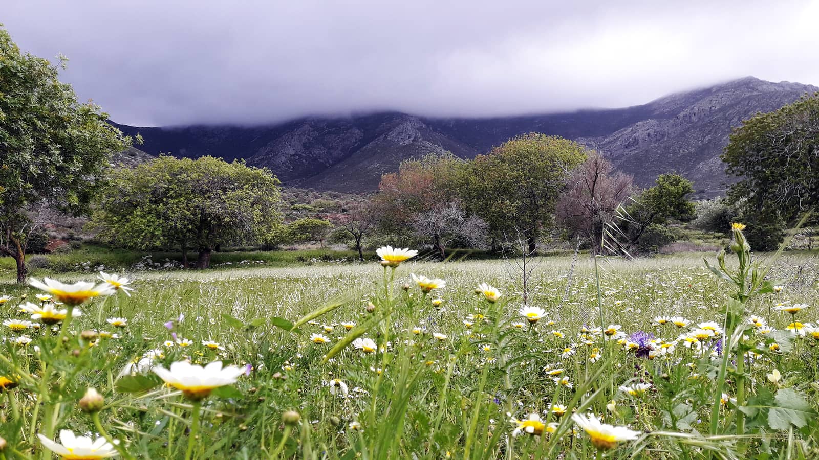
Tílos - Τήλος has been one of the best-kept secrets in the Dodecanese for some time, with good unspoiled beaches, friendly people and wonderful walking country: a tranquil antidote to Kos town.
From a distance it looks arid but it shelters groves of figs, almonds, walnuts, pomegranates and olives, all watered by fresh springs and thriving on vulcanic soil.
Visit the Flora of Tilos – Tilo Botanica.
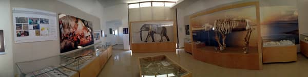
Pottery and stone tools discovered in Charkadió cave - Σπήλαιο Χαρκαδιό indicate human activity on Tilos in the early Neolithic period (8000 – 7000 BCE), along with the large assembly of bones from 1.2 – 1.6 m tall dwarf elephants, which not became extinct until 4 – 6 thousand years ago, meaning coexistence of these animals with humans.
Above the cave is the castle of Mesaria (1366), with ruins of settlements and Byzantine churches, and the
new (summer 2020) elephant museum, which was
previously located in the Megálo Chorió (Greek for “Big Village”).
The cave itself isn't open to the public, but the views over Eristos valley and Megalo Chorio are worthwhile.
The 15th c. Byzantine Monastery of Ag Panteleimonas (incl. 13th c. frescos and 18th c. woodcut temple) is set in a verdant area, full of giant cypresses and plane trees.
Pliny the Elder notes that in antiquity Tilos was known as Agathousa, and in the Middle Ages, it was known by the Italians as Episcopio, either because it was a Bishop Seat or because its position as Vantage Point. The island has also been called in Turkish İlyaki and in modern Italian Piscopi.
Excavation has identified Pelasgian masonry. Moreover, the island was successively dominated by Minoans and Mycenaeans in the Bronze Age (2800 – 1100 BCE) and, after the Trojan War, by the Dorians.

The Romans arrived in 42 BCE, and archaeological finds from Roman and early-Christian times demonstrate the prosperity of the island until the 551 Beirut earthquake. Lateron Tilos joined fortunes with Rhodes: The Knights of Saint John took control from 1309, restoring the Byzantine castles, and building new ones in order to defend against pirate raids. It was evacuated in 1470 as the Ottomans began the Siege of Rhodes and control passed to Suleiman I in 1522 when Rhodes fell. The Italians took posession of the island, after the Italo-Turkish War, from 1912 till 1943.
Livadia
The port of Livádia - Λιβάδια, at the head of a substantial bay offers now allround shelter. 18 odd years ago, when I was a young teenager, this port was nothing more than an exposed quay. Nonetheless this quiet and authentic venue was already a favourite of mine. It is still as chaotic and poorly managed but in a charming way.
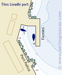
Go either alongside on the inside of the mole (the area close to the green light can be reserved for caïques and such), or stern-to the waterfront.
Preferably ignore the few remaining permanent moorings, and drop your own anchor as far away as possible over sand (bit mud like) and patches of weed; solid holding. The new lazy lines still not in function, you will still need to anchor. Friendly Harbour master (and owner of the restaurant / bar at the pier) Mr Panagiotis +30 698 6653695.
Wash from the ferries and swell make live in the basin much more pleasant than outside (ask the harbour master when ferries are due).
Rent scooters or a car at drivetilos.gr ~250 m south of the quay .
Good dining options in port, first and foremost “Omonoia Cafe“.
To the east, on Cape Ag Ioannis, is the Church of Ag Ioannis - Άγιος Ιωάννης situated in lush flowery fields with majestic views over Livadia bay.
The anchorage in the bay is exposed to all easterlies, which can be powerful in season.
The fishing port of St Stephan - Άγιος Στέφανος in the east of the bay is mostly <2 m deep.


Ag Zacharias (Despoti Nero)
The names Ágios Zacharías - Άγιος Ζαχαρίας and Despoti(kó) Neró - Δεσποτικό Νερό refer to two adjoining beaches in the same large triangular bay, south of Livadia.
St Zacharias, the father of John the Baptist, features some nice rocky formations for snorkelling and a mini peninsula.
 The pebbled beach of Despoti Nero is located in the deepest corner, and has nothing to do with the despotic Roman Emperor Nero - Ο Νέρων: the Modern Greek word for “water” is Νερό. Open to NW – NE; off the beaten track
Lat Long.
The pebbled beach of Despoti Nero is located in the deepest corner, and has nothing to do with the despotic Roman Emperor Nero - Ο Νέρων: the Modern Greek word for “water” is Νερό. Open to NW – NE; off the beaten track
Lat Long.
Follow the stream uphill to discover the ruins of Ancient Gera. This is a lesser known ghost village of Tilos, which served as an agricultural outpost of Megalo / Micro Chorio, fed by the nearby spring – indeed called “Despoti Nero” – and rich volcanic soil.
While rounding Cape Episkopi (east tip of Tilos) you can encounter strong currents exceeding 3 knots running either N or S, which will affect the sea state.
Sailing yacht rounding Cape Koetsoempa.
Agios Sergios
Ágios Sérgios or Ag Sergiou - Άγιος Σέργιος is a double headed bay with the proper beach in the east cove, while the west cove Lat Long is more snug so most yachtspersons will want to anchor here in light conditions. Good protection from the northerlies – still try Tholos (Theologos) first; anchor over sand / weeds in 3 – 8 m. A tripper boat will bring bathing guests.

Tholos (Theologos)
The triangular bay of Thólos - Θόλος
also known as Theológos - Θεολόγος is often overlooked, yet provides a rugged and scenic anchorage.
Mind the many reefs and rocks (awash) dotted along the east shore of the bay (snorkelling) and the tip of Cape Trachilos, and anchor in 5 – 8 m over sand (few rocks), ideally close to the short volcanic beach; take a line (see how) to the beach or the rocks; surprisingly well sheltered
Lat Long.
We have no familiarity with the next – ↻ – bay of Ormos Stavrós, which certainly looks promising from a distance; rarely used though.
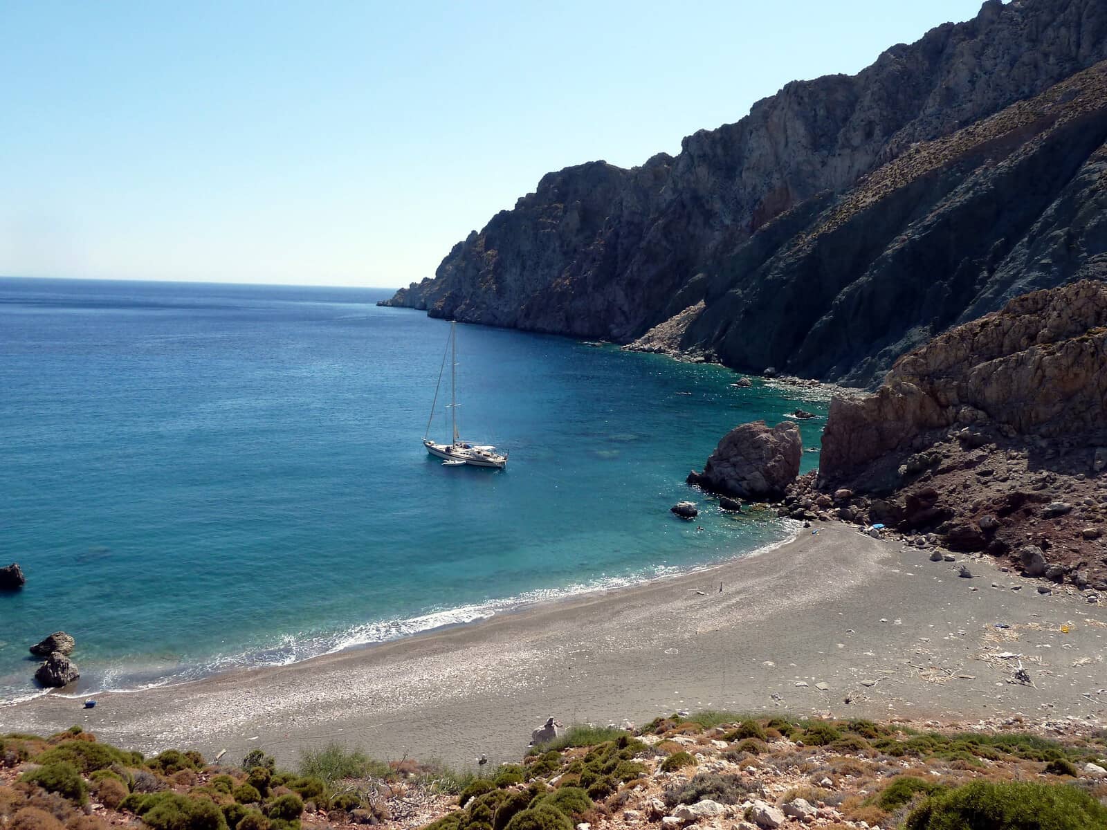
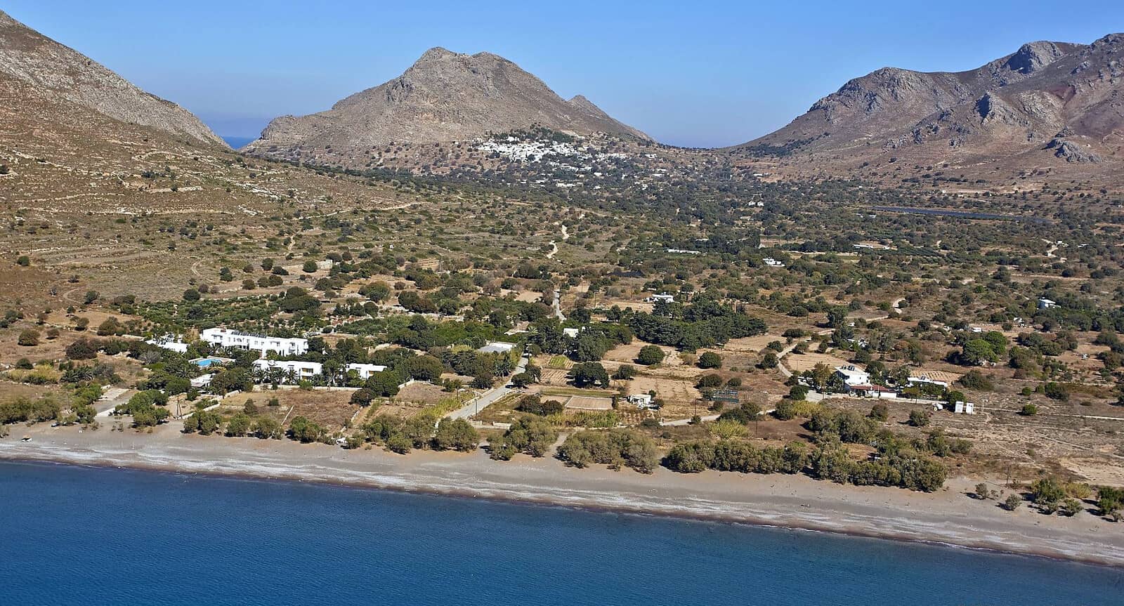
Eristos
The wide bay of Eristos - Εριστος offers a lovely sandy 700 m long beach where tamarisk trees provide natural shade for the summer heat.
The Meltemi gusts will come from the north and generate a swell causing rolling conditions anchor really close to the beach 3 – 5 m over sand; solid holding Lat Long, there is likely a swell.
The 30 min. hike from Eristos to Megalo Chorio is inessential, since locally you will want to visit “Restaurant En Plo - ΕΝ ΠΛΩ” 2 min. towards the verdant fields, and on the beach the “Kantina” from Stelios, which has been smartly upgraded in 2021 from a caravan to a real building – still reggae-themed. Furthermore, a volleybal net, and in the season pop-up tents with mainland Greeks on the beach.
Limenari
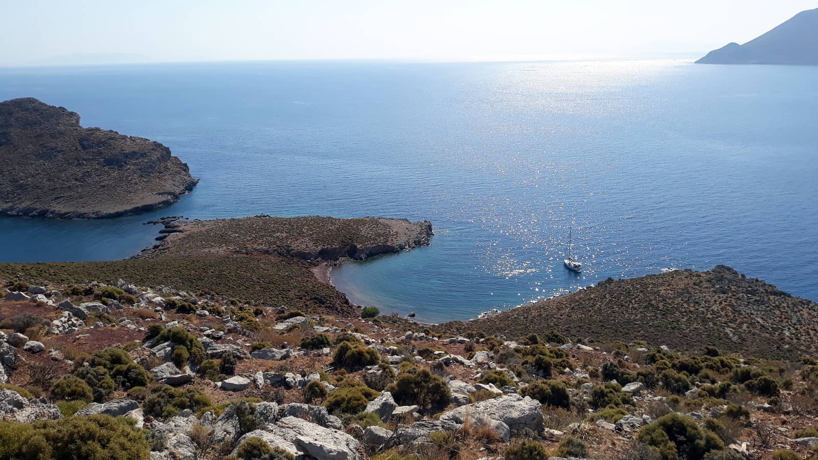
The unfrequented anchorage of Limenári - Λιμενάρι bay has two very appealing and pastel pink sandy beaches, which are unfortunately very shallow and therefore more suited to catamarans with a draft of <1.30 m.
Exposed to SSE – W winds; reliable holding in sand; handy large rock + shoal Lat Long to take a line to, then drop anchor in 3 – 6 m in NE direction; swimming / snorkelling and solitude.
Alternatively, anchor precisely in the middle Lat Long in 3 – 4 m, or as close as possible to the east beach, see photo below. The north beach is even more shallow.
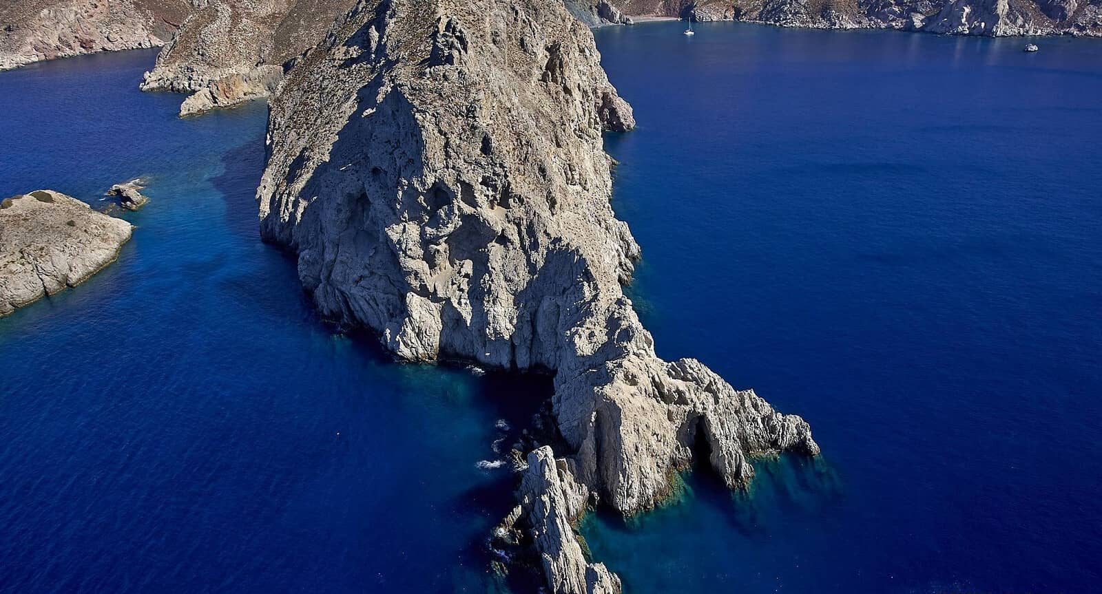
Gaidaros (Gaidaronisi) islet behind it, and Nisyros on the horizon.
The islet of Gaidaros (Gaidaronisi) is visible behind the headland.
Gaidaros islet
The small islet just north of Tilos island, Gáidaros Megálou Chorioú - Γάιδαρος Μεγάλου Χωριού or in short: Gáidaros (Gaidaronísi) - Γάιδαρος (Γαϊδουρονήσι)
meaning Donkey islet, has a suitable and generally unknown anchorage on the SSE side Lat Long; anchor in 3+ m over sand (the weed patches are clearly visible) and take a line the northern side of the beach (NW corner);
delightfully off the beaten track; exposed to ENE – SSW winds. There is a lighthouse on the north side and you will find some remaining concrete+wooden structures from the Italians.
Gaidouronisi was a metochion of the on Tilos situated Monastery of Agios Panteleimonas - Μονή Aγίου Παντελεήμονα.
Note that there is also a similarly named Gaïdaros (Livadion) islet just north of Livadia port.
Plaka
Pláka - Πλάκα beach under the north Tilos' Cape Spanó (Poúnta) is a safe anchorage even during strong Meltemi (here NNW). Just north of the beach (mostly pebbled) is a conspicious wind turbine. See the A-Z index for other places named “Plaka”.
This spot is known for its excellent holding; anchor close to the shore in 5 – 10 m over sand (and patches of weed); the bay is deep Lat Long;
nearly allround protection, yet very vulnerable to NNE – E winds, in which case you should relocate to either Livadia or the south coast (Limenari or Eristos).
The encompassing bay is called Ormos Agíou Antoníou or O. Plágio / Pláyio.
The second reason to drop anchor here – aside from finding shelter – is to visit the Monastery of Agios Panteleimonas - Μονή Aγίου Παντελεήμονα (also the island's patron saint), which is a 40 min. hike up the slopes of Mt Profitis Ilias (654 m).
The well preserved monastery features fresh cold water springs as well as an enormous loquat tree, all set in verdant surroundings that span the island's width.
St Anthony
The delightful port of St Anthony or Agíou Antoníou or Ágios Antónios - Αγίου Αντωνίου, Άγιος Αντώνιος has lots to offer except… actual space.
Entering in strong northerlies can be tricky – Plaka would then be “plan B” – but once inside the protection is allround Lat Long.
Solid holding but you will likely go alongside the N or NE mole where you will find a single shore power pillar (consult the fishermen).
Depths inside the basin are sufficient, but there is a sandbar (extending from the south) at the entrance: keep real close to the red harbour light. Larger (45+ ft) yachts should first run reconnaissance, or approach only in light conditions; very little manoeuvring space, do use bow thrusters; the Hanse 505 was a tight fit
C-Map and Eagleray show the correct situation and depths. The GWP finds this venue quite unfavourable, which only adds to the tranquility; more than two yachts is rare; berths and water are free, no electricity; room for 3 yachts, more if rafting up.
Both the “To Delfini” - Το δελφίνι taverna overseeing the port, and “Elpida Restaurant” (meaning “Hope”) 250 m west on the waterfront are an added bonus.
It is a 45 min. hike up to the Kastro. or take the around-the-island electric bus.
Note that there is also a St Anthony islet under Gyalis island.


Skafi
More or less No-go is the rectangular bay of Skáfi - Σκάφη situated “in” Lat Long the north cape of Tilos where you sometimes see yachts anchored. However, there are submarine cables and the ambience is below par. The beach is rather littered and is usually a lee shore; very shallow near the S and SE end.
Kokkini
The name Kokkíni - Κοκκίνι of this bay refers to the red rocks on the beach (kokkinos means “red”)
Lat Long but is
unnamed on most charts – with directly SE a larger and more exposed bay called Ghoghlakari or Khokhlakari – both these bays are very shallow.
Anchor in 4 – 6 m, which means hardly “inside” the bay.
Most yachtspersons will consider this a lunch-stop anchorage, but it offers lots of privacy: like Ag Antonios port, Tholos or Limenari it is a well-kept secret.
There is no passage between Gaidaros-Livadion and Tilos, see photo.
Note that there is a similarly named Gaidaros islet (with an anchorage) to the north of Tilos.