Pelagos sailing Sporades
The small wooded island of Pelagos - Πέλαγος or Kira Panayia - Κυρά Παναγιά, together with the so-called Northern Islands of Yioura, Psathoura and Piperi lie at the core of the National Marine Park of Alonissos • NMPANS, which was set up to protect endangered species of fauna as well as flora, both on land and in the sea.
In particular the Mediterranean Monk Seal Monachus monachus, Eleonora's Falcon Falco eleonorae, the Aegean Gull Larus audounii and the Yiaros wild goat Apra aegagrus are among these.
Because of the protected status, disembarkation on the Northern Islands is either restricted or fully forbidden. Therefore sailing around and anchoring without actually going on land is really the only option.
Yet, Pelagos is the perfect base to either explore the northern isles or to cross to Chalkidiki in the north, towards the ports of Porto Koufou or Sikias on the Sithonia peninsula, the middle promontory.
- All Greek islands
- Northern Sporades overview
- Skiathos
- Skopelos
- Alonissos
- Pelagos (Kira Panayia)
- Skyros
- Thasos
Previous island: Alonnisos
Next island: Skyros
On most maps and nautical charts the island is referred to as “Pelagos”, or sometimes “Pelagonisi”; in antiquity as “Ephthyros” - Έφθυρος and “Polyaigos” - Πολύαιγος (not to be confused with Milos island's Polyaigos) or Alonissos (even more confusing).
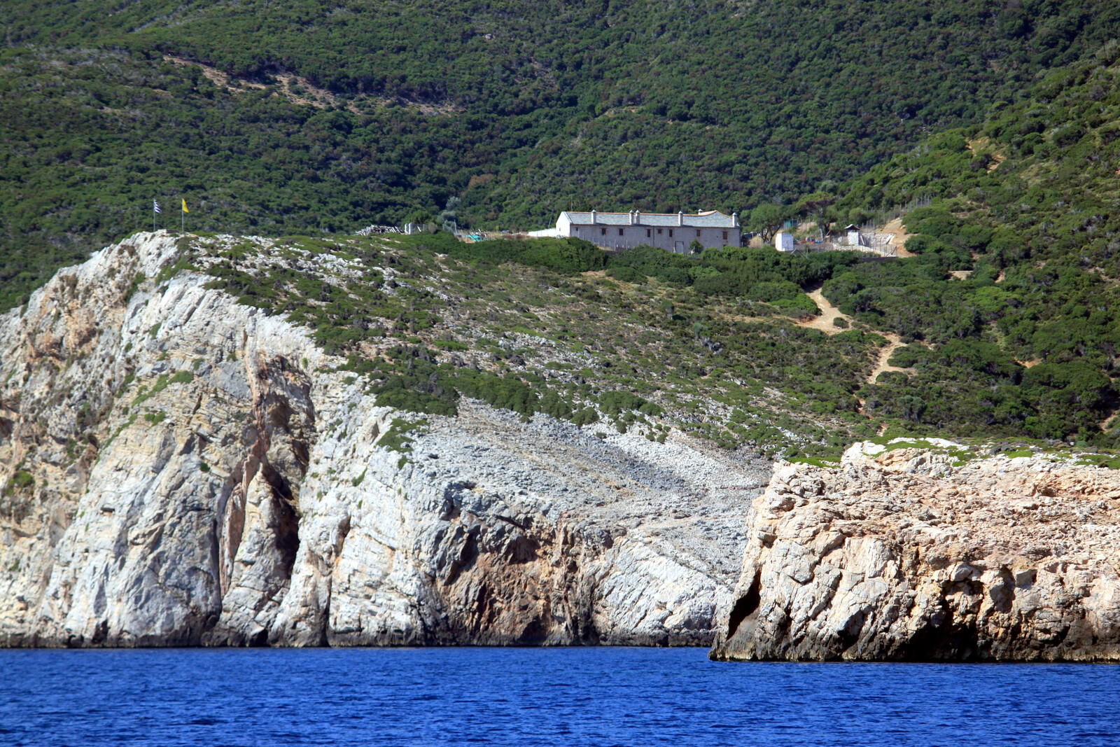
Nowadays it is also called “Kira Panayia”, after the Monastery of that name on its east coast, a dependency of Athos. This monastic Church – founded by the monks from Mt Athos in the Byzantine period – contains a number of old icons and can be reached via Monastery Bay (i.e. Monastiri) where a flight of steep winding steps lead up towards it.
The unforgivable misogyny of disallowing women to enter Mount Athos extends to female animals as well, so Athos's requirements of meat are met by its dependencies, the “metochia”. This is how goat-farming started on Kyra Panagia, and the system whereby the island is rented from the Megisti Lavra Monastery by goat-farmers to graze their flocks continues to the present day.

looking north from the path that leads up to the Monastery. Hi-res image
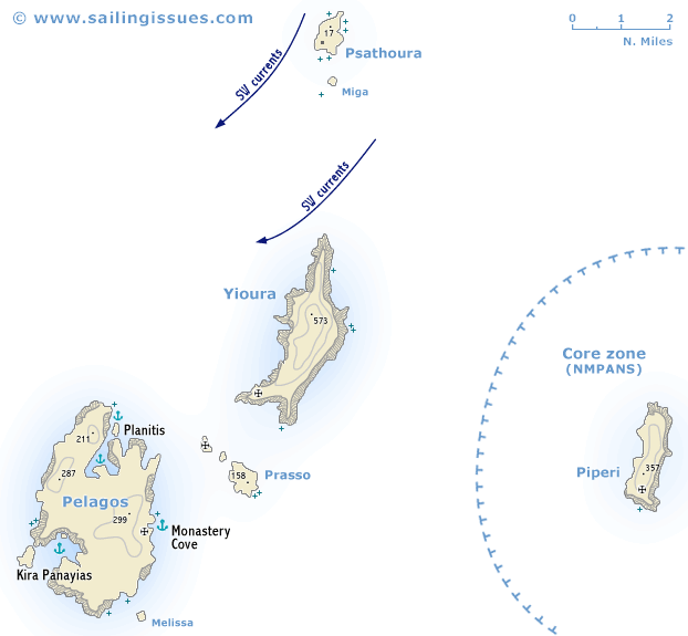
Marine park – Zone A
Ports / anchorages are clickable . signifies a highly recommended venue,
and a truly must-see venue; see other icons.
Kyra Panagia (Pelagos) A4
The Athonite island of Pelagos is not deserted insofar as the monk(s) and the two farm workers count as permanent residents.
This is in stark contrast to earlier times:
archaeological digs unearthed traces of a Neolithic settlement (from around 6000 BCE) in the bay of Agios Petros. The majority of it now lies submerged five to seven meters beneath the surface of the sea, but it appears to have been inhabited for about a thousand years. In classical antiquity, two fortified settlements were established at Kyra Panagia’s natural harbours, and became well-known during the dispute between Macedonia and the Athenians.
- In ancient times the island was also known as “Alonissos”, and from the 5th century BCE it belonged to Athens.
- In 351 BCE Sostratos, a brigand from Peparithos (the present-day Skopelos) took over the island and made it his stronghold.
- Then a little before 346 BCE Philippos of Macedonia took it over and chased Sostratos out.
- The Athenians however, to whom the island belonged, complained, and Philippos agreed to hand it back to them.
- In spite of this the Athenians remained unsatisfied and Hegesippus – who was the head of the embassy sent by the Athenians to Philip – made his speech “Concerning Alonissos”, of which only fragments survive. This speech was mistakenly attributed to Demosthenes, whose own work of the same title is lost.
You will still find an abundance of olive trees on the island, which in former times provided the monastic community with oil and olives. Nowadays no one looks after them and the harvest is meagre. Similarly, cultivation of the island's fertile plains has been abandoned. The multiple springs on the island mean that farm animals could be kept.
The story of the vernacular name of “Kyra Panagia” begins in 993, when Saint Athanasius – in search of a place capable of supplying Mount Athos with olive oil, wheat, honey, and meat – purchased the island from the monks residing in the bay of Agios Petros, who desired to leave due to escalating pirate activity in the North Aegean.
Since then and until the present day, Kyra Panagia has remained the property of the Megisti Lavra Monastery of the Autonomous Monastic State of Mount Athos, which uses it as a “metochi”, leasing it to those interested in developing agricultural and pastoral activities on its lands (in the past, there were also vineyards, of which very few remain). Although far from wooded, you will find mastic trees and strawberry trees.
Agios Petros
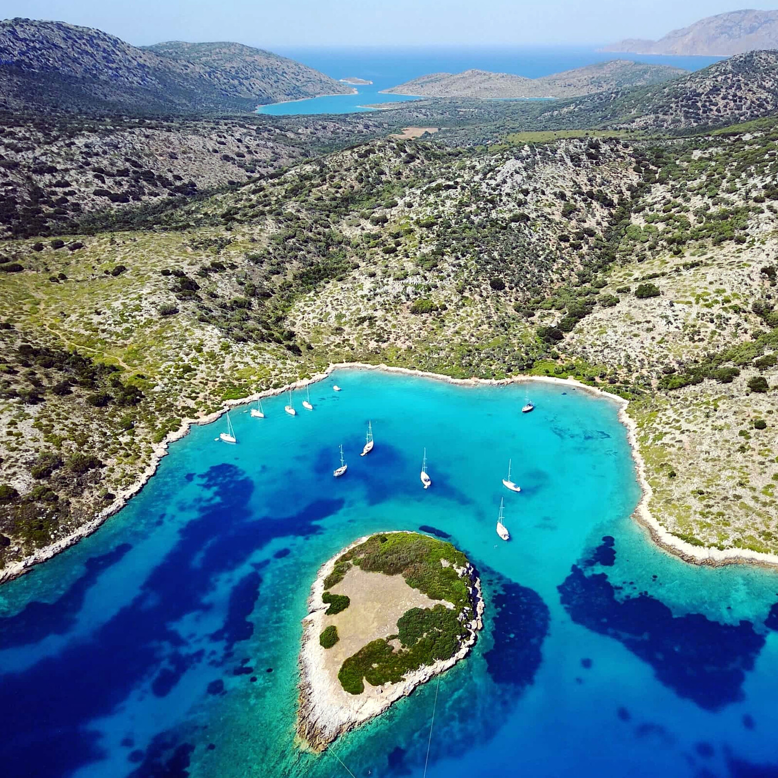
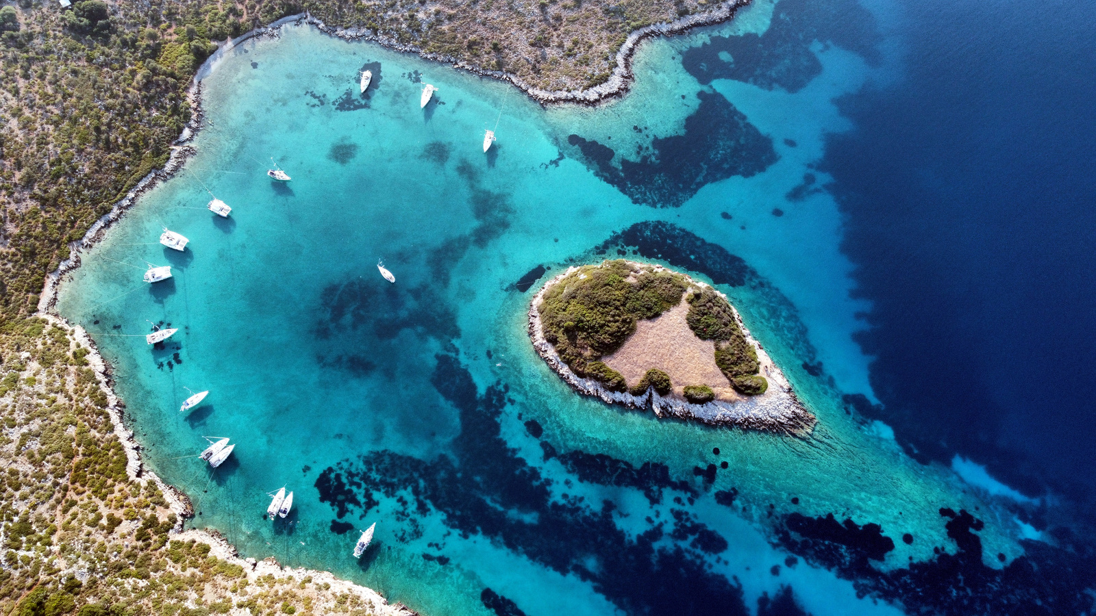
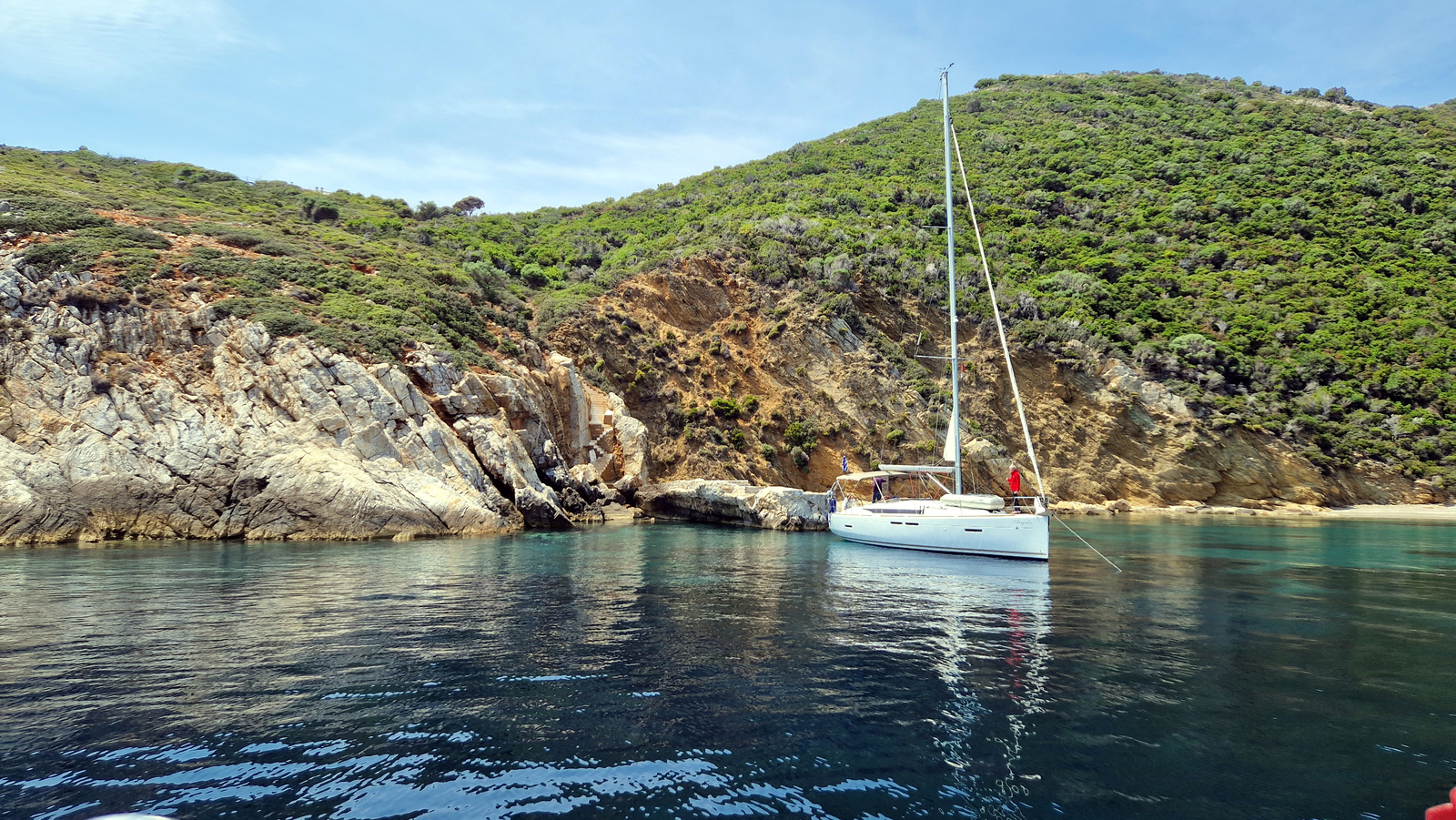
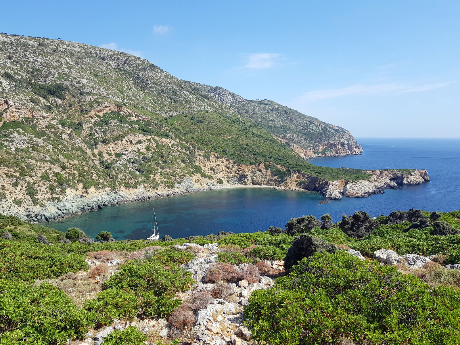
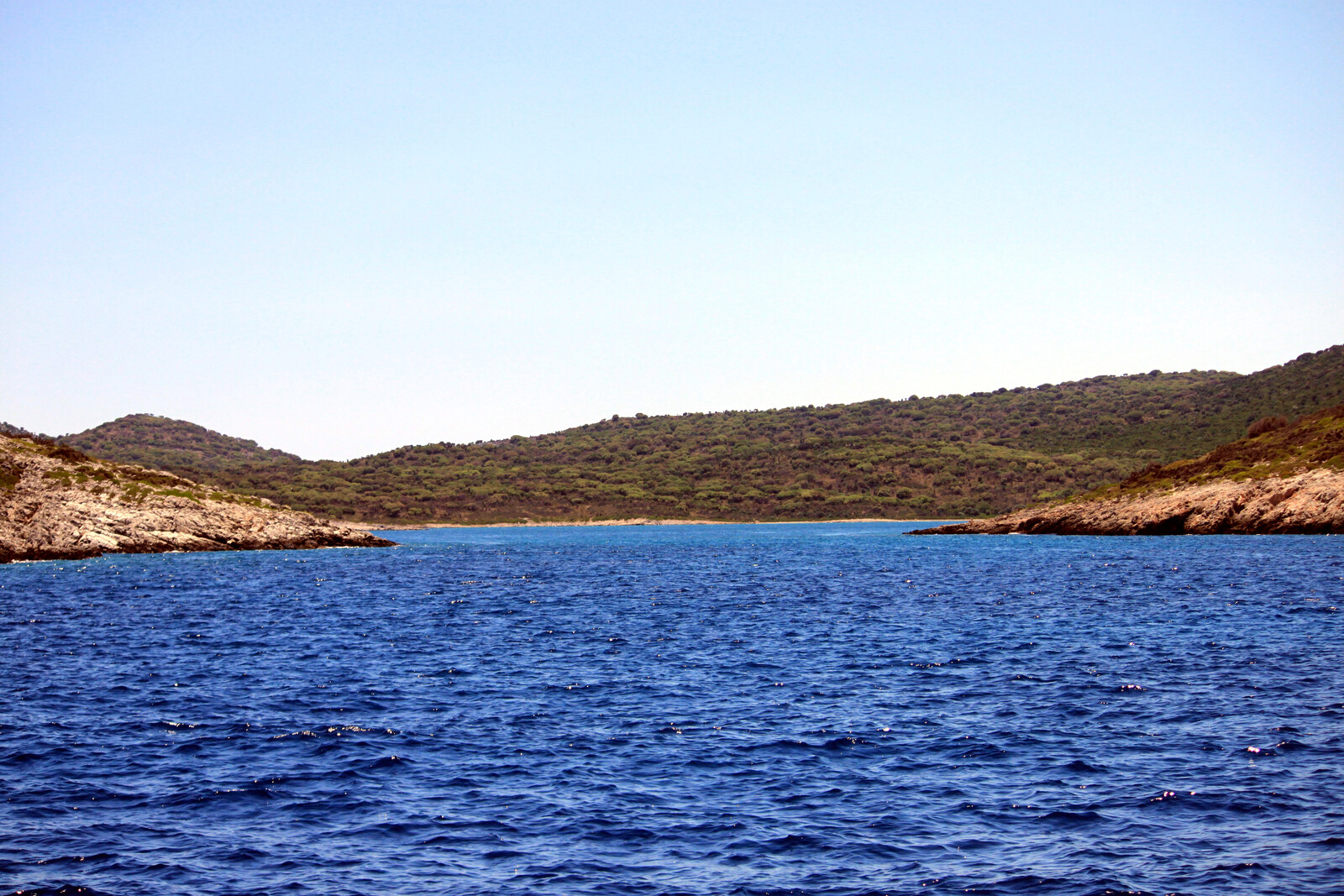
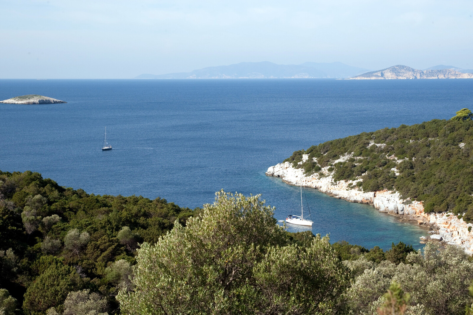
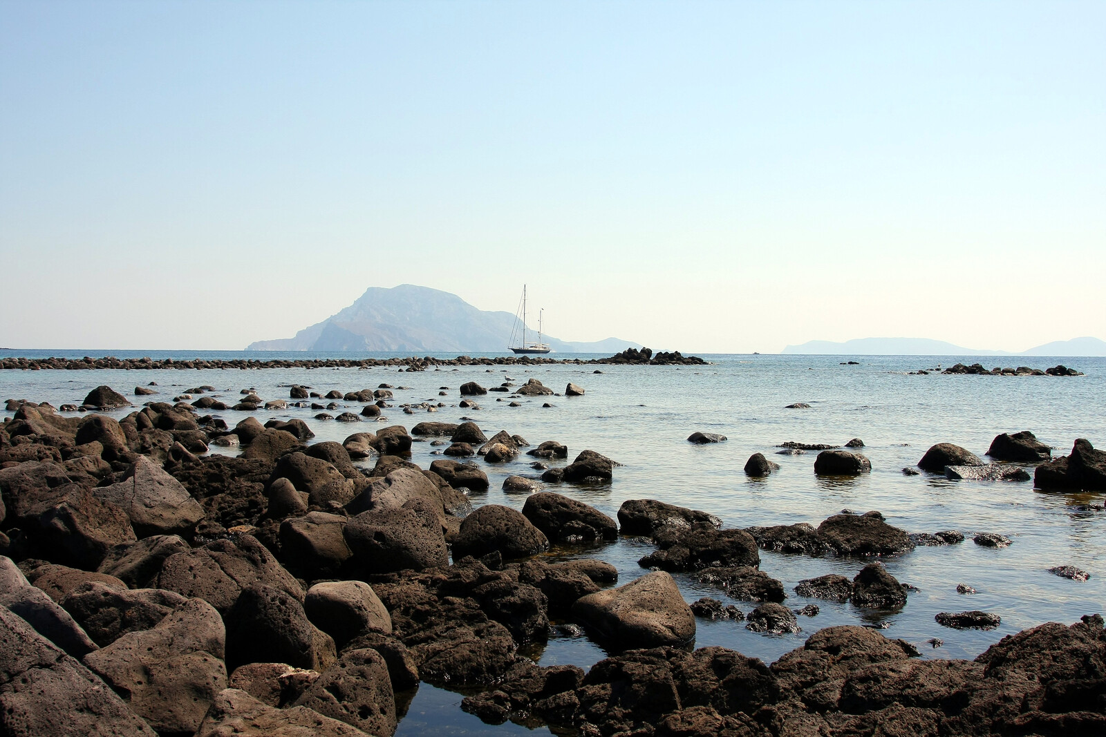
The stunning natural harbour of Agios Pétros - Αγίος Πέτρος is situated on the west of Kyra Panagia and is for most yachtspersons the first – and usually only – stay inside the Marine Park; often the furthest point in their itinerary sailing out of Skiathos or Volos.
The mountain top right is Yioura island.
The entrance of the bay is partially closed by the island of Phangrou (i.e. Pelerizza), where another important Classical shipwreck, with a cargo of wine amphorae, similar in many respects to the Peristera wreck, has been found and explored.
Inside in the north corner of the bay is the islet of Kyrá - Κυρά providing additional shelter, except for SW winds (rare).
In the eastern portion of the bay, the earliest excavated Neolithic settlement in the Aegean (5th millennium BCE) has been uncovered in the seventies. The site yielded important pottery and distinctive clay figurines, and these finds high-lighted the remarkable and unexpected degree of organisation and productivity of the vital culture which evolved in this archipelago in prehistoric times, see the oldest Aegean submerged settlement.
 Behind Kyra islet (in the prevailing NE winds) anchor over sand plus rocks in 4 – 7 m and take lines ashore; Lat Long gusts are N – NE, ideally position your yacht in this direction.
One particular source of irritation: the crystal clear water allows you to see the garbage (beer bottles, plastic wrappings, rusty sardines cans, etc.) on the seabed; flotillas (10+ yachts) from Volos? A trip line is recommended, but only at those popular spots around Kyra islet.

With NW or W winds aim for the cove to the west of Kyra islet; not much room to swing; less sand and more rocks! Lat Long
In case of easterly winds pick the Kokkina cove / beach in the east in front of the verdant plain with the remains of an olive orchard; very shallow, anchor in 3 – 4 m; suspicious holding; a superb 50 min. hike to the Monastery.
The penalty fine for entering Zone A of the Marine Park without a ticket is
equal to 20 times the corresponding ticket, so with a party of 8, this fine will be (8 × 5.5 + 33.5) × 20 = €1550 per night.
Although disembarking is officially forbidden in Agios Petros, walking to the Monastery is apparently condoned, see
Further park regulations regarding area A4.
The west coast of Kyra Panagia is off limits, see Park regulations regarding area A4.
Monastiri
Monastíri - Μοναστήρι i.e. “the bay of the Monastery” is situated on the east coast of the island, and is the only point on Kyra Panagia from where you are permitted to set foot on land. Note that you are not allowed to stay the night.
The anchorage is open to N – SE winds but also affected by stronger south winds; vessels should only approach in favourable conditions; the prevailing NE wind can cause a nasty swell. Anchor over sand and weeds in the deeper middle part in 9 – 15 m Lat Long or take a line ashore; mediocre holding.
In the low season you can go stern-to the rock formation that serves as the jetty, and from where the stairs lead up to the Monastery.
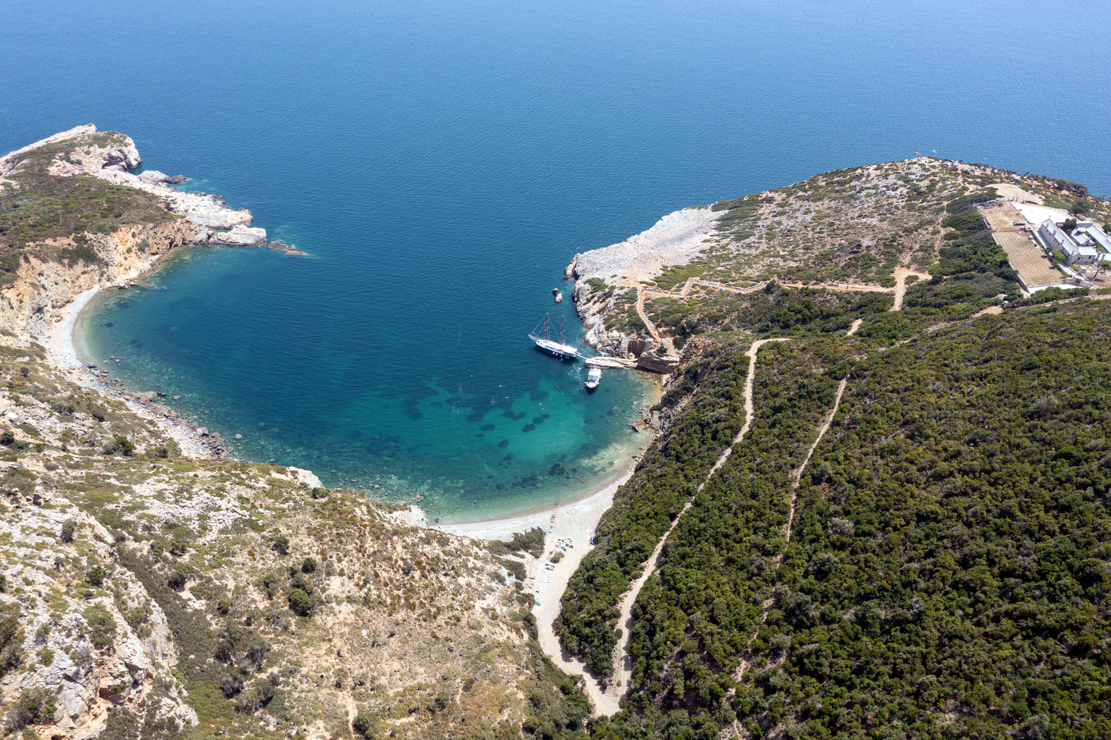
The real objective is obviously a visit to the Monastery “Kyra Panagia”, which translates into “[dedicated to] the Nativity of the Virgin Mary”.
Perched on a cliff edge, the Monastery overlooks an enthralling seascape, dominated by the opposite islet of Gioura and the rocky islets of Grammiza, Pappous and with Piperi island in the distance.
While it is often suggested that the Monastery was established around 1100, both the Church and annexes that you see today are clearly of post-Byzantine character, dating back to the 17th century and beautifully renovated in 1992.
Currently at least one monk will welcome you with Loukoumi (Greek version of Turkish delight) and tsipouro (traditional, Greek strong distilled spirit). Father Haritos has been in the Monastery since 2012 and he told us that they produce their own wine from their own vines, so clearly matters are improving: decades ago there was just a caretaker with his dog.
The Monastery is closed in the afternoon from 14:00 till 18:00, although the sign at Agios Petros reads 15:00 till 18:00; bring cash for souvenirs and choose a decent attire.
Few charter yachts and flotillas will venture this far – Monastiri gives therefore the first genuine impression of this ecological paradise!
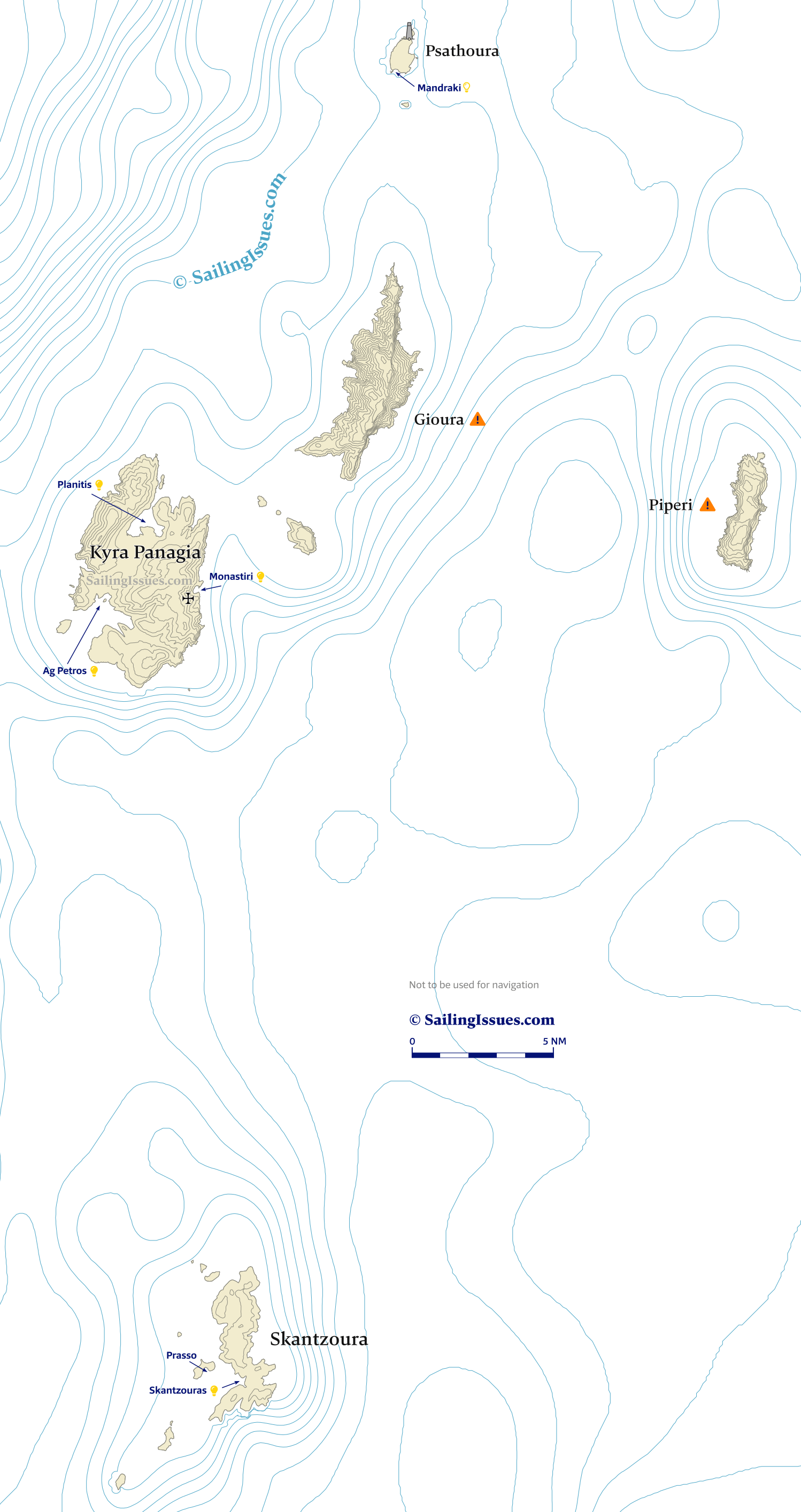
Planitis
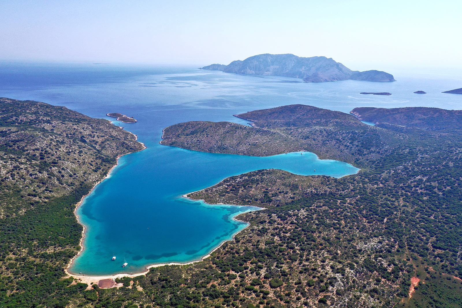
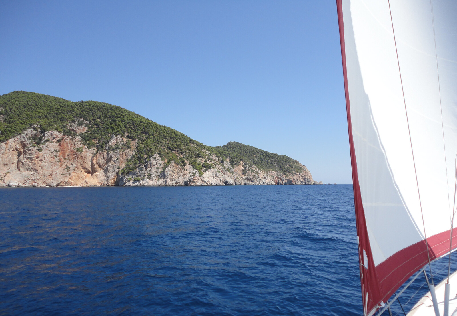
The unique bay of Planítis - Πλανήτης is arguably the finest natural harbour in the Mediterranean, fabulously away from civilization: no phone signal, lots of semi-wild goats, some glimpses of the endangered species of fowl, and decidedly wilder and quieter than Agio Petros.
While entrance seems awfully tight, it is 85 m at the scantiest point, and has a minimum depth is 6.4 m.
Beware that with over 30 knots of wind (especially in northerlies) entering or leaving becomes dangerous, plus there is no passage to the west of Sfika islet that guards this entrance.
Once inside on starboard you will see the cave has been converted into a shelter by the fishermen, with a good anchorage in NW winds. Further along Planitis widens and bifurcates into two large bays:
- Endéxio - Ενδέξιο in the east of Planitis which has an animal enclosure and a house on the east shore. In N or NE winds anchor in front of the house over mud; Lat Long solid holding. Alternatively with NW winds drop anchor in the opposite corner. Lat Long
- Draví - Δραví in the west of Planitis is less popular than Endexio.
Ideally go near Laspi cove in the east; Lat Long note that the cove itself is mostly less than 1.5 m, but there are plenty of useful rocks to take a line to directly west; thick mud and even clay; superb holding. Note that winds and gusts might rotate: either anchor in the middle of Dravi, or take lines ashore.
In the west corner especially children will appreciate the picturesque pebble beach with a lagoon in the middle, although this lee shore can collect an abundance of rubbish from (winter) storms – please bring garbage bags and help clean this beach.
Again, disembarkation is not allowed, and while placing your stern anchor on the beach, or playing on the beach is tolerated, hiking inland is forbidden. For the disobedient: follow a path that leads east to an amazing fjord-like bay.
The whole of Planitis offers outstanding all round protection, and even in stormy conditions the inside often mirrors a flat lake. Moreover, there is enough space to use all your chain; bringing hawsers to the rocks is not necessary. The solid holding in clay / mud and some sand and weeds further amplifies the shielding against meltemia.
No settlement has developed in ancient times – serving merely as a pirate's hideaway during the Byzantine era – plus the fact that the island belongs to Mount Athos appears to be the reason there has been no settlement in recent history. This is fortunate for the natural environment, which has remained undamaged except for over-grazing.
One mayor downside of Planitis: the water not always as clear as elsewhere in the Marine park, where there is clay or mud it can be murky after a storm. Furthermore, there is again garbage visible on the bottom, also the little beach looks like a fly tipping disaster.
Between Pelagos and Gioúra are several little islets (rocky outcrops), from NW to SE: Papous (with the Church Evangelista), Koumbi, Prásso (Gramm(i)(e)za). Mind that there is another islet named Prasso in the area, opposite the bay in Skantzoura!
Papous has a tiny sandy anchorage on the west suitable in NE winds; anchoring and disembarking are allowed here.
Skantzoura – A5
Skántzoura - Σκάντζουρα,
which lies to the south of the group, together with its outlying rocks and islets, is one of the most important breeding habitats in the Aegean for the rare Audouin’s gull (distinguishable from the herring gull by its smaller size and thinner wings), as well as for the Eleonora’s falcon.
Near the summit of the central hill stand the large and evocative ruins of the abandoned Monastery of the Annunciation, dating from the 18th century. In common with those on Kyra Panaghia, Gioura and Piperi, the Monastery was a dependency of the Megisti Lavra Monastery on Mount Athos.
The open waters around Skantzoura and Piperi are a good place to glimpse the graceful banking and swooping movements of the two kinds of shearwater which frequent the waters of the Park:
- the Mediterranean Yelkouan shearwater Puffinus yelkouan
- the larger and less common Cory’s shearwater Calonectris borealis, which has a wingspan of more than a metre, and is distinguished by a pure white underside with dark tail bar.
There are also sightings of cetaceans in these waters: the Sperm whale, the Long-finned pilot whale, and very occasionally the Orca, or Killer whale (the largest species of the dolphin family): striped dolphin and common dolphin will escort you around the park. We even encountered playful harbour porpoises (Phocoena phocoena) near Psathoura.
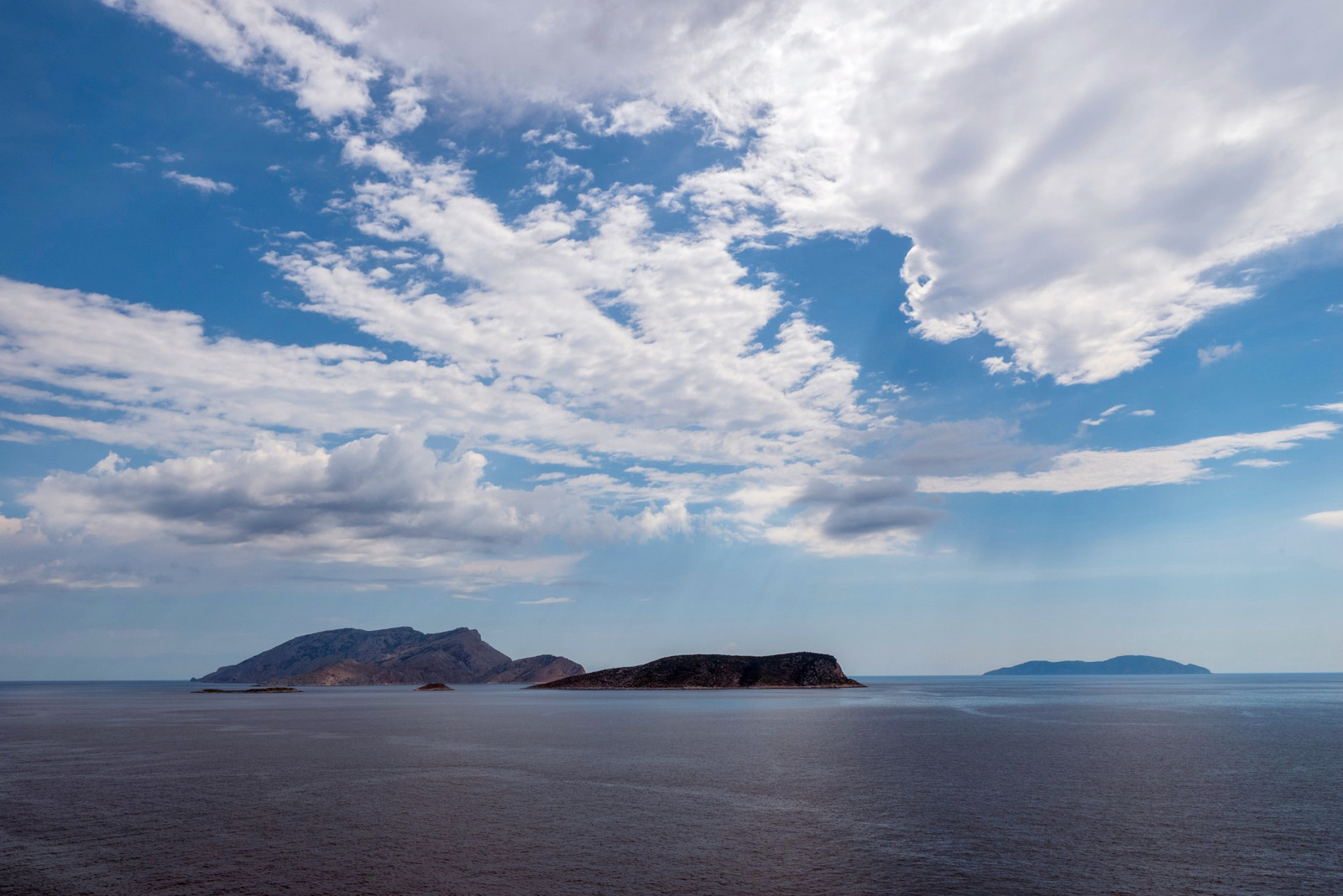
Limani
Limáni - Λιμάνι aka Skantzouras bay is the only place on Skantzoura island where you are permitted to anchor, see
Further park regulations regarding area A5.
There are two main anchorages, both in brilliant cerulean waters and very narrow:
- Skantzouras North cove Lat Long has room for one or two yachts; it has a small beach, yet you should deploy a line to either side. If the spot is taken, consider the tiny cove 250 meters to the NW, here you can get closer to the shore.
- Skantzouras south cove Lat Long also has a good sandy seabed with hardly any weeds; a plastic bottle marks a permanent mooring (thick rope SW corner in NE direction) on the bottom, use a tripline. NE and N winds will follow the coastline and blow from the NW, affecting this cove.

looking SW, with Skandali islet in the distance.
A-Z index: other places named “Limani”. Hi-res image
Prasso
Prásso - Πράσσο islet (rocky outcrop), which guards Livadi bay, has a nice anchorage on the south side, sheltered from SW – SE, thus only affected by southerly winds; Lat Long room for one or two yachts, or more if you take lines ashore; sand and seaweeds on the bottom, good holding; the seabed drops briskly to 25 m; Prasso is too low to comfortably stay here during a stronger meltemi.
The Monastery is / was dedicated to the Annunciation of the Lord (Greek: Evangelismos tis Theotokou), of which “Evangelistrias” is an abbreviation. There are still religious icons to be admired inside.
Gioura – A3
The former monastic island of Gioúra or Yioúra - Γιούρα is now a nature reserve, see Park regulations regarding area A3, and no activities are allowed within 0.5 NM.
Gioura has revealed an even earlier human presence than Kyra Panayia, c. 9000 – 6000 BCE.
In 1992 – 96 excavations were conducted in the floor of the “Cyclops Cave” – traditionally believed to have been the home of Polyphemos – in the interior of the south Lat Long of the island. These have yielded, from the deepest strata, beautifully fashioned fish-hooks from animal bones (now in the Volos Archaeological Museum), together with bones and skeletons of large fish showing that the technology of fishing was already mastered at this early date.
Evidence also suggests that animal husbandry (pigs, goats and sheep) was practised by the early part of this period. Also later material has be excavated, such as Roman lamps.
There are many caves and unusual limestone phenomena on Gioura: the mythical association with the Cyclops may have began around a curious and large circular perforation which completely pierces a scarp of rock. The forehead-shaped bulge of rock has the uncanny appearance of a gigantic brow with a single central eye.
Gioura’s impressive rock faces are home to a variety of unique chasmophytes or cliff-growing plants, including the very rare, endemic sandwort Arenaria phitosiana. Other rarities include Campanula reiseri; a scabious, Scabiosa hymetta; and a dwarf fritillary with dark purple flower, Fritillaria sporadum.
About 500 examples of an endemic species of goat, Capra aegagrus (dorcas), similar to the Cretan kri-kri but a little larger, roam the island. These are genomically distinct from the semi-wild (mostly feral) goats of e.g. Kyra Panayia.
Piperi – A1
To the east of Gioura lies the island Pipéri aka “Pepper (pot)” - Πιπέρι, which should be kept at a distance of at least 3 NM as it is the most intensively protected area of the whole Marine Park, see Park regulations regarding area A1.
You'll need special permission to approach the island within 3 NM of the coastline: area A1 is the sanctum sanctorum of the Marine Park.

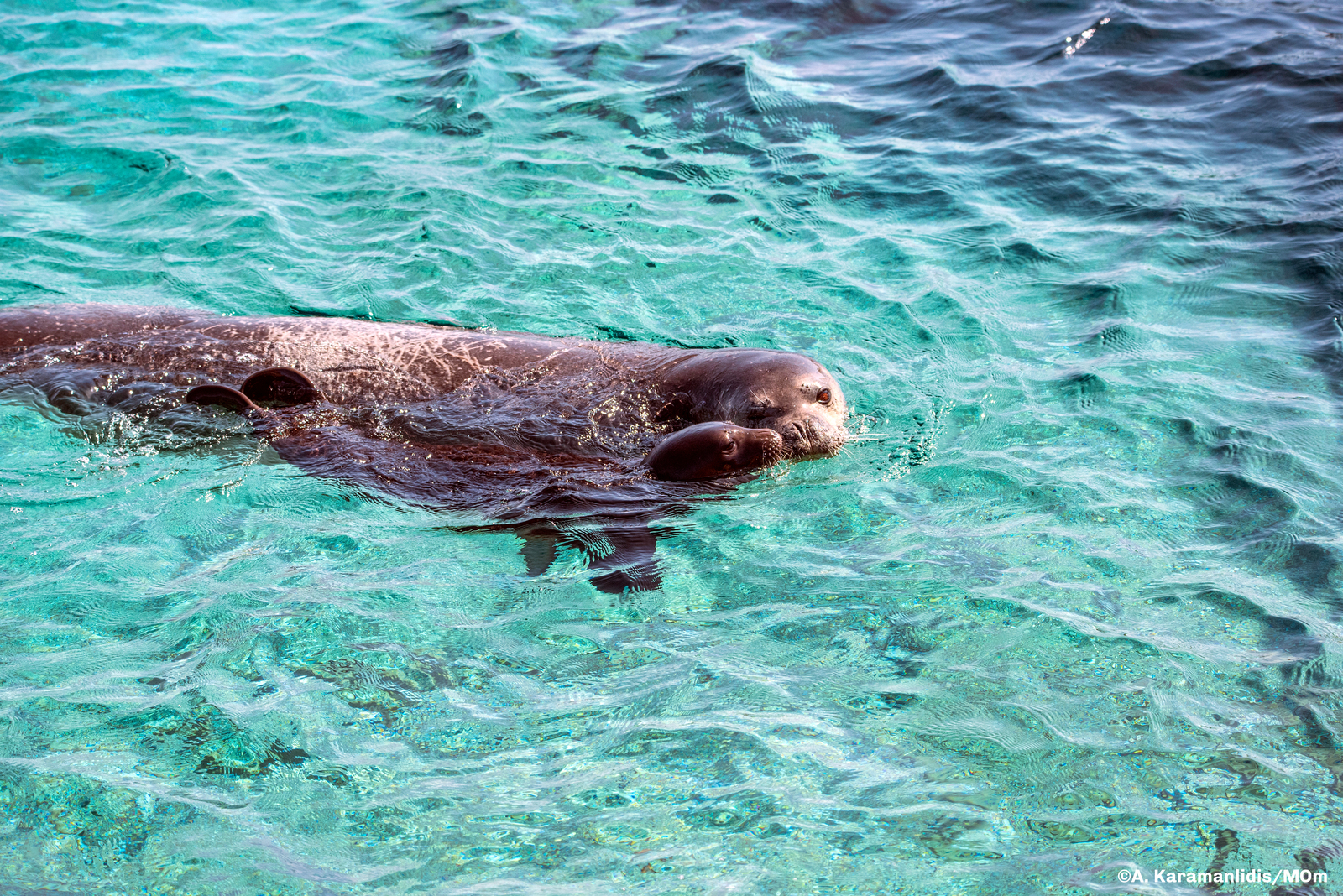
Piperi is a steep and well-wooded island representing a particularly important habitat for many of the important protected species: the caves along its shore for the monk seal, and its cliffs for rare chasmophyte plants, sea-birds and raptors. It is thought to be home to over 300 pairs of Eleonora’s falcon, which breed in the late summer and feed on small migrating birds through the autumn. This small falcon took its name from Eleanor of Arborea, the judge of the indigenous kingdoms of Sardinia during 1383, because she was the first legislator to protect the species of birds. Piperi is also home to Bonelli’s eagle, buzzard and Peregrine falcon.
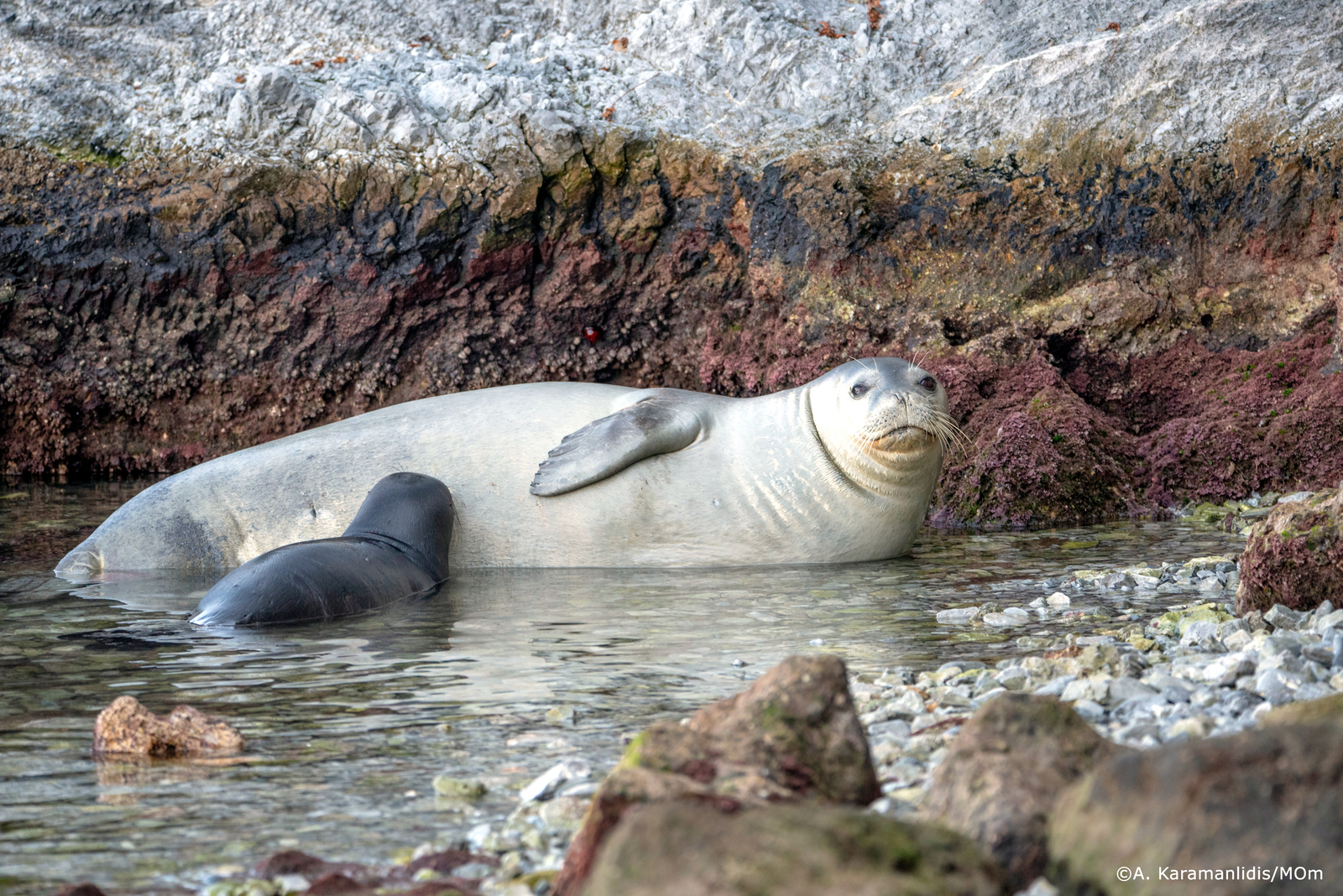
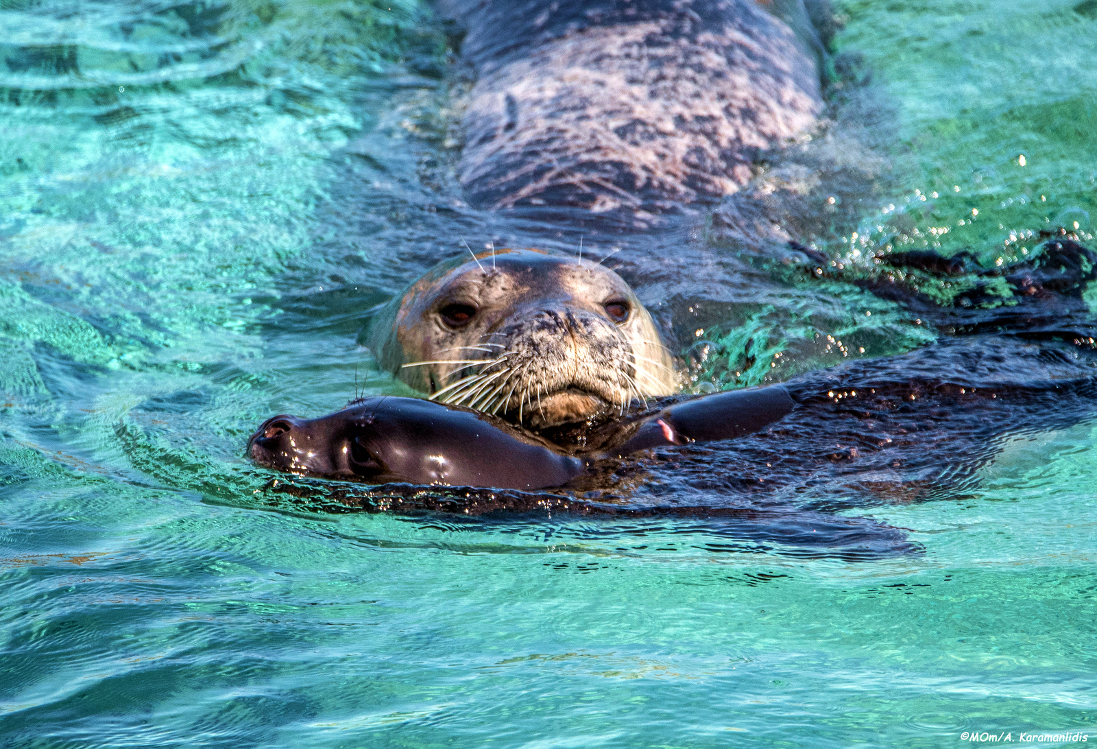
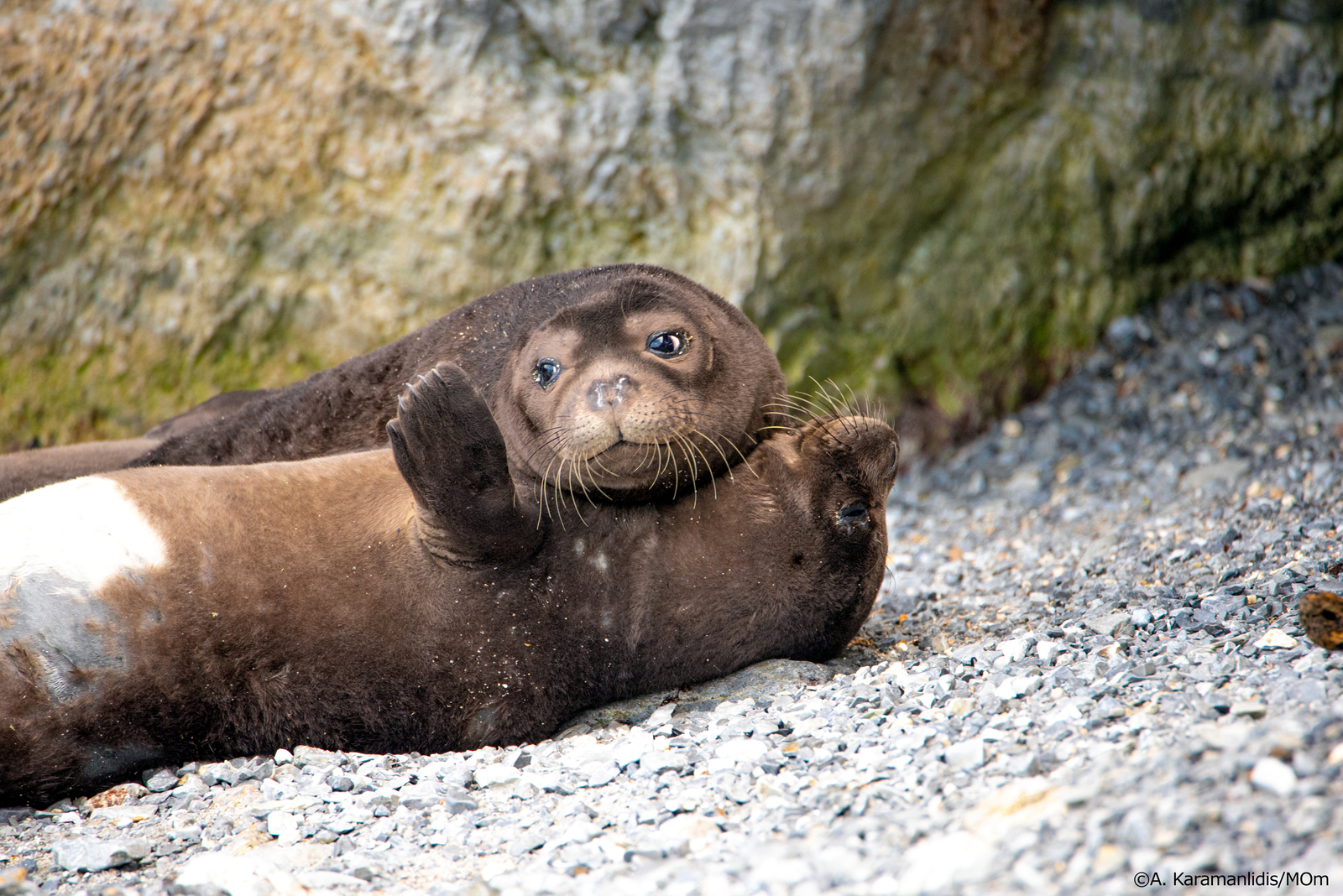
There are probably less than 500 pairs of Mediterranean monk seal (Monachus monachus) surviving in the world today. Traditionally hunted for their skins and oil, and killed by fishermen who saw them as a competitor for fish stocks, their numbers have recently dwindled further as a result of disturbance and pollution resulting from the human presence along the coasts which the seals frequent. The heart of the problem is the vulnerability of the female when gestating and nursing her young. The reproduction cycle is slow and the female, if unnaturally disturbed, can easily abort. She normally gives birth to the single pup on a beach or in a cave, and will nurse it for as much as six weeks, living off accumulated fat and not fishing or eating during the entire period. After weaning, the pup may still stay with the mother for up to three years. With the arrival of industrial fishing and the increasing construction of the Mediterranean shore, the seal which once basked and even pupped on open beaches, has now been forced to take refuge in hidden and inaccessible caves. Occasionally, due to bad weather, a pup may become irretrievably separated from the mother. Three such cases have been found, nurtured at the Seal Rescue Centre in Steni Vala, and subsequently released into their natural environment. Their names were Theodoros, Stelios and Efstratia, and their individual characters as distinct as their names.
The seal is glimpsed basking in the Odyssey, and makes an occasional appearance on early Greek vases. It was probably widely present in the whole of the Mediterranean and Black Sea littoral in Antiquity. Although it was more systematically hunted in Roman times and may have suffered a sharp decline in numbers as a result, the effect was never sufficient to endanger the survival of the species. Today, however, the seal is confined to two principal colonies: the northwest Aegean, and the Atlantic coast of Mauritania and Madeira. The mature animals may travel far in pursuit of food. They are very occasionally sighted in the Dodecanese (Karpathos, Tilos and Rhodes) and elsewhere in the Aegean.
During excavations in 1999 in the area of the Commercial Harbour of Rhodes, a grave dating from the 1st century BCE was found containing the skeleton of a monk seal, buried with funerary honours in a family inhumation, together with the remains of humans, a dog and some small grave gifts – just as if the seal had been a family member. The remarkable finds are displayed in the Rhodes Aquarium Museum. Fascinating in what this tells us about attitudes to animals in Antiquity, it also underlines the intelligence and potential for sociability of the seal. Ironically its trusting nature has tended only to contribute to its extinction. It has left it barely surviving as one of the world’s rarest mammals.
Psathoura – A2
Psathoúra - Ψαθούρα marks the northernmost extremity of the Sporades, and the end of an island chain that – via Euboea (i.e. Evia) – allows island-hopping all the way from the Cyclades to Chalkidiki, Thasos and Lemnos.
The volcanic island – which lies <4 NM due north of Gioura's cape Erimitis – is as flat as Gioura is mountainous. It has shores of white sand which contrast with its dark native rocks of volcanic andesite.
Anchoring is only allowed on the south side, see
Park regulations and Further specifics regarding area A2,
in the bay that is officially called Mandráki - Μανδράκι, see toponyms.

Mind the reef around Miga (aka Psathonisi) islet / rock to the south of the anchorage, as well as the reef that extends from the east of Psathoura where you should keep a distance of 0.4 NM from the island.
Psathoura's shallow dunes are a natural home for the beautiful and rare sea daffodil, Pancratium maritimum with a peak bloom in July August.
Just off the north coast are the submerged remains of buildings belonging to a large ancient city engulfed by the sea.
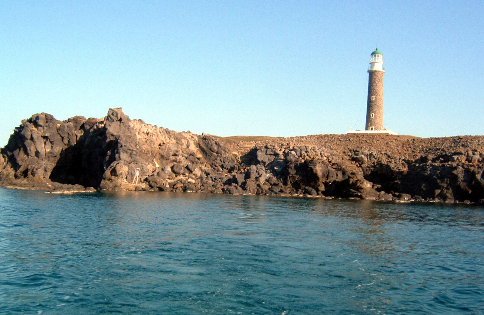
In depth: Lighthouse of Psathoura [in Greek].